 Block
BlockBoonsville, Texas
9 topographic sheets cover this place, the earliest surveyed in 1954 and the latest in 1991. It stands in the Bridgeport census division. It lies in ZIP code area 76426. It stands on Barton Branch. The Survey maps it on the Boonsville quadrangle.
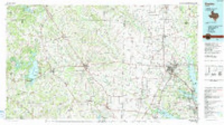
Topographic sheets covering this place
5 surveys from 9 printed sheetsMatched by testing this settlement's coordinate against the published boundary of every sheet in the United States Geological Survey's historical collection. Each opens the scanned sheet at the Survey.
- 1954 USGS Sherman quadrangle1:250000, 2 printings
- 1958 USGS Sherman quadrangle1:250000
- 1960 USGS Boonsville quadrangle1:24000, 3 printings
- 1985 USGS Denton quadrangle1:100000
- 1991 USGS Denton quadrangle1:100000, 2 printings
Fires near this place
145 since 1996Regional context, not property-specific evidence. The federal wildfire occurrence database lists 145 fires within 5 miles of Boonsville between 1996 and 2016, burning about 14,291 acres in total. 4 started naturally. 11 were recorded as arson. Distance is straight-line from the map coordinates, so a fire counted here may appear on a neighbouring settlement's page as well.
| Reported cause | Fires |
|---|---|
| Debris and open burning | 50 |
| Missing data/not specified/undetermined | 35 |
| Equipment and vehicle use | 31 |
| Arson/incendiarism | 11 |
| Power generation/transmission/distribution | 6 |
| Smoking | 5 |
| Natural | 4 |
| Misuse of fire by a minor | 2 |
| Recreation and ceremony | 1 |
The most recent of them, most recent first, with the day each was reported and the service that recorded it.
| Date | Cause | Size | Reported by | Name on the report |
|---|---|---|---|---|
| 7 September 2008 | Equipment and vehicle use | under an acre | Texas A & M Forest Service | not named |
| 5 September 2011 | Smoking | 1.0 acres | Texas A & M Forest Service | WILKINS FIRE |
| 24 September 2011 | Equipment and vehicle use | under an acre | Texas A & M Forest Service | SILLY BURN BAN, CUTOFF WHEEL IS OK... |
| 22 September 2011 | Natural | 2.0 acres | Texas A & M Forest Service | LIGHTNING NEVER STRIKES TWICE... |
| 22 September 2011 | Natural | under an acre | Texas A & M Forest Service | ...IN THE SAME SPOT. |
| 19 September 2011 | Debris and open burning | under an acre | Texas A & M Forest Service | 5572 920 F.I. |
| 18 September 2010 | Debris and open burning | under an acre | Texas A & M Forest Service | SALT CREEK CANENRTE |
| 15 September 2010 | Equipment and vehicle use | under an acre | Texas A & M Forest Service | F250 REMAINS |
Settlements close enough to share some of these fires:
Mines and quarries near this place
1 within 5 milesRegional context, not property-specific evidence. The federal mineral resources record lists 1 working within 5 miles of Boonsville: 1 producer. All of them still produce. What was taken out: Stone, Crushed/Broken. Distance is straight-line from the map coordinates, so a quarry counted here may appear on a neighbouring settlement's page as well.
| Where | Site | Commodity | Status | Recorded |
|---|---|---|---|---|
| Texas Industries Quarry | Stone, Crushed/Broken | Producer |
Storms near this place
36 since 1997Regional context, not property-specific evidence. The National Weather Service names Boonsville in 36 storm reports between 1997 and 2023: 20 hail, 8 thunderstorm wind, 4 flood, 2 flash flood. The reports record 3 injuries. Each account below is quoted exactly as the forecast office filed it, from the NOAA Storm Events Database, and each date opens the federal record of that event.
| When | Event | Place named | Harm | What the report says |
|---|---|---|---|---|
| March 2023 | Tornado (EF1) | Boonsville | 3 hurt | This is a continuation of a tornado that began in Parker County. The tornado developed along Pine Road west of Poolville, where the roof of a single family home sustained damaged. As the tornado tracked northeast, it produced extensive damage to trees across the northwestern side of Poolville including snapped trunks and uprooted trees. Structural damage includes the uplift and overturning of a metal garage structure near the intersection of Pine Road and Lone Star Road, roof and siding damage to a few single family residences, and the complete collapse of a large covered pavilion roof near the Poolville Cemetery. The tornado continued to move north-northeast towards the Wise County line producing additional damage to trees and several outdoor buildings along Clover Drive. Multiple manufactured homes along and just south of Highway 199 were damaged as the tornado crossed the county line. There were 3 injuries reported with damage in this area. The tornado appears to have lifted as it crossed Highway 199 with isolated damage noted beyond the end of the tornado track. |
| May 2012 | Lightning | Boonsville | $50,000 | A lightning strike started a fire at a deep well injection disposal site in the Salt Creek Area. Ten tanks were engulfed. |
| April 2011 | Hail | Boonsville | $30,000 | Quarter to baseball size hail fell in Boonsville. |
| March 2023 | Thunderstorm Wind | Boonsville | $20,000 | Damage to a car and an outbuilding was reported along PR 3863 near the end of a tornado track. |
| June 2015 | Flash Flood | Boonsville | $20,000 | Numerous roads were closed across the county from heavy rain brought by Tropical Depression Bill. Chico and Paradise experienced some of the worse flooding in the county. In Chico, the local newspaper reported the intersection of Farm Road 1810 & Texas 101 was a raging river. Parts of 1810, Decatur Street, Weatherford Street, and Buffalo Street were flooded. On 1810 east of Chico, the flood waters were so deep only the tops of cars could be seen. Several homes in Chico had to be evacuated or rescued due to rising flood waters; including parts of West Kentucky Street. In Bridgeport, several roads were closed and Harwood Park was flooded. Other roads that were reported as closed included CR 4757 at Van Meter, CR 1590 west of CR 1593, CR 1700, CR 3250 at Goalaz Crossing, FM 51, FM 2123 at CR 3340, FM 3259, FM 2265, and the southbound lanes of US 81/287 near the Navigator Truck Stop. |
| March 2023 | Thunderstorm Wind | Boonsville | $10,000 | Sporadic downed trees as well as minor roof and structure damage to houses were reported along County Road 3633. Time was estimated via radar. |
| May 2011 | Hail | Boonsville | $7,000 | Golfball sized hail fell near Salt Creek Road and Highway 199 in southern Wise County. |
| June 2023 | Hail | Boonsville | $5,000 | Golf ball size hail was reported near Boonsville. |
| June 2009 | Thunderstorm Wind | Boonsville | $5,000 | Numerous large trees are reported down along HWY 199 from near Joplin to near Springtown. Several houses had roof damage due to tree limbs falling on them. |
| June 2009 | Thunderstorm Wind | Boonsville | $5,000 | An 80 mph wind gust was measured in Big Salty, 8 miles south of Runaway Bay. |
| March 2009 | Hail | Boonsville | $3,000 | Golfball size hail was reported on HWY 199 between Salt Creek Road and FM 920. |
| March 2012 | Hail | Boonsville | $2,000 | Dime to golfball sized hail fell in Boonsville. |
| March 2009 | Hail | Boonsville | $2,000 | Golfball size hail was reported 9 miles south of Runaway Bay. |
| October 1998 | Thunderstorm Wind | Boonsville | $2,000 | Strong thunderstorm winds blew down trees and power lines. |
| May 2011 | Thunderstorm Wind | Boonsville | $1,500 | A trained spotter measured a 60 MPH wind gust on home weather equipment near Highway 199 and Salt Creek Road. Small tree limbs were knocked down. |
| August 1999 | Thunderstorm Wind | Boonsville | $500 | Trees were blown down by thunderstorm winds. |
| May 2015 | Flood | Boonsville | - | Many county roads remained closed due to flooding. The Sheriff's Office already reported a few structures were inundated. |
| May 2015 | Flood | Boonsville | - | Flooding continued across the county after heavy rain resulted in numerous creek and road flooding. Cottonwood Creek was out of its banks and flooding a nearby road. A high water rescue was also needed at FM 2123 and CR 3381. |
| June 2015 | Flood | Boonsville | - | Numerous roads in the county remained closed due to flooding from heavy rains from Tropical Depression Bill. |
| April 2014 | Hail | Boonsville | - | Nickel sized hail was reported in the Boonesville community. |
| April 2011 | Hail | Boonsville | - | Hail up to the size of pennies was reported in Boonsville. |
| April 2011 | Hail | Boonsville | - | The hail size increased from penny size to quarter size in Boonsville. |
| October 2009 | Flood | Boonsville | - | Persistent rainfall resulted in the flooding of fields across the county. Some lesser traveled roads had water flowing over them, but no roads were closed. |
| April 2000 | Hail | Boonsville | - | Hail occurred in Runaway Bay. |
| April 2000 | Hail | Boonsville | - | Occurred at Runaway Bay. |
| May 1997 | Flash Flood | Boonsville | - | Streets were closed due to high water in town. |
| December 2008 | Hail | Boonsville | - | no account filed |
| April 2002 | Hail | Boonsville | - | no account filed |
| October 2001 | Hail | Boonsville | - | no account filed |
| March 2000 | Hail | Boonsville | - | no account filed |
| August 1999 | Hail | Boonsville | - | no account filed |
| January 1999 | Hail | Boonsville | - | no account filed |
| June 1997 | Hail | Boonsville | - | no account filed |
| May 1997 | Hail | Boonsville | - | no account filed |
| April 1997 | Thunderstorm Wind | Boonsville | - | no account filed |
| March 1997 | Hail | Boonsville | - | no account filed |
Nearest settlements
The eight closest, with where each one stands in the county. Distances are straight-line, computed from the Geographic Names Information System coordinates.
| Map | Place | Distance | Sheets |
|---|---|---|---|
| Balsora | 3.4 miles | 9 | |
| Willow Point | 4.2 miles | 8 | |
| Draco | 6.8 miles | 9 | |
| Runaway Bay | 6.9 miles | 8 | |
| Rickels | 8.1 miles | 10 | |
| Cottondale | 8.4 miles | 9 | |
| Lake Bridgeport | 9.7 miles | 10 | |
| Lucky Ridge | 10.6 miles | 9 |
Elsewhere
Matched on this settlement's Geographic Names Information System number rather than its name, so it cannot be a different place of the same name in another state.
| Wikipedia article on Boonsville | An encyclopaedic summary. Its text is share-alike, so it is linked here rather than copied. |
| Wikidata item Q48848869 | The structured record the population and elevation above come from. Public domain (CC0). |
Provenance
This settlement is recorded in the Geographic Names Information System as feature 1331076. The sheet list is computed by point-in-boundary test against the United States Geological Survey's historical topographic inventory. Both are works of the United States government and carry no copyright under 17 U.S.C. 105.
Wildfire. Short, Karen C. 2022. Spatial wildfire occurrence data for the United States, 1992-2020 [FPA_FOD_20221014]. 6th Edition. Fort Collins, CO: Forest Service Research Data Archive. https://doi.org/10.2737/RDS-2013-0009.6 Collected with United States Government funding and usable without additional permissions or fees.
Mines and quarries. USGS Mineral Resources Data System (MRDS) https://mrdata.usgs.gov/mrds/ A work of the United States government, no copyright under 17 U.S.C. 105.
Storms. NOAA National Centers for Environmental Information, Storm Events Database https://www.ncei.noaa.gov/stormevents/ A work of the United States government, no copyright under 17 U.S.C. 105. Narratives are quoted verbatim from the National Weather Service report and are not edited or summarised.