 Block
BlockCottondale, Texas
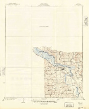
9 topographic sheets cover this place, the earliest surveyed in 1930 and the latest in 1991. It stands in the Bridgeport census division. It lies in ZIP code area 76073. It stands on Pecan Branch. The Survey maps it on the Cottondale quadrangle.
Topographic sheets covering this place
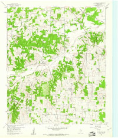
6 surveys from 9 printed sheetsMatched by testing this settlement's coordinate against the published boundary of every sheet in the United States Geological Survey's historical collection. Each opens the scanned sheet at the Survey.
- 1930 USGS Boyd quadrangle1:62500, 2 printings
- 1954 USGS Sherman quadrangle1:250000, 2 printings
- 1958 USGS Sherman quadrangle1:250000
- 1960 USGS Cottondale quadrangle1:24000
- 1985 USGS Denton quadrangle1:100000
- 1991 USGS Denton quadrangle1:100000, 2 printings
Fires near this place
105 since 2005Regional context, not property-specific evidence. The federal wildfire occurrence database lists 105 fires within 5 miles of Cottondale between 2005 and 2018, burning about 1,073 acres in total. 1 started naturally. 1 was recorded as arson. Distance is straight-line from the map coordinates, so a fire counted here may appear on a neighbouring settlement's page as well.
| Reported cause | Fires |
|---|---|
| Debris and open burning | 52 |
| Missing data/not specified/undetermined | 29 |
| Equipment and vehicle use | 19 |
| Arson/incendiarism | 1 |
| Misuse of fire by a minor | 1 |
| Recreation and ceremony | 1 |
| Power generation/transmission/distribution | 1 |
| Natural | 1 |
The most recent of them, most recent first, with the day each was reported and the service that recorded it.
| Date | Cause | Size | Reported by | Name on the report |
|---|---|---|---|---|
| 7 September 2013 | Equipment and vehicle use | 1.0 acres | Texas A & M Forest Service | CR 3672 |
| 6 September 2009 | Missing data/not specified/undetermined | 10 acres | Texas A & M Forest Service | 1951FM 2123 |
| 29 September 2014 | Debris and open burning | 1.0 acres | Texas A & M Forest Service | SPRING VALLEY RD |
| 28 September 2005 | Misuse of fire by a minor | 12 acres | Texas A & M Forest Service | not named |
| 25 September 2014 | Debris and open burning | 1.0 acres | Texas A & M Forest Service | SPRING VALLEY CT |
| 2 September 2008 | Debris and open burning | 5.0 acres | Texas A & M Forest Service | not named |
| 9 August 2013 | Debris and open burning | 1.0 acres | Texas A & M Forest Service | CR 3655 |
| 8 August 2014 | Debris and open burning | 5.0 acres | Texas A & M Forest Service | CR 3791 |
Settlements close enough to share some of these fires:
Storms near this place
40 since 1993Regional context, not property-specific evidence. The National Weather Service names Cottondale in 40 storm reports between 1993 and 2026: 17 hail, 13 thunderstorm wind, 5 flash flood, 4 tornado. The reports record 4 injuries. Each account below is quoted exactly as the forecast office filed it, from the NOAA Storm Events Database, and each date opens the federal record of that event.
| When | Event | Place named | Harm | What the report says |
|---|---|---|---|---|
| May 1994 | Thunderstorm Wind | Cottondale | 4 hurt, $500,000 | At 2.3 miles north of Cottondale one house was destroyed, and at least two mobile homes were destroyed by high winds. Damage was reported to four other mobile homes. A car and a truck were also destroyed. The sheriff's office reported four injuries, one of which was serious. |
| March 2025 | Tornado (EF1) | Cottondale | $750,000 | Widespread damaging straight-line winds occurred across much of Wise County during the predawn hours of March 4th, 2025. Within this broad wind field, a NWS WFO Fort Worth survey team identified a relatively short track tornado north of the Cottondale community. This tornado formed near the intersection of FM 2123 and FM 3552, where a wood frame residence lost much of its roof and internal rafters. The peak intensity of the tornado was determined from the damage at this residence, with EF-1 intensity winds estimated around 110 mph. The tornado impacted two outbuildings nearby, producing EF-0 roof damage. The tornado moved eastward, roughly paralleling County Road 3470 for at least two miles. Along this path, many larger hardwood trees exhibited limb damage, and a few outbuildings, frame residences, and manufactured homes also exhibited mostly high end EF-0 and low end EF-1 roof and fascia damage. The tornado dissipated near the intersection of County Road 3470 and School House Road. |
| March 2023 | Thunderstorm Wind | Cottondale | $300,000 | Sporadic wind damage was reported from southwest of Cottondale to south of Decatur. The damage mostly consisted of tree damage, damage to outbuildings and barns, and power poles. |
| May 1997 | Flash Flood | Cottondale | $75,000 | Roads were washed away and a bridge was washed out by flood waters. |
| April 2026 | Thunderstorm Wind | Cottondale | $30,000 | Strong straight line winds affected a rural area of southwest Wise County, west of County Road 3355 and north of County Road 3470. A small neighborhood near Windmill Trail had damage to some roofs, garage doors and windows, as well as scattered tree damage. Across County Road 3470, additional fencing, tree and roof damage occurred along this road. The last damage was some more tree damage near the intersection of County Road 3355 and County Road 3470. |
| May 1998 | Thunderstorm Wind | Cottondale | $25,000 | Thunderstorm winds destroyed a trailer and blew down trees. |
| April 2026 | Tornado (EF0) | Cottondale | $20,000 | A tornado formed near the intersection of Spring Valley Road and Wise County Road 3355. This tornado initially moved south, producing scattered tree, shingle, and outbuilding roof damage consistent with high end EF-0 winds. The tornado crossed FM 2123, just east of its intersection with Wise County Road 3355 in the Cottondale community, and dissipated shortly thereafter. Maximum estimated winds were 80 mph. |
| February 2022 | Hail | Cottondale | $15,000 | Hail measuring 2.125 inches was measured between Paradise and Cottondale. |
| April 2026 | Thunderstorm Wind | Cottondale | $8,000 | Scattered wind damage to trees and minor damage to homes were reported across the southern portions of Wise County from Cottondale towards Springtown. The damage was consistent with 70-80 mph winds. |
| April 2026 | Hail | Cottondale | $7,000 | Amateur radio operator reported 1.75 inch hail southwest of Paradise. |
| April 2026 | Hail | Cottondale | $7,000 | Report of 1.75 inch hail from mPING. |
| May 1994 | Thunderstorm Wind | Cottondale | $5,000 | Barns were unroofed by high winds. |
| May 2009 | Thunderstorm Wind | Cottondale | $4,000 | A trained spotter located 13 miles south of Bridgeport measured 70 mph winds. |
| June 2008 | Thunderstorm Wind | Cottondale | $2,000 | Trees were blown down in Cottondale. |
| July 1995 | Tornado (F0) | Cottondale | $2,000 | A tornado destroyed two outbuildings, damaged a home, snapped trees and killed a cow. |
| April 1994 | Thunderstorm Wind | Cottondale | $500 | Trees were damaged by winds estimated at over 60 miles an hour. |
| March 2026 | Hail | Cottondale | - | Amateur radio operator relayed report of 1 inch hail south of Bridgeport. |
| May 2024 | Hail | Cottondale | - | Public reported quarter size hail south of Cottondale. |
| March 2023 | Thunderstorm Wind | Cottondale | - | Sporadic downed trees were reported near Private Road 3496. Time was estimated via radar. |
| March 2023 | Thunderstorm Wind | Cottondale | - | A trained spotter measured a 62 mph wind gust in Cottondale. |
| April 2020 | Hail | Cottondale | - | A social media report indicated quarter sized hail approximately 6 miles southwest of the city of Paradise, TX. |
| June 2017 | Flood | Cottondale | - | A trained spotter reported water over the roadway with one unoccupied vehicle stuck in high water on CR 3451. |
| March 2016 | Flash Flood | Cottondale | - | Amateur radio reported a high water rescue on Private Road 3475 near Paradise, TX. |
| May 2015 | Flash Flood | Cottondale | - | Amateur radio reported a foot of water on the road near FM 3673 and Miller Creek Lake Rd. |
| October 2014 | Hail | Cottondale | - | Amateur radio reported 1 inch diameter hail 5 miles west of Cottondale, TX. |
| January 2013 | Hail | Cottondale | - | Nickel hail was reported in Cottondale, on Wise County Road 3555. |
| April 2011 | Hail | Cottondale | - | Nickel size hail was reported at the intersection of County Roads 3673 and 3661 about 5 miles east of Boonsville. |
| May 2009 | Hail | Cottondale | - | Nickel size hail was reported at Boonsville. |
| April 2008 | Tornado (EF0) | Cottondale | - | Spotters observed a tornado between Cottondale and Paradise. No damage was reported. |
| June 2005 | Thunderstorm Wind | Cottondale | - | Measured wind gust to 64 mph. |
| June 2000 | Flash Flood | Cottondale | - | Heavy thunderstorm rain brought water over F.M. 2123, which was closed at 1230 CST. |
| May 1997 | Flash Flood | Cottondale | - | Streets were closed due to high water in town. |
| December 2008 | Hail | Cottondale | - | no account filed |
| March 2001 | Hail | Cottondale | - | no account filed |
| May 1999 | Hail | Cottondale | - | no account filed |
| February 1997 | Thunderstorm Wind | Cottondale | - | no account filed |
| April 1996 | Hail | Cottondale | - | no account filed |
| March 1996 | Hail | Cottondale | - | no account filed |
| April 1994 | Hail | Cottondale | - | no account filed |
| October 1993 | Hail | Cottondale | - | no account filed |
Nearest settlements
The eight closest, with where each one stands in the county. Distances are straight-line, computed from the Geographic Names Information System coordinates.
| Map | Place | Distance | Sheets |
|---|---|---|---|
| Lucky Ridge | 2.8 miles | 9 | |
| Draco | 3.4 miles | 9 | |
| Keeter | 5.3 miles | 12 | |
| Paradise | 5.9 miles | 10 | |
| Boyd | 7.4 miles | 12 | |
| Annaville | 7.9 miles | 12 | |
| Boonsville | 8.4 miles | 9 | |
| Balsora | 8.5 miles | 9 |
Elsewhere
Matched on this settlement's Geographic Names Information System number rather than its name, so it cannot be a different place of the same name in another state.
| Wikipedia article on Cottondale | An encyclopaedic summary. Its text is share-alike, so it is linked here rather than copied. |
| Wikidata item Q48848872 | The structured record the population and elevation above come from. Public domain (CC0). |
Provenance
This settlement is recorded in the Geographic Names Information System as feature 1378164. The sheet list is computed by point-in-boundary test against the United States Geological Survey's historical topographic inventory. Both are works of the United States government and carry no copyright under 17 U.S.C. 105.
Wildfire. Short, Karen C. 2022. Spatial wildfire occurrence data for the United States, 1992-2020 [FPA_FOD_20221014]. 6th Edition. Fort Collins, CO: Forest Service Research Data Archive. https://doi.org/10.2737/RDS-2013-0009.6 Collected with United States Government funding and usable without additional permissions or fees.
Storms. NOAA National Centers for Environmental Information, Storm Events Database https://www.ncei.noaa.gov/stormevents/ A work of the United States government, no copyright under 17 U.S.C. 105. Narratives are quoted verbatim from the National Weather Service report and are not edited or summarised.