 Block
BlockBrownfield, Texas
8 topographic sheets cover this place, the earliest surveyed in 1954 and the latest in 1985. It stands in the Brownfield census division. It lies in ZIP code area 79316. The Survey maps it on the Brownfield West quadrangle. 8,936 people lived here at the 2020 count. It stands 3,310 feet above sea level.
Research this city
Population over time
2 figuresBrownfield fell from 9,657 to 8,936 between 2010 and 2020. These are the recorded population figures Wikidata holds for this place, reached through the Geographic Names Information System number this page is keyed on rather than by name, so they belong to this place and not to another of the same name. Most are census counts, but not all are: an early figure may be a founding or settlement estimate, and an estimate published within five years of a census is left out. The change column is computed, and is left blank where more than 20 years separate a figure from the one before it, because a gap that long is not a change between two counts.
| Year | People | Change |
|---|---|---|
| 2010 | 9,657 | |
| 2020 | 8,936 | -721 (-7%) |
Topographic sheets covering this place
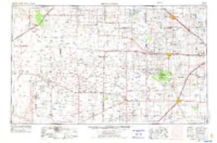
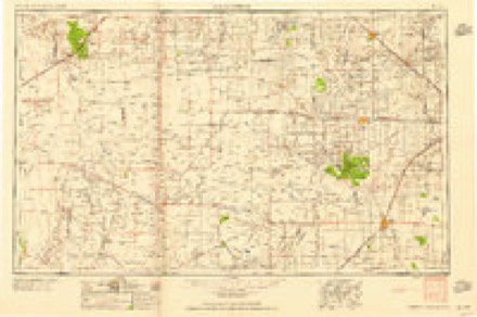
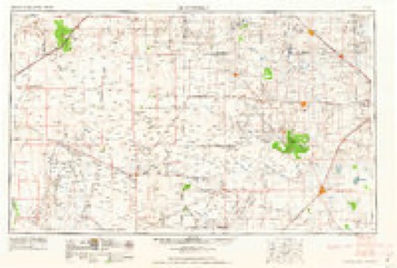
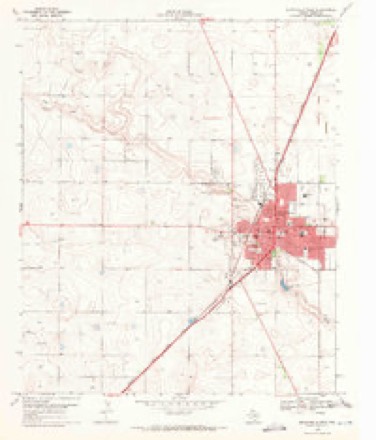
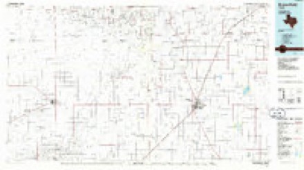
5 surveys from 8 printed sheetsMatched by testing this settlement's coordinate against the published boundary of every sheet in the United States Geological Survey's historical collection. Each opens the scanned sheet at the Survey.
- 1954 USGS Brownfield quadrangle1:250000, 2 printings
- 1958 USGS Brownfield quadrangle1:250000
- 1962 USGS Brownfield quadrangle1:250000
- 1969 USGS Brownfield West quadrangle1:24000, 2 printings
- 1985 USGS Brownfield quadrangle1:100000, 2 printings
Fires near this place
46 since 2005Regional context, not property-specific evidence. The federal wildfire occurrence database lists 46 fires within 5 miles of Brownfield between 2005 and 2015, burning about 375 acres in total. None started naturally. 1 was recorded as arson. Distance is straight-line from the map coordinates, so a fire counted here may appear on a neighbouring settlement's page as well.
| Reported cause | Fires |
|---|---|
| Smoking | 16 |
| Missing data/not specified/undetermined | 14 |
| Misuse of fire by a minor | 6 |
| Debris and open burning | 4 |
| Recreation and ceremony | 3 |
| Equipment and vehicle use | 1 |
| Arson/incendiarism | 1 |
| Power generation/transmission/distribution | 1 |
The most recent of them, most recent first, with the day each was reported and the service that recorded it.
| Date | Cause | Size | Reported by | Name on the report |
|---|---|---|---|---|
| 9 August 2011 | Smoking | 2.0 acres | Texas A & M Forest Service | 385 AND DAVID BAILEY |
| 4 July 2006 | Missing data/not specified/undetermined | 10 acres | Texas A & M Forest Service | not named |
| 2 July 2011 | Smoking | 2.0 acres | Texas A & M Forest Service | 2 SOUTH ON FM 403 |
| 12 July 2011 | Missing data/not specified/undetermined | 1.0 acres | Texas A & M Forest Service | 811 N CEDAR |
| 10 July 2006 | Missing data/not specified/undetermined | 1.0 acres | Texas A & M Forest Service | not named |
| 7 June 2011 | Recreation and ceremony | 1.0 acres | Texas A & M Forest Service | LUBBOCK AND ROSS |
| 22 June 2011 | Smoking | 2.0 acres | Texas A & M Forest Service | 401 N CUB ST. |
| 15 June 2006 | Debris and open burning | 25 acres | Texas A & M Forest Service | not named |
Settlements close enough to share some of these fires:
Mines and quarries near this place
1 within 5 milesRegional context, not property-specific evidence. The federal mineral resources record lists 1 working within 5 miles of Brownfield: 1 producer. All of them still produce. What was taken out: Sodium. Distance is straight-line from the map coordinates, so a quarry counted here may appear on a neighbouring settlement's page as well.
| Where | Site | Commodity | Status | Recorded |
|---|---|---|---|---|
| Brownfield Plant | Sodium | Producer |
Storms near this place
60 of 127 shownRegional context, not property-specific evidence. The National Weather Service names Brownfield in 127 storm reports between 1993 and 2025: 66 hail, 44 thunderstorm wind, 7 flash flood, 4 tornado. No death or injury is recorded in these reports. Each account below is quoted exactly as the forecast office filed it, from the NOAA Storm Events Database, and each date opens the federal record of that event.
| When | Event | Place named | Harm | What the report says |
|---|---|---|---|---|
| July 2010 | Flash Flood | Brownfield | $500,000 | Prolonged and heavy rainfall began to result in flash flooding over portions of Terry County during the late evening of the 3rd. ||Local emergency management officials initially reported that all roads leading to The Draw area in Brownfield were inundated with high running water by 20:41 CST. Also, at that time, two RV-campers were threatened by rapidly rising water in the Brownfield City Park. In addition, Webb Street also became inundated by flowing flood water east of town. Local authorities also reported that playa lakes in the Brownfield vicinity began to exceed capacity by 21:00 CST.||At 21:55 CST, first responders rescued a motorist as their vehicle was being washed away on U.S. Highway 62 southwest of Brownfield. Unspecified reports of a family rescued from raging flood waters additionally was received at that time, possibly along Texas Highway 137 southeast of Brownfield. ||Between 22:45 CST and 22:50 CST several reports of stranded motorists were received across southern and eastern Terry County, including along Farm to Market Road 2196 between Brownfield and Ropesville. Several of these motorists were reportedly taking refuge atop their vehicles. Damages to county roads and rural highways from flowing water was reported to be significant, totaling at least $300,000 in repair costs.||During the early morning hours of the 4th, additional heavy rainfall with Doppler radar estimated amounts approaching 14 inches, fell over the confluence of Sulphur and Lost Draws approximately five miles northwest of Brownfield. This water ran downstream and resulted in significant flash flooding in Brownfield during the hours around sunrise. Flood waters flowing through Brownfield during the early morning hours of Independence Day resulted in at least three flooded vehicles, damaged two homes, and caused at least $10,000 in damages to city streets.||Despite the number of high water rescues and widespread damages, no significant injuries were reported. Total infrastructure and agricultural losses from the Fourth of July flash floods and floods across Terry County, however, were estimated at $750,000. For the purposes of this report, these damages were differientiated between flash flood and flood as $500,000 and $250,000 respectively. |
| May 2006 | Tornado (F0) | Brownfield | $500,000 | Storm chasers and Skywarn storm spotters observed a third tornado northwest of Brownfield as an occluding mesocyclone produced intermittent tornadoes for more than fifteen minutes. This tornado remained on the ground for at least seven minutes, and tracked across open farmland. Two center-pivot irrigation units were destroyed, however, resulting in $500,000 in property damage. |
| June 2007 | Thunderstorm Wind | Brownfield | $250,000 | A swath of severe winds accompanied a bowing line-shaped convective complex as it moved southward over portions of Yoakum and Terry Counties during the late evening hours of the 26th. Severe winds impacted areas near Brownfield around 21:20 CST. A 62 mph gust was measured by the Texas Tech University West Texas Mesonet site just south of the city. In addition, the public estimated gusts up to 60 mph in the city. Newspaper articles reported that up to one hundred utility poles were downed during the storm, and that electrical services were knocked out to most of the city through the late evening hours. In addition, many trees suffered damage. No significant structural damage was reported. |
| July 2006 | Thunderstorm Wind | Brownfield | $175,000 | Thunderstorms produced damaging winds near Union in southeastern Terry County during the early evening hours of the 10th. Severe gusts estimated up to at least 65 mph ripped the roof off of the Union School gymnasium, and scattered debris more than 125 yards downwind. Several irrigation pivot systems were overturned. A cotton module builder damaged heavy farm equipment when it was rolled over by the winds. A trailer house located at the intersection of Texas Highways 213 and 137 suffered severe roof damage. Damage estimates were $175,000. No injuries were reported. |
| September 2014 | Flood | Brownfield | $100,000 | The Brownfield Sheriff's office reported water over roadways throughout town, as well as along portions of Highways 137 and 380 south and east of town on the 20th. Widespread rainfall amounts of two to four inches were observed with locally higher amounts. Several cars stalled out due to the high water. |
| October 2003 | Hail | Brownfield | $100,000 | The Brownfield PD reported golfball size hail in town. The hail damaged roofs and automobiles. |
| September 2010 | Thunderstorm Wind | Brownfield | $50,000 | Skywarn spotters reported that thunderstorm winds downed large branches. A dead tree reportedly was downed onto the roof of a home. In addition, a tin roof was partially removed from a business. The Texas Tech University West Texas Mesonet site south of town measured a peak wind gust of 59 mph. |
| June 1999 | Thunderstorm Wind | Brownfield | $50,000 | Strong thunderstorm wind blew down trees and 20 power poles. Roofs and sheds were also damaged by the wind. |
| June 1994 | Thunderstorm Wind | Brownfield | $50,000 | The public reported up to quarter-size hail in Spade in southeast Lamb County The Hockley County Sheriff's Office estimated 65 MPH winds In Levelland at 0000 CST, and also reported one barn was damaged by the wind. The Department of Public Safety reported a carport was damaged in Shallowater by high winds. Severe thunderstorm winds swept through Lubbock, downing many branches, some trees and many fences. It also destroyed at least three metal sheds, damaged a carport, and damaged part of the roof of a large retail store. South of the city of Lubbock, one mobile home was destroyed and a few trees were downed. In Brownfield, the Terry County Sheriff's Office estimated 60 MPH winds and reported some trees uprooted, one of which blocked a road in Brownfield. They also reported that one carport was heavily damaged. |
| December 1993 | Thunderstorm Wind | Brownfield | $50,000 | no account filed |
| July 2006 | Thunderstorm Wind | Brownfield | $25,000 | An isolated severe thunderstorm produced damaging winds near Brownfield during the evening of the 31st. A downburst resulted in 65 mph winds as measured by the Texas Tech University West Texas Mesonet site near the city. At least three utility poles were snapped by the winds, and two circuits were damaged. Electrical service was knocked out to more than 125 customers through 03:00 CST on August 1st. A number of elderly residents were impacted by the power outage, and emergency officials provided generators to several who required oxygen breathing machines. |
| October 2002 | Hail | Brownfield | $25,000 | Golfball size hail damaged roofs and automobiles. |
| March 2007 | Flash Flood | Brownfield | $20,000 | Local law enforcement officials reported that most city streets in Brownfield were inundated with flood waters after 18:30 CST. Three vehicles became stranded in high water and the occupants were rescued. No injuries were reported. Additionally, high water flowed over portions of U.S. Highway 380 east of Brownfield to the Lynn County line by 19:30 CST. |
| June 1995 | Tornado (F0) | Brownfield | $20,000 | no account filed |
| June 2008 | Thunderstorm Wind | Brownfield | $15,000 | Emergency management officials reported that damaging thunderstorm winds blew down several utility poles along U.S. Highway 380 west of Brownfield. |
| May 2003 | Thunderstorm Wind | Brownfield | $15,000 | Strong thunderstorm wind blew down at least eight power poles. |
| May 1998 | Hail | Brownfield | $15,000 | no account filed |
| May 2008 | Thunderstorm Wind | Brownfield | $10,000 | Local newspaper accounts indicate that damaging thunderstorm winds broke at least one utility pole in Brownfield. A combination of thunderstorm winds and lightning contributed to lost electrical service for a sizable section of the city. |
| June 1997 | Thunderstorm Wind | Brownfield | $10,000 | no account filed |
| May 1995 | Thunderstorm Wind | Brownfield | $10,000 | no account filed |
| January 2017 | Thunderstorm Wind | Brownfield | $8,000 | Law enforcement reported downed power lines on some streets in Brownfield. |
| June 2010 | Thunderstorm Wind | Brownfield | $5,000 | A complex of thunderstorms produced 50 mph to 60 mph wind gusts over portions of Terry County between 18:05 CST and 18:20 CST on the 1st. The winds downed a large tree which fell onto the roof of a home southwest of Brownfield. Damage to to the structure was minor. A nearby Texas Tech University West Texas Mesonet site recorded a 51 mph gust at 18:15 CST. |
| May 1997 | Thunderstorm Wind | Brownfield | $5,000 | no account filed |
| April 2003 | Thunderstorm Wind | Brownfield | $2,000 | Strong thunderstorm wind snapped a power pole on Highway 62/82. |
| May 2000 | Thunderstorm Wind | Brownfield | $2,000 | A tree was blown onto two cars, resulting in minor damage to both of them. |
| July 2008 | Thunderstorm Wind | Brownfield | $1,000 | no account filed |
| May 2025 | Hail | Brownfield | - | Local broadcast media relayed a report of a swath of hail south of Brownfield ranging in size from half dollar size to golf ball size. |
| May 2025 | Hail | Brownfield | - | Local broadcast media relayed a report of hail in Brownfield ranging in size from half dollar to ping pong ball size. Additional reports of golf ball size hail were received along Texas State Highway 137 between Brownfield and Union. |
| June 2024 | Hail | Brownfield | - | Several reports were received of hail in the city of Brownfield ranging in size from ping pongs to 2.25 inches in diameter. No damage was reported. |
| May 2024 | Thunderstorm Wind | Brownfield | - | A Texas Tech University West Texas mesonet site near Brownfield measured severe wind gusts from 2204 CST through 2211 CST. A peak wind gust of 64 mph was measured at 2211 CST. |
| May 2024 | Thunderstorm Wind | Brownfield | - | A Texas Tech University West Texas mesonet site near Brownfield measured severe wind gusts of 61 mph from 1654 CST through 1655 CST. |
| May 2023 | Thunderstorm Wind | Brownfield | - | A Texas Tech University West Texas mesonet site near Brownfield measured severe wind gusts from 0126 CST through 0127 CST. A peak wind gust of 65 mph was measured at 0127 CST. |
| May 2023 | Thunderstorm Wind | Brownfield | - | A Texas Tech University West Texas mesonet near Brownfield measured a severe wind gust of 58 mph. |
| August 2023 | Thunderstorm Wind | Brownfield | - | A Texas Tech University West Texas mesonet site near Brownfield measured a severe wind gust of 60 mph. These winds caused damage to a vineyard just to the northwest of Brownfield destroying a center pivot irrigation system. |
| September 2022 | Hail | Brownfield | - | An NWS cooperative weather observer reported quarter size hail in Brownfield. |
| September 2022 | Thunderstorm Wind | Brownfield | - | A Texas Tech University West Texas mesonet site near Brownfield measured a wind gust of 58 mph. |
| May 2021 | Hail | Brownfield | - | Several reports were received of hail up to golf ball size from approximately two miles west of Brownfield on US Highway 82 to Brownfield. No damage was reported. |
| September 2021 | Thunderstorm Wind | Brownfield | - | A Texas Tech University West Texas mesonet site near Brownfield measured severe wind gusts from 1856 CST through 1857 CST. A peak wind gust of 76 mph was measured at 1856 CST. |
| June 2020 | Thunderstorm Wind | Brownfield | - | A NWS storm survey revealed that a wet microburst hit the southern portion of the town of Brownfield from approximately 1735 to 1745 CST. Very intense winds leaned over or snapped off numerous power poles, damaged several mobile homes, and destroyed one mobile home. Two center pivots were also destroyed and numerous car windows were broken at the Rudd Correctional Facility. Given the magnitude of the damage, a National Weather Service damage survey team estimated that peak wind gusts of 100 to 105 mph likely affected the area. |
| March 2019 | Thunderstorm Wind | Brownfield | - | Measured by a Texas Tech University West Texas mesonet. |
| June 2019 | Thunderstorm Wind | Brownfield | - | From 1935 to 1940 CST, a Texas Tech University West Texas mesonet site near Brownfield reported severe thunderstorm winds. A peak wind gust measured 68 mph. |
| September 2019 | Thunderstorm Wind | Brownfield | - | A Texas Tech University West Texas mesonet site near Brownfield measured a wind gust of 58 mph. |
| May 2019 | Hail | Brownfield | - | A picture posted to social media showed a golf ball size hail stone. |
| October 2018 | Hail | Brownfield | - | Damage information was not available. |
| October 2018 | Hail | Brownfield | - | Damage information was not available. |
| April 2017 | Hail | Brownfield | - | Hail up to the size of golf balls was reported in Brownfield. No damage was reported. |
| April 2017 | Hail | Brownfield | - | Trained spotters and a NWS cooperative weather observer reported hail with sizes ranging from ping-pong balls to hen eggs. However, no damage was reported. |
| June 2017 | Thunderstorm Wind | Brownfield | - | A Texas Tech University West Texas mesonet site near Brownfield measured a wind gust to 66 mph. |
| September 2014 | Flood | Brownfield | - | Local emergency management officials reported street flooding and over spilling playa lakes as additional rainfall amounts of up to one inch fell on top of that from the 20th. |
| June 2013 | Hail | Brownfield | - | An Emergency Manager and public citizens observed quarter to half dollar size hail in Brownfield. |
| May 2013 | Thunderstorm Wind | Brownfield | - | A storm chaser estimated a wind gust to 67 mph five miles north-northeast of Brownfield. No damage was reported. |
| July 2012 | Thunderstorm Wind | Brownfield | - | A Texas Tech University West Texas mesonet site near Brownfield measured a wind gust to 62 mph. |
| May 2012 | Funnel Cloud | Brownfield | - | The Brownfield Emergency Manager relayed several reports of funnel clouds in the Brownfield area. |
| June 2011 | Thunderstorm Wind | Brownfield | - | The Texas Tech University West Texas mesonet site near Brownfield recorded a gust to 61 mph. No damage was reported. |
| August 2010 | Thunderstorm Wind | Brownfield | - | A Skywarn storm spotter reported thunderstorm winds estimated to exceed 60 mph in Brownfield between 17:14 CST and 17:18 CST. By 17:20 CST, the Texas Tech University West Texas Mesonet site just south of Brownfield measured a peak gust of 70 mph. No damages were reported. |
| October 2010 | Hail | Brownfield | - | Storm chasers and the local emergency manager reported quarter to golfball size hail just northwest of Brownfield along U.S Highway 385 around 19:45 CST. By 20:00 CST, storms and associated hailfall had expanded across the Brownfield vicinity and half dollar size hail was reported at the Terry County Airport along U.S. Highway 380 east of Brownfield. A swath of damaging hail then damaged and destroyed 25,000 acres of cotton crops as the parent thunderstorm complex moved northeastward toward the Terry and Lynn County line southeast of Meadow. |
| October 2010 | Hail | Brownfield | - | Additional convection developed south of the initial long-lived supercell. The newly developed storms also produced large hail. Multiple reports of quarter to ping pong ball size hail were recieved from the Brownfield vicinity at 16:45 CST. |
| June 2010 | Heavy Rain | Brownfield | - | Heavy rain caused ponding and minor flooding of city streets in Brownfield. |
| July 2010 | Flood | Brownfield | - | The flash floods which occurred in Terry County during the late evening hours of the 3rd and the early morning hours of the 4th transitioned toward standing flood waters during the morning hours on Independence Day. ||County agricultural and transportation officials, along with local media, reported that upwards of a foot of standing water remained over numerous rural and secondary roadways for days after the rainfall had subsided. Flood waters submerged local cotton crops until finally receeding on the 10th. Although damage to cotton crops was significant, local producers stated that most of the damage was not catastrophic and that productive crops remained possible.||Total infrastructure and agricultural losses from the Fourth of July flash floods and floods across Terry County were estimated at $750,000. For the purposes of this report, these damages were differientiated between flash flood and flood as $500,000 and $250,000 respectively. |
| June 2009 | Thunderstorm Wind | Brownfield | - | The Terry County Emergency Manager measured a 77 mph thunderstorm wind gust at 21:10 CST. No significant damage was reported. A near-by Texas Tech University West Texas Mesonet site recorded a 56 mph peak wind two miles south of Brownfield at the same time. |
Nearest settlements
The eight closest, with where each one stands in the county. Distances are straight-line, computed from the Geographic Names Information System coordinates.
Elsewhere
Matched on this settlement's Geographic Names Information System number rather than its name, so it cannot be a different place of the same name in another state.
| Wikipedia article on Brownfield | An encyclopaedic summary. Its text is share-alike, so it is linked here rather than copied. |
| Wikidata item Q981849 | The structured record the population and elevation above come from. Public domain (CC0). |
Provenance
This settlement is recorded in the Geographic Names Information System as feature 1352989. The sheet list is computed by point-in-boundary test against the United States Geological Survey's historical topographic inventory. Both are works of the United States government and carry no copyright under 17 U.S.C. 105.
Wildfire. Short, Karen C. 2022. Spatial wildfire occurrence data for the United States, 1992-2020 [FPA_FOD_20221014]. 6th Edition. Fort Collins, CO: Forest Service Research Data Archive. https://doi.org/10.2737/RDS-2013-0009.6 Collected with United States Government funding and usable without additional permissions or fees.
Mines and quarries. USGS Mineral Resources Data System (MRDS) https://mrdata.usgs.gov/mrds/ A work of the United States government, no copyright under 17 U.S.C. 105.
Storms. NOAA National Centers for Environmental Information, Storm Events Database https://www.ncei.noaa.gov/stormevents/ A work of the United States government, no copyright under 17 U.S.C. 105. Narratives are quoted verbatim from the National Weather Service report and are not edited or summarised.