 Block
BlockCanyon, Texas
9 topographic sheets cover this place, the earliest surveyed in 1954 and the latest in 1985. It stands in the Canyon census division. It lies in ZIP code area 79015. It stands on Hackberry Creek. The Survey maps it on the Canyon quadrangle. 14,836 people lived here at the 2020 count. It stands 3,543 feet above sea level.
Research this city
On record in Canyon
Buildings and businesses the archive holds for this place. Each opens its own page, with the source record it came from.
On the National Register 1 record
 L. T. Lester Houselisted 1978
Population over time
3 figuresCanyon grew from 1,400 to 14,836 between 1910 and 2020. These are the recorded population figures Wikidata holds for this place, reached through the Geographic Names Information System number this page is keyed on rather than by name, so they belong to this place and not to another of the same name. Most are census counts, but not all are: an early figure may be a founding or settlement estimate, and an estimate published within five years of a census is left out. The change column is computed, and is left blank where more than 20 years separate a figure from the one before it, because a gap that long is not a change between two counts.
| Year | People | Change |
|---|---|---|
| 1910 | 1,400 | |
| 2010 | 13,303 | |
| 2020 | 14,836 | +1,533 (+12%) |
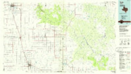
Topographic sheets covering this place
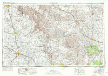
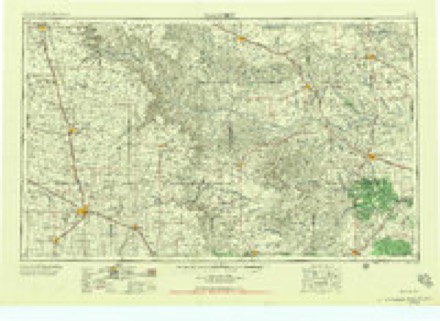
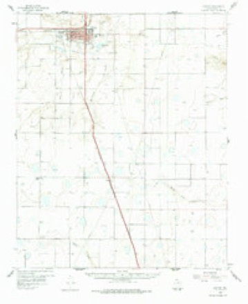
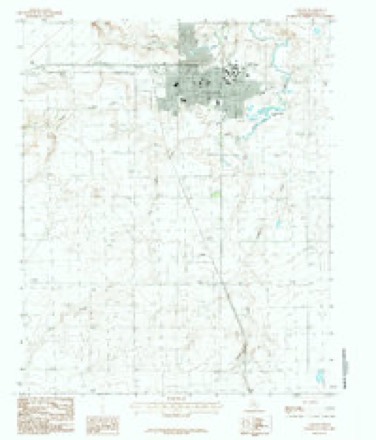
5 surveys from 9 printed sheetsMatched by testing this settlement's coordinate against the published boundary of every sheet in the United States Geological Survey's historical collection. Each opens the scanned sheet at the Survey.
- 1954 USGS Plainview quadrangle1:250000, 3 printings
- 1958 USGS Plainview quadrangle1:250000
- 1960 USGS Canyon quadrangle1:62500, 2 printings
- 1984 USGS Canyon quadrangle1:24000
- 1985 USGS Tulia quadrangle1:100000, 2 printings
Fires near this place
201 since 2005Regional context, not property-specific evidence. The federal wildfire occurrence database lists 201 fires within 5 miles of Canyon between 2005 and 2020, burning about 19,070 acres in total. 7 started naturally. 1 was recorded as arson. Distance is straight-line from the map coordinates, so a fire counted here may appear on a neighbouring settlement's page as well.
| Reported cause | Fires |
|---|---|
| Missing data/not specified/undetermined | 86 |
| Debris and open burning | 55 |
| Equipment and vehicle use | 39 |
| Natural | 7 |
| Power generation/transmission/distribution | 7 |
| Smoking | 2 |
| Other causes | 2 |
| Arson/incendiarism | 1 |
| Railroad operations and maintenance | 1 |
| Misuse of fire by a minor | 1 |
The most recent of them, most recent first, with the day each was reported and the service that recorded it.
| Date | Cause | Size | Reported by | Name on the report |
|---|---|---|---|---|
| 7 September 2011 | Missing data/not specified/undetermined | under an acre | Texas A & M Forest Service | 11-748 |
| 29 September 2010 | Missing data/not specified/undetermined | under an acre | Texas A & M Forest Service | 10-716 |
| 21 September 2016 | Debris and open burning | under an acre | Texas A & M Forest Service | 16-725 |
| 21 September 2016 | Debris and open burning | under an acre | Texas A & M Forest Service | 16-726 |
| 20 September 2017 | Debris and open burning | under an acre | Texas A & M Forest Service | 17-761 |
| 19 September 2020 | Missing data/not specified/undetermined | under an acre | Texas A & M Forest Service | 20926 |
| 17 September 2020 | Missing data/not specified/undetermined | under an acre | Texas A & M Forest Service | 20912 |
| 13 September 2010 | Debris and open burning | 12 acres | Texas A & M Forest Service | FM 1062 & ARNOT |
Settlements close enough to share some of these fires:
Storms near this place
60 of 420 shownRegional context, not property-specific evidence. The National Weather Service names Canyon in 420 storm reports between 1993 and 2025: 252 hail, 98 thunderstorm wind, 37 flash flood, 21 tornado. The reports record 1 injury. Each account below is quoted exactly as the forecast office filed it, from the NOAA Storm Events Database, and each date opens the federal record of that event.
| When | Event | Place named | Harm | What the report says |
|---|---|---|---|---|
| October 1999 | Lightning | Canyon | 1 hurt | A fourteen-year old boy was critically injured in the Lake Tanglewood area after being struck by lightning. |
| June 2004 | Hail | Canyon | $25,000,000 | Reported at Hunsley Road and Interstate 27. Many homes had damage to roofs and skylights from the hail. |
| May 2013 | Thunderstorm Wind | Canyon | $10,000,000 | Thunderstorms formed along a dryline stretching east-northeastward across Randall and Potter Counties during the afternoon hours of the 28th. These thunderstorms would take a northeast track which allowed them to move over the dryline. This caused the thunderstorms to produce isolated downbursts across the city. One such thunderstorm produced a localized downburst which downed power poles on US Highway 60 west of the city of Canyon (Randall County). The thunderstorm decayed quickly after moving to the dry side of the dryline due to ingesting much drier air into the updrafts. No injuries were associated with this gust. |
| June 2004 | Hail | Canyon | $10,000,000 | Reported at Rockwell Road and Interstate 27. Several homes and businesses had damage to roofs and windows. |
| June 1999 | Hail | Canyon | $8,000,000 | Three car dealerships just north of Canyon sustained heavy damage to around two hundred to three hundred vehicles and to their buildings with an estimated cost of one and a half million to two million dollars per dealership. The rest of the damage was to windows, skylights and roofs of homes on the north side of Canyon. |
| June 2025 | Hail | Canyon | $1,000,000 | A supercell thunderstorm tracked through southern Randall County and produced a swath of large hail from up to seven miles northwest of Canyon, and through the city of Canyon. Hail initially was around ping pong ball size but grew larger as the storm went through Canyon, producing hail up two and a half inches in diameter in Canyon. With measured winds around 70-80mph, much of this hail was wind-driven and produced significant damage to roofs, siding and broke many windows. While the total number of windows broken is unknown, it is at least 35. |
| April 2025 | Tornado (EF1) | Canyon | $500,000 | This tornado started around Northridge Drive where it brought down some tree limbs, It then crossed Hunsley Road where it began to impact homes, resulting in roof damage and fencing damage. It caused some fencing damage and minor roof damage to Freedom Fellowship Church. It then moved through the Madison Park subdivision, turning more to the west and following along Tatum Schulte Lane and Willeford Lane. Here, several homes received roof damage, fencing damage and some tree damage. Many of the homes sustained damage as a result of failure to the garage or porch roofs. One home had damage to cars and the home as a result|of a camper that went airborne, finally resting on between houses three doors down. The tornado then turned back to the southwest, crossing FM 2590 and causing additional tree and roof damage to some homes along Aztec Road. It crossed Hunsley Road again and the tornado lifted in the field behind a home. The maximum estimated winds were 110mph. |
| June 1995 | Hail | Canyon | $300,000 | no account filed |
| August 2002 | Thunderstorm Wind | Canyon | $250,000 | Several mobile homes were damaged with six to ten receiving moderate damage and twenty-five to thirty receiving only slight damage. Some vehicles were overturned and a few outbuildings had roofs or sidings ripped off. A dozen power poles were snapped by the strong winds. A large round trampoline was lifted over a house and split a big cedar rail fence like toothpicks. A Chevrolet dealer had tiles blown off the building and there was damage to vehicles on the lot. |
| June 2004 | Tornado (F1) | Canyon | $225,000 | The tornado caused damage to four homes at the intersection of Farm to Market Road 1541 and Nance Road. One home sustained major damage...losing the entire roof. The other three homes received minor damage. A boat and a horse trailer were also tossed around by the tornado and heavily damaged. No injuries were reported. |
| September 2007 | Flash Flood | Canyon | $138,000 | Extensive flash flooding was ongoing in and around Canyon with water flowing into some homes. Five to seven inches of rain fell during the time of the flash flooding. Dumpsters and large timber were floating down the streets with water entering the Junior High School and the Intermediate School. Vehicles and other storage items were washed out of the garages at the Palo Duro Retirement Village. Many streets in Canyon were flooded and impassable...including Russell Long Boulevard...which had several cars floating down the road and was closed down. Portions of U.S. Highway 87 and the intersection of 28th Street and 4th Avenue were also impassable due to flooding. The Canyon Fire Department had to rescue about a dozen stranded motorists. The northbound and southbound lanes of Interstate 27 east of Canyon were shut down and traffic along Farm to Market Road 1541 was rerouted. Hunsley Hills Boulevard was also closed. Runoff from the rainfall washed away three hundred yards of caliche from a construction site near the intersection of U.S. Highway 87 and U.S. Highway 60. Also...a section of Farm to Market Road 3331 between U.S. Highway 60 and Interstate 27 was washed away. Water entered many homes in Canyon and several homes had water entering into the basements. No injuries and no fatalities were reported. |
| June 1995 | Hail | Canyon | $100,000 | no account filed |
| June 1995 | Hail | Canyon | $100,000 | no account filed |
| June 2003 | Flash Flood | Canyon | $80,000 | Major flash flooding in the city of Canyon. Numerous roads were closed and garbage dumpsters were reported floating down the street. Bar ditches were reported overflowing. One home received damage by flood waters on Country Club Road and two other homes had their basements flooded. There was a high water vehicle rescue performed in Canyon at the intersection of Country Club Road and Rockwell Road when a woman drove her vehicle into flood waters which then swept her vehicle into the ditch. The water was reported to be up to her vehicle's windows. The woman was rescued by the Canyon Fire Department and no injuries occurred. |
| May 2002 | Hail | Canyon | $80,000 | Skylights broken and lots of roof damage along with windshields broken and damage to aircraft. |
| October 1998 | Tornado (F1) | Canyon | $75,000 | no account filed |
| May 1996 | Hail | Canyon | $75,000 | no account filed |
| October 2004 | Flash Flood | Canyon | $68,000 | no account filed |
| April 2003 | Thunderstorm Wind | Canyon | $60,000 | A mobile home was reportedly damaged. |
| July 2025 | Flash Flood | Canyon | $50,000 | Heavy rainfall and multiple rounds of rain brought flash flooding to north central Randall County. Vehicles were stalled in the fast moving flood waters near the US-87 and I-27 interchange. Some roads were also closed across the city of Canyon. |
| April 2012 | Thunderstorm Wind | Canyon | $50,000 | An official National Weather Service storm survey revealed that a storage unit was destroyed by thunderstorm wind gusts just south of Rockwell Road and Interstate 27 on Joy Avenue. There were no reports of injuries or fatalities. |
| May 2002 | Tornado (F2) | Canyon | $40,000 | A damage assessment was made on this tornado. This tornado began in Lubbock's County Warning Area in Swisher county. After the tornado tore through the community of Happy Texas, it moved east northeast and entered the extreme southern sections of Randall county. Two homes received moderate damage from the tornado in Randall county. No injuries or deaths occurred in Randall county. |
| May 1999 | Tornado (F0) | Canyon | $40,000 | Tornado killed a horse and destroyed a barn. Storm survey was done on this tornado. |
| May 2021 | Flash Flood | Canyon | $30,000 | Fire officials reported stranded vehicles and flooded roads along I-27 and HWY 217. Several other reports came in from the public of stranded vehicles as well. |
| March 2021 | Tornado (EF1) | Canyon | $30,000 | This satellite tornado occurred south of the main large tornado that was ongoing at the time. Radar and chaser reports/video suggest it was an anticyclonic tornado that occurred on the southern edge of the storms rear flank downdraft. A brief radar debris signature was noted after the tornado crossed he interstate. The tornado snapped power poles along I-27, south of the main tornado track, but no other notable damage occurred as it remained in open ranch and grassland country otherwise. |
| April 2012 | Thunderstorm Wind | Canyon | $30,000 | The public reported that a fence and an empty tractor trailer semi truck had been blown over. There were no reports of injuries or fatalities. |
| July 2010 | Flash Flood | Canyon | $30,000 | Local law enforcement officials reported that high water rescues had to be performed on stranded motorists at Hollywood Road or Loop 335 and Coulter Street...and also at Ridgecrest Circle and Teckla Boulevard in southwest Amarillo. An off-duty National Weather Service employee reported two to three feet of water on Country Club Drive in the Hunsley Hills section of Canyon. |
| August 2004 | Hail | Canyon | $28,000 | no account filed |
| August 2004 | Hail | Canyon | $26,000 | no account filed |
| August 2024 | Thunderstorm Wind | Canyon | $25,000 | Five power poles were snapped by thunderstorm winds along Farm to Market Road 1541. |
| August 2010 | Flash Flood | Canyon | $25,000 | A trained spotter reported that several vehicles had stalled on the north side of Canyon with water up to the doors. The trained spotter also reported that there was two to three feet of water over some roads. No injuries were reported. |
| June 2009 | Thunderstorm Wind | Canyon | $25,000 | The strong thunderstorm wind gust destroyed a barn at Farm to Market Road 1062 and Blessen Road. The public reported that an animal was injured. |
| March 2000 | Thunderstorm Wind | Canyon | $25,000 | Two car dealerships just north of Canyon had some damage. |
| July 1997 | Thunderstorm Wind | Canyon | $25,000 | Wind damage at Bell Street and Rockwell Road with power lines down and damage to trailers, cars, and sheds. |
| May 2003 | Dust Devil | Canyon | $25,000 | no account filed |
| April 2004 | Thunderstorm Wind | Canyon | $23,000 | Shingles were reportedly blown off a mobile home and a storage building was overturned. |
| June 2013 | Thunderstorm Wind | Canyon | $20,000 | A line of thunderstorms developed over the southern Texas Panhandle during the late night hours of the 16th. This line quickly showed indications that damaging winds would be the primary hazard. As the line moved over the town of Canyon (Randall County), KVII reported a trampoline was tossed over a house and impaled the roof of the house. The downdraft gust that caused this damage was estimated to be near 65 mph. The line continued to move to the southeast after producing this gust. |
| August 2008 | Thunderstorm Wind | Canyon | $20,000 | The Canyon Fire Department reported that a large tree blew down on a mobile home near the United Supermarket in Canyon. There was significant damage to the home...however no injuries were reported. |
| August 2003 | Flash Flood | Canyon | $20,000 | no account filed |
| May 1995 | Hail | Canyon | $20,000 | no account filed |
| May 2013 | Thunderstorm Wind | Canyon | $15,000 | A thunderstorm developed over southern Randall County during the mid-morning hours of the 21st. As the thunderstorm moved to the northeast it encountered a strongly sheared environment which toppled the storm structure. The core of the thunderstorm collapsed 1 mile east of the city of Canyon (Randall County) causing a dangerous cross wind on Interstate 27. This cross wind caused two semi-tractor trailers to be overturned. No injuries were reported in association with this damage, wind speed estimated from similar report in the area, and property damage values estimated. |
| May 1996 | Hail | Canyon | $15,000 | no account filed |
| April 2007 | Tornado (EF1) | Canyon | $14,000 | The tornado formed in the extreme southeast corner of Randall county about ten miles due south of Palo Duro Canyon State Park at 2000 CST. Damage occurred to farm structures and power poles. One horse was killed as a result of the tornado. This tornado was rated as a strong EF1 tornado. The tornado dissipated somewhere in the Palo Duro Canyon in eastern Randall County. No injuries were reported. |
| August 2004 | Hail | Canyon | $14,000 | no account filed |
| August 2004 | Hail | Canyon | $12,000 | no account filed |
| August 2025 | Hail | Canyon | $10,000 | A supercell thunderstorm produced hail from quarter to golfball size to the north and northwest of Canyon. |
| May 1999 | Tornado (F0) | Canyon | $10,000 | The tornado damaged an out building and the track was estimated. |
| August 2004 | Thunderstorm Wind | Canyon | $9,000 | no account filed |
| April 2004 | Thunderstorm Wind | Canyon | $8,000 | A metal shed was reportedly blown over due to the strong winds. |
| April 2004 | Thunderstorm Wind | Canyon | $8,000 | Rain gutters were reportedly blown off buildings with large tree limbs blown down. |
| August 2003 | Thunderstorm Wind | Canyon | $8,000 | no account filed |
| April 2004 | Thunderstorm Wind | Canyon | $6,000 | The strong winds reportedly caused damage to outdoor furniture. |
| May 2023 | Thunderstorm Wind | Canyon | $5,000 | Carport was destroyed alongside various roof shingles blown off and a wooden fence was broken by thunderstorm wind gust. |
| May 2021 | Thunderstorm Wind | Canyon | $5,000 | Downed powerlines were reported at 23rd St. and 10th Ave in Canyon. |
| June 2020 | Thunderstorm Wind | Canyon | $5,000 | The metal roof from a wooden pavilion with a was lifted and tossed down an alley. Damage also occurred to a vehicle as a result. |
| May 2008 | Thunderstorm Wind | Canyon | $5,000 | The Canyon Fire Department had reported that five power poles had blown down in Canyon. |
| August 1993 | Thunderstorm Wind | Canyon | $5,000 | Afternoon thunderstorms produced hail up to 1.25 inches and strong winds blew over some large trees in Canyon. |
| June 2009 | Thunderstorm Wind | Canyon | $4,000 | Strong thunderstorm wind gusts caused the roof to be peeled off from a barn at Farm to Market Road 1062 and Bushland Road. |
| May 2008 | Thunderstorm Wind | Canyon | $4,000 | The Canyon Fire Department reported that a power pole and an associated transformer were pulled out of the ground in Canyon. |
| April 2025 | Tornado (EF0) | Canyon | $3,000 | This was a very weak and brief tornado. It dropped down just to the south of McCormick Road, along Burrell Street. It resulted in some minor tree damage and tossed a trampoline in another resident's yard. It took a very narrow path to the northeast and|caused some damage to a barn near McCormick Road. The maximum estimated winds were 74mph. |
Nearest settlements
The eight closest, with where each one stands in the county. Distances are straight-line, computed from the Geographic Names Information System coordinates.
| Map | Place | Distance | Sheets |
|---|---|---|---|
| Cleta | 3.8 miles | 9 | |
| Rockwell Place | 4.4 miles | 8 | |
| Timbercreek Canyon | 7.3 miles | 8 | |
| Palisades | 8.3 miles | 8 | |
| Lake Tanglewood | 9.2 miles | 8 | |
| Umbarger | 10.1 miles | 10 | |
| Ogg | 10.1 miles | 9 | |
| Zita | 11.0 miles | 8 |
Elsewhere
Matched on this settlement's Geographic Names Information System number rather than its name, so it cannot be a different place of the same name in another state.
| Wikipedia article on Canyon | An encyclopaedic summary. Its text is share-alike, so it is linked here rather than copied. |
| Wikidata item Q976999 | The structured record the population and elevation above come from. Public domain (CC0). |
Provenance
This settlement is recorded in the Geographic Names Information System as feature 1353772. The sheet list is computed by point-in-boundary test against the United States Geological Survey's historical topographic inventory. Both are works of the United States government and carry no copyright under 17 U.S.C. 105.
Wildfire. Short, Karen C. 2022. Spatial wildfire occurrence data for the United States, 1992-2020 [FPA_FOD_20221014]. 6th Edition. Fort Collins, CO: Forest Service Research Data Archive. https://doi.org/10.2737/RDS-2013-0009.6 Collected with United States Government funding and usable without additional permissions or fees.
Storms. NOAA National Centers for Environmental Information, Storm Events Database https://www.ncei.noaa.gov/stormevents/ A work of the United States government, no copyright under 17 U.S.C. 105. Narratives are quoted verbatim from the National Weather Service report and are not edited or summarised.