 Block
BlockTimbercreek Canyon, Texas
8 topographic sheets cover this place, the earliest surveyed in 1954 and the latest in 1986. It stands in the Canyon census division. It lies in ZIP code area 79118. It sits by The Palisades. The Survey maps it on The Palisades quadrangle. 430 people lived here at the 2020 count. It stands 3,451 feet above sea level.
Population over time
3 figuresTimbercreek Canyon grew from 406 to 430 between 2000 and 2020. These are the recorded population figures Wikidata holds for this place, reached through the Geographic Names Information System number this page is keyed on rather than by name, so they belong to this place and not to another of the same name. Most are census counts, but not all are: an early figure may be a founding or settlement estimate, and an estimate published within five years of a census is left out. The change column is computed, and is left blank where more than 20 years separate a figure from the one before it, because a gap that long is not a change between two counts.
| Year | People | Change |
|---|---|---|
| 2000 | 406 | |
| 2010 | 418 | +12 (+3%) |
| 2020 | 430 | +12 (+3%) |
Topographic sheets covering this place
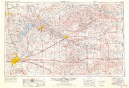
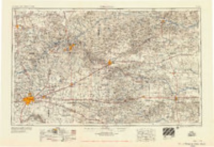
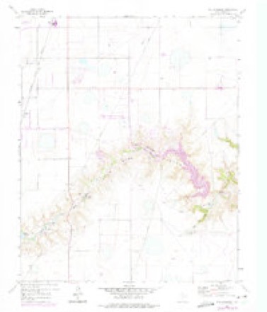
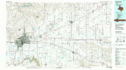
4 surveys from 8 printed sheetsMatched by testing this settlement's coordinate against the published boundary of every sheet in the United States Geological Survey's historical collection. Each opens the scanned sheet at the Survey.
- 1954 USGS Amarillo quadrangle1:250000, 2 printings
- 1958 USGS Amarillo quadrangle1:250000
- 1960 USGS The Palisades quadrangle1:24000, 3 printings
- 1986 USGS Amarillo quadrangle1:100000, 2 printings
Fires near this place
224 since 2006Regional context, not property-specific evidence. The federal wildfire occurrence database lists 224 fires within 5 miles of Timbercreek Canyon between 2006 and 2020, burning about 3,381 acres in total. 3 started naturally. 4 were recorded as arson. Distance is straight-line from the map coordinates, so a fire counted here may appear on a neighbouring settlement's page as well.
| Reported cause | Fires |
|---|---|
| Missing data/not specified/undetermined | 117 |
| Equipment and vehicle use | 40 |
| Debris and open burning | 36 |
| Power generation/transmission/distribution | 15 |
| Misuse of fire by a minor | 4 |
| Arson/incendiarism | 4 |
| Natural | 3 |
| Smoking | 3 |
| Railroad operations and maintenance | 1 |
| Other causes | 1 |
The most recent of them, most recent first, with the day each was reported and the service that recorded it.
| Date | Cause | Size | Reported by | Name on the report |
|---|---|---|---|---|
| 7 September 2019 | Equipment and vehicle use | 42 acres | Texas A & M Forest Service | WASHINGTON |
| 30 September 2009 | Equipment and vehicle use | 1.0 acres | Texas A & M Forest Service | CLAUDE HIGHWAY AND TANGLEWOOD |
| 29 September 2011 | Missing data/not specified/undetermined | under an acre | Texas A & M Forest Service | BURLINGTON ROAD |
| 28 September 2015 | Missing data/not specified/undetermined | 1.0 acres | Texas A & M Forest Service | FM 2219 |
| 25 September 2015 | Missing data/not specified/undetermined | 1.0 acres | Texas A & M Forest Service | POTTER RD |
| 25 September 2011 | Equipment and vehicle use | 15 acres | Texas A & M Forest Service | MCCORMICK |
| 22 September 2020 | Power generation/transmission/distribution | under an acre | Texas A & M Forest Service | 1184 |
| 21 September 2009 | Smoking | 1.0 acres | Texas A & M Forest Service | FIRE |
Settlements close enough to share some of these fires:
Storms near this place
60 of 85 shownRegional context, not property-specific evidence. The National Weather Service names Timbercreek Canyon in 85 storm reports between 2008 and 2026: 48 hail, 27 thunderstorm wind, 3 heavy rain, 3 flash flood. The reports record 1 death. Each account below is quoted exactly as the forecast office filed it, from the NOAA Storm Events Database, and each date opens the federal record of that event.
| When | Event | Place named | Harm | What the report says |
|---|---|---|---|---|
| December 2012 | Thunderstorm Wind | Timbercreek Canyon | 1 killed | A 69 mph thunderstorm winds gusts estimated via radar caused a tractor trailer rollover accident at the intersection of McAfee Road and Washington Street in Amarillo (Randall County). The tractor trailer was traveling south along Washington Street as a line of thunderstorms moved from west to east across Amarillo. The line of thunderstorms produced a downdraft which struck the tractor trailer perpendicular to its path of travel causing the driver to lose control of the vehicle. The driver of the semi-tractor trailer died as a result of the rollover. |
| August 2021 | Hail | Timbercreek Canyon | $60,000 | A NWS employee reported 1.25 diameter hailstones at their house in southwest Amarillo. |
| May 2024 | Hail | Timbercreek Canyon | $10,000 | no account filed |
| May 2008 | Thunderstorm Wind | Timbercreek Canyon | $8,000 | The Amarillo Emergency Management Office reported power lines blown down at Farmers Avenue and Western Street in south Amarillo. |
| June 2025 | Thunderstorm Wind | Timbercreek Canyon | $7,000 | A localized microburst occurred over south Amarillo, which blew the roof off a metal out-building and drove with wooden posts through the roof of a house. |
| August 2009 | Thunderstorm Wind | Timbercreek Canyon | $4,000 | An amateur radio operator reported that a street sign had blown down across the southbound lanes of Interstate 27 and McCormick Road. |
| April 2025 | Flood | Timbercreek Canyon | $2,000 | Heavy rain during the night of April 25th resulted in flooding of most of the access road near McCormick Road and I-27. It remained covered in water into the next morning and was barely passable. |
| October 2025 | Hail | Timbercreek Canyon | - | Hail fell that was mostly pea-sized but there were some nickel and quarter size hailstones that mixed in. |
| June 2023 | Funnel Cloud | Timbercreek Canyon | - | Funnel cloud reported by off duty NWS employee and local media. The funnel had lasted several minutes. |
| May 2021 | Hail | Timbercreek Canyon | - | Multiple reports came in from 1550 CST to 1612 CST for hail sizes ranging from 0.75 to 1.25 around southern Amarillo or west to northwest of Timbercreek Canyon. Sources for the reports ranged from public to emergency managers to spotters. |
| May 2021 | Flood | Timbercreek Canyon | - | Reports received of curb to curb flooding. |
| May 2020 | Hail | Timbercreek Canyon | - | This hail was observed 8 miles south of Canyon. |
| August 2020 | Hail | Timbercreek Canyon | - | A trained spotter reported nickel size hail. |
| June 2019 | Thunderstorm Wind | Timbercreek Canyon | - | There were multiple reports of wind damage near the intersection of Washington and McCormick. Trees were damaged, several garage doors were blown in, and a barn was destroyed. |
| April 2019 | Hail | Timbercreek Canyon | - | Late report of accumulating hail ranging from dimes to quarters. Ground was covered up to several inches deep. |
| May 2019 | Hail | Timbercreek Canyon | - | Report from MPing. |
| May 2019 | Hail | Timbercreek Canyon | - | Quarter size hail report received via MPing. |
| October 2019 | Flood | Timbercreek Canyon | - | Water over the roadway was reported on the Interstate-27 frontage road near McCormick Road. |
| May 2019 | Hail | Timbercreek Canyon | - | University researchers reported 1.27 inch hail, measured by calipers. |
| June 2018 | Thunderstorm Wind | Timbercreek Canyon | - | Waffle House reported they lost power with the strong winds that were ahead of the line of storms to the north. |
| May 2018 | Hail | Timbercreek Canyon | - | Nickel size hail reported. |
| September 2018 | Hail | Timbercreek Canyon | - | Golf ball size hail reported near Randall High School. |
| June 2017 | Flash Flood | Timbercreek Canyon | - | Water up to the bumper of a car. Cars being pulled out of high water by a wrecker just north of loop 335 on Coulter. |
| June 2017 | Hail | Timbercreek Canyon | - | Six to 8 inches of hail covering both sides of Washington just north of Camp Don Harrington. |
| June 2017 | Thunderstorm Wind | Timbercreek Canyon | - | One-thousand-pound building blown over. Pieces of metal torn off roof. |
| July 2017 | Hail | Timbercreek Canyon | - | Some accumulating hail on I 27 south at Sundown exit. |
| June 2016 | Thunderstorm Wind | Timbercreek Canyon | - | A large 4 to 6 inch diameter tree limb was blown down due to the strong wind associated with the severe thunderstorm. |
| April 2015 | Hail | Timbercreek Canyon | - | The public reported golf ball size hail at South Western and Loop 335 in Amarillo. |
| May 2015 | Thunderstorm Wind | Timbercreek Canyon | - | A member of the public estimated a wind gust of 60 mph at Timbercreek Canyon. |
| August 2015 | Thunderstorm Wind | Timbercreek Canyon | - | A detached garage was leveled, a swimming pool half full of water was flipped, and a swing set was blown across the yard. |
| August 2015 | Thunderstorm Wind | Timbercreek Canyon | - | A semi trailer was rolled 50 yard and a manufactured home was pushed off its blocks. This occurred near Mcafee Road and FM 1541, 2 miles west of Timbercreek Canyon. |
| August 2015 | Thunderstorm Wind | Timbercreek Canyon | - | Numerous large tree limbs up to 8 inches in diameter were snapped at Camp Don Harrington, 6 miles northeast of Canyon. |
| August 2015 | Thunderstorm Wind | Timbercreek Canyon | - | Large metal carports and a garage building was lifted from anchors and rolled. Power poles were also broken. Structure were rolled back to the southwest due to strong northeast winds behind the squall line associated with a wake low event. |
| July 2015 | Thunderstorm Wind | Timbercreek Canyon | - | A thunderstorm wind gust of 59 mph occurred at the KVII schoolnet site at Midway Alternative High School 5 miles west-northwest of Timber Creek Canyon. |
| May 2015 | Hail | Timbercreek Canyon | - | Ping pong ball size hail was reported 3 miles west-southwest of Timber Creek Canyon. |
| June 2014 | Hail | Timbercreek Canyon | - | A cluster of thunderstorms developed along a stalled frontal boundary during the early morning hours of the 6th. These thunderstorms quickly intensified while moving to the east. As the storms moved over the city of Amarillo (Randall County), the local broadcast media reported ping pong size hail (1.50 inches) 6 miles south-southwest of Amarillo (Randall County). After producing this hail the cluster of thunderstorms continued to move across the southern Texas Panhandle. |
| June 2014 | Thunderstorm Wind | Timbercreek Canyon | - | A cluster of thunderstorms developed along a stalled frontal boundary during the early morning hours of the 6th. These thunderstorms quickly intensified while moving to the east. As the storms moved over the city of Amarillo (Randall County), an estimated 65 mph thunderstorm wind gust blew in a garage door on a large outbuilding which also caused damage to the adjacent wall. A fence near the large outbuilding was also blown over. After producing this gust the cluster of thunderstorms continued to move across the southern Texas Panhandle. |
| June 2014 | Flash Flood | Timbercreek Canyon | - | A cluster of thunderstorms developed over the southern Texas Panhandle during the early morning hours of the 6th. These storms produced intense downpours which led to localized flash flooding across the city of Amarillo (Randall and Potter Counties). A NWS employee reported flash flooding making the intersection of Hollywood Street and Coulter Street impassable. Two vehicles became stranded in the flood waters but no high water rescues were reported. This flooding persisted until the rain came to an end around 3 AM CST. |
| June 2014 | Hail | Timbercreek Canyon | - | A cluster of thunderstorms developed along a stalled frontal boundary during the early morning hours of the 6th. These thunderstorms quickly intensified while moving to the east. As the storms neared the city of Amarillo (Randall County), a member of the public 8 miles southeast of Bushland (Randall County) reported hen egg size hail (2.00 inches). After producing this hail the cluster of thunderstorms continued to move across the southern Texas Panhandle. |
| June 2014 | Flash Flood | Timbercreek Canyon | - | A line of thunderstorms moved across Randall County during the late evening hours of the 8th. The line produced intense rainfall which caused localized flash flooding. This flash flooding caused 18 to 24 inches of water to cover the road at the Hunsley Hills Barricade (Randall County). This flash flooding continued until the rain moved east of Randall County by midnight on the 9th. |
| July 2014 | Hail | Timbercreek Canyon | - | The collision of two outflow boundaries caused the development of thunderstorms over the southern Texas Panhandle during the evening hours of the 14th. This allowed storms to quickly intensify to produce a mixture of heavy rain and nickel size hail (0.88 inch) as reported by a trained storm spotter. After producing this hail the storms slowly moved southward across the southern Texas Panhandle before weakening as sunset approached. |
| June 2014 | Thunderstorm Wind | Timbercreek Canyon | - | A line of thunderstorms moved out of the Oklahoma Panhandle and into the Texas Panhandle during the late night hours of the 22nd. As the line neared the town of Amarillo (Potter County), the KVII Schoolnet site 7 miles southwest of Pantex at Highland Park High School (Potter County) reported a 59 mph thunderstorm downburst gust. After producing this downburst gust the line continued to move to the south-southeast across the Texas Panhandle. |
| June 2014 | Thunderstorm Wind | Timbercreek Canyon | - | A cluster of discrete thunderstorms moving across the Texas Panhandle transitioned into a broken linear structure during the late evening hours of the 6th. As this broken line of storms moved over the town of Amarillo (Randall County), a member of the public reported an estimated 59 mph downburst 7 miles north-northeast of Canyon (Randall County). This gust lofted a trampoline over a fence in the Rockwell Road area. After producing this gust the line of thunderstorms continued moving eastward across the Panhandle. |
| June 2014 | Thunderstorm Wind | Timbercreek Canyon | - | A line of thunderstorms moved out of the Oklahoma Panhandle and into the Texas Panhandle during the late night hours of the 22nd. As the line neared Timbercreek Canyon (Randall County), KVII Schoolnet at Lakeview Elementary (Randall County) reported a 70 mph thunderstorm downburst gust. After producing this downburst gust the line continued to move to the south-southeast across the Texas Panhandle. |
| June 2014 | Thunderstorm Wind | Timbercreek Canyon | - | A cluster of discrete thunderstorms moving across the Texas Panhandle transitioned into a broken linear structure during the late evening hours of the 6th. As this broken line of storms moved north of the town of Canyon (Randall County), the local fire and rescue department reported an estimated 65 mph thunderstorm downburst caused minor roof damage to a building, caused an RV to lean against home, and lofted a trampoline into power lines. This damage was located 7 miles north-northeast of Canyon (Randall County). After producing this gust the line of thunderstorms continued moving eastward across the Panhandle. |
| June 2014 | Thunderstorm Wind | Timbercreek Canyon | - | A cluster of discrete thunderstorms moving across the Texas Panhandle transitioned into a broken linear structure during the late evening hours of the 6th. As this broken line of storms moved north of the town of Canyon (Randall County), local law enforcement reported an estimated 58 mph thunderstorm downburst blew trees down 7 miles north-northeast of Canyon (Randall County). After producing this gust the line of thunderstorms continued moving eastward across the Panhandle. |
| June 2014 | Thunderstorm Wind | Timbercreek Canyon | - | A line of thunderstorms moved out of the Oklahoma Panhandle and into the Texas Panhandle during the late night hours of the 22nd. As the line neared the town of Amarillo (Randall County), the KVII Schoolnet site 6 miles northwest of Timbercreek Canyon at Randall High School (Randall County) reported a 59 mph thunderstorm downburst gust. After producing this downburst gust the line continued to move to the south-southeast across the Texas Panhandle. |
| June 2013 | Heavy Rain | Timbercreek Canyon | - | A line of thunderstorm developed over the southern Texas Panhandle during the late night hours of the 16th and persisted into the early morning hours of the 17th. This line of thunderstorms produced a period of heavy rain over the city of Amarillo (Randall and Potter County). A member of the local television station KFDA reported that over the period of an hour 0.97 inches of rain fell at the station in downtown Amarillo (Potter County). This heavy rain led to minor flooding of streets in the southern portion of the city (Randall County). The flooding subsided after 1 AM CST. |
| May 2013 | Thunderstorm Wind | Timbercreek Canyon | - | Thunderstorms formed along a dryline stretching east-northeastward across Randall and Potter Counties during the afternoon hours of the 28th. These thunderstorms would take a northeast track which allowed them to move over the dryline. This caused the thunderstorms to produce isolated downbursts across the city. The KVII schoolnet site at Midway Alternative High School (Randall County) reported a 69 mph gust while a thunderstorm was overhead. The thunderstorm decayed quickly after moving to the dry side of the dryline due to ingesting much drier air into the updrafts. No damage or injuries were associated with this gust. |
| July 2013 | Heavy Rain | Timbercreek Canyon | - | A tropical shower moved over the city of Amarillo (Potter County) during the early morning hours of the 17th. Due to the above average mositure content in the atmosphere, these showers produced intense downpours over the city. An off duty NWS employee reported that this intense rain caused minor flooding of the south bound lanes of Coulter Street near the Loop 335 interchange. This minor flooding quickly receded as showers moved away from the city. No swift water rescues or stranded motorist were reported in association to this minor flooding. |
| June 2013 | Hail | Timbercreek Canyon | - | An embedded thunderstorm broke off from a line of storms moving across Northwest Texas. This storm moved to the northeast and moved across the southern Texas Panhandle during the evening hours of the 20th. As the thunderstorm moved across Randall County, a member of the public reported quarter size hail (1.00 inch) eight miles north of Canyon (Randall County). The thunderstorm continued to move to the northeast across the county after producing this hail, before diminishing over the central portion of Amarillo (Randall County). |
| March 2013 | Thunderstorm Wind | Timbercreek Canyon | - | A member of the public estimated a 60 mph wind gusts as the line of thunderstorms moved over their location in Timbercreek Canyon (Randall County). |
| July 2013 | Heavy Rain | Timbercreek Canyon | - | Scattered showers and thunderstorms developed across the southwestern Texas Panhandle during the evening hours of the 24th. These thunderstorms heavy rain on the southwest side of Amarillo (Randall County) which caused minor flooding of streets on Hillside Street and Coulter Road; Bell Street and 45th Ave; and on Western Street between Sundown Ave and Mack Road. Scattered showers and thunderstorms persisted through the overnight hours and into the late morning hours of the 25th. No stranded motorist or swift water rescues were reported in association to this minor flooding. |
| December 2012 | Thunderstorm Wind | Timbercreek Canyon | - | The Amarillo Emergency Manager reported a radio tower being blown down onto railroad tracks. A thunderstorm wind gust of 69 mph was estimated using radar images from the time the damage occurred. |
| July 2009 | Hail | Timbercreek Canyon | - | A trained spotter reported the hail near the intersection of Washington Street and Hollywood Road. |
| April 2009 | Hail | Timbercreek Canyon | - | An amateur radio operator reported penny size hail on the southwest part of Loop 335 or Hollywood Road at Soncy Road. |
| April 2009 | Hail | Timbercreek Canyon | - | A trained spotter reported the hail at 45th Street and Soncy Road. |
| March 2026 | Hail | Timbercreek Canyon | - | no account filed |
| May 2025 | Hail | Timbercreek Canyon | - | no account filed |
| October 2025 | Hail | Timbercreek Canyon | - | no account filed |
Nearest settlements
The eight closest, with where each one stands in the county. Distances are straight-line, computed from the Geographic Names Information System coordinates.
| Map | Place | Distance | Sheets |
|---|---|---|---|
| Palisades | 1.0 miles | 8 | |
| Lake Tanglewood | 1.9 miles | 8 | |
| Rockwell Place | 4.9 miles | 8 | |
| Zita | 5.7 miles | 8 | |
| Canyon | 7.3 miles | 9 | |
| Cleta | 10.5 miles | 9 | |
| Ogg | 15.5 miles | 9 | |
| Umbarger | 16.7 miles | 10 |
Elsewhere
Matched on this settlement's Geographic Names Information System number rather than its name, so it cannot be a different place of the same name in another state.
| Wikipedia article on Timbercreek Canyon | An encyclopaedic summary. Its text is share-alike, so it is linked here rather than copied. |
| Wikidata item Q2241890 | The structured record the population and elevation above come from. Public domain (CC0). |
Provenance
This settlement is recorded in the Geographic Names Information System as feature 1388605. The sheet list is computed by point-in-boundary test against the United States Geological Survey's historical topographic inventory. Both are works of the United States government and carry no copyright under 17 U.S.C. 105.
Wildfire. Short, Karen C. 2022. Spatial wildfire occurrence data for the United States, 1992-2020 [FPA_FOD_20221014]. 6th Edition. Fort Collins, CO: Forest Service Research Data Archive. https://doi.org/10.2737/RDS-2013-0009.6 Collected with United States Government funding and usable without additional permissions or fees.
Storms. NOAA National Centers for Environmental Information, Storm Events Database https://www.ncei.noaa.gov/stormevents/ A work of the United States government, no copyright under 17 U.S.C. 105. Narratives are quoted verbatim from the National Weather Service report and are not edited or summarised.