 Block
BlockFarnsworth, Texas
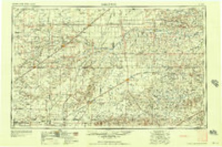
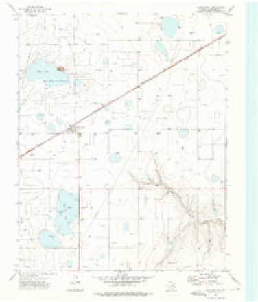
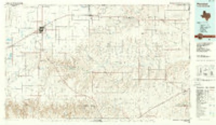
6 topographic sheets cover this place, the earliest surveyed in 1954 and the latest in 1986. It stands in the Perryton West census division. It lies in ZIP code area 79070. The Survey maps it on the Farnsworth quadrangle. 95 people lived here at the 2020 count. It stands 2,992 feet above sea level.
Topographic sheets covering this place
4 surveys from 6 printed sheetsMatched by testing this settlement's coordinate against the published boundary of every sheet in the United States Geological Survey's historical collection. Each opens the scanned sheet at the Survey.
- 1954 USGS Perryton quadrangle1:250000, 3 printings
- 1958 USGS Perryton quadrangle1:250000
- 1973 USGS Farnsworth quadrangle1:24000
- 1986 USGS Perryton quadrangle1:100000

Storms near this place
60 of 81 shownRegional context, not property-specific evidence. The National Weather Service names Farnsworth in 81 storm reports between 1994 and 2025: 50 hail, 16 thunderstorm wind, 12 tornado, 2 funnel cloud. No death or injury is recorded in these reports. Each account below is quoted exactly as the forecast office filed it, from the NOAA Storm Events Database, and each date opens the federal record of that event.
| When | Event | Place named | Harm | What the report says |
|---|---|---|---|---|
| June 2023 | Tornado (EF2) | Farnsworth | $114,000 | Several land spouts developed along the flanking line of a|tornadic supercell storm just north of the area. Two of these|grew significantly and became rather strong and long lived|tornadoes that were documented by several storm chasers in the|area. The stronger of the twins was rated an EF2 based on snapped|power poles along the path, but both mostly remained in open|grasslands.The tornado remained in open county and produced very|little damage outside the occasional prairie scrub brush which it|ripped from the ground. It did cross Highway 70 snapping power|poles at its peak which provided the EF2 rating. The tornado also|crossed Highway 83 before roping out near Wolf Creek Park. |
| September 2025 | Hail | Farnsworth | $10,000 | no account filed |
| March 2024 | Tornado (EFU) | Farnsworth | - | This tornado was photographed and filmed by multiple sources. It remained in a field and resulted in no known damage. |
| July 2022 | Thunderstorm Wind | Farnsworth | - | Seven power poles were blown down with power lines on the ground at the intersection of Highway 70 and FM Road 281. This was a public report relayed by the Ochiltree County sheriffs office. |
| July 2022 | Thunderstorm Wind | Farnsworth | - | Several downed power poles were reorted with power outages. |
| June 2022 | Thunderstorm Wind | Farnsworth | - | Eight power poles were knocked down along HWY 759 south of Farnsworth. |
| June 2022 | Thunderstorm Wind | Farnsworth | - | Eight power poles reported knocked down along Highway 281, 3 miles east of Highway 70. |
| June 2022 | Hail | Farnsworth | - | Reported both by local law enforcement and broadcast media. |
| May 2020 | Hail | Farnsworth | - | Trained spotter reported 1 inch hail around 8 miles south-southeast of Farnsworth. |
| June 2020 | Hail | Farnsworth | - | Around 11 miles southwest of Wolf Creek Park, mostly pea to dime size hail with a few stones as large as quarters. |
| June 2020 | Hail | Farnsworth | - | Around 10 miles south-southeast of Farnsworth, mostly pea to dime size hail with a few stones up to the size of quarters fell. The hail lasted about 10 minutes. |
| June 2020 | Hail | Farnsworth | - | Hen egg size hail fell 4 miles south of Farnsworth. |
| July 2019 | Hail | Farnsworth | - | Mostly pea to dime size hail with a few up to quarter size. |
| August 2019 | Hail | Farnsworth | - | One inch hail was reported. |
| August 2019 | Hail | Farnsworth | - | Perryton radio station KXDJ reported quarter size hail 13 miles southwest of Perryton. |
| August 2019 | Thunderstorm Wind | Farnsworth | - | A roof was blown off of an outbuilding. |
| August 2019 | Hail | Farnsworth | - | The hail was mostly dime to nickel size with some quarter size mixed in. The hail fell for 10 minutes. |
| August 2019 | Hail | Farnsworth | - | Dime to quarter size hail fell for about 10 minutes. |
| May 2019 | Funnel Cloud | Farnsworth | - | Late report of multiple brief funnel clouds near Farnsworth, TX. |
| May 2019 | Tornado (EF2) | Farnsworth | - | The tornado touched down in northern Roberts County around 659 pm CDT, crossed the Roberts/Ochiltree county line around 704 pm CDT and the Ochiltree/Lipscomb county line around 719 pm CDT before dissipating through a rope out process by 733 pm CDT. Damage from the tornado consisted mostly of damage to trees, power lines and |oil/natural gas field equipment and sheds. There was also two manufactured homes being transported via truck the were blown off Highway 83. The tornado was noted to be larger and possibly stronger in inaccessible open county to the southwest of|the location where it was measured to be around 1/2 mile wide and rated an EF2 by the survey team. |
| June 2018 | Hail | Farnsworth | - | Nickel to quarter sized hail reported. |
| June 2018 | Thunderstorm Wind | Farnsworth | - | Spotter estimated 60 mph wind gust. |
| July 2018 | Thunderstorm Wind | Farnsworth | - | Late report of thunderstorm wind gust and an inch of rain. |
| May 2018 | Funnel Cloud | Farnsworth | - | Funnel cloud one third of the way down. |
| May 2017 | Hail | Farnsworth | - | Late report. |
| May 2017 | Hail | Farnsworth | - | Pea and nickel size hail coating roadway on Route 15. |
| August 2017 | Thunderstorm Wind | Farnsworth | - | Measured wind gust of 60 MPH by trained spotter. |
| May 2016 | Hail | Farnsworth | - | A low-precipitation supercell produced 3.5 inch diameter hailstones measured by storm chasers and found along Highway 70 9 miles south of Perryton. |
| May 2016 | Thunderstorm Wind | Farnsworth | - | An estimated 70 mph wind gust was reported 21 miles south of Perryton with debris blowing across Highway 281. |
| May 2016 | Thunderstorm Wind | Farnsworth | - | A small structure was damaged at the intersection of Highway 70 and FM 281. |
| May 2016 | Hail | Farnsworth | - | Baseball size hail was reported 10 miles west-southwest of Wolf Creek Park. |
| May 2016 | Flash Flood | Farnsworth | - | Water was reported to be over the bridge on Highway 70 at Wolf Creek. |
| April 2016 | Hail | Farnsworth | - | Two inch diameter hail busted windshields on Highway 70 approximately 18 miles south of Perryton. |
| May 2016 | Tornado (EF0) | Farnsworth | - | This tornado moved across open fields. The only damage was to a pivot irrigation system. Damage was consistent with EF-0 with estimated peak winds of 80 mph. |
| May 2016 | Tornado (EF1) | Farnsworth | - | This was the second tornado from this supercell. The tornado was well documented by chasers as it moved around the main storm rotation creating a U-shaped track which was perpendicular to the storm motion at times. The tornado destroyed a barn, damaged power lines and two large sections of pivot irrigation as it narrowly missed a farm house. The tornado stalled at the end of the track and become an impressive multi-vortex tornado which stayed in nearly the same location for several minutes. The damage was consistent with EF-1 damage, with estimated peak winds 100 mph, however it should be noted the tornado did not hit any targets that would allow for a higher rating. |
| May 2016 | Tornado (EF1) | Farnsworth | - | This tornado snapped trees, damaged power lines and flipped pivot irrigation systems. This large tornado was briefly visible in the background of storm chaser video of the tornado to the southwest as it dissipated. Once again, this tornado occurred in an area with few targets, but what damage that did occur was consistent with EF-1 with estimated peak winds of 95 mph. |
| May 2016 | Tornado (EF1) | Farnsworth | - | Damage from this tornado included snapped tree trunks, damaged power poles, and flipped pivot irrigation systems. This damage is consistent with EF-1, with peak winds of 95 mph although few targets where hit. Similar to other tornadoes with this event, the track exhibited significant curvature following a counter-clockwise path. |
| May 2016 | Hail | Farnsworth | - | Storm chasers measured golf ball size hail was reported 9 miles southeast of Waka. Most of the hail was quarter to half dollar size. |
| May 2016 | Hail | Farnsworth | - | Quarter size hail was reported 25 miles south-southwest of Perryton. |
| May 2016 | Tornado (EFU) | Farnsworth | - | Chaser reported cone tornado on ground from 749 to 751 pm. Tornado was near Highway 281 and was viewed from the east looking back to the west at storm. The tornado moved across open grasslands and no damage occurred, therefore a rating was possible. |
| May 2016 | Thunderstorm Wind | Farnsworth | - | Telephone poles were reported down on FM 281 about 13 miles south-southeast of Waka. |
| June 2015 | Hail | Farnsworth | - | Quarter size hail was reported 4 mile southeast of Farnsworth. |
| November 2015 | Tornado (EF1) | Farnsworth | - | The tornado was spotted crossing Highway 70 and again near Highway 83. There was damage to power poles, fences and a few oil field equipment sheds along the path. Much of the path was not accessible to the NWS survey team. A rating of EF-1 was assigned with estimated maximum winds of 90 mph. |
| June 2014 | Thunderstorm Wind | Farnsworth | - | A line of thunderstorms moved out of the Oklahoma Panhandle and into the Texas Panhandle during the late night hours of the 22nd. As the line neared the town of Wolf Creek Park (Ochiltree County), an amateur radio operator reported an estimated 80 mph thunderstorm downburst gust 15 miles southwest of Wolf Creek Park (Ochiltree County). After producing this downburst gust the line continued to move to the south-southeast across the Texas Panhandle. |
| June 2014 | Tornado (EF0) | Farnsworth | - | A discrete supercell developed during the evening hours of the 6th. As the storm intensified it produced a brief tornado over the rural portions of Ochiltree County. Due to the location of the tornado, minimal damage was located however a team of storms chasers from Oklahoma City captured the tornado on film. During it's short duration the tornado was able to move northeastward across open fields before crossing Farm-to-Market Road 281. The winds were estimated at 70 mph. After producing this brief tornado, the supercell began to diminish as it merged with a broken line of thunderstorms. |
| September 2012 | Thunderstorm Wind | Farnsworth | - | The public estimated the thunderstorm wind gusts in the town of Farnsworth, Texas which is located in Ochiltree County in the northeast Texas Panhandle. There was no damage and there were no reports of injuries or fatalities. |
| May 2010 | Tornado (EF0) | Farnsworth | - | The tornado touched down fourteen miles southwest of Wolf Creek County Park in extreme southern Ochiltree County at 0232 CST. The tornado was on the ground for approximately one mile and then dissipated about thirteen miles southwest of Wolf Creek County Park at 0234 CST. The tornado remained over open country and had a maximum path width of fifty yards. No damage or injuries were reported. |
| May 2010 | Thunderstorm Wind | Farnsworth | - | A trained spotter estimated thunderstorm wind gusts of fifty-two knots about ten miles south of Farnsworth Texas. No damage or injuries were reported. |
| September 2025 | Hail | Farnsworth | - | no account filed |
| June 2022 | Hail | Farnsworth | - | no account filed |
| June 2022 | Hail | Farnsworth | - | no account filed |
| May 2019 | Hail | Farnsworth | - | no account filed |
| March 2019 | Hail | Farnsworth | - | no account filed |
| May 2018 | Hail | Farnsworth | - | no account filed |
| May 2018 | Hail | Farnsworth | - | no account filed |
| August 2017 | Hail | Farnsworth | - | no account filed |
| September 2012 | Hail | Farnsworth | - | no account filed |
| September 2012 | Hail | Farnsworth | - | no account filed |
| April 2011 | Hail | Farnsworth | - | no account filed |
| June 2010 | Hail | Farnsworth | - | no account filed |
Nearest settlements
The eight closest, with where each one stands in the county. Distances are straight-line, computed from the Geographic Names Information System coordinates.
Elsewhere
Matched on this settlement's Geographic Names Information System number rather than its name, so it cannot be a different place of the same name in another state.
| Wikipedia article on Farnsworth | An encyclopaedic summary. Its text is share-alike, so it is linked here rather than copied. |
| Wikidata item Q5436050 | The structured record the population and elevation above come from. Public domain (CC0). |
Provenance
This settlement is recorded in the Geographic Names Information System as feature 1357252. The sheet list is computed by point-in-boundary test against the United States Geological Survey's historical topographic inventory. Both are works of the United States government and carry no copyright under 17 U.S.C. 105.
Storms. NOAA National Centers for Environmental Information, Storm Events Database https://www.ncei.noaa.gov/stormevents/ A work of the United States government, no copyright under 17 U.S.C. 105. Narratives are quoted verbatim from the National Weather Service report and are not edited or summarised.