 Block
BlockGoldsmith, Texas
9 topographic sheets cover this place, the earliest surveyed in 1954 and the latest in 1986. It stands in the West Odessa-Goldsmith census division. It lies in ZIP code area 79741. The Survey maps it on the Goldsmith quadrangle. 236 people lived here at the 2020 count. It stands 3,140 feet above sea level.
Population over time
2 figuresGoldsmith fell from 257 to 236 between 2010 and 2020. These are the recorded population figures Wikidata holds for this place, reached through the Geographic Names Information System number this page is keyed on rather than by name, so they belong to this place and not to another of the same name. Most are census counts, but not all are: an early figure may be a founding or settlement estimate, and an estimate published within five years of a census is left out. The change column is computed, and is left blank where more than 20 years separate a figure from the one before it, because a gap that long is not a change between two counts.
| Year | People | Change |
|---|---|---|
| 2010 | 257 | |
| 2020 | 236 | -21 (-8%) |
Topographic sheets covering this place
4 surveys from 9 printed sheetsMatched by testing this settlement's coordinate against the published boundary of every sheet in the United States Geological Survey's historical collection. Each opens the scanned sheet at the Survey.
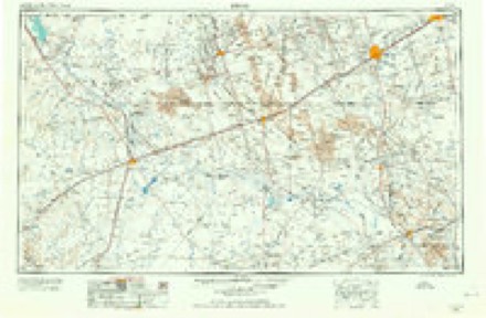
- 1954 USGS Pecos quadrangle1:250000, 3 printings
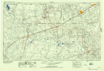
- 1957 USGS Pecos quadrangle1:250000
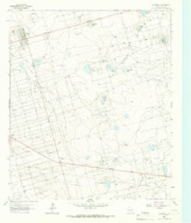
- 1965 USGS Goldsmith quadrangle1:24000, 3 printings
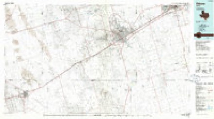
- 1986 USGS Odessa quadrangle1:100000, 2 printings
Mines and quarries near this place
1 within 5 milesRegional context, not property-specific evidence. The federal mineral resources record lists 1 working within 5 miles of Goldsmith: 1 producer. All of them still produce. What was taken out: Natural Gas, Sulfur. Distance is straight-line from the map coordinates, so a quarry counted here may appear on a neighbouring settlement's page as well.
| Where | Site | Commodity | Status | Recorded |
|---|---|---|---|---|
| Goldsmith Sulfur Plant | Natural Gas, Sulfur | Producer |
Storms near this place
38 since 1993Regional context, not property-specific evidence. The National Weather Service names Goldsmith in 38 storm reports between 1993 and 2025: 22 hail, 8 thunderstorm wind, 5 tornado, 3 flash flood. No death or injury is recorded in these reports. Each account below is quoted exactly as the forecast office filed it, from the NOAA Storm Events Database, and each date opens the federal record of that event.
| When | Event | Place named | Harm | What the report says |
|---|---|---|---|---|
| September 2016 | Hail | Goldsmith | $100,000 | A thunderstorm moved across Ector County and produced baseball sized hail two miles east of Goldsmith. The hail severely damaged numerous homes and cars. The cost of damage is a very rough estimate. |
| December 2004 | Thunderstorm Wind | Goldsmith | $35,000 | Multiple wind damage reports were received as a line of severe thunderstorms swept across Ector County. Several traffic signs were blown down in Goldsmith. Additional damage was reported in Odessa where power lines were downed by the winds at the intersection of 56th and Golden Streets. The most significant damage occurred along Sierra Street where a twelve by twenty-four foot storage barn was flattened by the winds. Debris from the destroyed barn damaged additional structures downwind. Large branches also were stripped from trees in the neighborhood. |
| March 2000 | Tornado (F0) | Goldsmith | $10,000 | The Wickett supercell storm occluded then spawned another strong mesocylone. What was believed to have been a weak tornado formed in western Ector County and knocked down two sets of utility poles. The tornado moved northeast through open country taking out a line of 11 utility poles about 2 miles west of FM 866, then proceeded to the northeast and knocked down 4 additional poles at the intersection of FM 866 and State Highway 302.Absolute confirmation of the tornado could not be gained due to the lack of damage in the path. Tall grasses in the path gave little clue to the winds in this weak phenomenon. The decision to classify this as a tornado was due to the extreme intensity of low level radar signatures as well as the fairly narrow damage path sustained over a three mile track.Although utility poles were knocked over, this tornado was rated only as a high F0 due to the seemingly undisturbed vegetation. |
| October 1995 | Thunderstorm Wind | Goldsmith | $10,000 | The Andrews County Sheriffs office reported three-quarter inch hail along the Andrews/Winkler County line along State Highway 115. As the storm progressed eastward it formed into an accelerating line that moved into Ector County. As the line of storms approached Goldsmith, a bow echo formed, with the resulting winds destroying a metal shed. As the line continued moving to the southeast, it broke up with an intensifying cell dropping three-quarter inch hail in Odessa. |
| July 1998 | Thunderstorm Wind | Goldsmith | $3,000 | Thunderstorm downburst winds knocked down several utility poles in Goldsmith. |
| June 2012 | Thunderstorm Wind | Goldsmith | $2,000 | A thunderstorm moved over Ector County and produced a 62 mph wind gust two miles east northeast of Goldsmith. A power pole broke due to this wind. |
| April 2017 | Hail | Goldsmith | $1,000 | A thunderstorm moved across Ector County and produced hail damage in Goldsmith from tennis ball sized hail. There were hail dents in the siding on one side of a house in Goldsmith. The cost of damage is a very rough estimate. |
| August 1993 | Thunderstorm Wind | Goldsmith | $500 | A rainfall observer reported 60-mph winds which caused damage to a building in Goldsmith. |
| May 2025 | Hail | Goldsmith | - | A report was received from the public of quarter-size hail along with heavy rainfall causing very low visibility along TX 302. The time of occurrence is estimated from radar. |
| May 2024 | Flash Flood | Goldsmith | - | Report from mPING of street/road flooding, street/road closed, or vehicles stranded. |
| June 2022 | Thunderstorm Wind | Goldsmith | - | A thunderstorm produced a wind gust of 76 mph as recorded by a vehicle mounted anemometer five miles northwest of Goldsmith. |
| June 2021 | Thunderstorm Wind | Goldsmith | - | A thunderstorm produced a 60 mph wind gust near Goldsmith. |
| May 2010 | Tornado (EF0) | Goldsmith | - | At 12:32 pm CST, members of the TWISTEX research team confirmed a rope tornado approximately 5.5 miles south southeast of Goldsmith, TX, and north of Highway 302. The tornado then moved northeast a little over a mile where it dissipated at 12:36 pm CST. No significant damage was observed with this tornado. |
| April 2009 | Hail | Goldsmith | - | The duration of the hail was estimated for this event. |
| August 2006 | Flash Flood | Goldsmith | - | A motorist driving on Texas Highway 181 in northern Ector County reported that one and a half to two feet of water was flowing over the road. Flooding deep enough to impede traffic also was reported at the intersection of the Interstate 20 service road and Grandview Avenue. |
| March 2004 | Hail | Goldsmith | - | Dime to nickel size hail covered the ground. |
| June 2004 | Flash Flood | Goldsmith | - | Storm spotters reported high water flowing over State Highway 158 four miles west-southwest of Goldsmith near the intersection with State Highway 302. |
| May 1999 | Tornado (F0) | Goldsmith | - | This tornado was spawned out of a small mesocyclone on the leading side of a short multicell line. The tornado had a condensation funnel to the ground, became rain-wrapped within about 2 minutes, and was estimated to have lasted about two additional minutes. The tornado formed about 2-3 miles south of the Andrews County line near FM 181. |
| April 1994 | Tornado (F0) | Goldsmith | - | The public reported a small rope tornado that lasted less than ,five minutes. |
| May 1993 | Hail | Goldsmith | - | Thunderstorms produced dime-size hail near Goldsmith and produced localized flooding in Goldsmith. No damage resulted from either the hail or the flooding. |
| May 1993 | Hail | Goldsmith | - | Thunderstorms produced dime-size hail near Goldsmith and produced localized flooding in Goldsmith. No damage resulted from either the hail or the flooding. |
| June 2022 | Hail | Goldsmith | - | no account filed |
| April 2017 | Hail | Goldsmith | - | no account filed |
| April 2017 | Hail | Goldsmith | - | no account filed |
| June 2015 | Hail | Goldsmith | - | no account filed |
| May 2010 | Hail | Goldsmith | - | no account filed |
| May 2010 | Hail | Goldsmith | - | no account filed |
| May 2010 | Hail | Goldsmith | - | no account filed |
| May 2007 | Hail | Goldsmith | - | no account filed |
| May 2002 | Hail | Goldsmith | - | no account filed |
| May 2002 | Hail | Goldsmith | - | no account filed |
| May 2002 | Hail | Goldsmith | - | no account filed |
| March 2000 | Hail | Goldsmith | - | no account filed |
| October 2000 | Hail | Goldsmith | - | no account filed |
| June 1997 | Hail | Goldsmith | - | no account filed |
| May 1997 | Hail | Goldsmith | - | no account filed |
| May 1994 | Tornado (F0) | Goldsmith | - | no account filed |
| May 1994 | Thunderstorm Wind | Goldsmith | - | no account filed |
Nearest settlements
The eight closest, with where each one stands in the county. Distances are straight-line, computed from the Geographic Names Information System coordinates.
| Map | Place | Distance | Sheets |
|---|---|---|---|
| Turnbaugh Corner | 3.6 miles | 8 | |
| North Cowden | 5.7 miles | 6 | |
| Notrees | 8.6 miles | 7 | |
| Scharbauer City | 10.2 miles | 6 | |
| West Odessa | 11.4 miles | 10 | |
| Gardendale | 12.8 miles | 6 | |
| Arcade | 15.2 miles | 10 | |
| Douro | 15.8 miles | 9 |
Elsewhere
Matched on this settlement's Geographic Names Information System number rather than its name, so it cannot be a different place of the same name in another state.
| Wikipedia article on Goldsmith | An encyclopaedic summary. Its text is share-alike, so it is linked here rather than copied. |
| Wikidata item Q982162 | The structured record the population and elevation above come from. Public domain (CC0). |
Provenance
This settlement is recorded in the Geographic Names Information System as feature 1373868. The sheet list is computed by point-in-boundary test against the United States Geological Survey's historical topographic inventory. Both are works of the United States government and carry no copyright under 17 U.S.C. 105.
Mines and quarries. USGS Mineral Resources Data System (MRDS) https://mrdata.usgs.gov/mrds/ A work of the United States government, no copyright under 17 U.S.C. 105.
Storms. NOAA National Centers for Environmental Information, Storm Events Database https://www.ncei.noaa.gov/stormevents/ A work of the United States government, no copyright under 17 U.S.C. 105. Narratives are quoted verbatim from the National Weather Service report and are not edited or summarised.