 Block
BlockNotrees, Texas
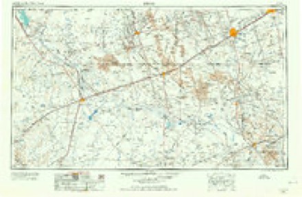
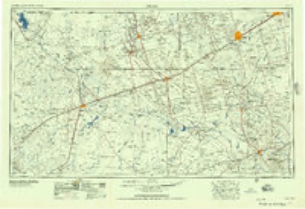
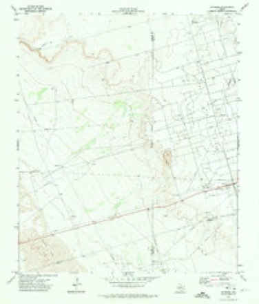
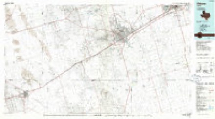
7 topographic sheets cover this place, the earliest surveyed in 1954 and the latest in 1986. It stands in the West Odessa-Goldsmith census division. It lies in ZIP code area 79759. The Survey maps it on the Notrees quadrangle. It stands 3,333 feet above sea level.
Topographic sheets covering this place
4 surveys from 7 printed sheetsMatched by testing this settlement's coordinate against the published boundary of every sheet in the United States Geological Survey's historical collection. Each opens the scanned sheet at the Survey.
- 1954 USGS Pecos quadrangle1:250000, 3 printings
- 1957 USGS Pecos quadrangle1:250000
- 1971 USGS Notrees quadrangle1:24000
- 1986 USGS Odessa quadrangle1:100000, 2 printings
Fires near this place
13 since 2007Regional context, not property-specific evidence. The federal wildfire occurrence database lists 13 fires within 5 miles of Notrees between 2007 and 2020, burning about 6,639 acres in total. 1 started naturally. None was recorded as arson. Distance is straight-line from the map coordinates, so a fire counted here may appear on a neighbouring settlement's page as well.
| Reported cause | Fires |
|---|---|
| Equipment and vehicle use | 9 |
| Missing data/not specified/undetermined | 2 |
| Power generation/transmission/distribution | 1 |
| Natural | 1 |
The most recent of them, most recent first, with the day each was reported and the service that recorded it.
| Date | Cause | Size | Reported by | Name on the report |
|---|---|---|---|---|
| 10 July 2007 | Missing data/not specified/undetermined | 1.0 acres | Texas A & M Forest Service | not named |
| 2 June 2011 | Equipment and vehicle use | 20 acres | Texas A & M Forest Service | WHEELER #1 |
| 11 June 2014 | Equipment and vehicle use | under an acre | Texas A & M Forest Service | CAPROCK #2 |
| 29 May 2009 | Power generation/transmission/distribution | 199 acres | Texas A & M Forest Service | HELL BOUND |
| 27 May 2016 | Equipment and vehicle use | 5.0 acres | Texas A & M Forest Service | GOLDSMITH ASSIST |
| 25 May 2008 | Natural | 400 acres | Texas A & M Forest Service | not named |
| 23 March 2010 | Equipment and vehicle use | 6,000 acres | Texas A & M Forest Service | VEST RANCH |
| 20 March 2020 | Equipment and vehicle use | 3.0 acres | Texas A & M Forest Service | EAST 302 |
Settlements close enough to share some of these fires:
Storms near this place
14 since 2000Regional context, not property-specific evidence. The National Weather Service names Notrees in 14 storm reports between 2000 and 2025: 9 hail, 3 tornado, 1 thunderstorm wind, 1 flash flood. No death or injury is recorded in these reports. Each account below is quoted exactly as the forecast office filed it, from the NOAA Storm Events Database, and each date opens the federal record of that event.
| When | Event | Place named | Harm | What the report says |
|---|---|---|---|---|
| May 2010 | Tornado (EF3) | Notrees | $100,000 | At 12:15 pm CST, members of the TWISTEX research group confirmed the formation of a tornado approximately 6.5 miles south of Notrees. This tornado progressed northeastward around 20 mph, first causing damage to power poles around from 12:16 to 12:17 pm CST. As it continued to track to the northeast, the tornado caused significant damage to oil equipment from 12:19 to 12:22 pm CST. Two type 320 pump jacks, each weighing 71,000 pounds including the concrete base, were blown over. The tornado then began to weaken at 12:27 pm CST, and dissipated at 12:28 pm CST approximately 2 miles southeast of Notrees, TX. |
| May 2024 | Thunderstorm Wind | Notrees | $40,000 | Photos were shared of a collapsed radio tower near Notrees. Time is estimated from radar. Wind speeds were estimated to have been 110-120 MPH. Property damage cost is an estimation. |
| September 2016 | Tornado (EF1) | Notrees | $30,000 | A supercell thunderstorm developed over Andrews County during the evening hours of September 17th. This storm encountered a stationary boundary and began moving southeast. The storm began to form a hook echo at 6:30 pm CDT as it moved toward Highway 115 in southwest Andrews County. Eyewitness reports from storm chasers and spotters in the area indicate that the initial tornado began at 7:13 pm CDT near the intersection of Andrews, Winkler and Ector Counties. Videos taken of the tornado show it touching down and lifting several times before eventually staying on the ground for several minutes over far northwest portions of Ector County. The tornado moved south southeastward across open fields of rural Ector County just west of FM 181. The damage assessment team looked at several different indicators to determine tornado intensity. The tornado snapped several electrical power poles and overturned a tank battery along its path. These damage indicators suggest EF1 intensity with wind speeds estimated at 90 to 105 mph. Near the end of the life cycle of the EF1 tornado, a weak anticyclonic circulation developed on the forward flank of the supercell around 7:25 pm CDT. This circulation moved southwest to the west of FM 181 and dissipated around 7:35 pm CDT. Storm chasers and spotters identified this funnel looking north from Goldsmith around 7:30 pm CDT. There was no evidence of damage or reports of the funnel cloud touching down. The tornado path width was estimated and the cost of damage is a very rough estimate. |
| June 2025 | Flash Flood | Notrees | - | A report was received from the public via mPING of street flooding just west of Notrees. The time of occurrence is estimated from radar. No reports of damage were received. |
| May 2023 | Hail | Notrees | - | Size estimated from public photo relayed by broadcast media. Time estimated from radar. |
| June 2007 | Tornado (EF0) | Notrees | - | A tornado 3/4 of a mile wide was reported near the Ector/Winkler County line along highway 302. The tornado lasted for approximately one minute. |
| May 2007 | Hail | Notrees | - | Golfball to baseball sized hail fell on Texas Highway 302 near the Winkler and Ector County lines. |
| June 2021 | Hail | Notrees | - | no account filed |
| April 2009 | Hail | Notrees | - | no account filed |
| June 2009 | Hail | Notrees | - | no account filed |
| March 2004 | Hail | Notrees | - | no account filed |
| October 2003 | Hail | Notrees | - | no account filed |
| March 2000 | Hail | Notrees | - | no account filed |
| October 2000 | Hail | Notrees | - | no account filed |
Nearest settlements
The eight closest, with where each one stands in the county. Distances are straight-line, computed from the Geographic Names Information System coordinates.
| Map | Place | Distance | Sheets |
|---|---|---|---|
| Turnbaugh Corner | 5.8 miles | 8 | |
| Goldsmith | 8.6 miles | 9 | |
| North Cowden | 14.2 miles | 6 | |
| West Odessa | 14.6 miles | 10 | |
| Badger | 15.0 miles | 8 | |
| Penwell | 15.0 miles | 8 | |
| Judkins | 15.2 miles | 8 | |
| Metz | 15.7 miles | 8 |
Elsewhere
Matched on this settlement's Geographic Names Information System number rather than its name, so it cannot be a different place of the same name in another state.
| Wikipedia article on Notrees | An encyclopaedic summary. Its text is share-alike, so it is linked here rather than copied. |
| Wikidata item Q7063522 | The structured record the population and elevation above come from. Public domain (CC0). |
Provenance
This settlement is recorded in the Geographic Names Information System as feature 1342897. The sheet list is computed by point-in-boundary test against the United States Geological Survey's historical topographic inventory. Both are works of the United States government and carry no copyright under 17 U.S.C. 105.
Wildfire. Short, Karen C. 2022. Spatial wildfire occurrence data for the United States, 1992-2020 [FPA_FOD_20221014]. 6th Edition. Fort Collins, CO: Forest Service Research Data Archive. https://doi.org/10.2737/RDS-2013-0009.6 Collected with United States Government funding and usable without additional permissions or fees.
Storms. NOAA National Centers for Environmental Information, Storm Events Database https://www.ncei.noaa.gov/stormevents/ A work of the United States government, no copyright under 17 U.S.C. 105. Narratives are quoted verbatim from the National Weather Service report and are not edited or summarised.