 Block
BlockGranbury, Texas
19 topographic sheets cover this place, the earliest surveyed in 1889 and the latest in 1985. It stands in the Granbury East census division. It lies in ZIP code area 76048. It stands on Lambert Branch. The Survey maps it on the Granbury quadrangle. 10,958 people lived here at the 2020 count. It stands 735 feet above sea level.
Research this city
On record in Granbury
Buildings and businesses the archive holds for this place. Each opens its own page, with the source record it came from.
On the National Register 4 records
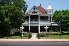 Baker-Carmichael Houselisted 2005
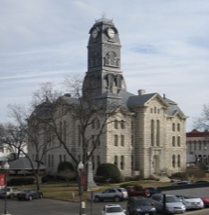 Hood County Courthouse Historic Districtlisted 1974
 Wright-Henderson-Duncan Houselisted 1978
- Granbury Elementary Schoollisted 2022
Population over time
3 figuresGranbury grew from 524 to 10,958 between 1880 and 2020. These are the recorded population figures Wikidata holds for this place, reached through the Geographic Names Information System number this page is keyed on rather than by name, so they belong to this place and not to another of the same name. Most are census counts, but not all are: an early figure may be a founding or settlement estimate, and an estimate published within five years of a census is left out. The change column is computed, and is left blank where more than 20 years separate a figure from the one before it, because a gap that long is not a change between two counts.
| Year | People | Change |
|---|---|---|
| 1880 | 524 | |
| 2010 | 7,978 | |
| 2020 | 10,958 | +2,980 (+37%) |
Topographic sheets covering this place
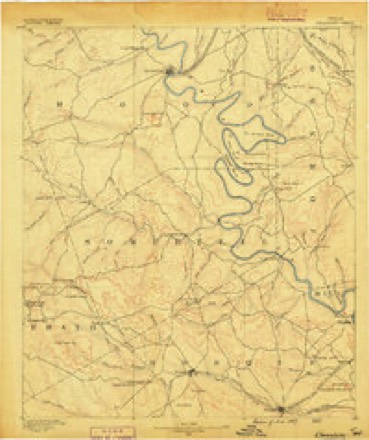
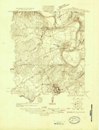
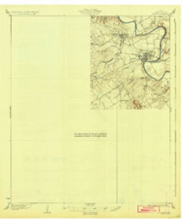
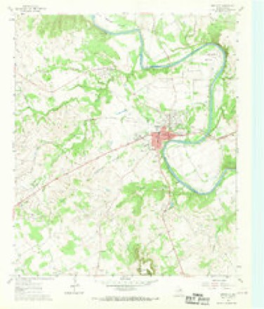
7 surveys from 19 printed sheetsMatched by testing this settlement's coordinate against the published boundary of every sheet in the United States Geological Survey's historical collection. Each opens the scanned sheet at the Survey.
- 1889 USGS Granbury quadrangle1:125000, 6 printings
- 1923 USGS Granbury 2-a quadrangle1:48000
- 1931 USGS Tolar quadrangle1:62500, 2 printings
- 1954 USGS Dallas quadrangle1:250000, 4 printings
- 1958 USGS Dallas quadrangle1:250000
- 1961 USGS Granbury quadrangle1:24000, 3 printings
- 1985 USGS Cleburne quadrangle1:100000, 2 printings
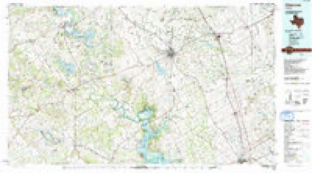
Fires near this place
172 since 2005Regional context, not property-specific evidence. The federal wildfire occurrence database lists 172 fires within 5 miles of Granbury between 2005 and 2020, burning about 785 acres in total. 1 started naturally. 7 were recorded as arson. Distance is straight-line from the map coordinates, so a fire counted here may appear on a neighbouring settlement's page as well.
| Reported cause | Fires |
|---|---|
| Missing data/not specified/undetermined | 86 |
| Debris and open burning | 41 |
| Equipment and vehicle use | 24 |
| Arson/incendiarism | 7 |
| Misuse of fire by a minor | 3 |
| Power generation/transmission/distribution | 3 |
| Smoking | 3 |
| Railroad operations and maintenance | 2 |
| Fireworks | 1 |
| Natural | 1 |
| Recreation and ceremony | 1 |
The most recent of them, most recent first, with the day each was reported and the service that recorded it.
| Date | Cause | Size | Reported by | Name on the report |
|---|---|---|---|---|
| 9 September 2017 | Debris and open burning | 1.0 acres | Texas A & M Forest Service | GAUNTT |
| 7 September 2011 | Missing data/not specified/undetermined | 1.0 acres | Texas A & M Forest Service | FIRE GRASS |
| 7 September 2007 | Missing data/not specified/undetermined | under an acre | Texas A & M Forest Service | not named |
| 27 September 2011 | Missing data/not specified/undetermined | 1.0 acres | Texas A & M Forest Service | HIDDEN COVE TRL. |
| 26 September 2009 | Debris and open burning | 1.0 acres | Texas A & M Forest Service | 3900 RHEA CT. |
| 26 September 2009 | Missing data/not specified/undetermined | under an acre | Texas A & M Forest Service | WHISPERING OAKS |
| 25 September 2012 | Debris and open burning | 1.0 acres | Texas A & M Forest Service | FIRE SMALL |
| 23 September 2005 | Missing data/not specified/undetermined | 5.0 acres | Texas A & M Forest Service | not named |
Settlements close enough to share some of these fires:
Mines and quarries near this place
1 within 5 milesRegional context, not property-specific evidence. The federal mineral resources record lists 1 working within 5 miles of Granbury: 1 producer. All of them still produce. What was taken out: Sand and Gravel, Construction. Distance is straight-line from the map coordinates, so a quarry counted here may appear on a neighbouring settlement's page as well.
| Where | Site | Commodity | Status | Recorded |
|---|---|---|---|---|
| Ingram Sand & Gravel | Sand and Gravel, Construction | Producer |
Storms near this place
60 of 148 shownRegional context, not property-specific evidence. The National Weather Service names Granbury in 148 storm reports between 1993 and 2025: 63 hail, 50 thunderstorm wind, 25 flash flood, 4 flood. No death or injury is recorded in these reports. Each account below is quoted exactly as the forecast office filed it, from the NOAA Storm Events Database, and each date opens the federal record of that event.
| When | Event | Place named | Harm | What the report says |
|---|---|---|---|---|
| May 1999 | Hail | Granbury | $5,000,000 | Numerous windows and car windshields were shattered. |
| March 2025 | Thunderstorm Wind | Granbury | $1,000,000 | Emergency management reported wind damage in Granbury near 701 Pintail Ct. Three bays in the marina were damaged with several sunken boats and jetskis. Widespread uprooted and damaged trees were also reported in this area. |
| May 2002 | Thunderstorm Wind | Granbury | $500,000 | The damage occurred in the Blue Water Shores community. One mobile home was rolled over and destroyed. Five other mobile homes were destroyed and nine more were heavily damaged. Minor damage occurred to thirty three other mobile homes and some permanent buildings. Numerous trees were snapped off or pushed over. Several power poles were snapped off. The damage was from a downburst. |
| October 1993 | Hail | Granbury | $500,000 | Total damage across Hood County was estimated at $400,000. |
| May 2003 | Hail | Granbury | $250,000 | Softball size hail caused severe damage to a one-half mile stretch of the Pecan Plantation subdivision southeast of Granbury. The large hail punched holes in a brand new spanish-tiled roof. |
| April 2007 | Tornado (EF1) | Granbury | $200,000 | A tornado moved through the community of Pecan Plantation, causing damage to trees, tree limbs, roofs, windows, playground sets, and fences. The most significant damage occurred to a brick home on the north side of Equestrian Drive. Portions of the roof were removed, a tree in the front yard was uprooted, the garage door was blown in, and windows were broken. Wind speeds were estimated at 95-100 MPH. |
| June 2004 | Flash Flood | Granbury | $150,000 | By 715 AM Peak Road and Bob White Road south of downtown flooded. At 718 AM, there was ahigh water rescue on the M&M Ranch Road 2 miles northeast of Granbury. By 900 AM, numerous roads were closed in and around Granbury. Highway 51 at Squaw Creek was covered with four feet of water.The Wheeler Branch Apartments were flooded. |
| June 1997 | Thunderstorm Wind | Granbury | $125,000 | Strong winds damaged a house and a mobile home, overturned two mobile homes, and damaged several barns. |
| June 2007 | Flood | Granbury | $100,000 | The Brazos River flooded due to continued runoff from recent heavy rainfall, causing damage to several homes and vehicles. |
| May 2003 | Lightning | Granbury | $100,000 | Lightning hit an Oncor transmission line between Somervell County and Parker County, causing at least 4 power plants to temporarily shut down. 300,000 to 400,000 customers across Texas were without electricity from 15 minutes to 2 hours before power was restored. |
| June 2009 | Hail | Granbury | $70,000 | Hail up to the size of Golfballs did considerable damage in Granbury. Up to 200 windows were broken at the Bromley Apartments and the roof was damaged. Cars were also damaged at the apartment complex with the windows broken on a few cars. Approximately 150 automobiles were damaged at Mike Brown Ford, but no windows were broken on the complex. Another 130 vehicles were damaged at Jerry Durant Toyota. A skylight was broken at Oak Woods Intermediate School. |
| April 2014 | Hail | Granbury | $60,000 | Amateur radio operators reported golf ball sized hail in Granbury. |
| May 2013 | Hail | Granbury | $60,000 | The hail grew to the size of baseballs. Also, winds in excess of 50 mph were reported near the Granbury High School. |
| May 2003 | Hail | Granbury | $50,000 | Hail caused roof damage to houses and minor damage to approximately 600 new cars at auto dealerships. |
| May 2002 | Thunderstorm Wind | Granbury | $50,000 | High winds blew down several radio towers, destroyed an outdoor movie screen, destroyed a fireworks stand, blew down an awning on a gas station, blew down trees and power lines. Minor damage was reported all over town to homes, outbuildings, and businesses. |
| May 1997 | Flash Flood | Granbury | $50,000 | Several roads were reported flooded in and around town. Two feet of water entered a home. |
| May 1994 | Thunderstorm Wind | Granbury | $50,000 | A house was unroofed and power poles were blown down by thunderstorm winds. |
| October 1996 | Tornado (F1) | Granbury | $40,000 | no account filed |
| March 2004 | Thunderstorm Wind | Granbury | $35,000 | In the DeCordova subdivision just south of Acton, there was structural damage to 6 homes, the roofs were partially unroofed, one side wall was blown down, and tree limbs up to 9 inches in diameter were blown down. |
| May 2013 | Hail | Granbury | $30,000 | Golfball sized hail was reported near the Granbury High School. |
| May 2021 | Hail | Granbury | $20,000 | Golf ball sized hail was reported in Granbury. |
| May 2021 | Hail | Granbury | $20,000 | Hail fell in North Granbury growing from quarter sized up to golf ball sized. |
| March 2007 | Flash Flood | Granbury | $20,000 | High water rescues were required near Dry Creek and also Stroud Creek. A pick-up was swept down Fall Creek. One of the occupants of the truck swam to safety while the other two clung to a tree and waited for help. Roads were also flooded in the county. A woman who's car was being swept away escaped by pulling her convertible top down. |
| September 2003 | Flash Flood | Granbury | $15,000 | Numerous roads were closed as heavy rain up to 5.75 inches fell across the county. |
| August 1998 | Thunderstorm Wind | Granbury | $15,000 | High winds unroofed a house and blew down a power pole. |
| April 2015 | Hail | Granbury | $12,000 | Hail up to the size of golf balls fell in Granbury. |
| May 2007 | Thunderstorm Wind | Granbury | $12,000 | A theater sign and several large tree limbs were blown down. |
| May 2024 | Hail | Granbury | $10,000 | Public report of golf ball sized hail in Granbury, TX. |
| July 2002 | Thunderstorm Wind | Granbury | $10,000 | A church steeple was blown off and several trees were blown down 4 to 6 miles south of Granbury on Highway 144 near Indian Harbor. |
| June 1997 | Thunderstorm Wind | Granbury | $10,000 | Strong winds damaged a building and blew down trees. |
| June 1995 | Thunderstorm Wind | Granbury | $10,000 | A barn was destroyed by high winds. |
| March 2023 | Hail | Granbury | $7,000 | Reports and pictures of hail up to 2 inches was reported in Granbury. |
| July 2009 | Thunderstorm Wind | Granbury | $7,000 | Peak winds of 70 mph were estimated in Granbury. |
| November 2024 | Thunderstorm Wind | Granbury | $5,000 | Part of a tin roof was torn off a manufactured home in Granbury. |
| May 2012 | Thunderstorm Wind | Granbury | $5,000 | Tree limbs that were 6 in diameter were knocked down in Granbury by thunderstorm winds. The winds were estimated to be at least 60 mph. |
| June 2009 | Hail | Granbury | $5,000 | Hen Egg size hail was reported in Indian Harbor 1 mile east of Granbury. |
| May 1994 | Thunderstorm Wind | Granbury | $5,000 | Power lines were blown down by thunderstorm winds. 7 SE Granbury,14,2005CST,,,0,0,0,0,Hail (0.75) |
| October 1994 | Thunderstorm Wind | Granbury | $5,000 | Trees and power lines were blown down by high winds. |
| May 2011 | Hail | Granbury | $5,000 | no account filed |
| March 2016 | Tornado (EF0) | Granbury | $4,000 | A brief tornado occurred on the east side of the Brazos River / Lake Granbury early in the morning of March 8th. The tornado was photographed by several citizens, but occurred in open land near a golf course. |
| May 2020 | Thunderstorm Wind | Granbury | $3,000 | A public report indicated large tree branches blown down in the city of Granbury, TX. |
| April 2005 | Lightning | Granbury | $3,000 | Lightning struck a tree, causing part of the tree to fall on a residential roof. |
| April 1995 | Thunderstorm Wind | Granbury | $2,000 | A barn was damaged by high winds. |
| June 1996 | Thunderstorm Wind | Granbury | $2,000 | no account filed |
| April 2007 | Thunderstorm Wind | Granbury | $1,000 | A section of fence was blown down with the posts broken off at the ground. |
| September 2001 | Thunderstorm Wind | Granbury | $1,000 | Power lines were blown down. |
| September 2001 | Thunderstorm Wind | Granbury | $1,000 | A radio tower was blown down. Trees were also blown down. |
| September 2001 | Thunderstorm Wind | Granbury | $1,000 | Trees and powerl lines were blown down. |
| June 1996 | Thunderstorm Wind | Granbury | $1,000 | no account filed |
| April 2025 | Flash Flood | Granbury | - | Street flooding was reported in Granbury. |
| May 2024 | Hail | Granbury | - | Report from mPING: Quarter (1.00 in.). |
| May 2024 | Hail | Granbury | - | Public report via mPING of half-dollar sized hail. |
| May 2024 | Flash Flood | Granbury | - | Various flooded roads were reported in Granbury by the emergency manager. |
| April 2024 | Thunderstorm Wind | Granbury | - | Amateur radio reported a mature Bradford Pear tree snapped in half from thunderstorm winds. |
| May 2023 | Thunderstorm Wind | Granbury | - | The Granbury Regional Airport AWOS observed a 58 mph wind gust. |
| April 2022 | Thunderstorm Wind | Granbury | - | A 51 kt wind gust was measured at KGDJ. |
| December 2021 | Hail | Granbury | - | Dime sized hail was reported via mPing. |
| May 2021 | Hail | Granbury | - | Hail up to the size of pennies was reported just north of Loop 567 along Highway 51 in Granbury. |
| March 2020 | Flash Flood | Granbury | - | Training thunderstorms caused flooding near Granbury. |
| May 2020 | Thunderstorm Wind | Granbury | - | A wind gust of 64 MPH was reported by the Granbury, TX Automated Weather Observation System. |
Nearest settlements
The eight closest, with where each one stands in the county. Distances are straight-line, computed from the Geographic Names Information System coordinates.
| Map | Place | Distance | Sheets |
|---|---|---|---|
| Thorp Spring | 2.8 miles | 19 | |
| Brazos Bend | 2.9 miles | 19 | |
| Oak Trail Shores | 3.9 miles | 19 | |
| Brushy | 4.2 miles | 19 | |
| Waples | 4.9 miles | 21 | |
| Fairview | 5.0 miles | 20 | |
| DeCordova | 5.3 miles | 21 | |
| Mambrino | 5.4 miles | 19 |
Elsewhere
Matched on this settlement's Geographic Names Information System number rather than its name, so it cannot be a different place of the same name in another state.
| Wikipedia article on Granbury | An encyclopaedic summary. Its text is share-alike, so it is linked here rather than copied. |
| Wikidata item Q923474 | The structured record the population and elevation above come from. Public domain (CC0). |
Provenance
This settlement is recorded in the Geographic Names Information System as feature 1336797. The sheet list is computed by point-in-boundary test against the United States Geological Survey's historical topographic inventory. Both are works of the United States government and carry no copyright under 17 U.S.C. 105.
Wildfire. Short, Karen C. 2022. Spatial wildfire occurrence data for the United States, 1992-2020 [FPA_FOD_20221014]. 6th Edition. Fort Collins, CO: Forest Service Research Data Archive. https://doi.org/10.2737/RDS-2013-0009.6 Collected with United States Government funding and usable without additional permissions or fees.
Mines and quarries. USGS Mineral Resources Data System (MRDS) https://mrdata.usgs.gov/mrds/ A work of the United States government, no copyright under 17 U.S.C. 105.
Storms. NOAA National Centers for Environmental Information, Storm Events Database https://www.ncei.noaa.gov/stormevents/ A work of the United States government, no copyright under 17 U.S.C. 105. Narratives are quoted verbatim from the National Weather Service report and are not edited or summarised.