 Block
BlockHale Center, Texas
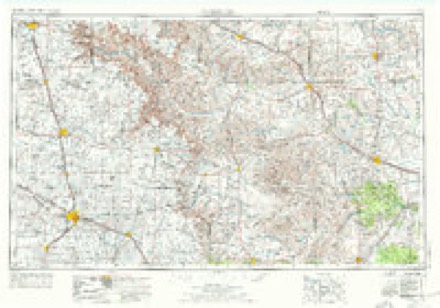
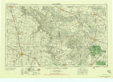
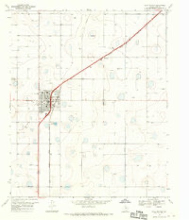
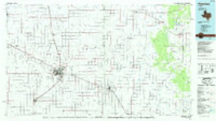
7 topographic sheets cover this place, the earliest surveyed in 1954 and the latest in 1985. It stands in the Hale Center census division. It lies in ZIP code area 79041. The Survey maps it on the Hale Center quadrangle. 2,062 people lived here at the 2020 count. It stands 3,419 feet above sea level.
Population over time
2 figuresHale Center fell from 2,252 to 2,062 between 2010 and 2020. These are the recorded population figures Wikidata holds for this place, reached through the Geographic Names Information System number this page is keyed on rather than by name, so they belong to this place and not to another of the same name. Most are census counts, but not all are: an early figure may be a founding or settlement estimate, and an estimate published within five years of a census is left out. The change column is computed, and is left blank where more than 20 years separate a figure from the one before it, because a gap that long is not a change between two counts.
| Year | People | Change |
|---|---|---|
| 2010 | 2,252 | |
| 2020 | 2,062 | -190 (-8%) |
Topographic sheets covering this place
4 surveys from 7 printed sheetsMatched by testing this settlement's coordinate against the published boundary of every sheet in the United States Geological Survey's historical collection. Each opens the scanned sheet at the Survey.
- 1954 USGS Plainview quadrangle1:250000, 3 printings
- 1958 USGS Plainview quadrangle1:250000
- 1968 USGS Hale Center quadrangle1:24000
- 1985 USGS Plainview quadrangle1:100000, 2 printings
Fires near this place
13 since 2006Regional context, not property-specific evidence. The federal wildfire occurrence database lists 13 fires within 5 miles of Hale Center between 2006 and 2018, burning about 1,650 acres in total. None started naturally. 2 were recorded as arson. Distance is straight-line from the map coordinates, so a fire counted here may appear on a neighbouring settlement's page as well.
| Reported cause | Fires |
|---|---|
| Equipment and vehicle use | 5 |
| Missing data/not specified/undetermined | 5 |
| Arson/incendiarism | 2 |
| Debris and open burning | 1 |
The most recent of them, most recent first, with the day each was reported and the service that recorded it.
| Date | Cause | Size | Reported by | Name on the report |
|---|---|---|---|---|
| 1 May 2018 | Equipment and vehicle use | 129 acres | Texas A & M Forest Service | EDWIN DAVIS FARM |
| 7 March 2006 | Arson/incendiarism | 1.0 acres | Texas A & M Forest Service | not named |
| 23 March 2011 | Debris and open burning | 152 acres | Texas A & M Forest Service | THOMPSON FIRE |
| 22 March 2010 | Equipment and vehicle use | 285 acres | Texas A & M Forest Service | 10-0322-01 |
| 9 February 2006 | Missing data/not specified/undetermined | 2.0 acres | Texas A & M Forest Service | not named |
| 8 February 2006 | Equipment and vehicle use | 2.0 acres | Texas A & M Forest Service | not named |
| 17 February 2006 | Equipment and vehicle use | 1.0 acres | Texas A & M Forest Service | not named |
| 9 November 2010 | Equipment and vehicle use | 366 acres | Texas A & M Forest Service | CURRY FIRE |
Settlements close enough to share some of these fires:
Storms near this place
49 since 1993Regional context, not property-specific evidence. The National Weather Service names Hale Center in 49 storm reports between 1993 and 2025: 28 hail, 10 thunderstorm wind, 4 flash flood, 3 tornado. The reports record 1 death. Each account below is quoted exactly as the forecast office filed it, from the NOAA Storm Events Database, and each date opens the federal record of that event.
| When | Event | Place named | Harm | What the report says |
|---|---|---|---|---|
| April 1998 | Lightning | Hale Center | 1 killed | Lightning struck and killed a 37 year-old male farmer who was out in an open area next to his irrigation/sprinkler system. |
| May 2019 | Flash Flood | Hale Center | $1,000,000 | Numerous roads in and around Plainview were flooded by torrential rainfall from a supercell thunderstorm. The intersection of Interstate 27 and Farm to Market Road 194 was completely inundated by water. Water may have been reaching into some businesses along the road. |
| May 2015 | Hail | Hale Center | $350,000 | A nearly stationary supercell produced a severe hail swath ranging in size from quarters to softballs. Several dozen vehicles traveling along Interstate 27 between Abernathy and the Hale Center rest stop suffered varying degrees of damage; the worst of which involved losing nearly all windows. |
| May 2008 | Thunderstorm Wind | Hale Center | $150,000 | Local farmers reported that thunderstorm winds destroyed at least six irrigation pivot systems northwest of Hale Center. |
| April 1998 | Tornado (F2) | Hale Center | $100,000 | A short-lived but strong (F2) tornado occurred just north of Hale Center. Two people narrowly escaped injury when their home was destroyed (they had sought shelter in a small, interior closet in this ranch-style house). The tornado also heavily damaged a vacant house, barn, hangar, and center-pivot irrigation system. Several large trees were destroyed/uprooted. Damage was investigated by NWS officials just a few hours after it occurred. |
| April 2010 | Flood | Hale Center | $75,000 | Low lying areas in and around Plainview were flooded by heavy rains. Flood waters threated the Ace Hardware store and several other structures, however, only minor damages were reported. |
| May 1995 | Thunderstorm Wind | Hale Center | $15,000 | no account filed |
| May 1999 | Thunderstorm Wind | Hale Center | $10,000 | Strong thunderstorm wind blew down several power poles. |
| July 1996 | Thunderstorm Wind | Hale Center | $5,000 | no account filed |
| December 1993 | Thunderstorm Wind | Hale Center | $5,000 | no account filed |
| September 2025 | Flash Flood | Hale Center | - | Local broadcast media relayed a video of flooding on Interstate-27 at the Cleveland Street underpass in Hale Center. The video also showed numerous vehicles stranded in flooded waters on the Interstate Highway. |
| May 2024 | Tornado (EFU) | Hale Center | - | An off-duty NWS employee and a trained spotter reported a brief tornado north of Hale Center that remained over an open field. |
| May 2023 | Hail | Hale Center | - | A member of the public reported golf ball size hail in Hale Center. |
| May 2021 | Hail | Hale Center | - | An intense supercell thunderstorm, which previously produced a tornado earlier in the evening, produced a large hail swath from approximately six miles south of Hale Center to Petersburg. Numerous reports of hail were received along this path length. Hail sizes ranged from quarter size at the initial report near the intersection of Interstate 27 and Farm to Market Road 37 at 2131 CST to three inches in diameter about five miles northwest of Petersburg at 2157 CST. |
| May 2021 | Tornado (EFU) | Hale Center | - | A few reports of a brief tornado were received from storm chasers and the public. The tornado remained over an open field and did not cause any known damage, therefore, an EF-Unknown was assigned. |
| May 2020 | Hail | Hale Center | - | Local broadcast media reported hail up to ping pong ball size in Hale Center. |
| May 2018 | Hail | Hale Center | - | No damage information was available. |
| March 2015 | Hail | Hale Center | - | Estimated by a storm chaser. No damage was noted. |
| April 2013 | Hail | Hale Center | - | A trained spotter measured quarter size hail. No damage was observed. |
| June 2012 | Thunderstorm Wind | Hale Center | - | A trained spotter estimated wind gusts up to 65 mph and extensive blowing dust. |
| June 2012 | Thunderstorm Wind | Hale Center | - | Relayed by the Hale Center EMC. |
| June 2012 | Hail | Hale Center | - | The Hale Center EMC estimated quarter size hail. No damage was reported. |
| October 2012 | Hail | Hale Center | - | A trained spotter estimated baseball size hail. The extent of any damage was not known. |
| October 2012 | Thunderstorm Wind | Hale Center | - | A trained spotter estimated wind gusts to 65 mph with two inch diameter hail. The extent of damage was not known. |
| October 2012 | Hail | Hale Center | - | A trained spotter estimated two inch diameter hail and winds of 65 mph. The extent of damage was not known. |
| June 2012 | Flood | Hale Center | - | Law enforcement closed the I-27 underpass in Hale Center for almost two hours after repeated heavy rains flooded the roadway. |
| July 2009 | Hail | Hale Center | - | A swath of large hail combined with destructive thunderstorm winds to result in significant cotton crop losses. Hail up to the size of pennies fell along a swath west of Interstate 27 from southwest of Plainview to near Cotton Center and Hale Center. Local agricultural officials reported significant cotton crop losses following the storm, with combined damages from hail and wind accounting for an estimated 20,000 acres lost. |
| May 2006 | Hail | Hale Center | - | Law enforcement officials reported golfball size hail along Interstate 27 south of Hale Center. |
| June 2005 | Hail | Hale Center | - | Reported by NBC/KCBD11 Storm Chaser. |
| April 2002 | Hail | Hale Center | - | The Hale County Sheriff's Office reported golfball size hail west of town on Farm-to-Market Road 1914. |
| May 2001 | Flash Flood | Hale Center | - | I-27 was flooded and subsequently closed due to a rapid rise of water. |
| May 2001 | Hail | Hale Center | - | Amateur radio storm spotters reported two inch diameter hail. |
| May 2015 | Flood | Hale Center | - | no account filed |
| September 2005 | Hail | Hale Center | - | no account filed |
| June 2005 | Hail | Hale Center | - | no account filed |
| June 2004 | Hail | Hale Center | - | no account filed |
| April 2002 | Hail | Hale Center | - | no account filed |
| April 2002 | Hail | Hale Center | - | no account filed |
| April 2001 | Hail | Hale Center | - | no account filed |
| April 1997 | Hail | Hale Center | - | no account filed |
| June 1996 | Hail | Hale Center | - | no account filed |
| June 1996 | Thunderstorm Wind | Hale Center | - | no account filed |
| May 1996 | Thunderstorm Wind | Hale Center | - | no account filed |
| August 1996 | Flash Flood | Hale Center | - | no account filed |
| June 1995 | Hail | Hale Center | - | no account filed |
| June 1995 | Hail | Hale Center | - | no account filed |
| June 1995 | Hail | Hale Center | - | no account filed |
| May 1995 | Hail | Hale Center | - | no account filed |
| May 1995 | Hail | Hale Center | - | no account filed |
Nearest settlements
The eight closest, with where each one stands in the county. Distances are straight-line, computed from the Geographic Names Information System coordinates.
| Map | Place | Distance | Sheets |
|---|---|---|---|
| Hale City (historical) | 2.5 miles | 7 | |
| Six Point | 3.1 miles | 7 | |
| Underwood | 5.4 miles | 10 | |
| Snyder | 6.7 miles | 7 | |
| Furguson | 6.7 miles | 7 | |
| Mayfield | 8.3 miles | 7 | |
| Happy Union | 8.4 miles | 7 | |
| Cotton Center | 9.3 miles | 10 |
Elsewhere
Matched on this settlement's Geographic Names Information System number rather than its name, so it cannot be a different place of the same name in another state.
| Wikipedia article on Hale Center | An encyclopaedic summary. Its text is share-alike, so it is linked here rather than copied. |
| Wikidata item Q970364 | The structured record the population and elevation above come from. Public domain (CC0). |
Provenance
This settlement is recorded in the Geographic Names Information System as feature 1358638. The sheet list is computed by point-in-boundary test against the United States Geological Survey's historical topographic inventory. Both are works of the United States government and carry no copyright under 17 U.S.C. 105.
Wildfire. Short, Karen C. 2022. Spatial wildfire occurrence data for the United States, 1992-2020 [FPA_FOD_20221014]. 6th Edition. Fort Collins, CO: Forest Service Research Data Archive. https://doi.org/10.2737/RDS-2013-0009.6 Collected with United States Government funding and usable without additional permissions or fees.
Storms. NOAA National Centers for Environmental Information, Storm Events Database https://www.ncei.noaa.gov/stormevents/ A work of the United States government, no copyright under 17 U.S.C. 105. Narratives are quoted verbatim from the National Weather Service report and are not edited or summarised.