 Block
BlockHiggins, Texas
6 topographic sheets cover this place, the earliest surveyed in 1954 and the latest in 1986. It stands in the Higgins census division. It lies in ZIP code area 79046. The Survey maps it on the Higgins South quadrangle. 356 people lived here at the 2020 count. It stands 2,569 feet above sea level.
Population over time
3 figuresHiggins fell from 425 to 356 between 2000 and 2020. These are the recorded population figures Wikidata holds for this place, reached through the Geographic Names Information System number this page is keyed on rather than by name, so they belong to this place and not to another of the same name. Most are census counts, but not all are: an early figure may be a founding or settlement estimate, and an estimate published within five years of a census is left out. The change column is computed, and is left blank where more than 20 years separate a figure from the one before it, because a gap that long is not a change between two counts.
| Year | People | Change |
|---|---|---|
| 2000 | 425 | |
| 2010 | 397 | -28 (-7%) |
| 2020 | 356 | -41 (-10%) |
Topographic sheets covering this place
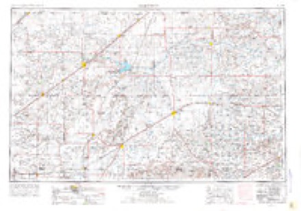
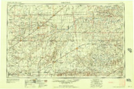
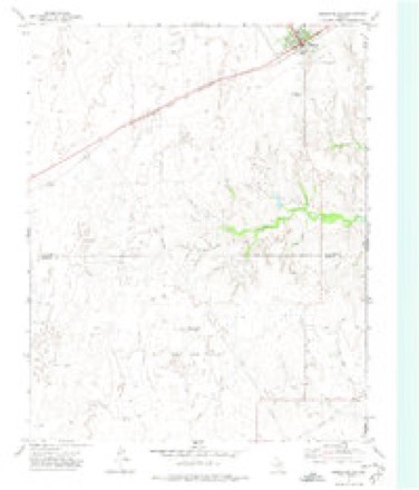
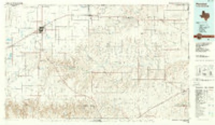
4 surveys from 6 printed sheetsMatched by testing this settlement's coordinate against the published boundary of every sheet in the United States Geological Survey's historical collection. Each opens the scanned sheet at the Survey.
- 1954 USGS Perryton quadrangle1:250000, 3 printings
- 1958 USGS Perryton quadrangle1:250000
- 1972 USGS Higgins South quadrangle1:24000
- 1986 USGS Perryton quadrangle1:100000
Fires near this place
12 since 2006Regional context, not property-specific evidence. The federal wildfire occurrence database lists 12 fires within 5 miles of Higgins between 2006 and 2014, burning about 6,593 acres in total. 1 started naturally. None was recorded as arson. Distance is straight-line from the map coordinates, so a fire counted here may appear on a neighbouring settlement's page as well.
| Reported cause | Fires |
|---|---|
| Missing data/not specified/undetermined | 3 |
| Railroad operations and maintenance | 3 |
| Debris and open burning | 2 |
| Equipment and vehicle use | 2 |
| Natural | 1 |
| Recreation and ceremony | 1 |
The most recent of them, most recent first, with the day each was reported and the service that recorded it.
| Date | Cause | Size | Reported by | Name on the report |
|---|---|---|---|---|
| 9 September 2011 | Railroad operations and maintenance | 5.0 acres | Texas A & M Forest Service | US 60 LIPSCOMB CO. |
| 12 September 2007 | Railroad operations and maintenance | 75 acres | Texas A & M Forest Service | not named |
| 31 July 2007 | Railroad operations and maintenance | 25 acres | Texas A & M Forest Service | not named |
| 10 July 2009 | Debris and open burning | 25 acres | Texas A & M Forest Service | CORKER |
| 10 July 2009 | Equipment and vehicle use | 250 acres | Texas A & M Forest Service | HIGGINS S FIRE |
| 31 May 2011 | Equipment and vehicle use | 10 acres | Texas A & M Forest Service | BIG BULL AND HIGGINS |
| 28 April 2006 | Natural | 3.0 acres | Texas A & M Forest Service | not named |
| 31 March 2014 | Missing data/not specified/undetermined | 250 acres | Texas A & M Forest Service | REKINDLE OF 4 MILES WEST OF HIGGINS |
Settlements close enough to share some of these fires:
Mines and quarries near this place
1 within 5 milesRegional context, not property-specific evidence. The federal mineral resources record lists 1 working within 5 miles of Higgins: 1 past producer. None of them still produces. What was taken out: Limestone, General. Distance is straight-line from the map coordinates, so a quarry counted here may appear on a neighbouring settlement's page as well.
| Where | Site | Commodity | Status | Recorded |
|---|---|---|---|---|
| Unknown Caliche Pit | Limestone, General | Past Producer |
Storms near this place
60 of 82 shownRegional context, not property-specific evidence. The National Weather Service names Higgins in 82 storm reports between 1993 and 2025: 71 hail, 7 thunderstorm wind, 4 tornado. No death or injury is recorded in these reports. Each account below is quoted exactly as the forecast office filed it, from the NOAA Storm Events Database, and each date opens the federal record of that event.
| When | Event | Place named | Harm | What the report says |
|---|---|---|---|---|
| July 2025 | Hail | Higgins | $15,000 | Large hail fell northwest of Higgins. Hail sizes were mostly dime size to quarter size, but a few hailstones were slightly larger than a golf ball. This resulted in damage to a fire engine that was en route to a wildfire caused by lightning. |
| May 2012 | Thunderstorm Wind | Higgins | $10,000 | A trained spotter reported that the strong thunderstorm wind gust blew over a carport and that there were two tree limbs blown down. There were no reports of injuries or fatalities. |
| June 2023 | Tornado (EF0) | Higgins | $1,000 | This tornado developed to the west of Highway 1453. It resulted in a few downed tree branches before crossing into Ellis County, Oklahoma. This tornado was also observed by several storm spotters and chasers. |
| April 2009 | Hail | Higgins | $1,000 | Hail broke sky lights in their home and lasted for five to ten minutes. |
| March 2012 | Hail | Higgins | $100 | The public reported that the hail was covering the ground and that a neighbor had a broken window due to the hail. There were no injuries reported. |
| May 2021 | Hail | Higgins | - | Hail stones ranged from 0.5 to 1 inch and Highway 60 was covered in hail. |
| June 2020 | Hail | Higgins | - | Billiard ball size hail fell in Higgins. A photo submitted by the observer also showed significant windshield damage due to large hail. |
| June 2020 | Hail | Higgins | - | Golf ball size hail fell 1 mile east of Higgins. |
| August 2019 | Thunderstorm Wind | Higgins | - | Part of a roof was blown off of a building. Multiple 55-gallon drums were blown down the street and some tree limbs were broken around town in Higgins. |
| August 2019 | Thunderstorm Wind | Higgins | - | A tree was uprooted in a pasture off of US Highway 60 near the Oklahoma state line. |
| April 2019 | Tornado (EFU) | Higgins | - | Broadcast media and multiple spotters reported a new tornado touchdown near Higgins, TX. NWS survey information suggests the tornado touchdown first occurred about 4 miles southwest of Higgins at 0429 PM and lifted at 0432 PM approximately 4 miles southwest of Higgins. The tornado was rated EF-Unknown since no damage was observed. The tornado track and times were based on spotter reports and radar data. |
| April 2019 | Tornado (EF0) | Higgins | - | Multiple sources reported a tornado touchdown. NWS survey information suggests the tornado touchdown began at 0354 PM 2 miles northeast of Glazier in Hemphill County and lifted at 0421 PM approximately 6 miles northeast of Glazier in Lipscomb County. A few trees were damaged along highway 60 southwest of Coburn, and some large tree limbs were snapped. The tornado was rated EF-0 with an estimated peak wind speed of 75 MPH. |
| May 2018 | Thunderstorm Wind | Higgins | - | Large tree limbs across Highway 213 just west of 1454 required crews to remove. |
| May 2018 | Hail | Higgins | - | All windows blown out on the north side of a home. |
| May 2016 | Hail | Higgins | - | Half dollar size hail fell 3 miles west-northwest of Higgins. |
| March 2015 | Hail | Higgins | - | A cluster multicells strengthened near Glazier just north of Canadian in Hemphill County and then moved northeast into Lipscomb County. One report of pea to marble size hail was received at 6:15 PM CST before the storm crossed into Lipscomb County. At 6:28 PM CST, one quarter size hail report was received by the public between Lipscomb and Higgins. |
| August 2015 | Hail | Higgins | - | Hail up to quarter size fell near the Oklahoma State line, 1 mile east-northeast of Higgins. |
| April 2012 | Thunderstorm Wind | Higgins | - | A trained spotter estimated the thunderstorm wind gusts in the town of Higgins, Texas. |
| August 2011 | Thunderstorm Wind | Higgins | - | The public estimated the thunderstorm wind gusts about two miles south southeast of Higgins Texas in Lipscomb County. There were no reports of damage or injuries. |
| May 2010 | Thunderstorm Wind | Higgins | - | A cooperative observer for the National Weather Service estimated sixty-one knot thunderstorm wind gusts just north of Higgins Texas. No damage or injuries were reported. |
| May 2008 | Hail | Higgins | - | City Official reported mostly penny size hail with a few to the size of baseballs. |
| May 1997 | Hail | Higgins | - | Report of hail covering the ground. |
| May 1995 | Hail | Higgins | - | Midday redevelopment of storms produced hail up to golf ball-size. At the same time golf ball-size hail was occurring in Childress the Childress surface observation report three-quarters-inch hail. |
| June 1995 | Hail | Higgins | - | Sixteen confirmed tornadoes on this date with two reaching the violent catagory. Very large hail and heavy rain also occurred and did considerable damage, much of it overlooked by the media due to the extent of the tornado damage. Early watches and warnings combined with extensive TV and radio coverage of the extreme danger these storms poised helped keep injuries to a minimum, and luckily no human deaths. |
| June 2023 | Hail | Higgins | - | no account filed |
| March 2021 | Hail | Higgins | - | no account filed |
| October 2021 | Hail | Higgins | - | no account filed |
| May 2019 | Hail | Higgins | - | no account filed |
| May 2018 | Hail | Higgins | - | no account filed |
| May 2018 | Hail | Higgins | - | no account filed |
| June 2017 | Hail | Higgins | - | no account filed |
| March 2012 | Hail | Higgins | - | no account filed |
| March 2012 | Hail | Higgins | - | no account filed |
| March 2012 | Hail | Higgins | - | no account filed |
| March 2012 | Hail | Higgins | - | no account filed |
| May 2010 | Hail | Higgins | - | no account filed |
| May 2010 | Hail | Higgins | - | no account filed |
| May 2010 | Hail | Higgins | - | no account filed |
| May 2010 | Hail | Higgins | - | no account filed |
| April 2009 | Hail | Higgins | - | no account filed |
| April 2009 | Hail | Higgins | - | no account filed |
| April 2009 | Hail | Higgins | - | no account filed |
| April 2009 | Hail | Higgins | - | no account filed |
| April 2009 | Hail | Higgins | - | no account filed |
| April 2009 | Hail | Higgins | - | no account filed |
| April 2009 | Hail | Higgins | - | no account filed |
| June 2008 | Hail | Higgins | - | no account filed |
| June 2008 | Hail | Higgins | - | no account filed |
| May 2008 | Hail | Higgins | - | no account filed |
| May 2008 | Hail | Higgins | - | no account filed |
| May 2008 | Hail | Higgins | - | no account filed |
| June 2008 | Hail | Higgins | - | no account filed |
| June 2008 | Hail | Higgins | - | no account filed |
| June 2008 | Hail | Higgins | - | no account filed |
| June 2008 | Hail | Higgins | - | no account filed |
| October 2008 | Hail | Higgins | - | no account filed |
| June 2007 | Hail | Higgins | - | no account filed |
| May 2007 | Hail | Higgins | - | no account filed |
| September 2006 | Hail | Higgins | - | no account filed |
| September 2006 | Hail | Higgins | - | no account filed |
Nearest settlements
The eight closest, with where each one stands in the county. Distances are straight-line, computed from the Geographic Names Information System coordinates.
| Map | Place | Distance | Sheets |
|---|---|---|---|
| Coburn | 7.8 miles | 6 | |
| Lipscomb | 15.2 miles | 6 | |
| Magoun | 17.7 miles | 6 | |
| Locust Grove | 18.2 miles | 6 | |
| Follett | 22.5 miles | 6 | |
| Barton Corners | 23.7 miles | 6 | |
| Sherlock | 24.8 miles | 6 | |
| Twin Grove | 26.2 miles | 6 |
Elsewhere
Matched on this settlement's Geographic Names Information System number rather than its name, so it cannot be a different place of the same name in another state.
| Wikipedia article on Higgins | An encyclopaedic summary. Its text is share-alike, so it is linked here rather than copied. |
| Wikidata item Q978067 | The structured record the population and elevation above come from. Public domain (CC0). |
Provenance
This settlement is recorded in the Geographic Names Information System as feature 1359148. The sheet list is computed by point-in-boundary test against the United States Geological Survey's historical topographic inventory. Both are works of the United States government and carry no copyright under 17 U.S.C. 105.
Wildfire. Short, Karen C. 2022. Spatial wildfire occurrence data for the United States, 1992-2020 [FPA_FOD_20221014]. 6th Edition. Fort Collins, CO: Forest Service Research Data Archive. https://doi.org/10.2737/RDS-2013-0009.6 Collected with United States Government funding and usable without additional permissions or fees.
Mines and quarries. USGS Mineral Resources Data System (MRDS) https://mrdata.usgs.gov/mrds/ A work of the United States government, no copyright under 17 U.S.C. 105.
Storms. NOAA National Centers for Environmental Information, Storm Events Database https://www.ncei.noaa.gov/stormevents/ A work of the United States government, no copyright under 17 U.S.C. 105. Narratives are quoted verbatim from the National Weather Service report and are not edited or summarised.