 Block
BlockLipscomb, Texas
6 topographic sheets cover this place, the earliest surveyed in 1954 and the latest in 1986. It stands in the Higgins census division. It lies in ZIP code area 79056. It stands on Sand Creek. The Survey maps it on the Lipscomb quadrangle. 66 people lived here at the 2020 count. It stands 2,392 feet above sea level.
On record in Lipscomb
Buildings and businesses the archive holds for this place. Each opens its own page, with the source record it came from.
On the National Register 1 record
 Lipscomb County Courthouselisted 2008
Population over time
2 figuresLipscomb grew from 37 to 66 between 2010 and 2020. These are the recorded population figures Wikidata holds for this place, reached through the Geographic Names Information System number this page is keyed on rather than by name, so they belong to this place and not to another of the same name. Most are census counts, but not all are: an early figure may be a founding or settlement estimate, and an estimate published within five years of a census is left out. The change column is computed, and is left blank where more than 20 years separate a figure from the one before it, because a gap that long is not a change between two counts.
| Year | People | Change |
|---|---|---|
| 2010 | 37 | |
| 2020 | 66 | +29 (+78%) |
Topographic sheets covering this place
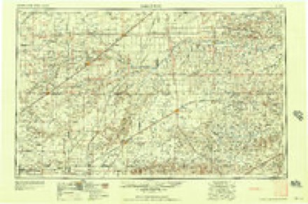
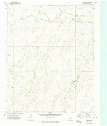
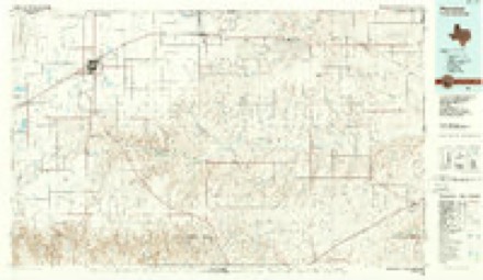
4 surveys from 6 printed sheetsMatched by testing this settlement's coordinate against the published boundary of every sheet in the United States Geological Survey's historical collection. Each opens the scanned sheet at the Survey.
- 1954 USGS Perryton quadrangle1:250000, 3 printings
- 1958 USGS Perryton quadrangle1:250000
- 1972 USGS Lipscomb quadrangle1:24000
- 1986 USGS Perryton quadrangle1:100000

Fires near this place
3 since 2009Regional context, not property-specific evidence. The federal wildfire occurrence database lists 3 fires within 5 miles of Lipscomb between 2009 and 2019, burning about 645 acres in total. 1 started naturally. None was recorded as arson. Distance is straight-line from the map coordinates, so a fire counted here may appear on a neighbouring settlement's page as well.
| Reported cause | Fires |
|---|---|
| Debris and open burning | 1 |
| Missing data/not specified/undetermined | 1 |
| Natural | 1 |
The most recent of them, most recent first, with the day each was reported and the service that recorded it.
| Date | Cause | Size | Reported by | Name on the report |
|---|---|---|---|---|
| 17 August 2019 | Natural | 500 acres | Texas A & M Forest Service | DUKE |
| 17 February 2011 | Missing data/not specified/undetermined | 45 acres | Texas A & M Forest Service | WEST OF LIPSCOMB |
| 28 January 2009 | Debris and open burning | 100 acres | Texas A & M Forest Service | KING BRUSH PILE |
Storms near this place
60 of 126 shownRegional context, not property-specific evidence. The National Weather Service names Lipscomb in 126 storm reports between 1993 and 2025: 77 hail, 33 thunderstorm wind, 11 tornado, 2 flash flood. The reports record 3 injuries. Each account below is quoted exactly as the forecast office filed it, from the NOAA Storm Events Database, and each date opens the federal record of that event.
| When | Event | Place named | Harm | What the report says |
|---|---|---|---|---|
| June 2003 | Thunderstorm Wind | Lipscomb | 3 hurt, $55,000 | High winds reportedly caused an empty trailer of a semi truck to slide into an automobile and then overturn along US Highway 83 in the southwest corner of Lipscomb County. Three people in the automobile were reportedly injured. |
| February 2000 | Tornado (F1) | Lipscomb | $500,000 | The tornado track was estimated and the tornado damaged nine irrigation sprinklers. Trees were uprooted and fences were blown down three miles east of Follett. The tornado also damaged roof tops, outbuildings, water wind mills, and one tractor cab along with several power line poles. The tornado exited LIpscomb County of Amarillo's County Warning Area and continued moving northeast into Ellis County of Norman's County Warning Area. |
| May 2007 | Flood | Lipscomb | $220,000 | Very heavy rainfall caused tremendous runoff into the Wolf Creek in Ochiltree and Lipscomb Counties. The flooding caused road closures along the south Wolf Creek in Ochiltree County and along the main stem of the Wolf Creek as it passed through Lake Fryer on into Lipscomb County. The flooding caused damage to some fifth wheel campers at Lake Fryer as they were drawn into the lake. The crest on the Wolf Creek at the gage site on the north side of Lipscomb was just over fifteen feet on the morning of May 24. The creek at Lipscomb was out of its banks for nearly four days and was running above the flood stage for almost thirty hours. This crest was the highest crest for the period of record. There was no reports of deaths or injuries from this flooding. |
| February 2000 | Hail | Lipscomb | $75,000 | Hail damaged automobiles and mainly the roofs of buildings. |
| July 1994 | Thunderstorm Wind | Lipscomb | $50,000 | Cooperative observer estimated winds of 60 to 70 mph. Power lines just east of Lipscomb were blown down and the power was out for over three hours. Nine head of cattle were killed when they came in contact with downed power lines. In Booker damage was estimated at $250K. The Texas Motel had its roof ripped completely off and the press box at Kiowa football field was blown off the bleachers. |
| September 1996 | Flash Flood | Lipscomb | $25,000 | no account filed |
| April 2001 | Thunderstorm Wind | Lipscomb | $20,000 | A cattle truck was reported blown over. |
| March 2007 | Flood | Lipscomb | $18,000 | Runoff from heavy rainfall the previous day along with already wet soils caused Wolf Creek to rise above flood stage at Lipscomb Texas. The creek crested just over ten feet around 1100 CST. Water flowed into Glen Turner Memorial Park on the north side of Lipscomb and some picnic tables were standing in water. There was no reports of injuries from the flooding. |
| May 2007 | Tornado (EF1) | Lipscomb | $13,000 | This tornado developed over open country about three miles southwest of Lipscomb at 2155 CST. The tornado traveled northeast for about four miles damaging a farm and trees. The tornado dissipated at 2205 CST just northwest of Lipscomb. No injuries were reported. |
| September 1999 | Thunderstorm Wind | Lipscomb | $10,000 | Report of high winds tearing the tin off the side of a house and power poles blown down. |
| May 2007 | Tornado (EF0) | Lipscomb | $6,000 | This tornado developed over extreme southwest Lipscomb County at 1656 CST and then moved northeast for about one mile before dissipating at 1657 CST. Although the tornado remained over open county...it did cause damage to a barn. No injuries were reported. |
| June 2025 | Hail | Lipscomb | $5,000 | A supercell thunderstorm moved across the eastern part of Lipscomb County. It produced hail up to the size of golfballs from roughly seven miles southeast of Lipscomb to Higgins. Quarter size hail fell about seven miles to the northeast of Glazier. |
| August 2001 | Thunderstorm Wind | Lipscomb | $5,000 | High winds blew down several trees. |
| August 2001 | Thunderstorm Wind | Lipscomb | $2,000 | High winds blew down a tree on State Highway 305. |
| May 2025 | Hail | Lipscomb | - | Hail up to quarter size fell along County Road X. |
| June 2025 | Thunderstorm Wind | Lipscomb | - | Lipscomb 8W mesonet station measured a 68 mph wind gust from a collapsing thunderstorm. |
| June 2024 | Thunderstorm Wind | Lipscomb | - | This mesonet first measured a wind gust of 59 mph at 2352CDT, with another gust of 65 mph at 2353CDT. |
| July 2023 | Thunderstorm Wind | Lipscomb | - | The first 60 mph plus wind gust was measured at 76 mph at 1927CDT. The mesonet then quickly measured a 95 and 96 mph wind gust over the next two minute. The last wind gust of 61 mph was at 1935CDT. |
| May 2022 | Thunderstorm Wind | Lipscomb | - | From the mesonet station located near Lipscomb. |
| June 2021 | Hail | Lipscomb | - | Hail stones measuring 1 to 1.5 inches were reported approximately 4 miles south of Lipscomb. |
| May 2020 | Hail | Lipscomb | - | Nickle size hail was reported 6 miles east of Wolf Creek Park. |
| May 2020 | Hail | Lipscomb | - | Nickel hail was covering the ground approximately 6 miles east of Wolf Creek Park. The hail occurred near the Ochiltree County line, near County Road V. |
| May 2020 | Hail | Lipscomb | - | An mPING report of one-inch diameter hail occurring 6 miles south of Lipscomb was received. |
| June 2020 | Hail | Lipscomb | - | Quarter size hail fell 6 miles west-southwest of Lipscomb. |
| May 2019 | Hail | Lipscomb | - | Late report of half dollar sized hail. |
| May 2019 | Funnel Cloud | Lipscomb | - | Funnel cloud northwest of location and halfway down. |
| May 2019 | Tornado (EF0) | Lipscomb | - | A tornado was observed on the ground for less than one minute by a trained spotter west of Lipscomb. No damage was reported. |
| May 2019 | Tornado (EF0) | Lipscomb | - | Survey was estimated using radar and chaser video. Occurred in open country and no damage was reported. |
| May 2019 | Tornado (EF2) | Lipscomb | - | The tornado touched down in northern Roberts County around 659 pm CDT, crossed the Roberts/Ochiltree county line around 704 pm CDT and the Ochiltree/Lipscomb county line around 719 pm CDT before dissipating through a rope out process by 733 pm CDT. Damage from the tornado consisted mostly of damage to trees, power lines and |oil/natural gas field equipment and sheds. There was also two manufactured homes being transported via truck the were blown off Highway 83. The tornado was noted to be larger and possibly stronger in inaccessible open county to the southwest of|the location where it was measured to be around 1/2 mile wide and rated an EF2 by the survey team. |
| March 2018 | Tornado (EF1) | Lipscomb | - | A tornado touched down in rural Hemphill County northwest of Glazier and continued into Lipscomb County. The tornado caused damage to trees, power poles and out building equivalent to a lower end EF1. |
| May 2018 | Hail | Lipscomb | - | Late picture report received of baseball sized hail. |
| May 2018 | Hail | Lipscomb | - | Late report of quarter to half dollar sized hail. |
| May 2018 | Thunderstorm Wind | Lipscomb | - | Estimated by law enforcement. |
| May 2018 | Hail | Lipscomb | - | Late report, with time estimated from radar. |
| May 2018 | Thunderstorm Wind | Lipscomb | - | Wind damage reported east-northeast of Lipscomb. |
| May 2018 | Hail | Lipscomb | - | Local media posted on social media a picture of large hail about 2 inches in diameter. |
| May 2018 | Hail | Lipscomb | - | Via Facebook. |
| July 2017 | Thunderstorm Wind | Lipscomb | - | Estimated 60 MPH wind gust. |
| May 2016 | Hail | Lipscomb | - | Penny to nickel size hail with a few golf ball size hailstones was reported 6 miles east of Wolf Creek Park. |
| May 2016 | Hail | Lipscomb | - | Half dollar size hail fell 6 miles east of Wolf Creek Park. |
| June 2015 | Hail | Lipscomb | - | Quarter size hail 2 miles east of Lipscomb. |
| November 2015 | Tornado (EF1) | Lipscomb | - | Much of the track of this storm was across farmland which was inaccessible. Therefore, track width and tornado strengths are based on locations where it crossed roadways. One home sustained roof damage. Additional damage included trees, fences, metal sheds, and oil field equipment. A rating of EF-1 was assigned with estimated maximum winds of 90 mph. The tornado started in northern Hemphill County and continued through Lipscomb County and into Ellis County, Oklahoma (see Storm Data for Oklahoma from NWS Norman for information about the ending location of this tornado). |
| August 2015 | Hail | Lipscomb | - | Quarter size hail fell 6 miles east of Wolf Creek Park. |
| May 2015 | Hail | Lipscomb | - | Quarter size hail was reported 12 miles north-northwest of Canadian. |
| May 2015 | Hail | Lipscomb | - | Storm chasers measured hail stones as large as two inches in diameter. |
| June 2014 | Thunderstorm Wind | Lipscomb | - | A cluster of thunderstorms moved out of the Oklahoma Panhandle and into the Texas Panhandle during the evening hours of the 30th. As this cluster of thunderstorms moved near the town of Lipscomb (Lipscomb County), a local law enforcement officer reported an estimated 60 mph thunderstorm downburst. After producing this downburst the cluster of thunderstorms continued to move to the southeast. |
| June 2014 | Hail | Lipscomb | - | A discrete thunderstorm developed over Lipscomb County during the early evening hours of the 18th. This storm intensified as it neared the town of Lipscomb (Lipscomb County), a member of the public one mile north of Lipscomb reported penny size hail (0.75 inch). The storm continued to move to the northeast after producing this hail. |
| June 2014 | Thunderstorm Wind | Lipscomb | - | A thunderstorm developed over the northern portion of Lipscomb County during the late evening hours of the 11th. As the storm tracked eastward and approached the town of Lipscomb (Lipscomb County), a local law enforcement official in town reported a estimated 60 mph thunderstorm downburst. After producing this downburst the storm continued to move eastward across the county. |
| June 2014 | Hail | Lipscomb | - | A thunderstorm developed over the southern portion of Lipscomb County during the late evening hours of the 11th. As the storm tracked eastward and approached the town of Lipscomb (Lipscomb County), a storm chaser 3 miles south of Lipscomb (Lipscomb County) reported quarter size hail (1.00 inch). After producing this hail the storm continued to move eastward across the county. |
| June 2014 | Hail | Lipscomb | - | A slow moving supercell moved out of the Oklahoma Panhandle and into the northeastern Texas Panhandle during the evening hours of the 22nd. As the supercell moved south of Wolf Creek Park (Ochiltree County), the local fire department reported golf ball size hail (1.75 inches) eleven miles southeast of Wolf Creek Park (Lipscomb County) at the intersection of US Highway 83 and State Highway 23. After producing this hail the supercell continue it's slow track southward across the eastern Texas Panhandle. |
| June 2014 | Tornado (EF0) | Lipscomb | - | A slow moving supercell thunderstorm moved southward across the eastern Texas Panhandle during the evening hours of the 22nd. This supercell produced multiple brief tornadoes over the course of several hours. This tornado developed over central Lipscomb County and was observed by trained storm spotters. The winds were estimated at 65 mph. After producing this tornado, the parent supercell continued moving southward across the eastern Texas Panhandle. |
| June 2013 | Thunderstorm Wind | Lipscomb | - | A line of thunderstorms developed across the northeastern Texas Panhandle shortly after 11 PM CST on the 3rd. This line quickly strengthened as it moved to the east. While this line was over Lipscomb (Lipscomb County) the Booker Fire Chief reported that a downburst had blown over outhouse buildings in the Wolf Creek Area (Lipscomb County). This line continued to move to the east across the Panhandle and entered western Oklahoma shortly after midnight on the 4th. |
| March 2012 | Hail | Lipscomb | - | The trained spotter reported that the hail was up to one inch deep and covering the ground. |
| June 2010 | Tornado (EF0) | Lipscomb | - | A brief rope tornado was reported by the broadcast media two miles south of the intersection of Texas State Highway 23 and Farm to Market Road 3260. The tornado stayed on the ground and remained over open country for two minutes before dissipating. No damage or injuries were reported. The path length and path width were estimated. |
| August 2009 | Thunderstorm Wind | Lipscomb | - | The general public reported thunderstorm wind gusts of fifty-two knots. |
| May 2007 | Hail | Lipscomb | - | Reported on the Ochiltree County and Lipscomb County line five miles north of U.S. Highway 83. |
| May 2007 | Hail | Lipscomb | - | Reported at Farm to Market Road 3260 and State Highway 23. |
| April 2005 | Hail | Lipscomb | - | Near Locust Grove |
| June 2003 | Flash Flood | Lipscomb | - | Flooding was reported over the road at the junction of U.S. Highway 83 and State Highway 23. |
| August 2001 | Thunderstorm Wind | Lipscomb | - | High winds blew a trampoline against a house. |
Nearest settlements
The eight closest, with where each one stands in the county. Distances are straight-line, computed from the Geographic Names Information System coordinates.
| Map | Place | Distance | Sheets |
|---|---|---|---|
| Locust Grove | 9.7 miles | 6 | |
| Barton Corners | 10.2 miles | 6 | |
| Twin Grove | 11.0 miles | 6 | |
| Coburn | 13.1 miles | 6 | |
| Sherlock | 14.9 miles | 6 | |
| Darrouzett | 15.0 miles | 6 | |
| Higgins | 15.2 miles | 6 | |
| Follett | 15.4 miles | 6 |
Elsewhere
Matched on this settlement's Geographic Names Information System number rather than its name, so it cannot be a different place of the same name in another state.
| Wikipedia article on Lipscomb | An encyclopaedic summary. Its text is share-alike, so it is linked here rather than copied. |
| Wikidata item Q973001 | The structured record the population and elevation above come from. Public domain (CC0). |
Provenance
This settlement is recorded in the Geographic Names Information System as feature 1361259. The sheet list is computed by point-in-boundary test against the United States Geological Survey's historical topographic inventory. Both are works of the United States government and carry no copyright under 17 U.S.C. 105.
Wildfire. Short, Karen C. 2022. Spatial wildfire occurrence data for the United States, 1992-2020 [FPA_FOD_20221014]. 6th Edition. Fort Collins, CO: Forest Service Research Data Archive. https://doi.org/10.2737/RDS-2013-0009.6 Collected with United States Government funding and usable without additional permissions or fees.
Storms. NOAA National Centers for Environmental Information, Storm Events Database https://www.ncei.noaa.gov/stormevents/ A work of the United States government, no copyright under 17 U.S.C. 105. Narratives are quoted verbatim from the National Weather Service report and are not edited or summarised.