 Block
BlockHondo, Texas
9 topographic sheets cover this place, the earliest surveyed in 1954 and the latest in 1992. It stands in the Hondo census division. It lies in ZIP code area 78861. The Survey maps it on the Hondo quadrangle. 8,289 people lived here at the 2020 count. It stands 892 feet above sea level.
Research this city
Population over time
2 figuresHondo fell from 8,803 to 8,289 between 2010 and 2020. These are the recorded population figures Wikidata holds for this place, reached through the Geographic Names Information System number this page is keyed on rather than by name, so they belong to this place and not to another of the same name. Most are census counts, but not all are: an early figure may be a founding or settlement estimate, and an estimate published within five years of a census is left out. The change column is computed, and is left blank where more than 20 years separate a figure from the one before it, because a gap that long is not a change between two counts.
| Year | People | Change |
|---|---|---|
| 2010 | 8,803 | |
| 2020 | 8,289 | -514 (-6%) |
Topographic sheets covering this place
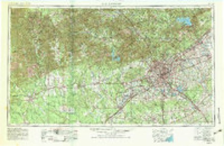
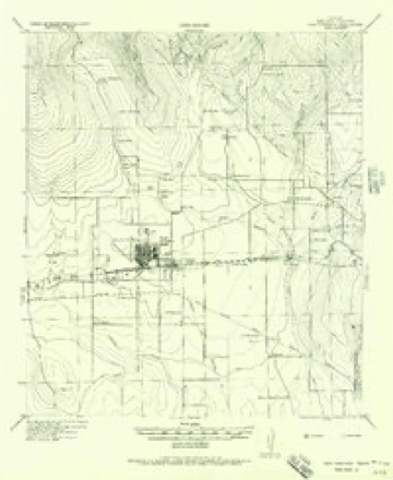
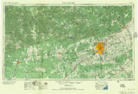
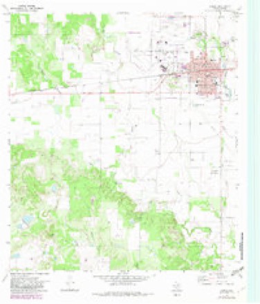
6 surveys from 9 printed sheetsMatched by testing this settlement's coordinate against the published boundary of every sheet in the United States Geological Survey's historical collection. Each opens the scanned sheet at the Survey.
- 1954 USGS San Antonio quadrangle1:250000, 3 printings
- 1956 USGS New Fountain quadrangle1:62500
- 1957 USGS San Antonio quadrangle1:250000
- 1970 USGS Hondo quadrangle1:24000, 2 printings
- 1985 USGS Uvalde quadrangle1:100000
- 1992 USGS Uvalde quadrangle1:100000
Fires near this place
15 since 2006Regional context, not property-specific evidence. The federal wildfire occurrence database lists 15 fires within 5 miles of Hondo between 2006 and 2020, burning about 1,742 acres in total. None started naturally. None was recorded as arson. Distance is straight-line from the map coordinates, so a fire counted here may appear on a neighbouring settlement's page as well.
| Reported cause | Fires |
|---|---|
| Missing data/not specified/undetermined | 13 |
| Debris and open burning | 2 |
The most recent of them, most recent first, with the day each was reported and the service that recorded it.
| Date | Cause | Size | Reported by | Name on the report |
|---|---|---|---|---|
| 25 September 2007 | Debris and open burning | 3.0 acres | Texas A & M Forest Service | not named |
| 19 September 2014 | Missing data/not specified/undetermined | 10 acres | Texas A & M Forest Service | 13 |
| 15 September 2009 | Missing data/not specified/undetermined | 30 acres | Texas A & M Forest Service | 35 |
| 25 July 2019 | Missing data/not specified/undetermined | 20 acres | Texas A & M Forest Service | HAY BALES AND HAY FIELD ON FIRE |
| 21 July 2020 | Missing data/not specified/undetermined | under an acre | Texas A & M Forest Service | GRASS FIRE (DISREGARDED ENROUTE) |
| 19 July 2008 | Debris and open burning | 10 acres | Texas A & M Forest Service | not named |
| 23 June 2013 | Missing data/not specified/undetermined | under an acre | Texas A & M Forest Service | GRASS FIRE CR 654 |
| 17 June 2006 | Missing data/not specified/undetermined | 100 acres | Texas A & M Forest Service | not named |
Settlements close enough to share some of these fires:
Mines and quarries near this place
1 within 5 milesRegional context, not property-specific evidence. The federal mineral resources record lists 1 working within 5 miles of Hondo: 1 producer. All of them still produce. What was taken out: Sand and Gravel, Construction. Distance is straight-line from the map coordinates, so a quarry counted here may appear on a neighbouring settlement's page as well.
| Where | Site | Commodity | Status | Recorded |
|---|---|---|---|---|
| Ralph Tschirhart Pit | Sand and Gravel, Construction | Producer | Gravel, Sand |
Storms near this place
60 of 64 shownRegional context, not property-specific evidence. The National Weather Service names Hondo in 64 storm reports between 1993 and 2022: 28 hail, 26 thunderstorm wind, 6 flash flood, 3 tornado. The reports record 40 injuries. Each account below is quoted exactly as the forecast office filed it, from the NOAA Storm Events Database, and each date opens the federal record of that event.
| When | Event | Place named | Harm | What the report says |
|---|---|---|---|---|
| October 2001 | Tornado (F2) | Hondo | 25 hurt, $20,000,000 | The tornado was spotted as it touched down near 940 pm CST just northwest of the Hondo airport. It grew to nearly 500 yards in width and moved toward the southeast for 1.2 miles across the airport and over the National Guard Armory before dissipating near the center of town. Although much of the damage was F0 and F1 on the Fujita Scale, the tornado was rated F2 because of the level of damage from the airport to the armory. During this time it destroyed a large hangar, partially destroyed the roof and walls of the concrete Armory and moved numerous mobile homes off their pads. One mobile home clearly showed the nature of damage from a tornado. The center of the mobile home was completely destroyed, along with a tree in front of it, while much less damage was indicted on both ends of the mobile home as well as vegetation near the ends. The storm also knocked out power to much of the area, and this, along with the darkness in the late night hour, made spotting very difficult. It is possible that additional small tornadoes might have accompanied the storm, but the combination of damage from the large tornado and the downburst winds, along with the darkness of the late night hour made it impossible to tell. Almost 150 homes in Hondo and almost 50 more outside the city were damaged, with nearly 100 mobile homes damaged. At least 10 houses and 30 mobile homes were destroyed. Losses to homes and mobile homes were estimated at 1.5 million dollars. In addition, nearly two dozen aircraft, including one corporate jet and 14 crop dusters, were damaged and destroyed at the Hondo Airport. Some were in collapsed hangars while others were lifted, tossed and set down across the Airport area. Commercial losses placed at 18 million dollars. At least 25 persons were injured. |
| March 2002 | Thunderstorm Wind | Hondo | 15 hurt, $200,000 | Across Eastern Medina County, wind damage was widespread, with road signs blown down, trees knocked over, roofs damaged and large limbs were taken out of trees. All the damage was laid out in an west-southwest to east-northeast path. Over a dozen people were injured as glass, broken from house and vehicle windows, was propelled by the gusty winds. |
| October 2001 | Thunderstorm Wind | Hondo | $2,000,000 | The damage at Hondo was due to the combination of a large tornado, severe downburst winds and large hail. The event was classic, as taught in the NWS Skywarn training program. Severe downburst winds (estimated in excess of 100 miles an hour), struck first, followed by heavy rain, then hail to the size of golfballs, and finally, just in front of the tornado, winds began to calm. This is the classic sequence - wind - rain - hail - calm - tornado. Wind damage began 2 miles northwest of the Hondo Airport, continued across the downtown area, and ended 5 miles southeast of the center of town. This damage was characterized by large limbs knocked from trees, trees uprooted, roofs and winds torn from homes and businesses, and power lines knocked down. |
| October 2001 | Hail | Hondo | $500,000 | no account filed |
| March 2002 | Hail | Hondo | $300,000 | Very large hail, up to softball size, was widespread across Hondo, damaging up to two-thirds of vehicle bodies and windows and breaking out building windows across the town. |
| May 2006 | Thunderstorm Wind | Hondo | $150,000 | Severe thunderstorm winds blew down trees, and damaged homes in Hondo. |
| May 2010 | Thunderstorm Wind | Hondo | $100,000 | A thunderstorm produced a measured wind gust of 67 mph on the Hondo Airport ASOS. The airport hanger was damaged and there were several trees blown down. |
| July 2000 | Thunderstorm Wind | Hondo | $100,000 | Severe thunderstorm winds blew down trees and power lines and damaged roofs of homes in Hondo. |
| September 1997 | Thunderstorm Wind | Hondo | $70,000 | no account filed |
| May 2002 | Thunderstorm Wind | Hondo | $50,000 | Severe thunderstorm winds overturned a trailer near Hondo. |
| May 2001 | Thunderstorm Wind | Hondo | $50,000 | Trees were reported to have been down down due to high winds. |
| October 2001 | Thunderstorm Wind | Hondo | $50,000 | Severe thunderstorms, striking again well after the previous tornadoes and downbursts, knocked out power to homes in the Hondo area and caused damage to roofs and carports around the town. |
| August 2000 | Thunderstorm Wind | Hondo | $30,000 | no account filed |
| January 1998 | Flash Flood | Hondo | $30,000 | no account filed |
| May 2001 | Thunderstorm Wind | Hondo | $20,000 | Trees were blown down by severe thunderstorm winds north of Hondo. The wind was accompanied by large hail that damaged fields of crops. |
| June 2000 | Flash Flood | Hondo | $10,000 | Rainfall of up to 5 inches caused widespread flash flooding of low water crossings in the city of Hondo. Water was also reported in homes due to wave action as cars drove through the flooded streets. |
| May 2011 | Thunderstorm Wind | Hondo | $5,000 | A thunderstorm produced wind gusts estimated at 50 knots which damaged a small portable building and a small utility pole. |
| May 2022 | Hail | Hondo | - | A thunderstorm produced ping pong ball size hail in Hondo. |
| April 2022 | Hail | Hondo | - | A thunderstorm produced quarter size hail in Hondo. |
| April 2022 | Hail | Hondo | - | A thunderstorm produced half dollar size hail in Hondo. |
| April 2022 | Hail | Hondo | - | A thunderstorm produced half dollar size hail in Hondo. |
| April 2022 | Hail | Hondo | - | A thunderstorm produced penny size hail in Hondo. |
| April 2021 | Hail | Hondo | - | Social media post shows a gargantuan hailstone likely 6+ inches in diameter. The hailstone was not saved and and therefore an official measurement could not be taken. |
| April 2021 | Hail | Hondo | - | A NWS storm survey team and employees from the Insurance Institute for Business and Home Safety (IBHS) conducted official measurements of a gargantuan hailstone. The stone fell at a residence in Hondo Texas during a supercell thunderstorm during the evening of April 28, 2021. With 3D scanning equipment, the IBHS was able to determine the maximum hail diameter at 6.416 inches, circumference at 19.73 inches, and volume of 40.239 cubic inches. The hailstone weight was 1.26 pounds. As of this writing, these measurements are being recognized as Texas state hail records. A full report on this hail event and this particular hailstone can be found at https://www.ncdc.noaa.gov/monitoring-content/extremes/scec/reports/20210624-Texas-Hailstone.pdf . |
| April 2021 | Hail | Hondo | - | Pictures shared on social media show several large hailstones over 5 inches in diameter. Significant hail damage occurred in and around Hondo with property damage to roofs, cars, windows, and some buildings. |
| June 2019 | Hail | Hondo | - | A thunderstorm produced 1.5 inch hail in Hondo. |
| June 2019 | Hail | Hondo | - | A thunderstorm produced 1.25 inch hail in Hondo. |
| September 2018 | Flash Flood | Hondo | - | Thunderstorms produced heavy rain that led to flash flooding closing several county roads in the southern half of the county. |
| May 2016 | Hail | Hondo | - | A thunderstorm produced two inch hail near Hwy 173 south of Hondo. |
| April 2015 | Thunderstorm Wind | Hondo | - | A thunderstorm produced wind gusts estimated at 75 mph flipped over four to five trailers at Hwy 90 and Hwy 173, blew the doors out at a car dealership, and knocked down several trees all in Hondo. |
| September 2013 | Flash Flood | Hondo | - | Several roads were closed in Hondo due to flooding. |
| May 2011 | Thunderstorm Wind | Hondo | - | A thunderstorm produced wind gusts estimated at 52 knots which caused tree damage city wide in Hondo. |
| July 2011 | Tornado (EF0) | Hondo | - | A thunderstorm produced a brief, weak tornado west of Hondo. The tornado did not cause any damage and was rated EF0. |
| July 2007 | Flood | Hondo | - | King Waterhole near Hondo crested at 16.6 ft on 07/21 at 1045cst, where flood stage is 12 ft. |
| May 2007 | Flash Flood | Hondo | - | Scattered showers and thunderstorms produced general 2 to 3 inch rain amounts over northeast Medina County with up to 5 inches near Rio Medina. SH173 closed due to high water at Verde Creek and FM471 was closed near LaCoste. |
| March 2007 | Tornado (EF0) | Hondo | - | A very small tornado touched down about 1 mile east of the intersection of SH173 and US90, then lifted and touched one more time. Its two touchdowns were along a very narrow path approximately 3 miles in length. The only visible evidence of damage was on the north side of US90 between CR451 and Hondo Creek, about 5 miles east of Hondo. Large limbs had been torn from a tree and thrown toward the south. Had the damage been due to thunderstorm winds, the debris would have been blown toward the east. It was estimated that this tornado formed approximately 1320 CST and was an EF-0 on the Enhanced Fujita Scale. It had a path width of 30 yards. |
| March 2007 | Thunderstorm Wind | Hondo | - | Severe thunderstorm winds blew down trees and damaged roofs of homes in Hondo. |
| March 2006 | Thunderstorm Wind | Hondo | - | Severe thunderstorm winds knocked over trees and blew down power lines down east of Hondo. |
| February 2005 | Thunderstorm Wind | Hondo | - | Severe thunderstorm sweeping southeastward from central Medina County blew down power lines across the southeast part of the county. Officials reported that power was restored after two hours. |
| October 1995 | Thunderstorm Wind | Hondo | - | Trees were blown over by thunderstorm winds. |
| April 1993 | Hail | Hondo | - | Nickel-size hail was reported between Hondo and Castroville by a National Weather Service employee. |
| May 1993 | Hail | Hondo | - | Dime-size hail was reported between Hondo and Castroville by the Sheriff's Office. |
| June 2017 | Hail | Hondo | - | no account filed |
| April 2016 | Hail | Hondo | - | no account filed |
| May 2013 | Hail | Hondo | - | no account filed |
| May 2013 | Hail | Hondo | - | no account filed |
| April 2013 | Hail | Hondo | - | no account filed |
| May 2009 | Thunderstorm Wind | Hondo | - | no account filed |
| June 2008 | Thunderstorm Wind | Hondo | - | no account filed |
| November 2006 | Hail | Hondo | - | no account filed |
| March 2004 | Hail | Hondo | - | no account filed |
| May 2002 | Hail | Hondo | - | no account filed |
| May 2002 | Hail | Hondo | - | no account filed |
| May 2001 | Hail | Hondo | - | no account filed |
| February 1998 | Hail | Hondo | - | no account filed |
| March 1997 | Thunderstorm Wind | Hondo | - | no account filed |
| April 1997 | Hail | Hondo | - | no account filed |
| March 1997 | Thunderstorm Wind | Hondo | - | no account filed |
| April 1997 | Hail | Hondo | - | no account filed |
| April 1997 | Thunderstorm Wind | Hondo | - | no account filed |
Nearest settlements
The eight closest, with where each one stands in the county. Distances are straight-line, computed from the Geographic Names Information System coordinates.
| Map | Place | Distance | Sheets |
|---|---|---|---|
| New Fountain | 5.1 miles | 9 | |
| Quihi | 6.6 miles | 9 | |
| D'Hanis | 7.4 miles | 9 | |
| Dunlay | 8.0 miles | 9 | |
| Bader | 10.0 miles | 9 | |
| Biry | 10.9 miles | 7 | |
| Noonan | 13.8 miles | 9 | |
| Castroville | 13.9 miles | 9 |
Elsewhere
Matched on this settlement's Geographic Names Information System number rather than its name, so it cannot be a different place of the same name in another state.
| Wikipedia article on Hondo | An encyclopaedic summary. Its text is share-alike, so it is linked here rather than copied. |
| Wikidata item Q976567 | The structured record the population and elevation above come from. Public domain (CC0). |
Provenance
This settlement is recorded in the Geographic Names Information System as feature 1359487. The sheet list is computed by point-in-boundary test against the United States Geological Survey's historical topographic inventory. Both are works of the United States government and carry no copyright under 17 U.S.C. 105.
Wildfire. Short, Karen C. 2022. Spatial wildfire occurrence data for the United States, 1992-2020 [FPA_FOD_20221014]. 6th Edition. Fort Collins, CO: Forest Service Research Data Archive. https://doi.org/10.2737/RDS-2013-0009.6 Collected with United States Government funding and usable without additional permissions or fees.
Mines and quarries. USGS Mineral Resources Data System (MRDS) https://mrdata.usgs.gov/mrds/ A work of the United States government, no copyright under 17 U.S.C. 105.
Storms. NOAA National Centers for Environmental Information, Storm Events Database https://www.ncei.noaa.gov/stormevents/ A work of the United States government, no copyright under 17 U.S.C. 105. Narratives are quoted verbatim from the National Weather Service report and are not edited or summarised.