 Block
BlockLaketon, Texas
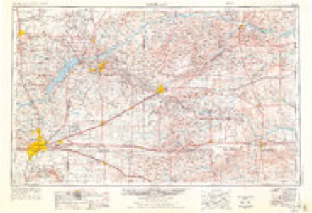
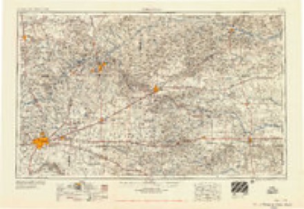
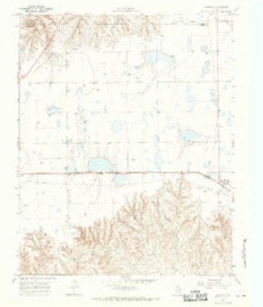
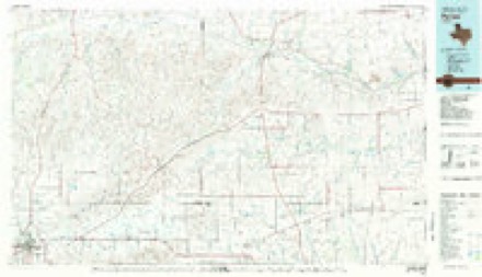
5 topographic sheets cover this place, the earliest surveyed in 1954 and the latest in 1982. It stands in the Lefors census division. It lies in ZIP code area 79065. The Survey maps it on the Laketon quadrangle.
Topographic sheets covering this place
4 surveys from 5 printed sheetsMatched by testing this settlement's coordinate against the published boundary of every sheet in the United States Geological Survey's historical collection. Each opens the scanned sheet at the Survey.
- 1954 USGS Amarillo quadrangle1:250000, 2 printings
- 1958 USGS Amarillo quadrangle1:250000
- 1966 USGS Laketon quadrangle1:24000
- 1982 USGS Pampa quadrangle1:100000
Fires near this place
15 since 2005Regional context, not property-specific evidence. The federal wildfire occurrence database lists 15 fires within 5 miles of Laketon between 2005 and 2020, burning about 2,274 acres in total. 4 started naturally. None was recorded as arson. Distance is straight-line from the map coordinates, so a fire counted here may appear on a neighbouring settlement's page as well.
| Reported cause | Fires |
|---|---|
| Missing data/not specified/undetermined | 7 |
| Equipment and vehicle use | 4 |
| Natural | 4 |
The most recent of them, most recent first, with the day each was reported and the service that recorded it.
| Date | Cause | Size | Reported by | Name on the report |
|---|---|---|---|---|
| 16 September 2014 | Missing data/not specified/undetermined | 1.0 acres | Texas A & M Forest Service | 2014104 |
| 12 June 2020 | Missing data/not specified/undetermined | 5.0 acres | Texas A & M Forest Service | HENDERSON |
| 20 May 2006 | Natural | 2.0 acres | Texas A & M Forest Service | not named |
| 20 May 2006 | Natural | 10 acres | Texas A & M Forest Service | not named |
| 20 May 2006 | Natural | 10 acres | Texas A & M Forest Service | not named |
| 11 May 2011 | Equipment and vehicle use | 15 acres | Texas A & M Forest Service | CIRCLE DOT |
| 10 April 2011 | Missing data/not specified/undetermined | 20 acres | Texas A & M Forest Service | HWY 152 & CR 23 |
| 16 March 2009 | Equipment and vehicle use | 2.0 acres | Texas A & M Forest Service | DEAN LARUE |
Settlements close enough to share some of these fires:
Storms near this place
38 since 1993Regional context, not property-specific evidence. The National Weather Service names Laketon in 38 storm reports between 1993 and 2023: 28 hail, 6 tornado, 3 thunderstorm wind, 1 funnel cloud. No death or injury is recorded in these reports. Each account below is quoted exactly as the forecast office filed it, from the NOAA Storm Events Database, and each date opens the federal record of that event.
| When | Event | Place named | Harm | What the report says |
|---|---|---|---|---|
| October 1993 | Tornado (F1) | Laketon | $500,000 | The tornado destroyed a carport and snapped four power poles. It was reported by the public through a local TV Meteorologist. The tornado moved over open pasture and dissipated with no further damage. |
| June 1995 | Hail | Laketon | $300,000 | no account filed |
| February 2012 | Tornado (EF1) | Laketon | $250,000 | This is the first segment of a tornado which formed ten miles south southwest of Miami just north of Texas State Highway 152 and traveled northeastward for about eight miles before exiting Gray county about five and a half miles north northeast of Laketon at 0055CST. While in Gray county, the tornado was rated an EF1. The tornado had a maximum width of one hundred yards. At he beginning of the tornado track in Gray county, there was a horse barn damaged as well as a center pivot irrigation system overturned. Then two miles from about where the tornado touched down to the northeast, also in Gray county, two single power poles were snapped at the base. There were no reports of injuries or fatalities. |
| August 2020 | Tornado (EF1) | Laketon | $90,000 | The tornado did minor damage around a residence which included,|very minor damage to the home roof cap, a rolled and displaced air|conditioner unit, and a destroyed free standing antenna tower. A|heavy duty metal storage box with a stored car inside was also|rolled onto some farming equipment. The tornado stripped|significant amounts of sheet metal off two barns and caused one|wall to collapse. The EF1 rating was due to four 10 inch power|poles which were snapped where the tornado crossed a nearby |county road. Debris from objects around the home and sheet metal |from the barns were carried 100-200 yards down the path. |
| May 1996 | Hail | Laketon | $50,000 | no account filed |
| May 2008 | Thunderstorm Wind | Laketon | $1,000 | The Roberts County Sheriff's Office reported a power pole snapped six miles south of Miami on Farm to Market Road 748...or two miles north of Laketon. |
| March 2021 | Hail | Laketon | - | Chasers said there was lots of quarter size to half dollar size hail stones. Hail accumulating on the ground up to 2 inches. Really strong winds estimating without descriptors about 70 to 80 mph. |
| March 2021 | Hail | Laketon | - | Chasers said there was lots of quarter size to half dollar size hail stones. Hail accumulating on the ground up to 2 inches. Really strong winds estimating without descriptors about 70 to 80 mph. |
| May 2018 | Funnel Cloud | Laketon | - | Storm chaser video showed a funnel cloud. |
| May 2018 | Hail | Laketon | - | Baseball sized hail reported. |
| May 2018 | Tornado (EF0) | Laketon | - | A brief tornado touchdown occurred in an open field with nothing known to have been damaged. |
| October 2014 | Hail | Laketon | - | A supercell moved across Gray County during the evening hours of the 9th. As the storm moved east of Lefors (Gray County), a trained storm spotter reported golf ball size hail (1.75 inches) eight miles east-northeast of Lefors (Gray County). After producing this hail, the supercell continued to moved eastward across the county. |
| April 2010 | Hail | Laketon | - | The hail was reported four miles north of Laketon in Gray County. |
| April 2008 | Hail | Laketon | - | Reported on County Road L. |
| May 1994 | Hail | Laketon | - | A very slow moving LP Supercell remained over Roberts County for several hours and produced hail to golf ball-size and a tornado. Most of the weather was over open country resulting in very little damage. The tornado had a sister funnel in the same wall cloud for part of its life cycle. |
| May 2023 | Hail | Laketon | - | no account filed |
| May 2023 | Hail | Laketon | - | no account filed |
| May 2023 | Hail | Laketon | - | no account filed |
| May 2018 | Hail | Laketon | - | no account filed |
| May 2012 | Hail | Laketon | - | no account filed |
| May 2012 | Hail | Laketon | - | no account filed |
| April 2012 | Hail | Laketon | - | no account filed |
| June 2008 | Hail | Laketon | - | no account filed |
| June 2008 | Hail | Laketon | - | no account filed |
| June 2008 | Hail | Laketon | - | no account filed |
| June 2008 | Thunderstorm Wind | Laketon | - | no account filed |
| June 2008 | Hail | Laketon | - | no account filed |
| May 1997 | Tornado (F0) | Laketon | - | no account filed |
| June 1996 | Thunderstorm Wind | Laketon | - | no account filed |
| May 1996 | Hail | Laketon | - | no account filed |
| May 1996 | Hail | Laketon | - | no account filed |
| May 1996 | Hail | Laketon | - | no account filed |
| May 1996 | Tornado (F0) | Laketon | - | no account filed |
| May 1996 | Hail | Laketon | - | no account filed |
| May 1995 | Hail | Laketon | - | no account filed |
| May 1995 | Hail | Laketon | - | no account filed |
| October 1993 | Hail | Laketon | - | no account filed |
| October 1993 | Hail | Laketon | - | no account filed |
Nearest settlements
The eight closest, with where each one stands in the county. Distances are straight-line, computed from the Geographic Names Information System coordinates.
Provenance
This settlement is recorded in the Geographic Names Information System as feature 1380049. The sheet list is computed by point-in-boundary test against the United States Geological Survey's historical topographic inventory. Both are works of the United States government and carry no copyright under 17 U.S.C. 105.
Wildfire. Short, Karen C. 2022. Spatial wildfire occurrence data for the United States, 1992-2020 [FPA_FOD_20221014]. 6th Edition. Fort Collins, CO: Forest Service Research Data Archive. https://doi.org/10.2737/RDS-2013-0009.6 Collected with United States Government funding and usable without additional permissions or fees.
Storms. NOAA National Centers for Environmental Information, Storm Events Database https://www.ncei.noaa.gov/stormevents/ A work of the United States government, no copyright under 17 U.S.C. 105. Narratives are quoted verbatim from the National Weather Service report and are not edited or summarised.