 Block
BlockLangtry, Texas
8 topographic sheets cover this place, the earliest surveyed in 1943 and the latest in 1985. It stands in the Del Rio Northwest census division. It lies in ZIP code area 78871. It lies near Mile Canyon. The Survey maps it on the Langtry quadrangle. 145 people lived here at the last count. It stands 1,289 feet above sea level.
Topographic sheets covering this place
5 surveys from 8 printed sheetsMatched by testing this settlement's coordinate against the published boundary of every sheet in the United States Geological Survey's historical collection. Each opens the scanned sheet at the Survey.
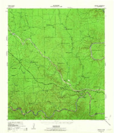
- 1943 USGS Langtry quadrangle1:62500, 2 printings
- 1958 USGS Del Rio quadrangle1:250000, 2 printings
- 1964 USGS Del Rio quadrangle1:250000
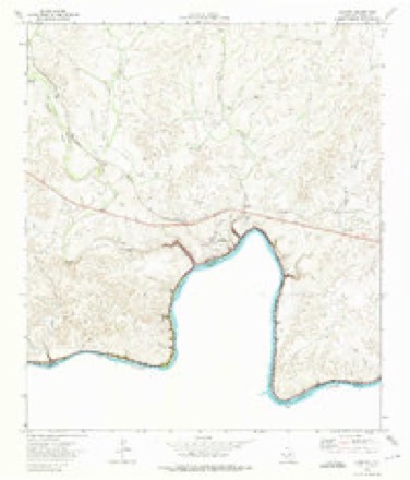
- 1973 USGS Langtry quadrangle1:24000
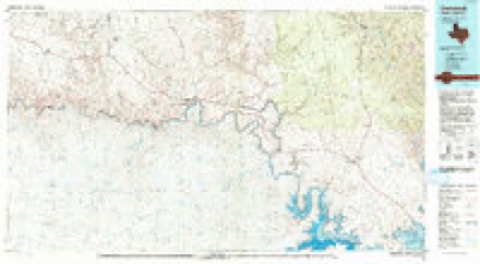
- 1985 USGS Comstock quadrangle1:100000, 2 printings
Fires near this place
6 since 1997Regional context, not property-specific evidence. The federal wildfire occurrence database lists 6 fires within 5 miles of Langtry between 1997 and 2017, burning about 192 acres in total. 1 started naturally. None was recorded as arson. Distance is straight-line from the map coordinates, so a fire counted here may appear on a neighbouring settlement's page as well.
| Reported cause | Fires |
|---|---|
| Missing data/not specified/undetermined | 2 |
| Debris and open burning | 2 |
| Natural | 1 |
| Recreation and ceremony | 1 |
The most recent of them, most recent first, with the day each was reported and the service that recorded it.
| Date | Cause | Size | Reported by | Name on the report |
|---|---|---|---|---|
| 5 August 2017 | Debris and open burning | 3.0 acres | Texas A & M Forest Service | LOOP 25 FIRE |
| 2 May 2001 | Debris and open burning | 80 acres | Amistad National Recreation Area | BILLINGS |
| 26 April 2008 | Missing data/not specified/undetermined | 38 acres | Amistad National Recreation Area | LANGTRY 1 |
| 19 April 1997 | Natural | 10 acres | Amistad National Recreation Area | RATTLESNAK |
| 13 April 2001 | Missing data/not specified/undetermined | under an acre | Amistad National Recreation Area | SOUTH SEEP |
| 20 February 2000 | Recreation and ceremony | 61 acres | Amistad National Recreation Area | LANGTRY |
Settlements close enough to share some of these fires:
Storms near this place
26 since 1993Regional context, not property-specific evidence. The National Weather Service names Langtry in 26 storm reports between 1993 and 2025: 11 hail, 6 flash flood, 5 thunderstorm wind, 3 flood. No death or injury is recorded in these reports. Each account below is quoted exactly as the forecast office filed it, from the NOAA Storm Events Database, and each date opens the federal record of that event.
| When | Event | Place named | Harm | What the report says |
|---|---|---|---|---|
| June 2014 | Flash Flood | Langtry | $50,000 | Coop Observer reported roads flooded around Langtry. Portions of the Judge Roy Bean Visitor Center sustained heavy water damage from a leaking roof after getting nearly 12 inches of rain in only a few hours. |
| August 2007 | Flash Flood | Langtry | $50,000 | Showers and thunderstorms associated with Erin spread across the northwest half of Val Verde County in the mid-afternoon. Rain totals averaged between 3 and 4 inches with up to 8 inches east of Juno and around Pandale. Flash flooding began in the evening and continued through midnight into the early morning hours. SH163, FM189, and FM1024 were reported closed due to high water. |
| April 1994 | Hail | Langtry | $50,000 | Thunderstorms that formed along a cold front moved southeastward across Val Verde County, producing widespread heavy rain and hail. Golf ball-sized hail fell southwest of Laughlin Air Force Base, along with very heavy rainfall. The hail was reported to be two inches deep. At 1658 CST, softball-sized hail was spotted just east of Langtry. A funnel cloud was sighted 12 miles south of Pandale by a deputy sheriff. At the same time, a funnel cloud was reported 10 miles northwest of Comstock by a deputy sheriff. Laughlin Air Force Base weather personnel reported funnel clouds over the base as well. |
| March 1993 | Hail | Langtry | $5,000 | Several severe thunderstorms moved across Val Verde County during the afternoon. The first reported of large hail was made in Langtry. Tennis ball-size hail was later reported in Langtry, a few cars were damaged along with some house windows. As the storm moved southeast it continued to produce large hail. A Federal Express truck was damaged between Langtry and Comstock. A funnel cloud was reported north of Comstock by the Sheriffs Office. A motorist that was drive under the storm at the time reported golfball-size hail and damage to her car. Golfball-size hail was next reported north of Del Rio at the Greenwood Ranch. As the next set of storms moved across the County a motorist reported golfball-size hail on Highway 377 northeast of Del rio. Golfball-size hail was reported on the LaGrand Ranch Northwest of Comstock. |
| September 2009 | Thunderstorm Wind | Langtry | $2,000 | Thunderstorms produced wind gusts estimated at 60 mph which knocked down large tree limbs, 2-3 inches in diameter, at the Judge Roy Bean visitor center. |
| May 2025 | Thunderstorm Wind | Langtry | - | A thunderstorm produced wind gusts estimated at 65 mph that blew a semi-trailer truck onto the shoulder of US 90 east of Langtry. |
| June 2025 | Thunderstorm Wind | Langtry | - | A thunderstorm produced wind gusts measured at 52 kts by a mesonet station east of Langtry. |
| June 2025 | Hail | Langtry | - | A thunderstorm produced penny size hail east of Langtry. |
| September 2023 | Thunderstorm Wind | Langtry | - | A thunderstorm produced wind gusts measured at 58 kts by the mesonet station Baker Suave Lomas west of Langtry. |
| May 2009 | Thunderstorm Wind | Langtry | - | The Judge Roy Bean Visitor Center reported several trees uprooted in Langtry. |
| June 2009 | Flash Flood | Langtry | - | Creeks and streams were flooded near the Pecos River. |
| April 2009 | Hail | Langtry | - | Dime to quarter size hail was reported in Langtry. |
| May 2007 | Flood | Langtry | - | The Pecos River at Langtry crested at 17.69 ft at 0330 CST on May 25, where flood stage is 7 ft. |
| May 2007 | Flood | Langtry | - | The Pecos River at Langtry crested at 18.15 ft at 0345 CST on May 10, where flood stage is 7 ft. |
| March 2007 | Flood | Langtry | - | The Pecos River near Langtry crested at 12.08 ft at 0800 CST on March 26, where flood stage is 7 ft. This was the 10th highest crest on record. |
| May 2005 | Flash Flood | Langtry | - | Thunderstorms developing just before midnight produced widespread 1 inch rain totals between Langtry and Juno in the north central part of Val Verde County. Highest totals were between 2 and 3 inches between the two towns. FM1024 was closed due to flash flooding approximately 25 miles southeast of Pandale. SH163 was closed near Juno |
| August 2005 | Flash Flood | Langtry | - | Slow-moving thunderstorms in the late afternoon produced general 2 to 3 inch rainfall in the Langtry area. Several roads in and around Langtry were closed through the early evening. |
| August 2004 | Flash Flood | Langtry | - | Thunderstorms persisted from late morning into the afternoon between Langtry and Comstock, producing general 2 inch totals, with up to 4 inches near Comstock. Flash flooding was reported by the Emergency Manager through the mid afternoon. |
| June 1997 | Tornado (F0) | Langtry | - | A small F0 tornado was sighted by a train engineer near Langtry. |
| March 1993 | Hail | Langtry | - | Several severe thunderstorms moved across Val Verde County during the afternoon. The first reported of large hail was made in Langtry. Tennis ball-size hail was later reported in Langtry, a few cars were damaged along with some house windows. As the storm moved southeast it continued to produce large hail. A Federal Express truck was damaged between Langtry and Comstock. A funnel cloud was reported north of Comstock by the Sheriffs Office. A motorist that was drive under the storm at the time reported golfball-size hail and damage to her car. Golfball-size hail was next reported north of Del Rio at the Greenwood Ranch. As the next set of storms moved across the County a motorist reported golfball-size hail on Highway 377 northeast of Del rio. Golfball-size hail was reported on the LaGrand Ranch Northwest of Comstock. |
| October 2014 | Hail | Langtry | - | no account filed |
| June 2010 | Hail | Langtry | - | no account filed |
| June 2003 | Hail | Langtry | - | no account filed |
| June 2001 | Hail | Langtry | - | no account filed |
| March 1998 | Hail | Langtry | - | no account filed |
| April 1996 | Hail | Langtry | - | no account filed |
Nearest settlements
The eight closest, with where each one stands in the county. Distances are straight-line, computed from the Geographic Names Information System coordinates.
| Map | Place | Distance | Sheets |
|---|---|---|---|
| Osman | 7.6 miles | 8 | |
| Shumla | 8.7 miles | 7 | |
| Pumpville | 13.3 miles | 8 | |
| Lull | 14.6 miles | 7 | |
| Comstock | 22.1 miles | 7 | |
| Bakers Crossing | 24.2 miles | 7 | |
| Pandale | 25.9 miles | 6 | |
| Box Canyon Estates | 28.3 miles | 7 |
Elsewhere
Matched on this settlement's Geographic Names Information System number rather than its name, so it cannot be a different place of the same name in another state.
| Wikipedia article on Langtry | An encyclopaedic summary. Its text is share-alike, so it is linked here rather than copied. |
| Wikidata item Q3217298 | The structured record the population and elevation above come from. Public domain (CC0). |
Provenance
This settlement is recorded in the Geographic Names Information System as feature 1377171. The sheet list is computed by point-in-boundary test against the United States Geological Survey's historical topographic inventory. Both are works of the United States government and carry no copyright under 17 U.S.C. 105.
Wildfire. Short, Karen C. 2022. Spatial wildfire occurrence data for the United States, 1992-2020 [FPA_FOD_20221014]. 6th Edition. Fort Collins, CO: Forest Service Research Data Archive. https://doi.org/10.2737/RDS-2013-0009.6 Collected with United States Government funding and usable without additional permissions or fees.
Storms. NOAA National Centers for Environmental Information, Storm Events Database https://www.ncei.noaa.gov/stormevents/ A work of the United States government, no copyright under 17 U.S.C. 105. Narratives are quoted verbatim from the National Weather Service report and are not edited or summarised.