 Block
BlockMarshall, Texas
12 topographic sheets cover this place, the earliest surveyed in 1956 and the latest in 1986. It stands in the Marshall census division. It lies in ZIP code area 75670. The Survey maps it on the Marshall East quadrangle. 23,392 people lived here at the 2020 count. It stands 413 feet above sea level.
Research this city
On record in Marshall
Buildings and businesses the archive holds for this place. Each opens its own page, with the source record it came from.
On the National Register 12 of 15 shown
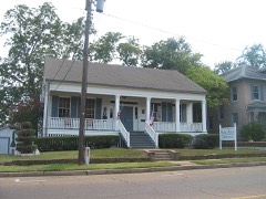 Arnot Houselisted 1979
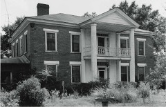 Edgemontlisted 1977
 First Methodist Churchlisted 1980
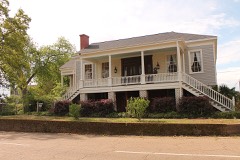 Fry-Barry Houselisted 1978
 Ginocchio Historic Districtlisted 1974
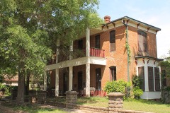 Hagerty Houselisted 1978
 Harrison County Courthouselisted 1977
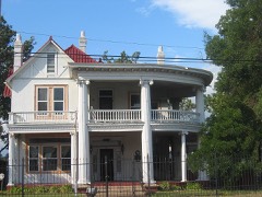 Hochwald Houselisted 1983
 Marshall US Post Officelisted 2001
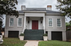 Old Pierce Houselisted 1973
 Starr Houselisted 1979
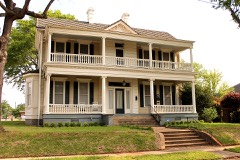 John R. Stinson Houselisted 1979
Population over time
2 figuresMarshall fell from 23,523 to 23,392 between 2010 and 2020. These are the recorded population figures Wikidata holds for this place, reached through the Geographic Names Information System number this page is keyed on rather than by name, so they belong to this place and not to another of the same name. Most are census counts, but not all are: an early figure may be a founding or settlement estimate, and an estimate published within five years of a census is left out. The change column is computed, and is left blank where more than 20 years separate a figure from the one before it, because a gap that long is not a change between two counts.
| Year | People | Change |
|---|---|---|
| 2010 | 23,523 | |
| 2020 | 23,392 | -131 (-1%) |
Topographic sheets covering this place
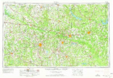
4 surveys from 12 printed sheetsMatched by testing this settlement's coordinate against the published boundary of every sheet in the United States Geological Survey's historical collection. Each opens the scanned sheet at the Survey.
- 1956 USGS Tyler quadrangle1:250000, 5 printings
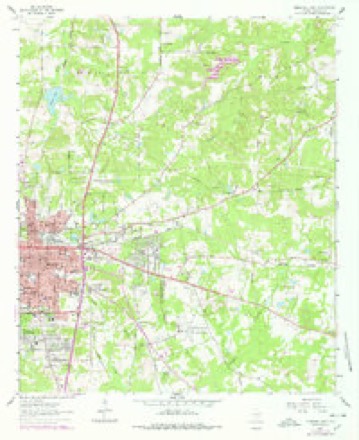
- 1962 USGS Marshall East quadrangle1:24000, 2 printings
- 1984 USGS Tyler quadrangle1:250000, 3 printings
- 1986 USGS Marshall quadrangle1:100000, 2 printings
Fires near this place
223 since 1992Regional context, not property-specific evidence. The federal wildfire occurrence database lists 223 fires within 5 miles of Marshall between 1992 and 2020, burning about 829 acres in total. 4 started naturally. 10 were recorded as arson. Distance is straight-line from the map coordinates, so a fire counted here may appear on a neighbouring settlement's page as well.
| Reported cause | Fires |
|---|---|
| Debris and open burning | 138 |
| Missing data/not specified/undetermined | 39 |
| Arson/incendiarism | 10 |
| Equipment and vehicle use | 9 |
| Smoking | 8 |
| Natural | 4 |
| Power generation/transmission/distribution | 4 |
| Misuse of fire by a minor | 4 |
| Railroad operations and maintenance | 3 |
| Recreation and ceremony | 2 |
| Fireworks | 2 |
The most recent of them, most recent first, with the day each was reported and the service that recorded it.
| Date | Cause | Size | Reported by | Name on the report |
|---|---|---|---|---|
| 8 September 2013 | Debris and open burning | 11 acres | Texas A & M Forest Service | 6297 |
| 8 September 2011 | Missing data/not specified/undetermined | 1.0 acres | Texas A & M Forest Service | BAILEY CUT OFF |
| 7 September 1993 | Debris and open burning | 5.0 acres | Texas A & M Forest Service | not named |
| 4 September 2011 | Missing data/not specified/undetermined | 3.0 acres | Texas A & M Forest Service | FM3379 |
| 4 September 2010 | Power generation/transmission/distribution | 7.0 acres | Texas A & M Forest Service | LINDEN - 155 |
| 30 September 1994 | Smoking | 1.0 acres | Texas A & M Forest Service | not named |
| 3 September 2015 | Missing data/not specified/undetermined | under an acre | Texas A & M Forest Service | TOMMIE DUTTON |
| 29 September 2007 | Debris and open burning | 1.5 acres | Texas A & M Forest Service | not named |
Settlements close enough to share some of these fires:
Mines and quarries near this place
10 of 27 shownRegional context, not property-specific evidence. The federal mineral resources record lists 27 workings within 5 miles of Marshall: 20 producers, 4 past producers, 3 unknowns. 20 still produce. What was taken out: Fire Clay (Refractory), Clay. Distance is straight-line from the map coordinates, so a quarry counted here may appear on a neighbouring settlement's page as well.
| Where | Site | Commodity | Status | Recorded |
|---|---|---|---|---|
| Marshall Plant No. 2 | Clay | Producer | ||
| Cobb Pit | Fire Clay (Refractory) | Producer | ||
| Cobb White and Schriver Pits | Fire Clay (Refractory) | Producer | Sedimentary | |
| Henderson Clay Prod Pit | Fire Clay (Refractory) | Unknown | ||
| Henderson Clay Products Inc Pit | Fire Clay (Refractory) | Unknown | ||
| Henderson Clay Products Inc Pit | Fire Clay (Refractory) | Producer | ||
| Marshall Pits | Fire Clay (Refractory) | Producer | ||
| Marshall Plant & Pits | Fire Clay (Refractory) | Producer | ||
| Marshall Pottery New Plant | Fire Clay (Refractory) | Producer | ||
| Marshall Pottery Old Plant | Fire Clay (Refractory) | Unknown |
Storms near this place
60 of 176 shownRegional context, not property-specific evidence. The National Weather Service names Marshall in 176 storm reports between 1993 and 2026: 89 thunderstorm wind, 49 hail, 25 flash flood, 5 lightning. The reports record 2 injuries. Each account below is quoted exactly as the forecast office filed it, from the NOAA Storm Events Database, and each date opens the federal record of that event.
| When | Event | Place named | Harm | What the report says |
|---|---|---|---|---|
| April 1994 | Thunderstorm Wind | Marshall | 1 hurt, $50,000,000 | Thunderstorm winds estimated at 70 miles an hour raked the south side of Marshall. Extensive roof damage was reported due to trees blown down onto homes and cars. One person was injured and admitted to the hospital. Other damage was done to commercial buildings, an apartment complex and 40 to 50 power line poles were blown down. |
| October 2001 | Thunderstorm Wind | Marshall | 1 hurt | A tree was blown over onto a man causing extensive injuries. |
| November 1994 | Thunderstorm Wind | Marshall | $500,000 | Numerous trees and power lines were blown down by high winds. Trees were blown down onto at least 30 homes causing over $100,000 damage. |
| April 1999 | Thunderstorm Wind | Marshall | $250,000 | North to south oriented multi-cellular squall line produced a significant microburst with damage to light to moderate damage homes and businesses. Numerous large trees toppled and snapped crushing cars and damaging roofs. One eye witness described as everything suddenly went horizontal, rain and debris. |
| October 2009 | Thunderstorm Wind | Marshall | $200,000 | Trees were downed onto powerlines, a few homes as well as on a few cars. Roof damage was reported to several buildings and commercial signs. Most of the damage was on the north side of the city. |
| May 1998 | Thunderstorm Wind | Marshall | $200,000 | Assisted living center under construction in east Marshall was torn down by high thunderstorm winds. |
| September 2001 | Lightning | Marshall | $120,000 | Lightning struck a 100 year old church which caught fire and burned to the ground. |
| February 1998 | Thunderstorm Wind | Marshall | $68,000 | Numerous reports of trees and powerlines toppled. Some trees that fell in and near the Linwood Drive Community caused minor roof damage to homes and removed some porches. Ten different locations in Marshall suffered damage with nearly 600 homes losing power. Winds measured by WCM who had porch removed from his home. |
| January 2013 | Thunderstorm Wind | Marshall | $40,000 | Numerous trees and powerlines were downed throughout the county. A tree was downed on a house and a shed near Marshall, Texas as well. |
| April 1999 | Thunderstorm Wind | Marshall | $40,000 | Numerous trees and powerlines were toppled. A home lost its roof. |
| December 1999 | Tornado (F1) | Marshall | $40,000 | In southwest Marshall from just southeast of West Pinecrest Drive (hwy 43) and just east of West End Blvd to South Washington Ave to just west of East End Blvd (Hwy 59). Eyewitnesses indicated tornado was heavily rain wrapped, fast moving and very difficult to see. Tree on home. Few removed shingles. About ten large pines snapped or uprooted. Flag pole bent. Power lines down. |
| April 1999 | Thunderstorm Wind | Marshall | $30,000 | Winds blew the roof off a business on the west side of town along Hwy 80. |
| May 2012 | Thunderstorm Wind | Marshall | $20,000 | Trees and powerlines were downed in downtown Marshall. One tree fell on a house. |
| July 2009 | Flash Flood | Marshall | $20,000 | A daycare facility on West Houston Street was flooded. |
| March 2007 | Tornado (EF1) | Marshall | $20,000 | A supercell thunderstorm moved northeast across Harrsion County Texas and spawned a tornado just west of Marshall, Texas. Damage consisted of soft wood trees with large branches broken or twisted...one hard wood blown down and a large barn blown apart. The tornado was rated an EF1 on the new Enhanced Fujita Scale. Damage Indicator (DI): SBO. Degree of Damage (DOD): 6. |
| March 2001 | Thunderstorm Wind | Marshall | $12,000 | A roof was blown off an old wood frame house in west Marshall from straight line winds (macroburst). |
| October 1997 | Lightning | Marshall | $12,000 | Lightning struck a small wood-framed home in town resulting in a fire causing moderate damage. |
| February 2011 | Thunderstorm Wind | Marshall | $10,000 | Trees were downed along Hwy. 59 near Marshall, Texas. Several trees were also downed along Rosborough Springs Road near Liberty Church Road. One tree fell on top of a house doing moderate damage but no injuries were reported. |
| July 2008 | Thunderstorm Wind | Marshall | $10,000 | Two trees were downed on Warren Drive near the Marshall, Texas airport. Another tree fell on a home near the airport. No injuries were reported. |
| May 1998 | Thunderstorm Wind | Marshall | $10,000 | Several trees down in town including one that fell across a house. |
| September 1996 | Thunderstorm Wind | Marshall | $10,000 | no account filed |
| March 2008 | Flash Flood | Marshall | $5,000 | A daycare on the west side of Houston Street west of downtown near a small creek had to be evacuated due to flash flooding. Minor street flooding was also reported at Hwy. 59 and Bussey Road and also on Franklin Street. |
| May 1995 | Thunderstorm Wind | Marshall | $5,000 | Several large oak trees were blown along with a billboard. |
| June 1994 | Thunderstorm Wind | Marshall | $5,000 | Power lines were blown down by thunderstorm winds. |
| October 1997 | Lightning | Marshall | $3,000 | no account filed |
| March 2026 | Thunderstorm Wind | Marshall | - | Multiple trees and power lines downed in the vicinity of Marshall. |
| January 2025 | Thunderstorm Wind | Marshall | - | Several trees downed along U.S. Highway 80 near Marshall. |
| June 2025 | Flash Flood | Marshall | - | Flash flooding reported across the highway with a high water rescue that occurred. |
| November 2025 | Flash Flood | Marshall | - | Flash flooding with high water reported at several locations in the city of Marshall along U.S. Highway 259. |
| January 2024 | Flash Flood | Marshall | - | Several roads were flooded across Harrison County. |
| February 2024 | Hail | Marshall | - | Golf ball size hail reported at Interstate 20 and Highway 59 south of Marshall. |
| February 2024 | Hail | Marshall | - | Ping pong ball size hail reported in Marshall. |
| February 2024 | Hail | Marshall | - | Nickel size hail reported in Marshall. |
| June 2024 | Flash Flood | Marshall | - | Flash flooding reported with numerous roads covered in high water in Marshall, resulting in road closures throughout parts of Harrison County. |
| April 2024 | Flash Flood | Marshall | - | Flash flooding reported in Marshall with water covering the road at the corner of West Grand Avenue and Ward Street as well as two other nearby intersections. |
| May 2024 | Hail | Marshall | - | Quarter size hail reported in Marshall. |
| March 2023 | Thunderstorm Wind | Marshall | - | Numerous trees downed, shingles removed and one brick support blown away in Marshall. |
| March 2023 | Thunderstorm Wind | Marshall | - | Damage survey concluded that damage on the southeast side of Marshall was consistent with that of straight-line winds near 95 mph with several trees uprooted and/or snapped. Concentrated tree damage was observed in the Bel Air community. |
| April 2023 | Thunderstorm Wind | Marshall | - | An NWS Storm Survey concluded that an intense and short thunderstorm line segment bowing arc moved through the northern half of the city of Marshall, and produced a damaging downburst of straight-line winds. These winds were estimated to range from roughly 65-85 mph, although there were a few locations where peak wind estimates were between 90-95 mph. A vast majority of the damage was due to uprooted trees with most structural damage to buildings and infrastructure due to trees falling. There were a few cases of wind doing damage to structures, such as at the East Texas Baptist University where the wind did minor roof damage and also removed the facade from a west-facing wall. In addition, there were a few outbuildings in the wind damage swath which were heavily damaged which were heavily damaged or destroyed by the force of the wind. The most concentrated damage extended from the university northeast through Sledge Street were numerous snapped trees garnered the peak wind estimate of 90-95 mph. But even in this area, the overwhelming majority of the trees fell to the east and did not exhibit a convergent damage pattern typical of tornadoes. The pattern of tree fall in an easterly direction was repeated in a vast majority of instances throughout the damage swath. |
| June 2023 | Thunderstorm Wind | Marshall | - | Trees downed throughout Harrison County. |
| June 2023 | Thunderstorm Wind | Marshall | - | NWS storm survey observed numerous snapped softwood trees indicative of 80 mph wind gusts, lying in southeasterly direction along Interstate 20 south of Marshall between State Highway 43 and U.S. Highway 59. |
| June 2023 | Thunderstorm Wind | Marshall | - | Reports of widespread trees and power lines downed in Marshall and throughout Harrison County. |
| June 2023 | Thunderstorm Wind | Marshall | - | Widespread reports of trees downed along with widespread power outages in the city of Marshall. |
| July 2023 | Flash Flood | Marshall | - | Numerous roads in Downtown Marshall south of Highway 43 including the south side of town were flooded. |
| October 2022 | Thunderstorm Wind | Marshall | - | Several trees and large limbs were blown down near Highway 43/Pinecrest Drive on Rosborough Springs Road in Marshall. |
| January 2022 | Hail | Marshall | - | Hen egg size hail fell in Marshall. |
| January 2022 | Hail | Marshall | - | Tennis ball size hail fell at the home of a NWS employee in Marshall. |
| May 2020 | Hail | Marshall | - | Quarter size hail fell and damaged a Texas DPS patrol vehicle and caused an accident on I-20 near Marshall. |
| April 2020 | Hail | Marshall | - | Quarter size hail was reported on the south side of Marshall. |
| April 2020 | Hail | Marshall | - | Nickel size hail fell just south of Marshall. |
| March 2019 | Thunderstorm Wind | Marshall | - | Winds were estimated at 65 mph on Highway 43 near Rosborough Springs Road. Small hail was reported as well. |
| April 2019 | Hail | Marshall | - | Nickel size hail fell in Marshall. |
| May 2019 | Thunderstorm Wind | Marshall | - | A NWS Storm Survey confirmed that damaging straight line winds uprooted approximately five trees along Interstate 20 between exits 610 and 614 and again at the Granger Hall Cemetery along Highway 43 just southwest of Marshall. Large limbs were also snapped off, with all of the damage oriented in a northeast direction. |
| June 2019 | Thunderstorm Wind | Marshall | - | A tree was blown down onto a home on East Rusk Street. |
| June 2019 | Thunderstorm Wind | Marshall | - | Several signs and a billboard were damaged by thunderstorm winds at the intersection of Highway 59 and Highway 80. |
| June 2019 | Thunderstorm Wind | Marshall | - | Trees were blown down at the intersection of Highway 80 and FM 968 west of Marshall. |
| May 2019 | Thunderstorm Wind | Marshall | - | Trees were downed on Meredith and Wingwood Street. |
| April 2018 | Hail | Marshall | - | Golfball size hail fell in Marshall. |
| April 2018 | Hail | Marshall | - | Half dollar size hail fell in Marshall. |
| March 2017 | Thunderstorm Wind | Marshall | - | Numerous trees were uprooted and snapped across the city of Marshall. A very concentrated area of snapped and uprooted trees occurred in the Greenwood Cemetery, and the damage pattern was consistent with a downburst, with wind speeds estimated between 95-105 mph. |
Nearest settlements
The eight closest, with where each one stands in the county. Distances are straight-line, computed from the Geographic Names Information System coordinates.
| Map | Place | Distance | Sheets |
|---|---|---|---|
| Bel Air | 1.8 miles | 12 | |
| Jasper Heights | 2.3 miles | 12 | |
| Quiney | 3.2 miles | 12 | |
| Gainesville | 5.6 miles | 12 | |
| Nesbitt | 5.7 miles | 12 | |
| Scottsville | 6.9 miles | 14 | |
| Woodlawn | 8.6 miles | 13 | |
| Crossroads | 9.6 miles | 14 |
Elsewhere
Matched on this settlement's Geographic Names Information System number rather than its name, so it cannot be a different place of the same name in another state.
| Wikipedia article on Marshall | An encyclopaedic summary. Its text is share-alike, so it is linked here rather than copied. |
| Wikidata item Q52996 | The structured record the population and elevation above come from. Public domain (CC0). |
Provenance
This settlement is recorded in the Geographic Names Information System as feature 1340990. The sheet list is computed by point-in-boundary test against the United States Geological Survey's historical topographic inventory. Both are works of the United States government and carry no copyright under 17 U.S.C. 105.
Wildfire. Short, Karen C. 2022. Spatial wildfire occurrence data for the United States, 1992-2020 [FPA_FOD_20221014]. 6th Edition. Fort Collins, CO: Forest Service Research Data Archive. https://doi.org/10.2737/RDS-2013-0009.6 Collected with United States Government funding and usable without additional permissions or fees.
Mines and quarries. USGS Mineral Resources Data System (MRDS) https://mrdata.usgs.gov/mrds/ A work of the United States government, no copyright under 17 U.S.C. 105.
Storms. NOAA National Centers for Environmental Information, Storm Events Database https://www.ncei.noaa.gov/stormevents/ A work of the United States government, no copyright under 17 U.S.C. 105. Narratives are quoted verbatim from the National Weather Service report and are not edited or summarised.