 Block
BlockPonder, Texas
8 topographic sheets cover this place, the earliest surveyed in 1954 and the latest in 1991. It stands in the Justin-Roanoke census division. It lies in ZIP code area 76259. The Survey maps it on the Ponder quadrangle. 2,442 people lived here at the 2020 count. It stands 732 feet above sea level.
Population over time
2 figuresPonder grew from 1,395 to 2,442 between 2010 and 2020. These are the recorded population figures Wikidata holds for this place, reached through the Geographic Names Information System number this page is keyed on rather than by name, so they belong to this place and not to another of the same name. Most are census counts, but not all are: an early figure may be a founding or settlement estimate, and an estimate published within five years of a census is left out. The change column is computed, and is left blank where more than 20 years separate a figure from the one before it, because a gap that long is not a change between two counts.
| Year | People | Change |
|---|---|---|
| 2010 | 1,395 | |
| 2020 | 2,442 | +1,047 (+75%) |
Topographic sheets covering this place
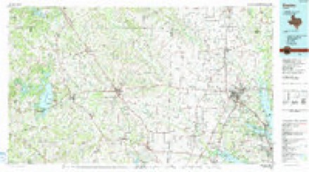
5 surveys from 8 printed sheetsMatched by testing this settlement's coordinate against the published boundary of every sheet in the United States Geological Survey's historical collection. Each opens the scanned sheet at the Survey.
- 1954 USGS Sherman quadrangle1:250000, 2 printings
- 1958 USGS Sherman quadrangle1:250000
- 1959 USGS Ponder quadrangle1:24000, 2 printings
- 1985 USGS Denton quadrangle1:100000
- 1991 USGS Denton quadrangle1:100000, 2 printings
Fires near this place
67 since 2005Regional context, not property-specific evidence. The federal wildfire occurrence database lists 67 fires within 5 miles of Ponder between 2005 and 2018, burning about 702 acres in total. 1 started naturally. 2 were recorded as arson. Distance is straight-line from the map coordinates, so a fire counted here may appear on a neighbouring settlement's page as well.
| Reported cause | Fires |
|---|---|
| Missing data/not specified/undetermined | 29 |
| Equipment and vehicle use | 17 |
| Debris and open burning | 11 |
| Railroad operations and maintenance | 4 |
| Smoking | 2 |
| Arson/incendiarism | 2 |
| Misuse of fire by a minor | 1 |
| Natural | 1 |
The most recent of them, most recent first, with the day each was reported and the service that recorded it.
| Date | Cause | Size | Reported by | Name on the report |
|---|---|---|---|---|
| 8 September 2011 | Equipment and vehicle use | 1.0 acres | Texas A & M Forest Service | 380 ACROSS FROM TRENT |
| 7 September 2011 | Missing data/not specified/undetermined | 100 acres | Texas A & M Forest Service | HIGHWAY 380 AND TRENT ROAD |
| 4 September 2011 | Missing data/not specified/undetermined | under an acre | Texas A & M Forest Service | 5413 TIM DONALD |
| 18 September 2013 | Missing data/not specified/undetermined | under an acre | Texas A & M Forest Service | 6634 TIM DONALD |
| 7 August 2011 | Missing data/not specified/undetermined | 5.0 acres | Texas A & M Forest Service | CEMETERY @ EAKIN CEMETERY |
| 29 August 2010 | Railroad operations and maintenance | 1.0 acres | Texas A & M Forest Service | FM 156 @ FM 1384 (OLIVER CREEK) |
| 17 August 2012 | Arson/incendiarism | 2.0 acres | Texas A & M Forest Service | FM 2449 |
| 14 August 2012 | Missing data/not specified/undetermined | 2.0 acres | Texas A & M Forest Service | ROBSON RANCH @ FAUGHT |
Settlements close enough to share some of these fires:
Mines and quarries near this place
1 within 5 milesRegional context, not property-specific evidence. The federal mineral resources record lists 1 working within 5 miles of Ponder: 1 past producer. None of them still produces. What was taken out: Sand and Gravel, Construction. Distance is straight-line from the map coordinates, so a quarry counted here may appear on a neighbouring settlement's page as well.
| Where | Site | Commodity | Status | Recorded |
|---|---|---|---|---|
| Unknown | Sand and Gravel, Construction | Past Producer |
Storms near this place
39 since 1994Regional context, not property-specific evidence. The National Weather Service names Ponder in 39 storm reports between 1994 and 2025: 23 hail, 12 thunderstorm wind, 2 flash flood, 2 lightning. No death or injury is recorded in these reports. Each account below is quoted exactly as the forecast office filed it, from the NOAA Storm Events Database, and each date opens the federal record of that event.
| When | Event | Place named | Harm | What the report says |
|---|---|---|---|---|
| May 2021 | Hail | Ponder | $5,000,000 | Multiple sources reported 1.75-inch to 4-inch diameter hail in the city of Ponder, TX. |
| March 2017 | Hail | Ponder | $250,000 | A delayed social media report indicated 2 inch diameter hail in the city of Ponder, TX. |
| September 2023 | Lightning | Ponder | $200,000 | A home in Ponder caught fire due to a lightning strike. |
| June 2007 | Flash Flood | Ponder | $200,000 | Several homes and apartments were flooded in Trophy Club, and two elderly couples had to be rescued from their apartments. Water was flowing swiftly across roads in Ponder, and Hickory Creek was out of its banks in the central part of the county. A vehicle was swept away on Mingo Road at Cooper Creek. |
| April 2006 | Hail | Ponder | $20,000 | Baseball-size hail between Ponder and Krum. |
| June 2006 | Thunderstorm Wind | Ponder | $20,000 | Widespread wind damage occurred with fences, outbuildings, and jungle gyms blown over and damaged. |
| September 2025 | Thunderstorm Wind | Ponder | $15,000 | A 72 mph wind gust was measured in Ponder. Large tree damage was reported southeast of FM 156 and FM 2449, along with minor roof damage. Large tree limbs were broken, fences were down, and a trampoline punctured a roof. |
| May 2002 | Lightning | Ponder | $15,000 | Lightning struck a gas storage tank of a well southwest of Ponder during the afternoon. The lightning started a fire which caused the damage to the well. |
| October 2014 | Hail | Ponder | $10,000 | A report of golf-ball sized hail was received via social media in Ponder, TX. |
| February 2001 | Thunderstorm Wind | Ponder | $10,000 | Numerous homes reported roof damage. |
| May 2011 | Thunderstorm Wind | Ponder | $5,000 | A few large trees were damaged, a mobile home sustained damage to its skirting and several shingles were blown off. |
| November 2015 | Thunderstorm Wind | Ponder | $1,500 | The light poles at the Ponder High School football stadium were bent in half by thunderstorm winds. |
| September 2023 | Thunderstorm Wind | Ponder | $1,000 | A retired NWS Employee reported 60+ mph winds in the Robson Ranch community. |
| June 1999 | Thunderstorm Wind | Ponder | $600 | A roof was blown off a storage building by thunderstorm winds. |
| November 2025 | Hail | Ponder | - | Several social media reports indicated quarter sized hail in Ponder. |
| May 2024 | Hail | Ponder | - | A trained spotter reported quarter sized hail on the north side of Ponder. |
| October 2021 | Thunderstorm Wind | Ponder | - | A trained spotter reported 60 MPH winds approximately 3 miles south-southwest of Northlake, TX. |
| July 2016 | Thunderstorm Wind | Ponder | - | Over 60 MPH winds reported southeast of Ponder and southwest of Denton. |
| November 2015 | Hail | Ponder | - | Amateur radio reported golf-ball sized hail near Hwy 156 in Ponder, TX. |
| April 2001 | Thunderstorm Wind | Ponder | - | Reported by R.A.C.E.S. |
| September 2001 | Thunderstorm Wind | Ponder | - | A trained spotter estimated wind gusts to 61 knots. |
| April 2000 | Flash Flood | Ponder | - | Heavy thunderstorm rains brought water over Highway 156 near Ponder. |
| April 1995 | Hail | Ponder | - | Three billboards were destroyed by high winds. |
| April 1994 | Hail | Ponder | - | During the evening hours of the 25th, three supercell thunderstorms moved across the Dallas/Fort Worth metropolitan area producing torrential rain, large hail, high winds, and six tornadoes. Three persons were killed and 55 injured from the tornadoes. The ,hailstorms across Tarrant County did 50-100 million dollars damage, the DeSoto tornado approximately 50 million dollars damage, and the Lancaster tornado approximately 100 million dollars damage. Storm A moved across northern Tarrant and northern Dallas counties between 1800 CST and 1930 CST producing hail up to 2 inches in diameter and torrential rains. Storm B moved eastward into western Tarrant County at approximately 1800 CST. This storm had a history of producing large hail across Stephens, Palo Pinto, and Parker Counties. Once again, this storm produced large hail across the southern half of Fort Worth and Arlington, and a brief tornado touchdown in south Fort Worth 2 miles south of Edgecliff Village at 1842 CST. By 1930 CST, Storm B had moved into southwest Dallas County, producing a brief tornado touchdown at Joe Pool Lake. A second tornado occurred at approximately 1950 CST, doing considerable damage in DeSoto. At 2030 CST, a strong tornado developed rapidly just west of Lancaster, and the storm began turning to the right, moving east-southeast. At 2040 CST, Lancaster was devastated by a tornado producing upper scale F3 and lower scale F4 damage. At 2058 CST, Storm B moved to the Dallas-Ellis county line, and a tornado was reported 2 miles south of Red Oak, in extreme northern Ellis County. Storm C began developing rapidly at 1840 CST, 5 miles southwest of Weatherford, moving to the east. Storm C quickly became severe, producing hail up to golf ball-size on the Parker-Tarrant county line by 1930 CST. Storm C continued to move east across southern Tarrant County producing torrential rain and up to baseball-size hail. At 2030 CST, Storm C, now located in southeast Tarrant County near Mansfield, turned right and began moving southeast toward Midlothian. At 2058 CST, a tornado was reported 4 miles west of Midlothian. |
| April 1994 | Hail | Ponder | - | During the evening hours of the 25th, three supercell thunderstorms moved across the Dallas/Fort Worth metropolitan area producing torrential rain, large hail, high winds, and six tornadoes. Three persons were killed and 55 injured from the tornadoes. The ,hailstorms across Tarrant County did 50-100 million dollars damage, the DeSoto tornado approximately 50 million dollars damage, and the Lancaster tornado approximately 100 million dollars damage. Storm A moved across northern Tarrant and northern Dallas counties between 1800 CST and 1930 CST producing hail up to 2 inches in diameter and torrential rains. Storm B moved eastward into western Tarrant County at approximately 1800 CST. This storm had a history of producing large hail across Stephens, Palo Pinto, and Parker Counties. Once again, this storm produced large hail across the southern half of Fort Worth and Arlington, and a brief tornado touchdown in south Fort Worth 2 miles south of Edgecliff Village at 1842 CST. By 1930 CST, Storm B had moved into southwest Dallas County, producing a brief tornado touchdown at Joe Pool Lake. A second tornado occurred at approximately 1950 CST, doing considerable damage in DeSoto. At 2030 CST, a strong tornado developed rapidly just west of Lancaster, and the storm began turning to the right, moving east-southeast. At 2040 CST, Lancaster was devastated by a tornado producing upper scale F3 and lower scale F4 damage. At 2058 CST, Storm B moved to the Dallas-Ellis county line, and a tornado was reported 2 miles south of Red Oak, in extreme northern Ellis County. Storm C began developing rapidly at 1840 CST, 5 miles southwest of Weatherford, moving to the east. Storm C quickly became severe, producing hail up to golf ball-size on the Parker-Tarrant county line by 1930 CST. Storm C continued to move east across southern Tarrant County producing torrential rain and up to baseball-size hail. At 2030 CST, Storm C, now located in southeast Tarrant County near Mansfield, turned right and began moving southeast toward Midlothian. At 2058 CST, a tornado was reported 4 miles west of Midlothian. |
| April 1994 | Hail | Ponder | - | During the evening hours of the 25th, three supercell thunderstorms moved across the Dallas/Fort Worth metropolitan area producing torrential rain, large hail, high winds, and six tornadoes. Three persons were killed and 55 injured from the tornadoes. The ,hailstorms across Tarrant County did 50-100 million dollars damage, the DeSoto tornado approximately 50 million dollars damage, and the Lancaster tornado approximately 100 million dollars damage. Storm A moved across northern Tarrant and northern Dallas counties between 1800 CST and 1930 CST producing hail up to 2 inches in diameter and torrential rains. Storm B moved eastward into western Tarrant County at approximately 1800 CST. This storm had a history of producing large hail across Stephens, Palo Pinto, and Parker Counties. Once again, this storm produced large hail across the southern half of Fort Worth and Arlington, and a brief tornado touchdown in south Fort Worth 2 miles south of Edgecliff Village at 1842 CST. By 1930 CST, Storm B had moved into southwest Dallas County, producing a brief tornado touchdown at Joe Pool Lake. A second tornado occurred at approximately 1950 CST, doing considerable damage in DeSoto. At 2030 CST, a strong tornado developed rapidly just west of Lancaster, and the storm began turning to the right, moving east-southeast. At 2040 CST, Lancaster was devastated by a tornado producing upper scale F3 and lower scale F4 damage. At 2058 CST, Storm B moved to the Dallas-Ellis county line, and a tornado was reported 2 miles south of Red Oak, in extreme northern Ellis County. Storm C began developing rapidly at 1840 CST, 5 miles southwest of Weatherford, moving to the east. Storm C quickly became severe, producing hail up to golf ball-size on the Parker-Tarrant county line by 1930 CST. Storm C continued to move east across southern Tarrant County producing torrential rain and up to baseball-size hail. At 2030 CST, Storm C, now located in southeast Tarrant County near Mansfield, turned right and began moving southeast toward Midlothian. At 2058 CST, a tornado was reported 4 miles west of Midlothian. |
| May 2021 | Hail | Ponder | - | no account filed |
| May 2015 | Hail | Ponder | - | no account filed |
| April 2014 | Hail | Ponder | - | no account filed |
| May 2011 | Hail | Ponder | - | no account filed |
| May 2007 | Hail | Ponder | - | no account filed |
| April 2006 | Hail | Ponder | - | no account filed |
| May 2005 | Hail | Ponder | - | no account filed |
| March 2004 | Hail | Ponder | - | no account filed |
| June 2004 | Hail | Ponder | - | no account filed |
| June 2004 | Hail | Ponder | - | no account filed |
| June 2004 | Hail | Ponder | - | no account filed |
| May 2003 | Hail | Ponder | - | no account filed |
| June 1996 | Thunderstorm Wind | Ponder | - | no account filed |
Nearest settlements
The eight closest, with where each one stands in the county. Distances are straight-line, computed from the Geographic Names Information System coordinates.
Elsewhere
Matched on this settlement's Geographic Names Information System number rather than its name, so it cannot be a different place of the same name in another state.
| Wikipedia article on Ponder | An encyclopaedic summary. Its text is share-alike, so it is linked here rather than copied. |
| Wikidata item Q981982 | The structured record the population and elevation above come from. Public domain (CC0). |
Provenance
This settlement is recorded in the Geographic Names Information System as feature 1344345. The sheet list is computed by point-in-boundary test against the United States Geological Survey's historical topographic inventory. Both are works of the United States government and carry no copyright under 17 U.S.C. 105.
Wildfire. Short, Karen C. 2022. Spatial wildfire occurrence data for the United States, 1992-2020 [FPA_FOD_20221014]. 6th Edition. Fort Collins, CO: Forest Service Research Data Archive. https://doi.org/10.2737/RDS-2013-0009.6 Collected with United States Government funding and usable without additional permissions or fees.
Mines and quarries. USGS Mineral Resources Data System (MRDS) https://mrdata.usgs.gov/mrds/ A work of the United States government, no copyright under 17 U.S.C. 105.
Storms. NOAA National Centers for Environmental Information, Storm Events Database https://www.ncei.noaa.gov/stormevents/ A work of the United States government, no copyright under 17 U.S.C. 105. Narratives are quoted verbatim from the National Weather Service report and are not edited or summarised.