 Block
BlockStony, Texas
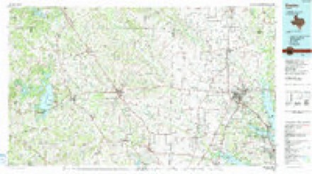
8 topographic sheets cover this place, the earliest surveyed in 1954 and the latest in 1991. It stands in the Justin-Roanoke census division. It lies in ZIP code area 76259. The Survey maps it on the Ponder quadrangle.
Topographic sheets covering this place
5 surveys from 8 printed sheetsMatched by testing this settlement's coordinate against the published boundary of every sheet in the United States Geological Survey's historical collection. Each opens the scanned sheet at the Survey.
- 1954 USGS Sherman quadrangle1:250000, 2 printings
- 1958 USGS Sherman quadrangle1:250000
- 1959 USGS Ponder quadrangle1:24000, 2 printings
- 1985 USGS Denton quadrangle1:100000
- 1991 USGS Denton quadrangle1:100000, 2 printings
Fires near this place
51 since 2005Regional context, not property-specific evidence. The federal wildfire occurrence database lists 51 fires within 5 miles of Stony between 2005 and 2020, burning about 961 acres in total. None started naturally. 1 was recorded as arson. Distance is straight-line from the map coordinates, so a fire counted here may appear on a neighbouring settlement's page as well.
| Reported cause | Fires |
|---|---|
| Equipment and vehicle use | 20 |
| Missing data/not specified/undetermined | 16 |
| Debris and open burning | 8 |
| Misuse of fire by a minor | 2 |
| Power generation/transmission/distribution | 2 |
| Arson/incendiarism | 1 |
| Railroad operations and maintenance | 1 |
| Smoking | 1 |
The most recent of them, most recent first, with the day each was reported and the service that recorded it.
| Date | Cause | Size | Reported by | Name on the report |
|---|---|---|---|---|
| 7 September 2011 | Missing data/not specified/undetermined | 20 acres | Texas A & M Forest Service | SH 380 @ TRENT RD |
| 24 September 2008 | Equipment and vehicle use | under an acre | Texas A & M Forest Service | not named |
| 1 September 2007 | Equipment and vehicle use | 1.0 acres | Texas A & M Forest Service | not named |
| 17 August 2012 | Arson/incendiarism | 2.0 acres | Texas A & M Forest Service | FM 2449 |
| 15 August 2014 | Debris and open burning | 1.0 acres | Texas A & M Forest Service | GRASS FIRE |
| 12 August 2005 | Missing data/not specified/undetermined | 600 acres | Texas A & M Forest Service | NORTH TX - 6 |
| 10 August 2009 | Debris and open burning | 10 acres | Texas A & M Forest Service | 14963 GEORGE FOSTER |
| 1 August 2018 | Equipment and vehicle use | 1.0 acres | Texas A & M Forest Service | 13566NCOUNTYLINERD08012018 |
Settlements close enough to share some of these fires:
Mines and quarries near this place
1 within 5 milesRegional context, not property-specific evidence. The federal mineral resources record lists 1 working within 5 miles of Stony: 1 past producer. None of them still produces. What was taken out: Stone, Crushed/Broken. Distance is straight-line from the map coordinates, so a quarry counted here may appear on a neighbouring settlement's page as well.
| Where | Site | Commodity | Status | Recorded |
|---|---|---|---|---|
| Brutex Operation | Stone, Crushed/Broken | Past Producer |
Storms near this place
14 since 2008Regional context, not property-specific evidence. The National Weather Service names Stony in 14 storm reports between 2008 and 2024: 7 thunderstorm wind, 4 hail, 1 flash flood, 1 heavy rain. No death or injury is recorded in these reports. Each account below is quoted exactly as the forecast office filed it, from the NOAA Storm Events Database, and each date opens the federal record of that event.
| When | Event | Place named | Harm | What the report says |
|---|---|---|---|---|
| May 2015 | Tornado (EF1) | Stony | $200,000 | A National Weather Service damage survey crew found evidence of EF-1 damage, especially near the Bolivar community in western Denton County, Texas. This tornado formed from the same parent supercell which produced a tornado in Wise County. The tornado began in the far southwestern portion of Denton County, producing damage to open farm and ranch land. Once the storm moved into the Bolivar community, damage to several roofs on homes were noted, as well as substantial damage to barns. A metal storage tank was lifted and thrown into the base of a high tension power line, causing the steel beams to collapse. |
| September 2023 | Thunderstorm Wind | Stony | $10,000 | Damage to metal buildings and trees was reported on Southwind Place near Krum. Some siding was also removed from a home in the Krum area in addition to shingle and fence damage. |
| April 2011 | Hail | Stony | $10,000 | Hen egg to tennis ball size hail fell at the intersection of Farm-to-Market Road 2622 and Highway 380 near Stony. |
| April 2011 | Thunderstorm Wind | Stony | $7,000 | A home and a barn near Jackson Road and Ripy Road, west of Denton, sustained roof damage. The doors were also ripped from the barn. |
| February 2022 | Hail | Stony | $6,000 | Half dollar and golf ball sized hail was reported near Highway 380 and North Jackson Road. |
| March 2017 | Thunderstorm Wind | Stony | $5,000 | Denton County Fire Dispatch reported a tractor-trailer blown over by thunderstorm winds. |
| August 2012 | Thunderstorm Wind | Stony | $5,000 | Emergency management reported that 20 to 30 trees were blown down just west of Krum. |
| June 2011 | Thunderstorm Wind | Stony | $5,000 | Thunderstorm winds of 55 to 60 MPH were estimated approximately 11 miles west of Denton along Highway 380. |
| September 2023 | Thunderstorm Wind | Stony | $3,000 | Significant damage to a Greenhouse on Donald Road was reported via email. |
| May 2024 | Hail | Stony | - | A report from social media said quarter size hail fell at Smith Road and HWY 380. |
| June 2020 | Thunderstorm Wind | Stony | - | Amateur radio measured a 58 MPH wind gust near the intersection of Highway 380 and Jackson Road. |
| May 2015 | Heavy Rain | Stony | - | Measured 6.77 of rain between 6 am and 116 pm five miles south of Slidell. |
| June 2011 | Hail | Stony | - | Nickel sized hail was reported 11 miles west of Denton. |
| May 2008 | Flash Flood | Stony | - | Flooding was reported at the Ripy Street Bridge north of Highway 380. |
Nearest settlements
The eight closest, with where each one stands in the county. Distances are straight-line, computed from the Geographic Names Information System coordinates.
Provenance
This settlement is recorded in the Geographic Names Information System as feature 1379120. The sheet list is computed by point-in-boundary test against the United States Geological Survey's historical topographic inventory. Both are works of the United States government and carry no copyright under 17 U.S.C. 105.
Wildfire. Short, Karen C. 2022. Spatial wildfire occurrence data for the United States, 1992-2020 [FPA_FOD_20221014]. 6th Edition. Fort Collins, CO: Forest Service Research Data Archive. https://doi.org/10.2737/RDS-2013-0009.6 Collected with United States Government funding and usable without additional permissions or fees.
Mines and quarries. USGS Mineral Resources Data System (MRDS) https://mrdata.usgs.gov/mrds/ A work of the United States government, no copyright under 17 U.S.C. 105.
Storms. NOAA National Centers for Environmental Information, Storm Events Database https://www.ncei.noaa.gov/stormevents/ A work of the United States government, no copyright under 17 U.S.C. 105. Narratives are quoted verbatim from the National Weather Service report and are not edited or summarised.