 Block
BlockPringle, Texas
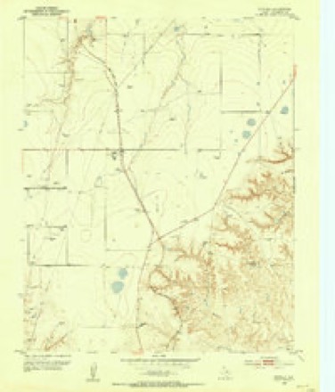
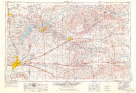
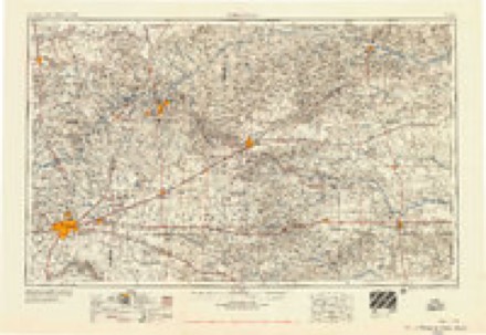
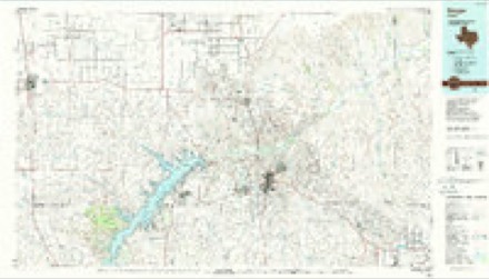
6 topographic sheets cover this place, the earliest surveyed in 1953 and the latest in 1986. It stands in the Stinnett census division. It lies in ZIP code area 79083. The Survey maps it on the Pringle quadrangle.
Topographic sheets covering this place
4 surveys from 6 printed sheetsMatched by testing this settlement's coordinate against the published boundary of every sheet in the United States Geological Survey's historical collection. Each opens the scanned sheet at the Survey.
- 1953 USGS Pringle quadrangle1:24000
- 1954 USGS Amarillo quadrangle1:250000, 2 printings
- 1958 USGS Amarillo quadrangle1:250000
- 1986 USGS Borger quadrangle1:100000, 2 printings
Fires near this place
29 since 2006Regional context, not property-specific evidence. The federal wildfire occurrence database lists 29 fires within 5 miles of Pringle between 2006 and 2020, burning about 1,991 acres in total. 2 started naturally. None was recorded as arson. Distance is straight-line from the map coordinates, so a fire counted here may appear on a neighbouring settlement's page as well.
| Reported cause | Fires |
|---|---|
| Missing data/not specified/undetermined | 11 |
| Equipment and vehicle use | 9 |
| Debris and open burning | 5 |
| Natural | 2 |
| Power generation/transmission/distribution | 2 |
The most recent of them, most recent first, with the day each was reported and the service that recorded it.
| Date | Cause | Size | Reported by | Name on the report |
|---|---|---|---|---|
| 5 September 2019 | Missing data/not specified/undetermined | 40 acres | Texas A & M Forest Service | STEVENSON LEASE 1 FIRE |
| 4 August 2008 | Equipment and vehicle use | 60 acres | Texas A & M Forest Service | not named |
| 8 July 2011 | Missing data/not specified/undetermined | 100 acres | Lake Meredith National Recreation Area | WOMBLE |
| 6 July 2009 | Debris and open burning | 1.0 acres | Texas A & M Forest Service | DITCH |
| 23 July 2009 | Missing data/not specified/undetermined | 2.0 acres | Lake Meredith National Recreation Area | CHISHOM |
| 14 July 2011 | Missing data/not specified/undetermined | 1.0 acres | Texas A & M Forest Service | TUCKER |
| 28 June 2016 | Equipment and vehicle use | under an acre | Texas A & M Forest Service | NORTH OF STINNETT FIRE |
| 2 June 2020 | Equipment and vehicle use | 16 acres | Texas A & M Forest Service | WOMBLE |
Settlements close enough to share some of these fires:
Storms near this place
60 of 75 shownRegional context, not property-specific evidence. The National Weather Service names Pringle in 75 storm reports between 1995 and 2025: 53 hail, 11 thunderstorm wind, 10 tornado, 1 flash flood. No death or injury is recorded in these reports. Each account below is quoted exactly as the forecast office filed it, from the NOAA Storm Events Database, and each date opens the federal record of that event.
| When | Event | Place named | Harm | What the report says |
|---|---|---|---|---|
| May 2010 | Tornado (EF2) | Pringle | $40,000 | The tornado touched down three miles south southwest of Pringle or six miles northwest of Stinnett at 1844 CST. The tornado was on the ground for about five miles with a maximum path width of three hundred yards. The tornado moved to the north dissipating at 1900 CST three miles northwest of Pringle. The National Weather Service survey team found significant damage to a farm located on County Road J between County Road 8 and County Road 9. A large portion of the roof was removed from the residence with considerable damage to several small sheds in the vicinity. Numerous trees were stripped with many broken large branches. A pickup truck behind the residence was flipped upside down with the cab smashed. Several power poles were snapped along County Road J just to the east of the residence with additional damage sustained to a few irrigation pivots. A storage bin and large fuel tank were found up to fifty yards to the east northeast of their original locations. One resident was home at the time but no injuries were reported. |
| May 2010 | Tornado (EF1) | Pringle | $28,000 | The tornado touched down about three miles south southwest of Pringle at 0056 CST. The National Weather Service survey team found a metal barn completely destroyed with the sturdy steel frame found forty feet north northeast of its original location. Several large tractors suffered significant damage with the cab windows blown out. One tractor was moved a few feet to the north. The tornado was on the ground for less than one half mile and dissipated at 0057 CST with a maximum path width of one hundred yards. No injuries were reported. |
| June 2025 | Tornado (EF1) | Pringle | $25,000 | This tornado developed south of W 13th Avenue to the southeast of Spearman, producing its first signs of damage once it crossed CR Y just east of CR 27. EF-1 damage occurred in the area including two small pinyon trees being uprooted with others having branches snapped, as well as metal barns having lost several side and|roofing panels. The tornado continued tracking to the south-southeast, pulling roofing and siding off multiple metal barns near CR AA and CR 28. The strongest damage occurred when it crossed CR 28 to the southeast, snapping several wooden power|poles. This is where the tornado achieved peak intensity and earned the EF-2 rating. In the later stages of its life, the tornado flipped single sections of irrigation pivots just north of FM 281, and again as it crossed into far northeast Hutchinson county before eventually lifting. Along the western edge of the track, there were several instances of damage due to strong winds associated with the rear flank downdraft of the supercell. This included snapped wooden power lines and flipped irrigation pivots. The maximum estimated winds of the tornado was 115mph, which occurred in Hansford County. Winds were around 70mph in Hutchinson County. The max width of the tornado was 150 yards also in Hansford County. Total track length was around 9.5 miles. |
| April 2025 | Hail | Pringle | $10,000 | A supercell thunderstorm produced a swath of hail across portions northern Hutchinson County to the northeast of Pringle. Initially hail of quarter size fell just outside of Pringle but the hail increased in size as the supercell continued to move to the north and east. Measured hail increased to billiard ball and tennis ball size with the maximum observed hail size being three inches in diameter, or around the size of a large apple. Some of this hail was found by spotters after the storm had passed so there may have been some additional melting that occurred. |
| June 2010 | Thunderstorm Wind | Pringle | $10,000 | The broadcast media reported that an overhead door was blown out of the main building to a cotton gin. Also...a five hundred gallon gas tank was completely blown over from the stand that it was on. Telephone poles which were stacked on the ground near one of the cotton gin buildings were blown eighty to one hundred feet by the thunderstorm wind gusts. No injuries were reported. |
| May 2010 | Hail | Pringle | $8,000 | The public reported that the large hail broke all windows in their residence and also broke all windows on their vehicle. |
| May 2024 | Tornado (EFU) | Pringle | - | This tornado briefly touched down in the Canadian River Valley, and was documented by law enforcement reports and storm chaser footage. This tornado did not produce any damage. |
| May 2019 | Hail | Pringle | - | Late report via social media of golf ball hail size. |
| May 2019 | Thunderstorm Wind | Pringle | - | Storm chaser called in with wind gusts estimated up to 70 mph. |
| May 2019 | Flash Flood | Pringle | - | Flooding in area of Texas Highway 136, with 18 inches, rapidly flowing over roadway. |
| May 2019 | Tornado (EFU) | Pringle | - | NWS damage survey information found that a tornado touchdown first occurred about 11 miles SSW of Spearman at 0336 pm CDT and lifted at 0349 pm CDT approximately 8 miles SSW of Spearman. The tornado crossed the Hansford County line around 342 pm CDT. The tornado was rated EF-unknown, with track and times based on eyewitness accounts and video. |
| May 2018 | Hail | Pringle | - | Late report of quarter size hail, with a time estimated from radar. |
| May 2018 | Hail | Pringle | - | Late report received, and the time was estimated on radar. |
| May 2017 | Thunderstorm Wind | Pringle | - | Winds estimated at 60 MPH. |
| May 2017 | Thunderstorm Wind | Pringle | - | From trained spotter. |
| May 2016 | Hail | Pringle | - | Quarter size hail was reported 4 miles south of Pringle on Highway 136. |
| May 2016 | Tornado (EFU) | Pringle | - | A brief anticyclonic tornado lasting three minutes was reported by an off duty NWS employee. No damage was observed. This tornado was rated EF-U as it remained in open grasslands. |
| August 2014 | Thunderstorm Wind | Pringle | - | Scattered convection affected Hutchinson County during the early evening hours of the 21st. As storms neared the town of Spearman (Hutchinson County), a trained spotter reported an estimated 60 mph thunderstorm downburst caused a semi-tractor trailer to overturn 10 miles south of Spearman (Hutchinson County). No injuries were reported with this damage. After producing this downburst, the storms diminished over Hutchinson County. |
| August 2013 | Tornado (EF0) | Pringle | - | A weak and brief tornado was photographed by spotters near Pringle (Hutchinson County). The tornado lasted 20 seconds and no damage was reported. The maximum wind speed was estimated at 65 mph. |
| May 2010 | Hail | Pringle | - | The public reported that the hail was six inches deep. |
| May 2010 | Hail | Pringle | - | The public reported that the hail beat down a large crop of wheat. |
| June 2010 | Hail | Pringle | - | The public estimated the hail to be the size of lemons. |
| June 2009 | Thunderstorm Wind | Pringle | - | A trained spotter estimated thunderstorm wind gusts of fifty-two knots south of Spearman. |
| May 2008 | Tornado (EF0) | Pringle | - | This tornado developed at 1553 CST about seven miles west southwest of Pringle and moved northeast for about a half mile. The tornado then dissipated at 1554 CST and remained over open country. No damage or injuries were reported. The tornado path length and path width were estimated. |
| May 2007 | Hail | Pringle | - | Hail fell on the Hutchinson County and Hansford County line on State Highway 207. |
| May 2002 | Tornado (F0) | Pringle | - | The tornado remained over open country and no damage or injuries were reported. The tornado path length and width were estimated. |
| May 2024 | Hail | Pringle | - | no account filed |
| May 2024 | Hail | Pringle | - | no account filed |
| August 2023 | Hail | Pringle | - | no account filed |
| May 2023 | Hail | Pringle | - | no account filed |
| May 2023 | Hail | Pringle | - | no account filed |
| May 2023 | Hail | Pringle | - | no account filed |
| June 2023 | Hail | Pringle | - | no account filed |
| June 2023 | Hail | Pringle | - | no account filed |
| July 2022 | Hail | Pringle | - | no account filed |
| July 2022 | Hail | Pringle | - | no account filed |
| May 2019 | Hail | Pringle | - | no account filed |
| May 2019 | Hail | Pringle | - | no account filed |
| May 2018 | Hail | Pringle | - | no account filed |
| August 2018 | Hail | Pringle | - | no account filed |
| May 2017 | Hail | Pringle | - | no account filed |
| May 2017 | Hail | Pringle | - | no account filed |
| May 2017 | Thunderstorm Wind | Pringle | - | no account filed |
| May 2017 | Hail | Pringle | - | no account filed |
| August 2017 | Hail | Pringle | - | no account filed |
| June 2012 | Hail | Pringle | - | no account filed |
| April 2011 | Hail | Pringle | - | no account filed |
| May 2010 | Hail | Pringle | - | no account filed |
| May 2010 | Hail | Pringle | - | no account filed |
| May 2010 | Hail | Pringle | - | no account filed |
| May 2010 | Hail | Pringle | - | no account filed |
| May 2010 | Hail | Pringle | - | no account filed |
| May 2010 | Hail | Pringle | - | no account filed |
| May 2010 | Hail | Pringle | - | no account filed |
| May 2010 | Hail | Pringle | - | no account filed |
| May 2010 | Hail | Pringle | - | no account filed |
| April 2009 | Hail | Pringle | - | no account filed |
| June 2009 | Hail | Pringle | - | no account filed |
| June 2009 | Hail | Pringle | - | no account filed |
| May 2008 | Hail | Pringle | - | no account filed |
Nearest settlements
The eight closest, with where each one stands in the county. Distances are straight-line, computed from the Geographic Names Information System coordinates.
| Map | Place | Distance | Sheets |
|---|---|---|---|
| Morse Junction | 5.8 miles | 6 | |
| Stinnett | 8.5 miles | 6 | |
| Dial | 11.0 miles | 6 | |
| Stekoll Camp | 12.5 miles | 6 | |
| Plemons | 12.9 miles | 8 | |
| Holt | 13.0 miles | 6 | |
| Oil City | 14.3 miles | 9 | |
| Electric City | 16.6 miles | 8 |
Provenance
This settlement is recorded in the Geographic Names Information System as feature 1380904. The sheet list is computed by point-in-boundary test against the United States Geological Survey's historical topographic inventory. Both are works of the United States government and carry no copyright under 17 U.S.C. 105.
Wildfire. Short, Karen C. 2022. Spatial wildfire occurrence data for the United States, 1992-2020 [FPA_FOD_20221014]. 6th Edition. Fort Collins, CO: Forest Service Research Data Archive. https://doi.org/10.2737/RDS-2013-0009.6 Collected with United States Government funding and usable without additional permissions or fees.
Storms. NOAA National Centers for Environmental Information, Storm Events Database https://www.ncei.noaa.gov/stormevents/ A work of the United States government, no copyright under 17 U.S.C. 105. Narratives are quoted verbatim from the National Weather Service report and are not edited or summarised.