 Block
BlockStinnett, Texas
6 topographic sheets cover this place, the earliest surveyed in 1953 and the latest in 1986. It stands in the Stinnett census division. It lies in ZIP code area 79083. The Survey maps it on the Stinnett quadrangle. 1,650 people lived here at the 2020 count. It stands 3,186 feet above sea level.
On record in Stinnett
Buildings and businesses the archive holds for this place. Each opens its own page, with the source record it came from.
On the National Register 1 record
 Hutchinson County Courthouselisted 2012
Topographic sheets covering this place
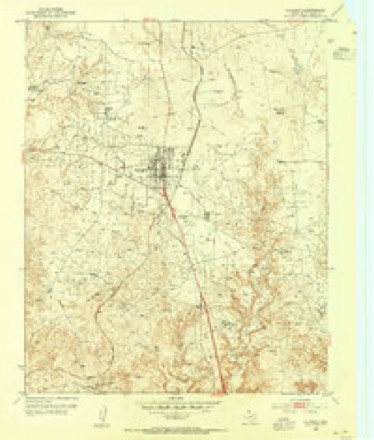
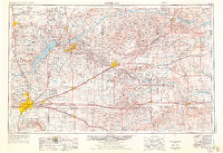
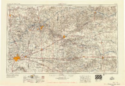
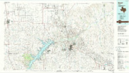
4 surveys from 6 printed sheetsMatched by testing this settlement's coordinate against the published boundary of every sheet in the United States Geological Survey's historical collection. Each opens the scanned sheet at the Survey.
- 1953 USGS Stinnett quadrangle1:24000
- 1954 USGS Amarillo quadrangle1:250000, 2 printings
- 1958 USGS Amarillo quadrangle1:250000
- 1986 USGS Borger quadrangle1:100000, 2 printings
Fires near this place
127 since 2002Regional context, not property-specific evidence. The federal wildfire occurrence database lists 127 fires within 5 miles of Stinnett between 2002 and 2020, burning about 9,182 acres in total. 9 started naturally. None was recorded as arson. Distance is straight-line from the map coordinates, so a fire counted here may appear on a neighbouring settlement's page as well.
| Reported cause | Fires |
|---|---|
| Missing data/not specified/undetermined | 65 |
| Equipment and vehicle use | 23 |
| Power generation/transmission/distribution | 20 |
| Natural | 9 |
| Debris and open burning | 7 |
| Other causes | 1 |
| Smoking | 1 |
| Misuse of fire by a minor | 1 |
The most recent of them, most recent first, with the day each was reported and the service that recorded it.
| Date | Cause | Size | Reported by | Name on the report |
|---|---|---|---|---|
| 6 September 2010 | Equipment and vehicle use | 20 acres | Texas A & M Forest Service | BLAKE |
| 5 September 2010 | Missing data/not specified/undetermined | 1.0 acres | Texas A & M Forest Service | HEIFER REKINDLE |
| 3 September 2017 | Power generation/transmission/distribution | 5.0 acres | Texas A & M Forest Service | TRESTLE FIRE |
| 29 September 2010 | Equipment and vehicle use | 5.0 acres | Texas A & M Forest Service | CONWAY |
| 20 September 2010 | Equipment and vehicle use | 1.0 acres | Texas A & M Forest Service | TIRE |
| 12 September 2019 | Missing data/not specified/undetermined | 1.0 acres | Lake Meredith National Recreation Area | 687 MM61 |
| 5 August 2010 | Missing data/not specified/undetermined | 500 acres | Lake Meredith National Recreation Area | HEFER |
| 4 August 2009 | Missing data/not specified/undetermined | 10 acres | Texas A & M Forest Service | FARLEY |
Settlements close enough to share some of these fires:
Storms near this place
60 of 192 shownRegional context, not property-specific evidence. The National Weather Service names Stinnett in 192 storm reports between 1993 and 2025: 123 hail, 51 thunderstorm wind, 9 flash flood, 6 tornado. No death or injury is recorded in these reports. Each account below is quoted exactly as the forecast office filed it, from the NOAA Storm Events Database, and each date opens the federal record of that event.
| When | Event | Place named | Harm | What the report says |
|---|---|---|---|---|
| April 2001 | Thunderstorm Wind | Stinnett | $70,000 | An eighteen wheeler was blown over on State Highway 152. |
| May 1995 | Hail | Stinnett | $50,000 | no account filed |
| June 2004 | Thunderstorm Wind | Stinnett | $35,000 | Power lines and power poles blown down. Also...high winds caused damage to roofs. |
| June 2002 | Thunderstorm Wind | Stinnett | $35,000 | Numerous trees and powerlines were reported down. Also...irrigation equipment reported damaged by the high winds. |
| June 2024 | Thunderstorm Wind | Stinnett | $20,000 | Photos were submitted to the weather service of downed electric lines resulting in additional damage to paneling on a house. Small trees were also blown over. |
| April 2001 | Thunderstorm Wind | Stinnett | $20,000 | Scotts Acres in Stinnett was hit hard as the high winds turned over a mobile home and a roof was damaged. |
| May 1995 | Hail | Stinnett | $20,000 | no account filed |
| July 2002 | Thunderstorm Wind | Stinnett | $15,000 | Powerlines were reported down. |
| July 2002 | Thunderstorm Wind | Stinnett | $15,000 | A shed and trees were reported blown down. |
| April 2001 | Thunderstorm Wind | Stinnett | $9,000 | One mile of power lines were reported blown down. |
| June 2009 | Thunderstorm Wind | Stinnett | $7,000 | A trained spotter reported that thunderstorm wind gusts had blown off the roofs of a couple of outbuildings on the southwest side of Stinnett. Also...the thunderstorm wind gusts also blew down a few power lines. |
| July 2006 | Thunderstorm Wind | Stinnett | $6,000 | no account filed |
| July 1994 | Thunderstorm Wind | Stinnett | $5,000 | Stinnett Police Department reported winds of 70 mph with the roof blown off a mobile home. |
| June 1994 | Thunderstorm Wind | Stinnett | $5,000 | no account filed |
| May 2007 | Thunderstorm Wind | Stinnett | $4,000 | An antenna at a restaurant was blown down by the high winds. |
| April 2003 | Hail | Stinnett | $2,000 | Hail broke windows out of Texas Department of Transportation vehicle. |
| April 2025 | Thunderstorm Wind | Stinnett | - | The mesonet located two miles north of Stinnett measured a 59mph wind gust. |
| June 2025 | Thunderstorm Wind | Stinnett | - | The mesonet located two miles north of Stinnett was hit by an outflow from a thunderstorm that was located well to the north to northeast. |
| June 2025 | Hail | Stinnett | - | A thunderstorm moved over and just to the southwest of Stinnett and produced severe hail. Golfball hail fell over Stinnett. The ICECHIP research team measured several hailstones to the southwest of Stinnett, between one and four miles. These ranged from 24 to 33mm, which when converted to inches is 1.0-1.25 inches. |
| May 2024 | Thunderstorm Wind | Stinnett | - | A 60mph wind gust occurred from a decaying shower or dry microburst. |
| April 2022 | Hail | Stinnett | - | Two reports came in for hail for 1.25 and 2 in diameter. |
| May 2021 | Thunderstorm Wind | Stinnett | - | Trained spotter reported tree limbs being snapped off, and ending up 2 to 3 blocks before landing on the ground. Also, power lines are arcing. |
| February 2020 | Thunderstorm Wind | Stinnett | - | This gust was measured at the West Texas Mesonet station 1 mile north-northwest of Stinnett. |
| April 2020 | Hail | Stinnett | - | One-inch hail was reported in Stinnett. |
| June 2020 | Thunderstorm Wind | Stinnett | - | This gust was measured at the West Texas Mesonet station 1 mile north-northwest of Stinnett. |
| June 2020 | Hail | Stinnett | - | Quarter size hail fell at Stinnett. |
| June 2019 | Thunderstorm Wind | Stinnett | - | Damage to a roof of a house occurred and 6 inch tree limbs were broken off from thunderstorm winds. |
| May 2019 | Hail | Stinnett | - | Late report of quarter size hail north of Stinnett, TX. |
| May 2019 | Tornado (EF0) | Stinnett | - | NWS damage survey information found that a cone tornado touched down for approximately 3 minutes in the Canadian River valley. The tornado received was given an EF-0 rating, with time and track based on trained spotter information. |
| September 2019 | Thunderstorm Wind | Stinnett | - | A spotter reported trees bending at least halfway over with rain falling sideways. |
| June 2018 | Thunderstorm Wind | Stinnett | - | Power lines blown down which energized a cable line, resulting in 3 separate house fires. The extent of fire damage to each house is unknown at this time. |
| June 2018 | Thunderstorm Wind | Stinnett | - | Chaser reported 60 mph inflow from a thunderstorm. |
| August 2018 | Flash Flood | Stinnett | - | Major street flooding in Stinnett. One foot of fast flowing water over some roads in town with water well up into residents yards. Rainfall of 1.53 in 40 minutes at nearby West Texas Mesonet site. Emergency manager reported water flowing into home with garage and utility rooms completely flooded. |
| August 2018 | Flash Flood | Stinnett | - | Road was impassible and closed due to 2 feet of rapidly running water across 1526 at a creek crossing. |
| May 2017 | Hail | Stinnett | - | Tennis ball size hail reported with accumulating hail of at least golf ball size. |
| May 2017 | Thunderstorm Wind | Stinnett | - | Five power poles snapped on FM 1060 about 9-12 miles south of Capps switch. |
| April 2017 | Hail | Stinnett | - | Public called and reported slightly larger than ping pong ball sized hail in Stinett. |
| May 2016 | Hail | Stinnett | - | Pea to nickel size hail with a few golf ball size hailstones was reported one mile west-northwest of Stinnett. |
| May 2016 | Hail | Stinnett | - | Hailstones ranged in size from half inch in diameter to the size of golf balls on Highway 207, 4 miles north of Stinnett. |
| April 2016 | Hail | Stinnett | - | Golf ball size hail was reported in Stinnett. |
| April 2016 | Hail | Stinnett | - | Golf ball size hail was reported 4 miles north of Stinnett. |
| June 2015 | Flash Flood | Stinnett | - | Street flooding was reported in Fritch. The most significant flooding occurred along portions of South Railroad Avenue near Highway 136 where as much as 18 inches of water covered the road. Additional flooding occurred along Highway 136 from an eighth of a mile south of Stinnett to approximately one mile south of Stinnett. As much as 8 inches of water was reported over the highway. |
| June 2014 | Thunderstorm Wind | Stinnett | - | A cluster of thunderstorms moved out of the Oklahoma Panhandle and into the Texas Panhandle during the evening hours of the 30th. As this cluster of thunderstorms moved near the town of Stinnett (Hutchinson County), the KVII schoolnet site 1 mile west-northwest of Stinnett (Hutchinson County) reported a 66 mph thunderstorm downburst. After producing this downburst the cluster of thunderstorms continued to move to the southeast. |
| June 2013 | Heavy Rain | Stinnett | - | Training thunderstorms brought heavy rain to Hutchinson County during the morning hours of the 19th. The KVII Schoolnet site 1 mile west northwest of Stinnett (Hutchinson County) reported 2.48 inches of storm total rain. |
| August 2013 | Heavy Rain | Stinnett | - | A line of thunderstorms moved across Hutchinson County during the late evening hours of the 8th. The line produced heavy rain over the city of Stinnett (Hutchinson County) which caused minor flooding of city streets. The Hutchinson County Emergency manager reported that the Stinnett Fire Department was conducting traffic control for the affected streets. The minor flooding receded quickly once the line moved away from the city. No swift water rescues or stranded motorist were reported in association to this flooding. |
| August 2013 | Hail | Stinnett | - | A supercell thunderstorm moved southward across the Texas Panhandle during the evening hours of the 14th. A local broadcast station reported golf ball size hail (1.75 inches) 3 miles west of Stinnett (Hutchinson County). The supercell thunderstorm continued moving southward after producing this hail. |
| August 2013 | Hail | Stinnett | - | A supercell thunderstorm moved southward across the Texas Panhandle during the evening hours of the 14th. The Hutchinson County Sheriff's Office reported quarter size hail (1.00 inches) 7 miles west of Stinnett (Hutchinson County). The supercell thunderstorm continued moving southward after producing this hail. |
| May 2008 | Hail | Stinnett | - | The hail was reported to be marble size to nickel size. |
| May 2008 | Hail | Stinnett | - | The hail was reported to be golf ball size to hen egg size. |
| March 2007 | Hail | Stinnett | - | Large hail reported at State Highway 152 and Farm to Market Road 687. |
| May 2007 | Tornado (EF0) | Stinnett | - | This tornado developed over open country at 1915 CST and remained on the ground for less than one minute. The tornado had a path length of less than one mile and a path width of less than fifty yards. The tornado was confirmed using video provided by a storm chaser. No damage or injuries were reported. |
| May 2007 | Tornado (EF0) | Stinnett | - | This tornado developed over open country at 1917 CST about fourteen miles northeast of Stinnett and remained on the ground for less than one minute. No damage or injuries were reported. The tornado was confirmed using video provided by a storm chaser. |
| June 2004 | Flash Flood | Stinnett | - | All roads south and west of Stinnett were reported to be underwater. |
| June 2004 | Flash Flood | Stinnett | - | Flooding of streets and roads reported in Stinnett. |
| June 2004 | Flash Flood | Stinnett | - | Several streets in Stinnett were reported underwater. |
| June 2004 | Flash Flood | Stinnett | - | Six to eight inches of water was reported flowing over the roads. |
| May 2003 | Tornado (F0) | Stinnett | - | The tornado remained over open country. No damage or injuries were reported. |
| July 2002 | Flash Flood | Stinnett | - | Fifteen inches of water was reported over the roadway at the intersection of Highways 207 and 281. No cars were stranded and no injuries were reported. |
| July 2001 | Flash Flood | Stinnett | - | Ten to twelve inches of water over three to four streets was reported in town with the flash flooding lasting about two hours. |
| September 1993 | Hail | Stinnett | - | A very active severe weather day across the area. Panhandle Sheriff's Office combined with the SkyWarn spotter network to provide numerous reports of hail mainly in the 1.00- to 2.00-inch size. Reports of broken windows and windshields along with some roof damage came in from several sources. |
Nearest settlements
The eight closest, with where each one stands in the county. Distances are straight-line, computed from the Geographic Names Information System coordinates.
| Map | Place | Distance | Sheets |
|---|---|---|---|
| Dial | 3.4 miles | 6 | |
| Stekoll Camp | 4.8 miles | 6 | |
| Oil City | 6.7 miles | 9 | |
| Plemons | 7.3 miles | 8 | |
| Electric City | 8.2 miles | 8 | |
| Pringle | 8.5 miles | 6 | |
| Sanford | 9.9 miles | 9 | |
| Phillips | 10.3 miles | 8 |
Elsewhere
Matched on this settlement's Geographic Names Information System number rather than its name, so it cannot be a different place of the same name in another state.
| Wikipedia article on Stinnett | An encyclopaedic summary. Its text is share-alike, so it is linked here rather than copied. |
| Wikidata item Q685281 | The structured record the population and elevation above come from. Public domain (CC0). |
Provenance
This settlement is recorded in the Geographic Names Information System as feature 1369216. The sheet list is computed by point-in-boundary test against the United States Geological Survey's historical topographic inventory. Both are works of the United States government and carry no copyright under 17 U.S.C. 105.
Wildfire. Short, Karen C. 2022. Spatial wildfire occurrence data for the United States, 1992-2020 [FPA_FOD_20221014]. 6th Edition. Fort Collins, CO: Forest Service Research Data Archive. https://doi.org/10.2737/RDS-2013-0009.6 Collected with United States Government funding and usable without additional permissions or fees.
Storms. NOAA National Centers for Environmental Information, Storm Events Database https://www.ncei.noaa.gov/stormevents/ A work of the United States government, no copyright under 17 U.S.C. 105. Narratives are quoted verbatim from the National Weather Service report and are not edited or summarised.