 Block
BlockSalado, Texas
14 topographic sheets cover this place, the earliest surveyed in 1893 and the latest in 1985. It stands in the South Bell census division. It lies in ZIP code area 76571. It stands on Watkins Branch. The Survey maps it on the Salado quadrangle. 2,394 people lived here at the 2020 count. It stands 600 feet above sea level.
On record in Salado
Buildings and businesses the archive holds for this place. Each opens its own page, with the source record it came from.
On the National Register 12 of 19 shown
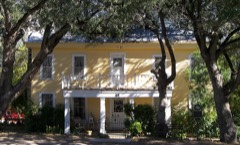 Anderson House and Storelisted 1983
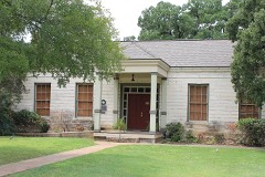 Armstrong-Adams Houselisted 1983
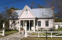 George Washington Baines Houselisted 1983
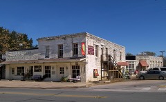 Barbee-Berry Mercantile Buildinglisted 1984
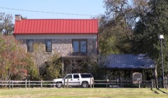 Barton Houselisted 1983
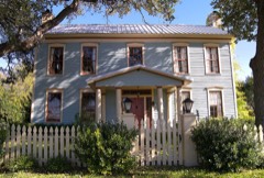 Fowler Houselisted 1983
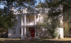 Capt. Robert Halley Houselisted 1983
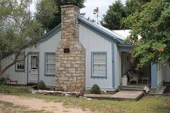 Hendrickson-Caskey Houselisted 1995
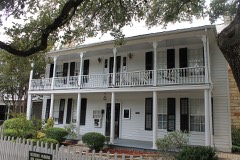 Norton-Orgain Houselisted 1992
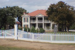 Col. Elijah Sterling Clack Robertson Plantationlisted 1983
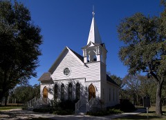 Salado United Methodist Chruchlisted 1984
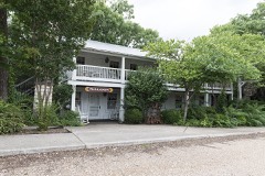 Stagecoach Innlisted 2017
Surveyed buildings and structures 2 records
- "Shady Villa", East access Road I-35, Saladofederal building survey, 5 photographs
- E. Sterling C. Robertson Plantation House, West access road, I-35 vicinity, Saladofederal building survey, 17 photographs
Population over time
2 figuresSalado grew from 2,126 to 2,394 between 2010 and 2020. These are the recorded population figures Wikidata holds for this place, reached through the Geographic Names Information System number this page is keyed on rather than by name, so they belong to this place and not to another of the same name. Most are census counts, but not all are: an early figure may be a founding or settlement estimate, and an estimate published within five years of a census is left out. The change column is computed, and is left blank where more than 20 years separate a figure from the one before it, because a gap that long is not a change between two counts.
| Year | People | Change |
|---|---|---|
| 2010 | 2,126 | |
| 2020 | 2,394 | +268 (+13%) |
Topographic sheets covering this place
4 surveys from 14 printed sheetsMatched by testing this settlement's coordinate against the published boundary of every sheet in the United States Geological Survey's historical collection. Each opens the scanned sheet at the Survey.
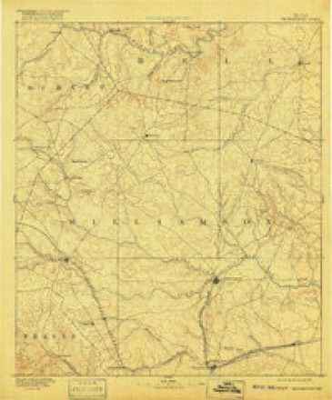
- 1893 USGS Georgetown quadrangle1:125000, 5 printings
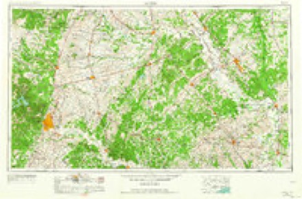
- 1954 USGS Austin quadrangle1:250000, 4 printings
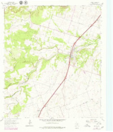
- 1964 USGS Salado quadrangle1:24000, 3 printings
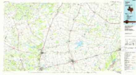
- 1985 USGS Taylor quadrangle1:100000, 2 printings
Photographs
2 photographs,Taken for the Office of War Information and the Farm Security Administration, who photographed the country between 1935 and 1944. Works of United States government photographers, with no known restriction on use. Each opens its catalogue record.
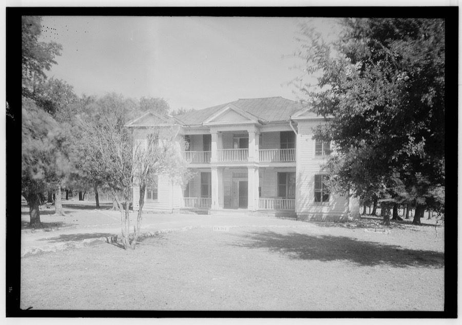
Photographer not recorded. Library of Congress
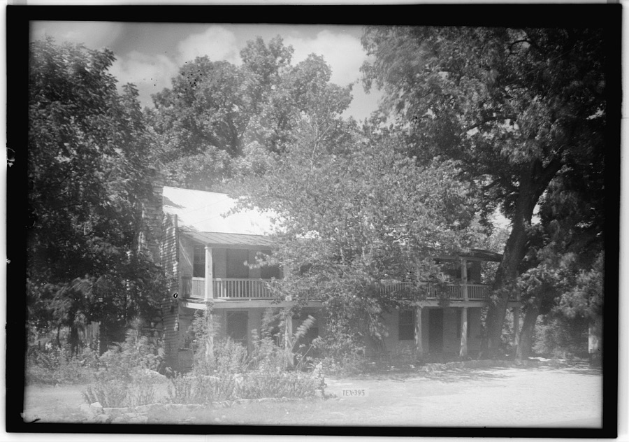
Photographer not recorded. Library of Congress
Fires near this place
95 since 2003Regional context, not property-specific evidence. The federal wildfire occurrence database lists 95 fires within 5 miles of Salado between 2003 and 2017, burning about 2,502 acres in total. 1 started naturally. 2 were recorded as arson. Distance is straight-line from the map coordinates, so a fire counted here may appear on a neighbouring settlement's page as well.
| Reported cause | Fires |
|---|---|
| Debris and open burning | 54 |
| Equipment and vehicle use | 20 |
| Missing data/not specified/undetermined | 14 |
| Power generation/transmission/distribution | 3 |
| Arson/incendiarism | 2 |
| Natural | 1 |
| Smoking | 1 |
The most recent of them, most recent first, with the day each was reported and the service that recorded it.
| Date | Cause | Size | Reported by | Name on the report |
|---|---|---|---|---|
| 4 September 2011 | Debris and open burning | 1.0 acres | Texas A & M Forest Service | 1220 ELMER KING RD |
| 30 September 2006 | Arson/incendiarism | 1.0 acres | Texas A & M Forest Service | not named |
| 30 September 2005 | Debris and open burning | 261 acres | Texas A & M Forest Service | MUSTANG CREEK |
| 22 September 2011 | Natural | 1.0 acres | Texas A & M Forest Service | HACKBERRY & GOOSNECK |
| 21 September 2008 | Equipment and vehicle use | 1.0 acres | Texas A & M Forest Service | not named |
| 21 September 2006 | Debris and open burning | 2.0 acres | Texas A & M Forest Service | not named |
| 19 September 2008 | Equipment and vehicle use | 10 acres | Texas A & M Forest Service | not named |
| 16 September 2008 | Equipment and vehicle use | 3.0 acres | Texas A & M Forest Service | not named |
Settlements close enough to share some of these fires:
Mines and quarries near this place
2 within 5 milesRegional context, not property-specific evidence. The federal mineral resources record lists 2 workings within 5 miles of Salado: 1 producer, 1 past producer. 1 still produces. What was taken out: Sand and Gravel, Construction. Distance is straight-line from the map coordinates, so a quarry counted here may appear on a neighbouring settlement's page as well.
| Where | Site | Commodity | Status | Recorded |
|---|---|---|---|---|
| Bandas Industries Inc Reed,S Lake | Sand and Gravel, Construction | Producer | ||
| Unknown | Sand and Gravel, Construction | Past Producer |
Storms near this place
45 since 1993Regional context, not property-specific evidence. The National Weather Service names Salado in 45 storm reports between 1993 and 2024: 26 hail, 12 thunderstorm wind, 4 flash flood, 2 flood. No death or injury is recorded in these reports. Each account below is quoted exactly as the forecast office filed it, from the NOAA Storm Events Database, and each date opens the federal record of that event.
| When | Event | Place named | Harm | What the report says |
|---|---|---|---|---|
| April 2022 | Hail | Salado | $1,000,000 | Many social media reports of large hail ranging up to 4 inch in diameter hail was reported in and around the Salado, TX area. This was in addition to the 5.6+ inch hail stone that is noted separately. The large hail fell for several minutes. |
| June 2007 | Flood | Salado | $750,000 | Runoff from heavy rains caused Mills Creek to flood portions of Salado, including Mill Creek Drive and Smith Bluff. About 30 homes were evacuated and one man had to be rescued from his rooftop. A water rescue was required on the Little River, and Salado Creek flooded the Interstate 35 access roads and the bridge on Main Street by four feet of water. One vehicle was washed off the road and a high water rescue was needed. |
| April 2024 | Hail | Salado | $500,000 | Emergency manager reported baseball sized hail fell in Salado. |
| April 2022 | Hail | Salado | $500,000 | A social media picture indicated a 5.6+ inch diameter hail stone in Salado, TX. Swift actions were taken by NWS Fort Worth and the IBHS (Insurance Institute for Business & Home Safety) to preserve and document this record hailstone. The IBHS officially measured the hailstone at: Maximum diameter 5.676 in, Mass 409.3 g, Volume 29.5 in3 making it the largest hail stone on record in the FWD CWA to date. Other large hailstones also fell in this same area. |
| May 2008 | Thunderstorm Wind | Salado | $100,000 | Two foot diameter trees were snapped in half along Highway 95 in Little River Academy. Numerous signs and billboards were blown down between Salado and Little River Academy. Trees fell on and damaged cars in Little River. |
| May 2008 | Thunderstorm Wind | Salado | $50,000 | Numerous trees had large limbs broken. A few trees were uprooted or snapped at the trunk. Several storage buildings were damaged, and a few homes suffered minor roof damage. Additional homes were damaged by falling trees and limbs. |
| May 2008 | Thunderstorm Wind | Salado | $50,000 | Trees were blown down and the high school lost some bricks. A historic home and a restaurant in Salado suffered roof damage. |
| May 2008 | Thunderstorm Wind | Salado | $30,000 | Trees were blown down and a hotel under construction was damaged at I-35 and exit 286. |
| November 2001 | Thunderstorm Wind | Salado | $25,000 | There was wind damage to two recreational vehicles, one mobile home, a two story house, and signswere blown down. |
| May 2001 | Thunderstorm Wind | Salado | $25,000 | A large tree was blown down onto an SUV. |
| May 2008 | Thunderstorm Wind | Salado | $20,000 | A carport was damaged. |
| October 2009 | Flash Flood | Salado | $15,000 | Five bridges in Salado were closed for a few hours due to high water that covered each bridge with up to 3 feet of water. The South Ridge and Chisholm Trail bridges in Mill Creek, the Smith Bluff bridge east of Mill Creek, and two access road bridges along Interstate 35 were all closed down. |
| May 2001 | Tornado (F0) | Salado | $15,000 | The walls of a house bowed in and the roof was lifted off and moved six inches. |
| July 2008 | Thunderstorm Wind | Salado | $12,000 | Rock facing was removed from the wall of a commercial building. |
| June 2019 | Hail | Salado | $10,000 | Broadcast media supplied a picture of hen-egg sized hail in the city of Salado, TX. |
| April 2008 | Hail | Salado | $5,000 | no account filed |
| March 2014 | Hail | Salado | $4,000 | no account filed |
| October 2009 | Flood | Salado | $3,000 | Two flooded bridges along the access road of Interstate 35 in Salado were reopened during the afternoon hours, but the South Ridge bridge and Chisholm Trail bridges in Mill Creek remained closed until the following morning when the water finally drained. The closure of these two bridges cut off residents' access through the subdivision. |
| May 2001 | Thunderstorm Wind | Salado | $2,000 | A porch was blown down by high winds. |
| April 2020 | Thunderstorm Wind | Salado | $1,000 | A social media report indicated downed trees and power lines in the city of Salado, TX. |
| June 2007 | Hail | Salado | $1,000 | no account filed |
| May 2024 | Flash Flood | Salado | - | Media reports all low water crossings near Salado Creek 1 mile east of I-35 are out. |
| April 2022 | Hail | Salado | - | Amateur radio reported half dollar sized hail near the intersection of Highways 2484 and 1670 in Bell County. |
| April 2010 | Hail | Salado | - | Penny size hail was reported in Salado. |
| October 2010 | Hail | Salado | - | Half dollar size hail was reported near Salado. |
| October 2010 | Hail | Salado | - | Quarter size hail was reported 2 miles north of Salado. |
| February 2009 | Thunderstorm Wind | Salado | - | Two 18 wheelers were overturned. A 35-foot communications tower on top of a building was folded over. 70 MPH winds were estimated in the area. |
| June 2007 | Flash Flood | Salado | - | Interstate 35 service roads were flooded north of FM 2484. |
| October 2006 | Hail | Salado | - | Penny-size hail reported from Salado to near Belton. |
| June 2004 | Flash Flood | Salado | - | Water was reported over a street in town, and over FM 1123 outside of Salado. On Church Street, south of the fire department, barricades were up due to high water. |
| March 2000 | Thunderstorm Wind | Salado | - | Tractor trailer rigs were blown off I-35. |
| May 1994 | Hail | Salado | - | Three feet of water was over Interstate 35 in Salado. |
| April 1993 | Hail | Salado | - | Thunderstorms developed late in the afternoon ahead of a cold front and moved slowly southeast through parts of north central and northeast Texas during the evening hours. |
| April 2014 | Hail | Salado | - | no account filed |
| April 2005 | Hail | Salado | - | no account filed |
| November 2004 | Hail | Salado | - | no account filed |
| November 2004 | Hail | Salado | - | no account filed |
| March 2000 | Hail | Salado | - | no account filed |
| April 2000 | Hail | Salado | - | no account filed |
| March 2000 | Hail | Salado | - | no account filed |
| February 1998 | Hail | Salado | - | no account filed |
| May 1997 | Hail | Salado | - | no account filed |
| May 1997 | Hail | Salado | - | no account filed |
| April 1997 | Hail | Salado | - | no account filed |
| September 1996 | Hail | Salado | - | no account filed |
Nearest settlements
The eight closest, with where each one stands in the county. Distances are straight-line, computed from the Geographic Names Information System coordinates.
| Map | Place | Distance | Sheets |
|---|---|---|---|
| Prairie Dell | 4.9 miles | 14 | |
| Union Grove | 5.0 miles | 19 | |
| Summers Mill | 5.9 miles | 14 | |
| Childers Mill (historical) | 6.2 miles | 14 | |
| Dog Ridge (historical) | 7.6 miles | 19 | |
| Cedar Valley | 7.9 miles | 15 | |
| Belton | 8.5 miles | 16 | |
| Holland | 8.7 miles | 14 |
Elsewhere
Matched on this settlement's Geographic Names Information System number rather than its name, so it cannot be a different place of the same name in another state.
| Wikipedia article on Salado | An encyclopaedic summary. Its text is share-alike, so it is linked here rather than copied. |
| Wikidata item Q1479634 | The structured record the population and elevation above come from. Public domain (CC0). |
Provenance
This settlement is recorded in the Geographic Names Information System as feature 1367336. The sheet list is computed by point-in-boundary test against the United States Geological Survey's historical topographic inventory. Both are works of the United States government and carry no copyright under 17 U.S.C. 105.
Wildfire. Short, Karen C. 2022. Spatial wildfire occurrence data for the United States, 1992-2020 [FPA_FOD_20221014]. 6th Edition. Fort Collins, CO: Forest Service Research Data Archive. https://doi.org/10.2737/RDS-2013-0009.6 Collected with United States Government funding and usable without additional permissions or fees.
Mines and quarries. USGS Mineral Resources Data System (MRDS) https://mrdata.usgs.gov/mrds/ A work of the United States government, no copyright under 17 U.S.C. 105.
Storms. NOAA National Centers for Environmental Information, Storm Events Database https://www.ncei.noaa.gov/stormevents/ A work of the United States government, no copyright under 17 U.S.C. 105. Narratives are quoted verbatim from the National Weather Service report and are not edited or summarised.