 Block
BlockSan Antonio, Texas
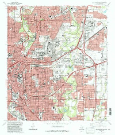
12 topographic sheets cover this place, the earliest surveyed in 1953 and the latest in 1992. It stands in the San Antonio Central census division. It lies in ZIP code area 78205. It stands on Apache Creek. The Survey maps it on the San Antonio East quadrangle. 1,434,625 people lived here at the 2020 count. It stands 650 feet above sea level.
Research this city
On record in San Antonio
Buildings and businesses the archive holds for this place. Each opens its own page, with the source record it came from.
On the National Register 12 of 145 shown
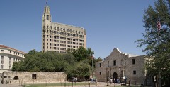 Alamo, TheNational Historic Landmark · listed 1966
 Army Medical Department MuseumNational Historic Landmark · listed 1975
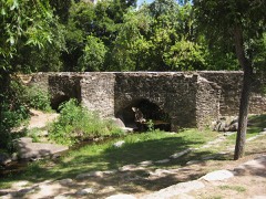 Espada AqueductNational Historic Landmark · listed 1966
 Hangar 9National Historic Landmark · listed 1970
 Majestic TheatreNational Historic Landmark · listed 1975
 Mission ConcepcionNational Historic Landmark · listed 1970
 Randolph Field Historic DistrictNational Historic Landmark · listed 1996
 Spanish Governor's PalaceNational Historic Landmark · listed 1970
 Alamo Methodist Churchlisted 1979
 Alamo National Bank Buildinglisted 1984
 Alamo National Bank Buildinglisted 2006
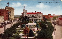 Alamo Plaza Historic Districtlisted 1977
Surveyed buildings and structures 12 of 45 shown
- Alamo Roman and Portland Cement Company, Brackenridge Park, San Antoniofederal building survey, 4 photographs
- Argyle House, 924 Patterson & Argyle-Alamo Heights, San Antoniofederal building survey, 3 photographs
- Bexar County Courthouse, 20 Dolorosa Street, San Antoniofederal building survey, 7 photographs
- Charles L. Lege House, 533 West Elmira Street, San Antoniofederal building survey, 4 photographs
- Colonel Jeremiah Y. Dashiell House, 511 Villita Street, San Antoniofederal building survey, 7 photographs
- Espada Acequia, Piedras Creek Aqueduct, Spanning Piedras Creek east of Espada Road, San Antoniofederal building survey, 3 photographs
- Gustave Uhl House, San Antoniofederal building survey, 3 photographs
- James Vance House, San Antoniofederal building survey, 3 photographs
- Jose Antonio Navarro Store, 232 South Laredo Street, San Antoniofederal building survey, 3 photographs
- Menger Hotel, Alamo Plaza, San Antoniofederal building survey, 3 photographs
- Mission Nuestra Senora de La Purisima Concepcion, 807 Mission Road, San Antoniofederal building survey, 18 photographs
- Mission San Antonio de Valero, Alamo Plaza, San Antoniofederal building survey, 26 photographs
Population over time
18 figuresSan Antonio grew from 3,488 to 1,434,625 between 1850 and 2020. These are the recorded population figures Wikidata holds for this place, reached through the Geographic Names Information System number this page is keyed on rather than by name, so they belong to this place and not to another of the same name. Most are census counts, but not all are: an early figure may be a founding or settlement estimate, and an estimate published within five years of a census is left out. The change column is computed, and is left blank where more than 20 years separate a figure from the one before it, because a gap that long is not a change between two counts.
| Year | People | Change |
|---|---|---|
| 1850 | 3,488 | |
| 1860 | 8,235 | +4,747 (+136%) |
| 1870 | 12,256 | +4,021 (+49%) |
| 1880 | 20,550 | +8,294 (+68%) |
| 1890 | 37,673 | +17,123 (+83%) |
| 1900 | 53,321 | +15,648 (+42%) |
| 1910 | 96,614 | +43,293 (+81%) |
| 1920 | 161,379 | +64,765 (+67%) |
| 1930 | 231,542 | +70,163 (+43%) |
| 1940 | 253,854 | +22,312 (+10%) |
| 1950 | 408,442 | +154,588 (+61%) |
| 1960 | 587,718 | +179,276 (+44%) |
| 1970 | 654,153 | +66,435 (+11%) |
| 1980 | 785,940 | +131,787 (+20%) |
| 1990 | 935,933 | +149,993 (+19%) |
| 2000 | 1,144,646 | +208,713 (+22%) |
| 2010 | 1,327,407 | +182,761 (+16%) |
| 2020 | 1,434,625 | +107,218 (+8%) |
Topographic sheets covering this place
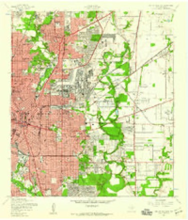
6 surveys from 12 printed sheetsMatched by testing this settlement's coordinate against the published boundary of every sheet in the United States Geological Survey's historical collection. Each opens the scanned sheet at the Survey.
- 1953 USGS San Antonio East quadrangle1:24000
- 1954 USGS San Antonio quadrangle1:250000, 3 printings
- 1957 USGS San Antonio quadrangle1:250000
- 1967 USGS San Antonio East quadrangle1:24000, 3 printings
- 1985 USGS San Antonio quadrangle1:100000, 3 printings
- 1992 USGS San Antonio East quadrangle1:24000
What the histories say of this town
115,047 words3 chapters about San Antonio from the published histories of the county, public domain and reproduced complete.
| Chapter | From | Length |
|---|---|---|
| San Antonio De Bexar : a Guide and History | San Antonio De Bexar : a Guide and History (1890) | 75,242 words in 5 parts |
| History | History and Legends of the Alamo and Other Missions in and Around San Antonio (1917) | 34,475 words in 3 parts |
| Great San Antonio, the City of Destiny and of Your Destination | Great San Antonio, the City of Destiny and of Your Destination (1918) | 5,330 words |
Photographs
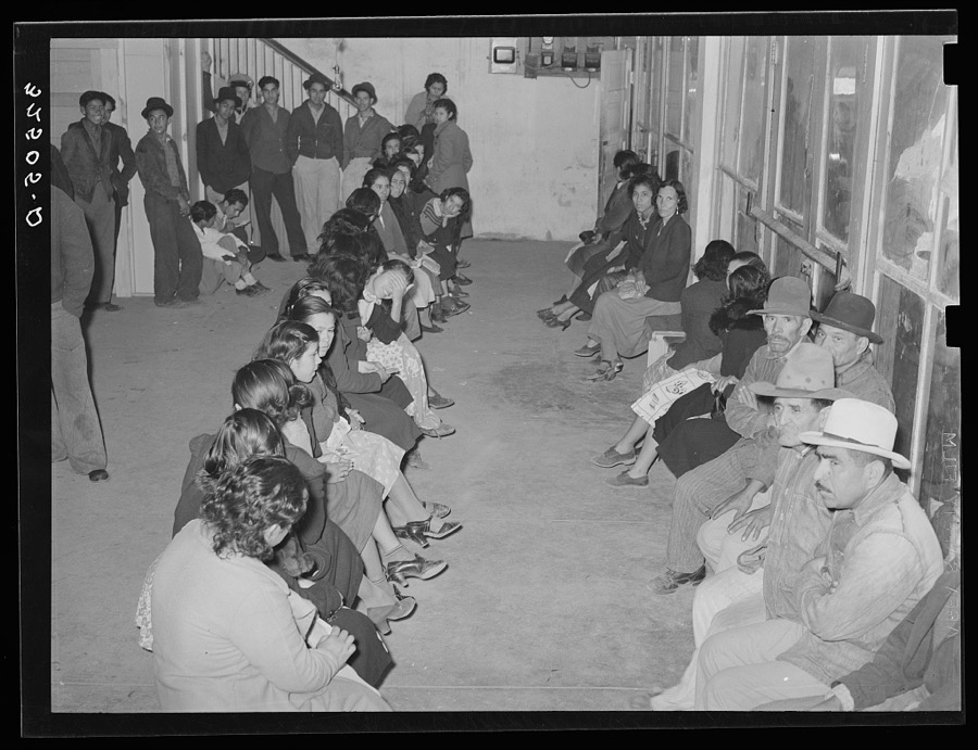
8 of 52 photographs shown, 1939Taken for the Office of War Information and the Farm Security Administration, who photographed the country between 1935 and 1944. Works of United States government photographers, with no known restriction on use. Each opens its catalogue record.

Lee, Russell, 1939. Library of Congress

Lee, Russell, 1939. Library of Congress

Lee, Russell, 1939. Library of Congress

Lee, Russell, 1939. Library of Congress

Lee, Russell, 1939. Library of Congress
Lee, Russell, 1939. Library of Congress

Lee, Russell, 1939. Library of Congress

Lee, Russell, 1939. Library of Congress
Every photograph of Bexar County
Fires near this place
1 since 2011Regional context, not property-specific evidence. The federal wildfire occurrence database lists 1 fire within 5 miles of San Antonio in 2011, burning about 1 acre in total. None started naturally. None was recorded as arson. Distance is straight-line from the map coordinates, so a fire counted here may appear on a neighbouring settlement's page as well.
| Reported cause | Fires |
|---|---|
| Debris and open burning | 1 |
The most recent of them, most recent first, with the day each was reported and the service that recorded it.
| Date | Cause | Size | Reported by | Name on the report |
|---|---|---|---|---|
| 3 August 2011 | Debris and open burning | 1.0 acres | Texas A & M Forest Service | IH 16/ S. ZARZAMORA |
Settlements close enough to share some of these fires:
Mines and quarries near this place
6 within 5 milesRegional context, not property-specific evidence. The federal mineral resources record lists 6 workings within 5 miles of San Antonio: 4 producers, 1 unknown, 1 past producer. 4 still produce. What was taken out: Sand and Gravel, Construction, Stone, Crushed/Broken, Limestone, General, Limestone, General, Limestone, Ultra Pure. Distance is straight-line from the map coordinates, so a quarry counted here may appear on a neighbouring settlement's page as well.
| Where | Site | Commodity | Status | Recorded |
|---|---|---|---|---|
| Acme | Sand and Gravel, Construction | Unknown | ||
| Affiliated Aggregates Quarry | Stone, Crushed/Broken, Limestone, General | Producer | ||
| Cementville Quarry | Limestone, General, Limestone, Ultra Pure | Past Producer | Limestone | |
| San Antonio Portland Cement Co | Clay, Stone, Crushed/Broken | Producer | ||
| San Antonio Portland Clay Pit | Clay | Producer | ||
| San Antonio Prtlnd Limestone Quarry | Stone, Crushed/Broken | Producer |
Storms near this place
60 of 180 shownRegional context, not property-specific evidence. The National Weather Service names San Antonio in 180 storm reports between 1993 and 2026: 94 hail, 37 thunderstorm wind, 35 flash flood, 5 tornado. The reports record 4 deaths and 14 injuries. Each account below is quoted exactly as the forecast office filed it, from the NOAA Storm Events Database, and each date opens the federal record of that event.
| When | Event | Place named | Harm | What the report says |
|---|---|---|---|---|
| May 1999 | Lightning | San Antonio | 1 killed, 1 hurt | Two men, one aged 46 and another aged 43, were closing up windows on a station wagon at the older man's home when the vehicle was struck by lightning. Both men were tossed away from the vehicle by the strike and were hospitalized. The older man died a few days later. |
| April 2026 | Flood | San Antonio | 1 killed | Thunderstorms produced heavy rain Monday and Monday night across the northeast side of San Antonio. Between 4 and 6 inches of rain occurred. This caused a quick rise into flood stage on Salado Creek early Tuesday morning. A 44 year old man was killed by the flood waters in the Salado Creek Greenway, near J Street Park. Authorities were not able to determine how the man got into the water, but was suspected of being homeless and living near the creek. |
| June 2016 | Flash Flood | San Antonio | 1 killed | Newspaper reports show that a body of a man was recovered near the 700 block of Camaron in San Pedro Creek. The body was recovered early on Friday morning but the man drowned early Thursday morning as he and a friend were skateboarding in the creek drainage tunnel. Heavy rain caused a surge a water down the tunnel and both men were swept down the creek. One person was able to save himself. |
| September 2004 | Flash Flood | San Antonio | 1 killed | A young girl drowned in a brief flash flood event as she and her grandmother were driving across a culvert that was under construction. Although less than 2 inches of rain had fallen, water swept quickly through the low area, trapping the vehicle. The grandmother left the car and was pulled to safety by residents of the area. The young girl was swept off her feet and washed into a drainage pipe where she drowned. |
| June 2003 | Thunderstorm Wind | San Antonio | 9 hurt, $30,000 | An off-duty NWS employee reported trees blown over by severe thunderstorm winds in northern San Antonio near the intersections of Blanco Road and Loop 410. |
| May 2001 | Lightning | San Antonio | 4 hurt | no account filed |
| May 2001 | Hail | San Antonio | $120,000,000 | no account filed |
| March 1994 | Hail | San Antonio | $5,000,000 | Hail first began falling in extreme northwestern Bexar County near 1230 CST, increasing to golf ball-size by 2450 CST. At 2456 CST, winds gusted to 56 knots at the San Antonio International Airport. Shortly after 0100 CST, residents in north-central San Antonio reported hearing a "roaring train" sound near the airport. Power lines were downed in the area, trees were blown over and a sturdy metal sign was knocked down. Windows were blown out at Broadway and Intersate 410. Shortly afterward, wind gusts to 58 knots were recorded at Randolph Air Force Base. Leaves were stripped from trees in north Bexar County. Considerable damage was reported to roofs of homes and to windows of cars and houses across the northern half of Bexar County. Some of the roof damage was due to broken tree branches being blown over onto houses. Power was knocked to 30,000 homes and businesses for several hours. |
| June 2019 | Thunderstorm Wind | San Antonio | $1,000,000 | A thunderstorm produced wind gusts estimated at 70 mph that blew across much of the downtown area of San Antonio. A large a tree on King William St. was blown down and this is just one of hundreds of trees that were severely damaged or were uprooted across the city during the late afternoon hours during this event. Some of the downed trees fell on homes and cars and caused structural damage adding to the overall monetary loss for the event which does include an estimate of insured losses as well as city cleanup. |
| July 2008 | Tornado (EF0) | San Antonio | $800,000 | A tornado touched down on the south side of San Antonio. There was considerable damage to a boat shop and boat storage facility. A boat storage rack had its roof and top level twisted back on itself and the roof of an adjacent building was damaged in a similar manor. Tornadic Winds damaged roofs and uprooted trees along Steves and McKinley Avenues. The most extensive damage was along Steves Avenue where many of the homes along the street suffered roof damage and many large trees were uprooted or snapped off. One home had its metal roof peeled back by the wind. Another home had a carport and patio roof torn off the house and thrown over the roof to the other side of the house. A fast food restaurant on the northeast corner of Steves and Roosevelt Aves. had a portion of its roof blown off. It looked like the wind entered through a gable vent and pushed the roof out from the inside. Winds were estimated near 80 mph. Sixty homes were damaged along with 10 commercial buildings. |
| March 1994 | Hail | San Antonio | $500,000 | As a second wave of thunderstorms moved into Bexar County from the west, hail up to one inch in diameter began to fall at the Rolling Oaks Mall in the northeast part of the county. Hail up to golf ball-size was also indicated at Universal City. Damage was reported to windows and to fences due to gusty winds. |
| May 2002 | Thunderstorm Wind | San Antonio | $400,000 | Severe thunderstorm winds damaged 16 cars and knocked over fences in the northwest part of San Antonio, near I-10 and Callaghan Road. The area of damage was very limited in extent, covering only about a square mile. |
| November 2000 | Thunderstorm Wind | San Antonio | $150,000 | Widespread damage from severe thunderstorm winds was reported across the central and east sections of Bexar County. The storms blew over numerous trees and power lines, blocking streets and damaging homes. In all, some 54 streets were blocked by the damage. The winds also damaged windows and roofs of homes. |
| September 2019 | Thunderstorm Wind | San Antonio | $100,000 | A thunderstorm produced wind gusts estimated at 60 mph that blew down about 100 feet of scaffolding from the side of the 14 story AT&T building in downtown San Antonio. Some of the scaffolding landed on St. Mark's Episcopal Church across E. Martin St. damaging that building. At least four cars were also damaged. A family of three were indirectly injured when they ran from the collapsing scaffolding. They received minor cuts and bruises. |
| February 1998 | Thunderstorm Wind | San Antonio | $100,000 | no account filed |
| July 2007 | Thunderstorm Wind | San Antonio | $80,000 | A short, curved line of thunderstorms, approaching from the northwest, intersected near 1:25 am CST with a second line of thunderstorms building westward from Seguin and Gonzales. For the next 20 minutes the storms appeared to strengthen near this intersection and spread southwestward. By 1:50 am CST the storms at this intersection began moving toward the southeast and by 1:55 am CST all storms were weakening rapidly. The greatest damage was located along Knollcreek Drive on the north side from Jung Road Classen Road. On the south end the damage was located parallel to and about one quarter mile northwest of Nacogdoches from its intersection with Bell Drive to its intersection with OConnor Road. The most typical kind of damage over the area consisted of broken tree limbs and branches that had been tossed toward the southeast, indicating wind gusts of 45 to 60 mph. However, in a number of locations large trees were snapped off or knocked over. A few trees showed signs of weak root systems, but most of the trees were healthy. This level of damage indicated wind gusts of 80 to 100 mph. |
| April 2002 | Flash Flood | San Antonio | $80,000 | Flash flooding erupted over large sections of San Antonio as general 2 inch rain amounts fell over the northern part of the county, with up to 4 inches in the north central portion. Damage was mainly to roads across the city. |
| November 2000 | Thunderstorm Wind | San Antonio | $80,000 | no account filed |
| April 1996 | Thunderstorm Wind | San Antonio | $70,000 | no account filed |
| August 2012 | Lightning | San Antonio | $50,000 | A thunderstorm produced a lightning strike that started a house fire in San Antonio. |
| April 2007 | Thunderstorm Wind | San Antonio | $50,000 | A line of thunderstorms moved into Bexar County just after midnight, producing widespread wind damage to trees northeast of San Antonio. Gusts were estimated in the range of 40 to 50 knots with higher gusts near 70 knots. Most of the damage reported was in the form of trees blown down. |
| July 2007 | Tornado (EF1) | San Antonio | $50,000 | In surveying damage in northeast San Antonio, staff found indications of a tornado at two locations. It is thought that the severe thunderstorm winds struck the area near 1:25 am CST and the tornado struck after the severe thunderstorm winds. The tornado damage was similar to the other damage in the area, consisting of fences blown down and trees snapped off or blown over, except that the debris was tossed in all different directions. It touched down near 1:30 am CST close to the intersection of Knollbluff and Flowing Spring and moved southeast for approximately 1000 feet before lifting and moving over a utility plant. At one point along Flowing Spring it fired pieces from the top of a fence toward the south into the second story of a home, and shortly afterward, it threw other pieces into a roof of a different home back to the northwest. The tornado touched down again near the intersection of Saddle Ridge and Cedar Moss, a little over a half-mile to the southeast of its lift point. Here it knocked over two large trees, tossing one to the east and one to the south. Residents at this location reported high winds, followed by hail, and then a calm period before their ears suddenly popped and they heard a sound like a freight train. The tornado moved toward the southeast for approximately 300 feet then lifted and dissipated. A review of the damage indicated tornado winds of 80 to 100 mph at both locations, making it an EF-1 on the Enhanced Fujita Scale. |
| August 2006 | Thunderstorm Wind | San Antonio | $50,000 | Roof pieces and aluminum were blown down at the Rivercenter Mall in downtown San Antonio. Damage was reported to some of the furniture in the mall, with brief flooding in the Lagoon area of the mall |
| June 2003 | Thunderstorm Wind | San Antonio | $50,000 | Severe thunderstorm winds blew down trees and destroyed a $35K canopy at Wolff stadium in western San Antonio. |
| December 2002 | Thunderstorm Wind | San Antonio | $50,000 | Trees were blown down by severe thunderstorm winds at the west edge of the city of San Antonio near the intersection of Marbach Road and Loop 410. |
| May 2002 | Thunderstorm Wind | San Antonio | $50,000 | Severe thunderstorm winds damaged property of the Animal Defense League on Wurzbach Parkway in northeast San Antonio. Fences were knocked down and roofs were taken off buildings. |
| March 2000 | Hail | San Antonio | $50,000 | Hail was reported by the public to have damaged cars on I-37 along the south side of San Antonio. |
| March 2000 | Hail | San Antonio | $50,000 | Very large hail was reported at Stinson Airport on the southeast side of San Antonio. Damage was mainly indicated to buildings and vehicles. |
| October 2000 | Tornado (F0) | San Antonio | $50,000 | A small and short-lived tornado touched down near Culebra and I-35, causing minor damage to the roof of a motel and a police substation. Widespread damage was reported to car windows. |
| March 1999 | Thunderstorm Wind | San Antonio | $50,000 | Severe thunderstorm winds knocked over power lines and blew down trees in the area near the intersection of Interstate 10 and Loop 410. |
| April 1999 | Thunderstorm Wind | San Antonio | $50,000 | NWS off-duty employee reports trees down and large limbs off trees. Power lines blown down with power out to much of northern San Antonio. |
| April 1994 | Hail | San Antonio | $50,000 | A thunderstorm that formed along a cold front began producing nickle-sized hail in downtown San Antonio. The storm entered the city from the west at nearly 30 mph. Brief heavy rain accompanied the thunderstorm. |
| May 1999 | Thunderstorm Wind | San Antonio | $50,000 | no account filed |
| May 2000 | Tornado (F0) | San Antonio | $40,000 | A small tornado was observed by the public as it touched down in a residential area near the intersection of Zarzamora and US90. The tornado missed homes in the area, but destroyed around 20 trees. |
| August 2003 | Thunderstorm Wind | San Antonio | $30,000 | As the line of thunderstorms associated with the late season cold front moved southward into Bexar County, they produced additional severe winds that blew down power lines near the intersection of US281 and Loop1604 on the north side of San Antonio, as observed by an NWS employee on the way home. Extremely heavy rain and very intense, frequent lightning accompanied the storms. |
| May 2000 | Thunderstorm Wind | San Antonio | $30,000 | Power lines were blown down by severe thunderstorm winds. |
| March 1998 | Thunderstorm Wind | San Antonio | $30,000 | A severe thunderstorm blew out windows and caused damage to roofs in the Fort Sam Houston portion of San Antonio. |
| June 1999 | Flash Flood | San Antonio | $30,000 | no account filed |
| September 1997 | Thunderstorm Wind | San Antonio | $30,000 | no account filed |
| July 1996 | Thunderstorm Wind | San Antonio | $30,000 | no account filed |
| September 2010 | Thunderstorm Wind | San Antonio | $20,000 | A thunderstorm produced wind gusts estimated at 50 mph which knocked a tree onto a car at the intersection of Zarzamora and Phyllis Streets in San Antonio. |
| July 1995 | Thunderstorm Wind | San Antonio | $20,000 | High winds knocked down trees and blew over power poles in downtown San Antonio. |
| August 1998 | Flash Flood | San Antonio | $20,000 | no account filed |
| May 1997 | Thunderstorm Wind | San Antonio | $20,000 | no account filed |
| June 1996 | Thunderstorm Wind | San Antonio | $20,000 | no account filed |
| June 2019 | Thunderstorm Wind | San Antonio | $10,000 | Tents and outdoor equipment were damaged at the UTSA Institute of Texan Cultures. Strong winds associated with a severe thunderstorm were responsible for the damage that included setup for the Texas Folklife Festival. Tree damage was also reported. |
| April 2000 | Flash Flood | San Antonio | $10,000 | Thunderstorms produced rain accumulations of 2 to 3 inches over much of the city. The San Antonio Emergency Management reported brief flooding and road closures. |
| February 1998 | Thunderstorm Wind | San Antonio | $10,000 | Severe winds destroyed roofs of homes and blew in windows of homes and cars. Power lines were also blown down in and around San Antonio. |
| June 1999 | Flash Flood | San Antonio | $10,000 | no account filed |
| June 1999 | Flash Flood | San Antonio | $10,000 | no account filed |
| May 2021 | Thunderstorm Wind | San Antonio | $1,000 | A thunderstorm produced wind gusts estimated at 65 mph that knocked down some one inch diameter tree limbs in southern San Antonio. |
| May 2025 | Flash Flood | San Antonio | - | Thunderstorms produced heavy rain that led to flash flooding. There were multiple stranded vehicles and high water rescues reported across San Antonio. |
| May 2025 | Flash Flood | San Antonio | - | Thunderstorms produced heavy rain that led to flash flooding. There were multiple high water rescues in central and northern San Antonio. |
| April 2023 | Hail | San Antonio | - | A thunderstorm produced quarter size hail near downtown San Antonio. |
| April 2023 | Hail | San Antonio | - | A thunderstorm produced quarter size hail southeast of downtown San Antonio. |
| May 2023 | Flash Flood | San Antonio | - | Thunderstorms produced heavy rain that led to flash flooding. Several lanes of S. Laredo St. were flooded near Apache Creek and I-35. |
| May 2023 | Flash Flood | San Antonio | - | Thunderstorms produced heavy rain that led to flash flooding. A car was stranded in flood water near the St. Mary's St. bridge over the San Antonio River in downtown San Antonio. |
| October 2023 | Tornado (EF0) | San Antonio | - | A National Weather Service damage survey concluded an EF-0 tornado started near the south end of the Masonic Cemetery off of E. Commerce St. in San Antonio. Several trees were damaged in the cemetery between E. Commerce and E. Crockett St., and a fence was damaged at the tennis courts in Fairchild Park. As the track headed north-northeast, there was sporadic, very minor tree damage in the neighborhood, and a couple metal roof panels were lifted off an old structure in the railyard just west of N. New Braunfels Ave. The damage path was more notable within Ft. Sam Houston. Several trampolines were lofted, part of the roof was damaged on a building near the south end of the Fort, and significant tree damage was observed throughout the Fort property up to near Old Austin Rd. After that point, damage was again more sporadic and the tornado may have briefly lifted through much of Terrell Hills until reaching the Alcove Apartments on N. Vandiver Rd. Roof damage was noted to the northern building there, as well as damage to the Southwest Preparatory school across Seidel Rd. Security camera footage showed a small circulation crossing at Austin Hwy and N. Vandiver Rd. at 7:18 am, and though it is possible that additional sporadic damage occurred northeast of here, the survey team was unable to find any notable damage north of Austin Hwy. The path length was 5.17 miles, and maximum winds were estimated at 80 mph. |
| May 2022 | Hail | San Antonio | - | A thunderstorm produced penny size hail in San Antonio. |
| May 2021 | Hail | San Antonio | - | A thunderstorm produced three inch hail at Noria St. and S. Calaveras St. on the west side of San Antonio. |
Nearest settlements
The eight closest, with where each one stands in the county. Distances are straight-line, computed from the Geographic Names Information System coordinates.
| Map | Place | Distance | Sheets |
|---|---|---|---|
| Olmos Park | 3.8 miles | 12 | |
| Phoenix | 3.9 miles | 12 | |
| Columbia Heights | 4.1 miles | 13 | |
| Terrell Hills | 4.2 miles | 12 | |
| Salado Junction | 4.4 miles | 12 | |
| Alamo Heights | 4.4 miles | 12 | |
| Balcones Heights | 5.4 miles | 12 | |
| San Jose | 5.7 miles | 13 |
Elsewhere
Matched on this settlement's Geographic Names Information System number rather than its name, so it cannot be a different place of the same name in another state.
| Wikipedia article on San Antonio | An encyclopaedic summary. Its text is share-alike, so it is linked here rather than copied. |
| Wikidata item Q975 | The structured record the population and elevation above come from. Public domain (CC0). |
Provenance
This settlement is recorded in the Geographic Names Information System as feature 1380951. The sheet list is computed by point-in-boundary test against the United States Geological Survey's historical topographic inventory. Both are works of the United States government and carry no copyright under 17 U.S.C. 105.
Wildfire. Short, Karen C. 2022. Spatial wildfire occurrence data for the United States, 1992-2020 [FPA_FOD_20221014]. 6th Edition. Fort Collins, CO: Forest Service Research Data Archive. https://doi.org/10.2737/RDS-2013-0009.6 Collected with United States Government funding and usable without additional permissions or fees.
Mines and quarries. USGS Mineral Resources Data System (MRDS) https://mrdata.usgs.gov/mrds/ A work of the United States government, no copyright under 17 U.S.C. 105.
Storms. NOAA National Centers for Environmental Information, Storm Events Database https://www.ncei.noaa.gov/stormevents/ A work of the United States government, no copyright under 17 U.S.C. 105. Narratives are quoted verbatim from the National Weather Service report and are not edited or summarised.