 Block
BlockSimms, Texas
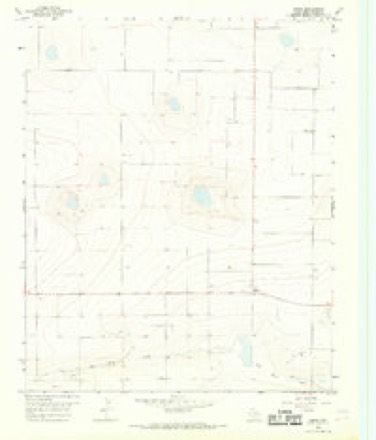
6 topographic sheets cover this place, the earliest surveyed in 1954 and the latest in 1985. It stands in the Hereford West census division. It lies in ZIP code area 79045. The Survey maps it on the Simms quadrangle.
Topographic sheets covering this place
4 surveys from 6 printed sheetsMatched by testing this settlement's coordinate against the published boundary of every sheet in the United States Geological Survey's historical collection. Each opens the scanned sheet at the Survey.
- 1954 USGS Tucumcari quadrangle1:250000, 2 printings
- 1958 USGS Tucumcari quadrangle1:250000
- 1966 USGS Simms quadrangle1:24000
- 1985 USGS Vega quadrangle1:100000, 2 printings
Fires near this place
1 since 2008Regional context, not property-specific evidence. The federal wildfire occurrence database lists 1 fire within 5 miles of Simms in 2008, burning about 2 acres in total. None started naturally. None was recorded as arson. Distance is straight-line from the map coordinates, so a fire counted here may appear on a neighbouring settlement's page as well.
| Reported cause | Fires |
|---|---|
| Equipment and vehicle use | 1 |
The most recent of them, most recent first, with the day each was reported and the service that recorded it.
| Date | Cause | Size | Reported by | Name on the report |
|---|---|---|---|---|
| 24 April 2008 | Equipment and vehicle use | 2.0 acres | Texas A & M Forest Service | not named |
Storms near this place
28 since 2008Regional context, not property-specific evidence. The National Weather Service names Simms in 28 storm reports between 2008 and 2025: 21 hail, 2 thunderstorm wind, 2 flood, 1 heavy rain. No death or injury is recorded in these reports. Each account below is quoted exactly as the forecast office filed it, from the NOAA Storm Events Database, and each date opens the federal record of that event.
| When | Event | Place named | Harm | What the report says |
|---|---|---|---|---|
| June 2025 | Tornado (EF0) | Simms | $45,000 | Several visuals from storm spotters indicated that funnel clouds and perhaps brief touchdowns occurred before this tornado from the same supercell as it crossed western Deaf Smith County. However, this tornado did overturn a couple of pivots south of |County Road 27 and east of Highway 214. This appears to have been the only damage noted from this tornado so the exact length of the track is unknown due to the lack of damage indicators. The estimated wind speed from this tornado was 85mph. |
| August 2011 | Thunderstorm Wind | Simms | $30,000 | A trained spotter reported that a metal granary was blown about seventy-five yards north of where it was originally located. There were no reports of injuries or fatalities. |
| June 2025 | Flood | Simms | $1,000 | There were some locations where three to five inches of moving water accumulated on the road. Other isolated spots had one to two inches. Ditches were full in several spots and fields were flooded. |
| May 2023 | Hail | Simms | - | Light hail accumulation occurred at the time or report. |
| April 2019 | Hail | Simms | - | Accumulating hail reported just west of Simms area. |
| October 2019 | Flash Flood | Simms | - | A water rescue took place along FM 1412 west of US Highway 385 near a creek bed. A motorist attempted to drive through fast flowing water. The vehicle was swept about 100 feet and off the road into a creek. The person was rescued. FM 1412 was closed due to high water approximately 3 miles west of US Highway 385. |
| October 2019 | Flood | Simms | - | Several roads were reported to be flooded south of Adrian and south of Vega. The time of the report is estimated. |
| May 2016 | Hail | Simms | - | Mostly dime to nickel size hail fell at this location with a few stones up to quarter size. |
| May 2016 | Hail | Simms | - | Pea to penny size hail fell 3 miles west-southwest of Simms. |
| May 2016 | Hail | Simms | - | Ping pong ball size hail occurred 1 mile east-southeast of Simms. |
| May 2016 | Hail | Simms | - | Half dollar to hen egg size hail fell 2 miles east of Simms. |
| May 2016 | Hail | Simms | - | Hail at least the size of half dollars covered the road 8 miles northeast of Simms. |
| May 2016 | Hail | Simms | - | Two inch diameter hail was measured with a tape measure 8 miles northeast of Simms. |
| May 2016 | Hail | Simms | - | Nickel to quarter size hail occurred 8 miles northeast of Simms. |
| May 2013 | Heavy Rain | Simms | - | The Emergency Manager for Deaf Smith County reported that hail up to the size of tennis balls (2.00 inches) was covering the ground and roadways. The hail clogged drainage systems which caused fields along the road to become flooded. The flood waters did not impact the roads and quickly receded once the drainage systems unclogged. |
| May 2013 | Hail | Simms | - | A supercell thunderstorm that developed along a retreating dryline in Deaf Smith and Oldham Counties tracked to the northeast across the southern Texas Panhandle. A storm chaser reported ping pong ball size hail 15 miles south of Adrian (Deaf Smith County). The supercell continued traveling in a northeastern direction which took it out of the county shortly after 10 pm. No injuries were relayed with this report. |
| May 2013 | Hail | Simms | - | A supercell thunderstorm that developed along a retreating dryline in Deaf Smith and Oldham Counties tracked to the northeast across the southern Texas Panhandle. The Deaf Smith County Emergency Manager reported tennis ball size hail 5 miles east of Simms (Deaf Smith County). The hail clogged drainage systems close to the road and caused some of the fields to flood. The supercell continued traveling in a northeastern direction which took it out of the county shortly after 10 pm. No injuries were relayed with this report. |
| December 2012 | Thunderstorm Wind | Simms | - | A line of thunderstorms moved into Oldham County and produced multiple thunderstorm wind gusts across the county. Center pivots used in irrigation were blown over 12 miles to the south-shoutwest of Vega. These winds were estimated to be between 60 mph and 70 mph by radar. At the same location pea size hail was also observed. |
| April 2009 | Hail | Simms | - | The public reported the hail along State Highway 214. The hail began as pea size then increased to quarter size. The hail covered the ground to a depth of a few inches in places. Tree limbs were broken by the hail and birds were killed. |
| June 2025 | Hail | Simms | - | no account filed |
| May 2021 | Hail | Simms | - | no account filed |
| June 2019 | Hail | Simms | - | no account filed |
| June 2019 | Hail | Simms | - | no account filed |
| June 2019 | Hail | Simms | - | no account filed |
| June 2017 | Hail | Simms | - | no account filed |
| September 2011 | Hail | Simms | - | no account filed |
| June 2009 | Hail | Simms | - | no account filed |
| June 2008 | Hail | Simms | - | no account filed |
Nearest settlements
The eight closest, with where each one stands in the county. Distances are straight-line, computed from the Geographic Names Information System coordinates.
| Map | Place | Distance | Sheets |
|---|---|---|---|
| Walcott | 11.0 miles | 8 | |
| Milo Center | 14.0 miles | 8 | |
| Ford | 14.4 miles | 6 | |
| Westway | 15.6 miles | 9 | |
| Bootleg | 16.4 miles | 8 | |
| Hereford | 20.4 miles | 8 | |
| Joel | 22.3 miles | 8 | |
| Glenrio (historical) | 22.7 miles | 5 |
Elsewhere
Matched on this settlement's Geographic Names Information System number rather than its name, so it cannot be a different place of the same name in another state.
| Wikipedia article on Simms | An encyclopaedic summary. Its text is share-alike, so it is linked here rather than copied. |
| Wikidata item Q128800307 | The structured record the population and elevation above come from. Public domain (CC0). |
Provenance
This settlement is recorded in the Geographic Names Information System as feature 1380544. The sheet list is computed by point-in-boundary test against the United States Geological Survey's historical topographic inventory. Both are works of the United States government and carry no copyright under 17 U.S.C. 105.
Wildfire. Short, Karen C. 2022. Spatial wildfire occurrence data for the United States, 1992-2020 [FPA_FOD_20221014]. 6th Edition. Fort Collins, CO: Forest Service Research Data Archive. https://doi.org/10.2737/RDS-2013-0009.6 Collected with United States Government funding and usable without additional permissions or fees.
Storms. NOAA National Centers for Environmental Information, Storm Events Database https://www.ncei.noaa.gov/stormevents/ A work of the United States government, no copyright under 17 U.S.C. 105. Narratives are quoted verbatim from the National Weather Service report and are not edited or summarised.