 Block
BlockWashburn, Texas
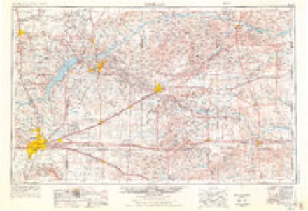
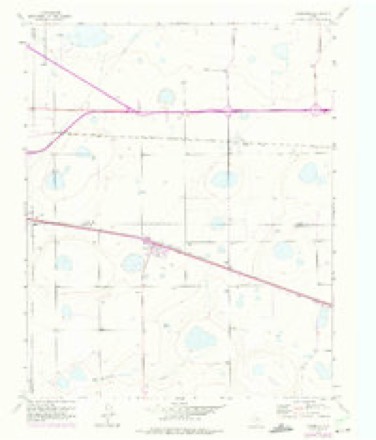
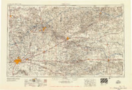
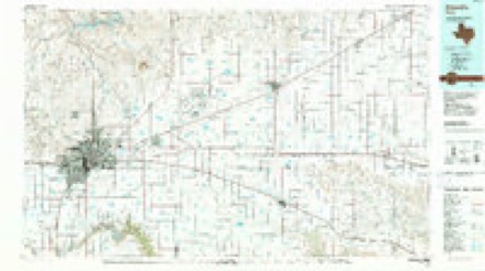
8 topographic sheets cover this place, the earliest surveyed in 1954 and the latest in 1986. It stands in the Claude North census division. It lies in ZIP code area 79019. The Survey maps it on the Washburn quadrangle. 116 people lived here at the 2020 count. It stands 3,530 feet above sea level.
Topographic sheets covering this place
4 surveys from 8 printed sheetsMatched by testing this settlement's coordinate against the published boundary of every sheet in the United States Geological Survey's historical collection. Each opens the scanned sheet at the Survey.
- 1954 USGS Amarillo quadrangle1:250000, 2 printings
- 1956 USGS Washburn quadrangle1:24000, 3 printings
- 1958 USGS Amarillo quadrangle1:250000
- 1986 USGS Amarillo quadrangle1:100000, 2 printings
Fires near this place
49 since 2004Regional context, not property-specific evidence. The federal wildfire occurrence database lists 49 fires within 5 miles of Washburn between 2004 and 2020, burning about 5,468 acres in total. 7 started naturally. 1 was recorded as arson. Distance is straight-line from the map coordinates, so a fire counted here may appear on a neighbouring settlement's page as well.
| Reported cause | Fires |
|---|---|
| Missing data/not specified/undetermined | 16 |
| Equipment and vehicle use | 12 |
| Natural | 7 |
| Debris and open burning | 4 |
| Power generation/transmission/distribution | 3 |
| Smoking | 3 |
| Railroad operations and maintenance | 2 |
| Recreation and ceremony | 1 |
| Arson/incendiarism | 1 |
The most recent of them, most recent first, with the day each was reported and the service that recorded it.
| Date | Cause | Size | Reported by | Name on the report |
|---|---|---|---|---|
| 23 August 2008 | Natural | 50 acres | Texas A & M Forest Service | not named |
| 22 August 2008 | Natural | 1.5 acres | Texas A & M Forest Service | not named |
| 1 August 2006 | Smoking | 5.0 acres | Texas A & M Forest Service | not named |
| 4 July 2018 | Missing data/not specified/undetermined | 1.0 acres | Texas A & M Forest Service | TA |
| 22 July 2006 | Smoking | 5.0 acres | Texas A & M Forest Service | not named |
| 14 July 2020 | Power generation/transmission/distribution | under an acre | Texas A & M Forest Service | FIRE |
| 11 July 2020 | Recreation and ceremony | 5.0 acres | Texas A & M Forest Service | FIRE |
| 9 June 2009 | Missing data/not specified/undetermined | under an acre | Texas A & M Forest Service | HWY 287 & WEST END OF TOWN |
Settlements close enough to share some of these fires:
Mines and quarries near this place
1 within 5 milesRegional context, not property-specific evidence. The federal mineral resources record lists 1 working within 5 miles of Washburn: 1 producer. All of them still produce. What was taken out: Sand and Gravel, Construction. Distance is straight-line from the map coordinates, so a quarry counted here may appear on a neighbouring settlement's page as well.
| Where | Site | Commodity | Status | Recorded |
|---|---|---|---|---|
| Box Canyon Pit | Sand and Gravel, Construction | Producer |
Storms near this place
56 since 1994Regional context, not property-specific evidence. The National Weather Service names Washburn in 56 storm reports between 1994 and 2025: 38 hail, 11 thunderstorm wind, 4 tornado, 2 flood. No death or injury is recorded in these reports. Each account below is quoted exactly as the forecast office filed it, from the NOAA Storm Events Database, and each date opens the federal record of that event.
| When | Event | Place named | Harm | What the report says |
|---|---|---|---|---|
| May 2013 | Thunderstorm Wind | Washburn | $500,000 | A decaying thunderstorm produced a localized downburst on US Highway 287 about 5 miles east of the Interstate 40 and US Highway 287 split (Armstrong County). A tractor trailer that was traveling on US Highway 287 was hit by this downburst and was blown over. No Injuries were relayed with this report from the Armstrong County Emergency Manager. |
| September 2025 | Thunderstorm Wind | Washburn | $40,000 | A truck and camper flipped over on US 287 a mile east of Washburn. |
| March 2021 | Tornado (EF0) | Washburn | $30,000 | Continuation from a tornado that started in Randall County. The supercell underwent another odd handoff from the Palo Duro Canyon tornado near Highway 1258 which was documented by storm chasers in the area. Again, both the initial and new developing tornado co-existed for a period of time creating a wide damage path Near County Road 1 in Armstrong County. This tornado path remained in very rural country with few damage indicators and was likely stronger than suggested by the very limited rating. Along the path the tornado snapped a few small diameter power poles and destroyed a couple out buildings. It also pushed over a semi before it dissipated just north of Highway 287. |
| March 2021 | Tornado (EF1) | Washburn | $20,000 | This is a continuation of a tornado that started in Randall County. After crossing Palo Duro Canyon and the county line, the tornado stayed in open county and did minimal damage. It performed another rapid and complicated tornado handoff to the Palo Duro Canyon to Washburn tornado very close to the county line near the intersection of 1258 and Goathead Road as a new circulation took over. |
| May 1998 | Thunderstorm Wind | Washburn | $15,000 | Two vehicles were blown off U.S. Highway 287 with one overturned. |
| June 2008 | Thunderstorm Wind | Washburn | $9,000 | The public reported that the thunderstorm wind gust lifted shingles off the roof of a home. |
| August 2007 | Thunderstorm Wind | Washburn | $9,000 | The roof was reported blown off of a barn with additional tree and shingle damage in the town of Washburn. No injuries were reported. |
| July 2021 | Thunderstorm Wind | Washburn | $5,000 | A roof was taken off of a front porch. Also a heavy duty swing-set was blown over and several tree limbs were blown down. |
| July 1999 | Thunderstorm Wind | Washburn | $5,000 | A storage building was blown over and large tree branches were downed. |
| June 1994 | Thunderstorm Wind | Washburn | $5,000 | no account filed |
| June 2008 | Hail | Washburn | $2,000 | The public reported that the large hail broke the windshield on a vehicle and also broke a window of a home. |
| April 2022 | Hail | Washburn | - | Multiple reports of 1 to 1.25 in diameter were received between 1918 CDT and 1926 CDT across portions of southwest Amarillo. Some of these reports came in from NWS employees and some came from the public. |
| June 2020 | Hail | Washburn | - | Quarter size hail fell 3 miles east-southeast of Washburn. |
| June 2019 | Thunderstorm Wind | Washburn | - | Late report from social media, of wooden structures being blown over and damaged. |
| May 2019 | Tornado (EF0) | Washburn | - | Chaser reported landspout with corresponding video. |
| September 2019 | Flood | Washburn | - | Unpaved roads across west central Armstrong county were reported to be difficult to impossible to travel on due to high water. Paved roads remained passable. |
| September 2019 | Flood | Washburn | - | Water covered parts of the road on Highway 1258 between County Road 3 and County Road 8. |
| May 2017 | Hail | Washburn | - | Late report. Half Dollar size hail reported. |
| August 2017 | Flash Flood | Washburn | - | Flooding has been reported on county road 2 and fm 1151. |
| May 2016 | Hail | Washburn | - | Quarter size hail was reported 8 miles west of Claude. |
| May 2016 | Hail | Washburn | - | Quarter size hail was reported in Washburn. |
| June 2014 | Hail | Washburn | - | A cluster of thunderstorms developed along a stalled frontal boundary during the early morning hours of the 6th. These thunderstorms quickly intensified while moving to the east. As the storms moved into Armstrong County, the County Emergency Manager reported half dollar size hail (1.25 inches) falling at FM 1151 (Armstrong County). After producing this hail the cluster of thunderstorms continued to move across the southern Texas Panhandle. |
| August 2014 | Hail | Washburn | - | Discrete thunderstorms developed across Armstrong County during the afternoon hours of the 8th. As these thunderstorms approached the town of Washburn (Armstrong County), a trained storm spotter reported golf ball size hail (1.75 inches). After producing this hail the storms continued to move to the northeast across the southern Texas Panhandle. |
| April 2010 | Hail | Washburn | - | Ham Radio Operator and trained spotter reported the hail near U.S. Highway 287 and Farm to Market Road 2373. |
| June 2007 | Hail | Washburn | - | Reported at County Road 1 and Farm to Market Road 1258. |
| October 2007 | Hail | Washburn | - | Reported seven miles east northeast of Palo Duro Canyon State Park. |
| June 2025 | Hail | Washburn | - | no account filed |
| March 2021 | Hail | Washburn | - | no account filed |
| June 2012 | Hail | Washburn | - | no account filed |
| June 2012 | Hail | Washburn | - | no account filed |
| June 2012 | Hail | Washburn | - | no account filed |
| June 2012 | Hail | Washburn | - | no account filed |
| June 2012 | Hail | Washburn | - | no account filed |
| November 2011 | Hail | Washburn | - | no account filed |
| June 2008 | Hail | Washburn | - | no account filed |
| June 2008 | Hail | Washburn | - | no account filed |
| June 2008 | Hail | Washburn | - | no account filed |
| April 2007 | Hail | Washburn | - | no account filed |
| June 2006 | Hail | Washburn | - | no account filed |
| August 2006 | Thunderstorm Wind | Washburn | - | no account filed |
| May 2005 | Hail | Washburn | - | no account filed |
| April 2004 | Hail | Washburn | - | no account filed |
| September 2002 | Hail | Washburn | - | no account filed |
| May 2002 | Hail | Washburn | - | no account filed |
| August 2001 | Hail | Washburn | - | no account filed |
| March 2000 | Thunderstorm Wind | Washburn | - | no account filed |
| May 1999 | Hail | Washburn | - | no account filed |
| June 1999 | Hail | Washburn | - | no account filed |
| July 1999 | Hail | Washburn | - | no account filed |
| May 1996 | Hail | Washburn | - | no account filed |
| May 1996 | Hail | Washburn | - | no account filed |
| May 1996 | Hail | Washburn | - | no account filed |
| May 1995 | Hail | Washburn | - | no account filed |
| June 1995 | Hail | Washburn | - | no account filed |
| July 1995 | Hail | Washburn | - | no account filed |
| July 1995 | Tornado (F1) | Washburn | - | no account filed |
Nearest settlements
The eight closest, with where each one stands in the county. Distances are straight-line, computed from the Geographic Names Information System coordinates.
Elsewhere
Matched on this settlement's Geographic Names Information System number rather than its name, so it cannot be a different place of the same name in another state.
| Wikipedia article on Washburn | An encyclopaedic summary. Its text is share-alike, so it is linked here rather than copied. |
| Wikidata item Q7971443 | The structured record the population and elevation above come from. Public domain (CC0). |
Provenance
This settlement is recorded in the Geographic Names Information System as feature 1370872. The sheet list is computed by point-in-boundary test against the United States Geological Survey's historical topographic inventory. Both are works of the United States government and carry no copyright under 17 U.S.C. 105.
Wildfire. Short, Karen C. 2022. Spatial wildfire occurrence data for the United States, 1992-2020 [FPA_FOD_20221014]. 6th Edition. Fort Collins, CO: Forest Service Research Data Archive. https://doi.org/10.2737/RDS-2013-0009.6 Collected with United States Government funding and usable without additional permissions or fees.
Mines and quarries. USGS Mineral Resources Data System (MRDS) https://mrdata.usgs.gov/mrds/ A work of the United States government, no copyright under 17 U.S.C. 105.
Storms. NOAA National Centers for Environmental Information, Storm Events Database https://www.ncei.noaa.gov/stormevents/ A work of the United States government, no copyright under 17 U.S.C. 105. Narratives are quoted verbatim from the National Weather Service report and are not edited or summarised.