 Block
BlockWharton, Texas
10 topographic sheets cover this place, the earliest surveyed in 1953 and the latest in 1994. It stands in the Wharton census division. It lies in ZIP code area 77488. The Survey maps it on the Wharton quadrangle. 8,627 people lived here at the 2020 count. It stands 102 feet above sea level.
Research this city
On record in Wharton
Buildings and businesses the archive holds for this place. Each opens its own page, with the source record it came from.
On the National Register 12 of 32 shown
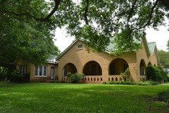 Willie Banker Jr. Houselisted 1993
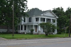 Bolton-Outlar Houselisted 1993
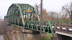 Colorado River Bridgelisted 1993
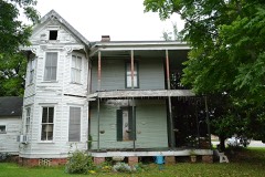 Wiley J. Croom Houselisted 1993
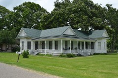 Dr. Green Davidson Houselisted 1993
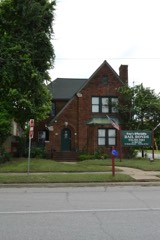 Ben and Mary Davis Houselisted 1993
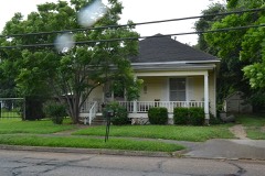 Nettie Elkins Houselisted 1993
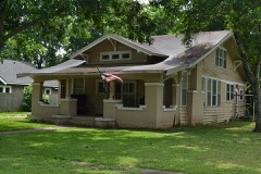 E. Clyde and Mary Elliott Houselisted 1993
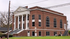 First Methodist Episcopal Church South, Oldlisted 1993
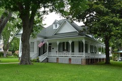 John A. and Sophie Garrett Houselisted 1993
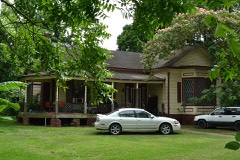 George C. and Annie Gifford Houselisted 1993
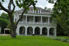 Joseph Andrew Hamilton Houselisted 1993
Population over time
2 figuresWharton fell from 8,832 to 8,627 between 2010 and 2020. These are the recorded population figures Wikidata holds for this place, reached through the Geographic Names Information System number this page is keyed on rather than by name, so they belong to this place and not to another of the same name. Most are census counts, but not all are: an early figure may be a founding or settlement estimate, and an estimate published within five years of a census is left out. The change column is computed, and is left blank where more than 20 years separate a figure from the one before it, because a gap that long is not a change between two counts.
| Year | People | Change |
|---|---|---|
| 2010 | 8,832 | |
| 2020 | 8,627 | -205 (-2%) |
Topographic sheets covering this place
4 surveys from 10 printed sheetsMatched by testing this settlement's coordinate against the published boundary of every sheet in the United States Geological Survey's historical collection. Each opens the scanned sheet at the Survey.
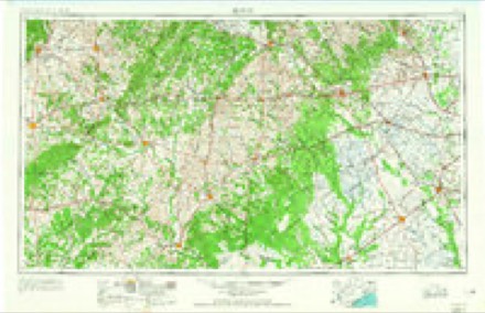
- 1953 USGS Seguin quadrangle1:250000, 4 printings
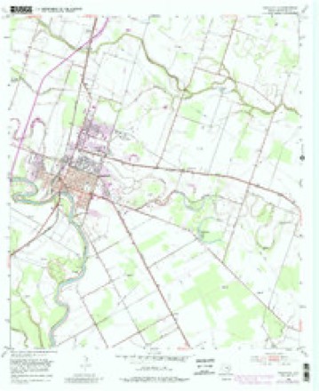
- 1953 USGS Wharton quadrangle1:24000, 4 printings
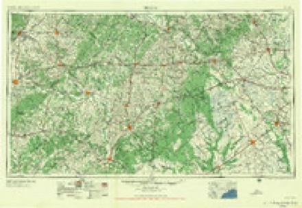
- 1958 USGS Seguin quadrangle1:250000
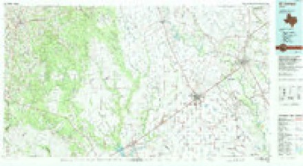
- 1994 USGS El Campo quadrangle1:100000
Storms near this place
59 since 1996Regional context, not property-specific evidence. The National Weather Service names Wharton in 59 storm reports between 1996 and 2015: 21 thunderstorm wind, 20 hail, 7 flash flood, 7 tornado. The reports record 6 injuries. Each account below is quoted exactly as the forecast office filed it, from the NOAA Storm Events Database, and each date opens the federal record of that event.
| When | Event | Place named | Harm | What the report says |
|---|---|---|---|---|
| June 2004 | Tornado (F1) | Wharton | 6 hurt, $300,000 | Tornado formed just outside city limits and caused damage to shopping center roof, several homes, and overturned a pump house as it entered Wharton. A mobile home was flipped over, damage occurred to several out houses, and vehicles. Numerous trees and power lines were knocked down. Overall, six minor injuries were reported, mainly from flying glass. |
| June 2004 | Tornado (F1) | Wharton | $100,000 | Second tornado that traveled east of, and nearly parallel to, the first tornado through Wharton. Several 3 to 4 foot diameter trees were snapped in half with power lines knocked down. |
| September 2002 | Flash Flood | Wharton | $95,000 | Water in homes in Wharton. |
| June 2004 | Flash Flood | Wharton | $70,000 | Flooding in and around Wharton with several rescues made from flooded homes. |
| March 2002 | Tornado (F0) | Wharton | $50,000 | A Tornado touchdown damaged a trailer on Nelson Road and Texas Highway 102, reported by Emergency management. |
| December 2002 | Thunderstorm Wind | Wharton | $35,000 | Roof blown off a business. |
| December 2002 | Thunderstorm Wind | Wharton | $35,000 | Roof damage, trees down and light poles down in and around Wharton. |
| November 2004 | Tornado (F0) | Wharton | $25,000 | Four homes were damaged in the Spanish Camp area near the intersection of FM 1161 and FM 640. |
| August 2000 | Thunderstorm Wind | Wharton | $25,000 | Metal building blown 70 feet with large tree down. |
| August 1998 | Thunderstorm Wind | Wharton | $25,000 | Trees blown down (some on houses) in Wharton and in Hungerford. |
| April 2004 | Hail | Wharton | $20,000 | Quarter-size hail in Wharton. |
| April 1997 | Tornado (F0) | Wharton | $20,000 | no account filed |
| June 1996 | Thunderstorm Wind | Wharton | $20,000 | no account filed |
| May 2011 | Thunderstorm Wind | Wharton | $15,000 | Numerous branches, trees and power lines down scattered over large area, mainly north of 59. Fourteen thousand homes were left without power. |
| June 2006 | Hail | Wharton | $15,000 | Golfball-size hail on County Road 120. |
| June 2004 | Flash Flood | Wharton | $15,000 | Flooded roads in and around Wharton. |
| November 2003 | Flash Flood | Wharton | $15,000 | Flooding in and around the town of Wharton. |
| October 2003 | Tornado (F0) | Wharton | $15,000 | Roof damage along with two uprooted gas pumps at convenience store. |
| November 2000 | Thunderstorm Wind | Wharton | $15,000 | Trees down on CR 226. |
| November 2000 | Thunderstorm Wind | Wharton | $15,000 | Trees down on Alabama Road near CR 129. |
| September 1997 | Hail | Wharton | $15,000 | Severe roof and car damage. |
| April 1997 | Flash Flood | Wharton | $15,000 | no account filed |
| December 2002 | Thunderstorm Wind | Wharton | $12,000 | Some power lines down and a roof blown off a barn on Chudalla Road. |
| June 2010 | Thunderstorm Wind | Wharton | $10,000 | Several trees were reported downed along with damage to a telephone pole. |
| August 2004 | Thunderstorm Wind | Wharton | $10,000 | Power lines down. |
| April 1997 | Hail | Wharton | $10,000 | no account filed |
| June 2008 | Hail | Wharton | $9,000 | Penny to quarter size hail was observed in Wharton and lasted for approximately twenty minutes. |
| March 2003 | Hail | Wharton | $9,000 | no account filed |
| March 2005 | Thunderstorm Wind | Wharton | $8,000 | Local newspaper reported a light pole and a couple of power lines downed. |
| October 2002 | Flash Flood | Wharton | $7,000 | Six streets closed and eight others with very high water in Wharton and El Campo. |
| February 1998 | Thunderstorm Wind | Wharton | $7,000 | Trees and powerpoles blown down near the country club. |
| March 2003 | Hail | Wharton | $6,000 | no account filed |
| March 2003 | Hail | Wharton | $6,000 | no account filed |
| February 2011 | Thunderstorm Wind | Wharton | $5,000 | Downed trees blocked roadways at the intersection of Avenue A and Texas, Cornell and Elm, and in the 800 block of North Alabama in the city of Wharton. |
| March 2007 | Thunderstorm Wind | Wharton | $5,000 | Tree down on a home. |
| June 2006 | Hail | Wharton | $5,000 | Penny-size hail. |
| March 2005 | Hail | Wharton | $5,000 | Reported at the sheriff's office. |
| April 1997 | Hail | Wharton | $5,000 | no account filed |
| April 1997 | Hail | Wharton | $5,000 | no account filed |
| May 1996 | Hail | Wharton | $5,000 | no account filed |
| May 1996 | Thunderstorm Wind | Wharton | $5,000 | no account filed |
| September 1996 | Thunderstorm Wind | Wharton | $5,000 | no account filed |
| March 2008 | Hail | Wharton | $3,000 | Golfball size hail was observed in the town of Wharton. |
| April 2006 | Thunderstorm Wind | Wharton | $3,000 | Tree down on the Highway 59 bridge over the Colorado River. |
| September 1997 | Hail | Wharton | $3,000 | no account filed |
| June 2008 | Thunderstorm Wind | Wharton | $2,000 | Thunderstorm winds downed tree limbs and power lines throughout the city of Wharton. Several streets and highways, including U.S. 59 southbound at the Colorado bridge, were blocked. |
| October 2006 | Thunderstorm Wind | Wharton | $2,000 | Strong wind gusts knocked down two power lines. |
| October 1998 | Flash Flood | Wharton | $2,000 | Minor street flooding in Wharton. |
| September 1997 | Hail | Wharton | $2,000 | no account filed |
| March 2007 | Hail | Wharton | $1,000 | Nickel-size hail. |
| April 2015 | Hail | Wharton | - | Nickel sized hail was reported in the Wharton area. |
| September 2014 | Funnel Cloud | Wharton | - | Two funnel clouds were sighted over the west side of the city of Wharton. |
| May 2014 | Funnel Cloud | Wharton | - | A funnel cloud was reported between the towns of Wharton and Pierce. |
| April 2013 | Hail | Wharton | - | A severe thunderstorm produced quarter sized hail. |
| April 2013 | Hail | Wharton | - | A severe thunderstorm produced quarter to golf ball sized hail. |
| June 2007 | Thunderstorm Wind | Wharton | - | Trees downed. |
| June 2004 | Funnel Cloud | Wharton | - | Funnel cloud sighted at Highway 60 and FM 1299. |
| November 2003 | Tornado (F0) | Wharton | - | Tornado reported touching down near Highway 59 and Colorado River. |
| June 2004 | Funnel Cloud | Wharton | - | no account filed |
Nearest settlements
The eight closest, with where each one stands in the county. Distances are straight-line, computed from the Geographic Names Information System coordinates.
| Map | Place | Distance | Sheets |
|---|---|---|---|
| Dinsmore | 2.8 miles | 10 | |
| Sorrelle | 3.6 miles | 9 | |
| Mackay | 3.8 miles | 9 | |
| Lefman | 4.2 miles | 10 | |
| Burr | 5.1 miles | 10 | |
| Glen Flora | 5.4 miles | 9 | |
| Hungerford | 6.2 miles | 8 | |
| Pierce | 7.2 miles | 8 |
Elsewhere
Matched on this settlement's Geographic Names Information System number rather than its name, so it cannot be a different place of the same name in another state.
| Wikipedia article on Wharton | An encyclopaedic summary. Its text is share-alike, so it is linked here rather than copied. |
| Wikidata item Q970540 | The structured record the population and elevation above come from. Public domain (CC0). |
Provenance
This settlement is recorded in the Geographic Names Information System as feature 1371316. The sheet list is computed by point-in-boundary test against the United States Geological Survey's historical topographic inventory. Both are works of the United States government and carry no copyright under 17 U.S.C. 105.
Storms. NOAA National Centers for Environmental Information, Storm Events Database https://www.ncei.noaa.gov/stormevents/ A work of the United States government, no copyright under 17 U.S.C. 105. Narratives are quoted verbatim from the National Weather Service report and are not edited or summarised.