 Block
Sugar House, Utah
25 topographic sheets cover this place, the earliest surveyed in 1885 and the latest in 1998. It stands in the Salt Lake City census division. It lies in ZIP code area 84105. It stands on Emigration Creek. The Survey maps it on the Sugar House quadrangle.
On record in Sugar House
Buildings and businesses the archive holds for this place. Each opens its own page, with the source record it came from.
On the National Register within a mile 12 of 40 shown
The National Register names another town for these. They stand within one mile of this settlement's coordinate.
 Richardson-Bower Buildinglisted 2003 · 0.2 miles away
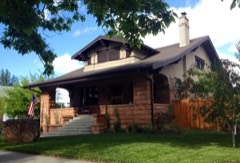 Booth-Parsons Houselisted 2012 · 0.2 miles away
 Mountain States Telephone and Telegraph Co. Garagelisted 1998 · 0.3 miles away
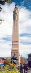 Sugar House Monumentlisted 2003 · 0.3 miles away
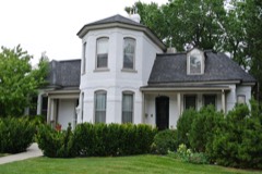 John M. Whitaker Houselisted 1978 · 0.3 miles away
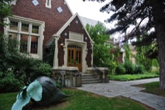 Sprague Branch of the Salt Lake City Public Librarylisted 2003 · 0.3 miles away
 Crown Cleaning and Dyeing Company Buildinglisted 2003 · 0.3 miles away
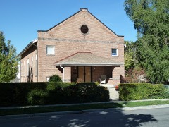 Seventh-day Adventist Meetinghouse and Schoollisted 2007 · 0.3 miles away
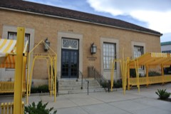 US Post Office-Sugar Houselisted 1994 · 0.3 miles away
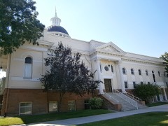 Forest Dale Historic Districtlisted 2009 · 0.3 miles away
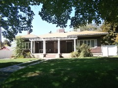 Genevieve & Alexander Curtis Houselisted 2010 · 0.4 miles away
 Irving Junior High Schoollisted 1978 · 0.4 miles away
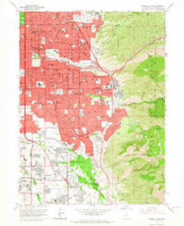
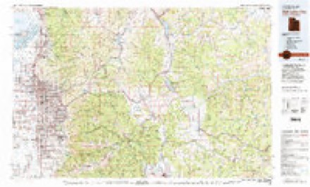
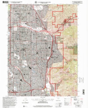
Topographic sheets covering this place
10 surveys from 25 printed sheetsMatched by testing this settlement's coordinate against the published boundary of every sheet in the United States Geological Survey's historical collection. Each opens the scanned sheet at the Survey.
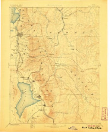
- 1885 USGS Salt Lake quadrangle1:250000, 7 printings
- 1925 USGS Ft. Douglas quadrangle1:125000
- 1928 USGS Ft. Douglas quadrangle1:125000, 2 printings
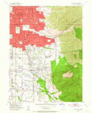
- 1952 USGS Sugar House quadrangle1:24000, 2 printings
- 1954 USGS Salt Lake City quadrangle1:250000, 4 printings
- 1958 USGS Salt Lake City quadrangle1:250000
- 1960 USGS Salt Lake City quadrangle1:250000
- 1963 USGS Sugar House quadrangle1:24000, 3 printings
- 1980 USGS Salt Lake City quadrangle1:100000, 3 printings
- 1998 USGS Sugar House quadrangle1:24000
Fires near this place
33 since 1992Regional context, not property-specific evidence. The federal wildfire occurrence database lists 33 fires within 5 miles of Sugar House between 1992 and 2020, burning about 647 acres in total. 5 started naturally. 1 was recorded as arson. Distance is straight-line from the map coordinates, so a fire counted here may appear on a neighbouring settlement's page as well.
| Reported cause | Fires |
|---|---|
| Missing data/not specified/undetermined | 15 |
| Natural | 5 |
| Fireworks | 4 |
| Recreation and ceremony | 4 |
| Power generation/transmission/distribution | 2 |
| Misuse of fire by a minor | 1 |
| Other causes | 1 |
| Arson/incendiarism | 1 |
The most recent of them, most recent first, with the day each was reported and the service that recorded it.
| Date | Cause | Size | Reported by | Name on the report |
|---|---|---|---|---|
| 6 September 2007 | Missing data/not specified/undetermined | 2.0 acres | Salt Lake Field Office | DEVONSHIRE 2 |
| 16 September 2002 | Natural | under an acre | Utah Division Forestry Fire State Lands | BOX ELDER |
| 14 September 2020 | Recreation and ceremony | 35 acres | Utah Division Forestry Fire State Lands | CONNECTICUT |
| 10 September 1997 | Natural | 15 acres | Uinta-Wasatch-Cache National Forest | OLYMPUS |
| 6 August 2016 | Missing data/not specified/undetermined | 5.0 acres | Utah Division Forestry Fire State Lands | ENSIGN INCORPORATED |
| 6 August 2005 | Missing data/not specified/undetermined | under an acre | Uinta-Wasatch-Cache National Forest | GEORGE'S |
| 24 August 2000 | Natural | under an acre | Utah Division Forestry Fire State Lands | LENORA FORCE |
| 22 August 2000 | Missing data/not specified/undetermined | 3.0 acres | Utah Division Forestry Fire State Lands | MM 24 |
Settlements close enough to share some of these fires:
Mines and quarries near this place
10 of 45 shownRegional context, not property-specific evidence. The federal mineral resources record lists 45 workings within 5 miles of Sugar House: 23 past producers, 18 producers, 3 occurrences, 1 unknown. 18 still produce. What was taken out: Lead, Gold, Iron, Silver. Distance is straight-line from the map coordinates, so a quarry counted here may appear on a neighbouring settlement's page as well.
| Where | Site | Commodity | Status | Recorded |
|---|---|---|---|---|
| Alta Champion | Silver, Lead, Gold, Bismuth | Producer | Vein | |
| Canyon Rim Quarries | Limestone, General, Clay, Cement Rock | Past Producer | Calcite | |
| Dry Fork Mine | Silver, Copper, Zinc, Lead, Iron | Past Producer | Chalcopyrite, Galena, Pyrite, Sphalerite | |
| Fort Douglas Sandstone Quarry | Stone, Dimension | Past Producer | Quartzite | |
| Intermountain Smelting Corp | Antimony | Producer | ||
| Midvale Minerals Co. | Zinc, Silver, Lead, Arsenic | Producer | ||
| National Tunnel and Mines Co. | Lead, Zinc, Gold | Past Producer | ||
| New England | Silver, Zinc, Lead | Past Producer | ||
| New York & Great Western Mining, Smelting, and Development Company | Zinc, Lead | Past Producer | ||
| Onyx Ranch | Gemstone | Producer | Onyx |
Storms near this place
17 since 1997Regional context, not property-specific evidence. The National Weather Service names Sugar House in 17 storm reports between 1997 and 2025: 13 thunderstorm wind, 2 flood, 1 tornado, 1 debris flow. The reports record 1 injury. Each account below is quoted exactly as the forecast office filed it, from the NOAA Storm Events Database, and each date opens the federal record of that event.
| When | Event | Place named | Harm | What the report says |
|---|---|---|---|---|
| April 2023 | Debris Flow | Sugar House | 1 hurt, $50,000 | The eastbound lanes of Interstate 80 were closed in Parleys Canyon for around two hours in the morning near the Emigration Canyon exit due to a mudslide. The slide led to two single-vehicle crashes. One person received minor injuries in one of the crashes. |
| June 1997 | Flood | Sugar House | $10,000 | Heavy rain fell in this 40 minute time span in the Sugar House area. Street flooding caused a low portion of Interstate-80 near 1300 East to temporarily close. Other minor street flooding occurred in the area. A spotter in Sugar House measured 1.24" of rain in this 40 minute time span. |
| May 2025 | Thunderstorm Wind | Sugar House | - | The SR-65 at Big Mountain Pass mesonet station recorded a wind gust of 63 mph as a result of outflow winds associated with a nearby cluster of showers and thunderstorms moving through the area. |
| September 2024 | Thunderstorm Wind | Sugar House | - | The SR-65 at Big Mountain Pass mesonet station recorded a wind gust of 60 mph as a result of outflow winds associated with a nearby cluster of showers and thunderstorms moving through the area. |
| August 2023 | Thunderstorm Wind | Sugar House | - | Mesonet station PC022 at Mount Aire Canyon recorded a wind gust of 59 mph. |
| September 2023 | Thunderstorm Wind | Sugar House | - | The Parleys Canyon @ Quarry mesonet station recorded a wind gust of 70 mph as a result of outflow winds associated with a nearby cluster of showers and thunderstorms moving through the area. |
| September 2023 | Thunderstorm Wind | Sugar House | - | The Mount Aire Canyon mesonet station recorded a wind gust of 60 mph as a result of outflow winds associated with a nearby cluster of showers and thunderstorms moving through the area. |
| May 2022 | Thunderstorm Wind | Sugar House | - | The Mount Aire Canyon automated weather station recorded a peak wind gust of 60 mph. |
| July 2022 | Thunderstorm Wind | Sugar House | - | The PacifiCorp Mount Aire Canyon mesonet site measured a wind gust of 58 mph at 5:30 pm MST as a result of strong outflow from nearby convection. |
| September 2022 | Thunderstorm Wind | Sugar House | - | The SR-65 at Big Mountain Pass weather station recorded a wind gust of 58 mph as a result of outflow winds associated with a nearby cluster of showers and thunderstorms moving through the area. |
| June 2022 | Thunderstorm Wind | Sugar House | - | A peak wind gust of 61 mph was recorded by the Parley's Canyon at Quarry mesonet station. |
| June 2022 | Thunderstorm Wind | Sugar House | - | The Mount Aire Canyon mesonet station recorded a peak wind gust of 60 mph. |
| August 2021 | Thunderstorm Wind | Sugar House | - | The Parley's Canyon at Quarry automated weather station recorded a peak wind gust of 58 mph. |
| June 2020 | Thunderstorm Wind | Sugar House | - | The Sugarhouse 2 E sensor recorded a peak wind gust of 62 mph. |
| April 2010 | Thunderstorm Wind | Sugar House | - | The Parleys Canyon sensor recorded a wind gust of 59 mph. |
| August 2001 | Tornado (F0) | Sugar House | - | A small tornado briefly touched down in the Sugarhouse area of Salt Lake City. Other reports of the storm indicated a funnel cloud and strong thunderstorm winds. No damage or injuries were reported. |
| September 1997 | Flood | Sugar House | - | no account filed |
Nearest settlements
The eight closest, with where each one stands in the county. Distances are straight-line, computed from the Geographic Names Information System coordinates.
| Map | Place | Distance | Sheets |
|---|---|---|---|
| South Salt Lake | 1.3 miles | 25 | |
| Foothill Village | 2.1 miles | 25 | |
| Granite | 2.2 miles | 25 | |
| Roper | 2.4 miles | 25 | |
| University Village | 2.5 miles | 27 | |
| Canyon Rim | 2.7 miles | 25 | |
| Millcreek | 2.7 miles | 25 | |
| Salt Lake City | 2.8 miles | 27 |
Provenance
This settlement is recorded in the Geographic Names Information System as feature 1446208. The sheet list is computed by point-in-boundary test against the United States Geological Survey's historical topographic inventory. Both are works of the United States government and carry no copyright under 17 U.S.C. 105.
Wildfire. Short, Karen C. 2022. Spatial wildfire occurrence data for the United States, 1992-2020 [FPA_FOD_20221014]. 6th Edition. Fort Collins, CO: Forest Service Research Data Archive. https://doi.org/10.2737/RDS-2013-0009.6 Collected with United States Government funding and usable without additional permissions or fees.
Mines and quarries. USGS Mineral Resources Data System (MRDS) https://mrdata.usgs.gov/mrds/ A work of the United States government, no copyright under 17 U.S.C. 105.
Storms. NOAA National Centers for Environmental Information, Storm Events Database https://www.ncei.noaa.gov/stormevents/ A work of the United States government, no copyright under 17 U.S.C. 105. Narratives are quoted verbatim from the National Weather Service report and are not edited or summarised.