 Block
Zion Lodge, Utah
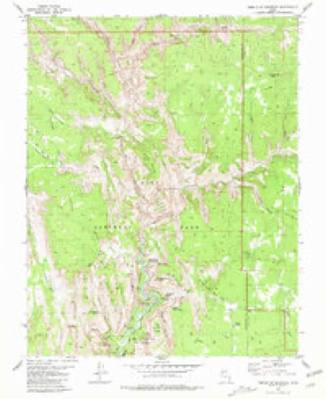
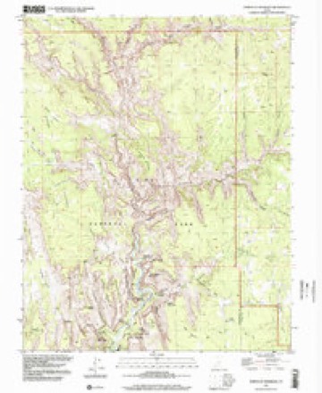
16 topographic sheets cover this place, the earliest surveyed in 1886 and the latest in 1997. It stands in the Hurricane census division. It lies in ZIP code area 84767. It lies near Heaps Canyon. The Survey maps it on the Temple of Sinawava quadrangle.
Research this city
On record in Zion Lodge
Buildings and businesses the archive holds for this place. Each opens its own page, with the source record it came from.
On the National Register within a mile 7 records
The National Register names another town for these. They stand within one mile of this settlement's coordinate.
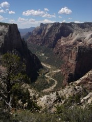 Floor of the Valley Roadlisted 1996 · 0.1 miles away
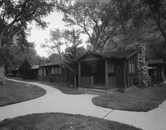 Zion Lodge Historic Districtlisted 1982 · 0.1 miles away
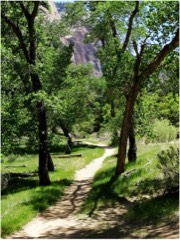 Grotto Traillisted 1996 · 0.1 miles away
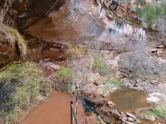 Emerald Pools Traillisted 1987 · 0.1 miles away
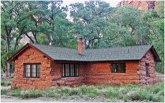 Museum-Grotto Residencelisted 1987 · 0.5 miles away
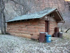 Grotto Camping Ground North Comfort Stationlisted 1987 · 0.9 miles away
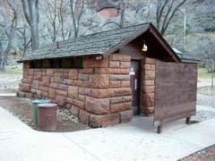 Grotto Camping Ground South Comfort Stationlisted 1987 · 1.0 miles away
Topographic sheets covering this place
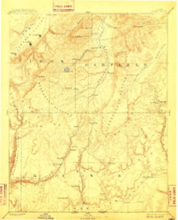
7 surveys from 16 printed sheetsMatched by testing this settlement's coordinate against the published boundary of every sheet in the United States Geological Survey's historical collection. Each opens the scanned sheet at the Survey.
- 1886 USGS Kanab quadrangle1:250000, 5 printings
- 1953 USGS Cedar City quadrangle1:250000, 3 printings
- 1958 USGS Cedar City quadrangle1:250000, 2 printings
- 1962 USGS Cedar City quadrangle1:250000
- 1980 USGS Kanab quadrangle1:100000
- 1980 USGS Temple of Sinawava quadrangle1:24000, 3 printings
- 1997 USGS Temple of Sinawava quadrangle1:24000
Photographs
1 photograph,Taken for the Office of War Information and the Farm Security Administration, who photographed the country between 1935 and 1944. Works of United States government photographers, with no known restriction on use. Each opens its catalogue record.
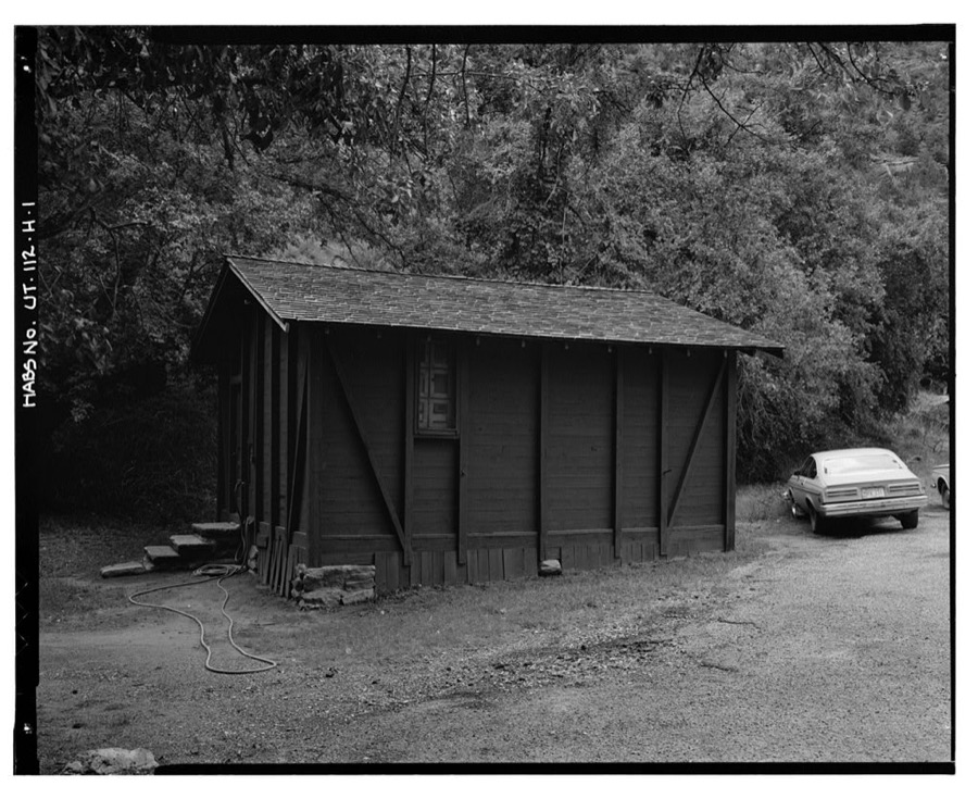
Photographer not recorded. Library of Congress
Fires near this place
213 since 1992Regional context, not property-specific evidence. The federal wildfire occurrence database lists 213 fires within 5 miles of Zion Lodge between 1992 and 2020, burning about 995 acres in total. 132 started naturally. 6 were recorded as arson. Distance is straight-line from the map coordinates, so a fire counted here may appear on a neighbouring settlement's page as well.
| Reported cause | Fires |
|---|---|
| Natural | 132 |
| Recreation and ceremony | 32 |
| Missing data/not specified/undetermined | 15 |
| Equipment and vehicle use | 6 |
| Debris and open burning | 6 |
| Smoking | 6 |
| Arson/incendiarism | 6 |
| Fireworks | 5 |
| Misuse of fire by a minor | 3 |
| Power generation/transmission/distribution | 1 |
| Other causes | 1 |
The most recent of them, most recent first, with the day each was reported and the service that recorded it.
| Date | Cause | Size | Reported by | Name on the report |
|---|---|---|---|---|
| 9 September 2011 | Natural | under an acre | Utah Division Forestry Fire State Lands | JOLLEY |
| 8 September 1997 | Natural | under an acre | Zion National Park | MOKI |
| 6 September 1995 | Natural | under an acre | Zion National Park | TIN ROOF |
| 5 September 1995 | Natural | under an acre | Zion National Park | OAK CREEK |
| 3 September 2011 | Natural | 196 acres | Zion National Park | HERBS |
| 3 September 2006 | Natural | under an acre | Zion National Park | COUNTY FIRE |
| 3 September 2006 | Natural | under an acre | Zion National Park | WYLIE |
| 3 September 1995 | Recreation and ceremony | under an acre | Zion National Park | NEIGHBOR |
Settlements close enough to share some of these fires:
Storms near this place
54 since 2007Regional context, not property-specific evidence. The National Weather Service names Zion Lodge in 54 storm reports between 2007 and 2025: 52 flash flood, 1 heavy rain, 1 thunderstorm wind. The reports record 8 deaths and 1 injury. Each account below is quoted exactly as the forecast office filed it, from the NOAA Storm Events Database, and each date opens the federal record of that event.
| When | Event | Place named | Harm | What the report says |
|---|---|---|---|---|
| September 2015 | Flash Flood | Zion Lodge | 7 killed | Multiple rounds of heavy rainfall brought flash flooding to Zion National Park, including along North Creek, but the most notable flood occurred in Keyhole Canyon. A group of seven people entered Keyhole Canyon in the early afternoon, planning to travel through the small but popular canyoneering route. Flooding in Keyhole Canyon occurred quickly; no one in the group was able to escape the canyon or get to higher ground, and the flood killed all seven individuals. The seven victims were between 51 and 59 years old. |
| August 2022 | Flash Flood | Zion Lodge | 1 killed, 1 hurt | Flows increased on the North Fork of the Virgin River in Zion National Park. The trail became impassable near the mouth of The Narrows. Flood waters in The Narrows swept some hikers off their feet and isolated others on higher ground. Two people were swept downstream. One was swept a couple of hundred yards and found. The individual survived with minor injuries. The other was reported as missing to Zion National Park officials later that evening, and was found deceased the following Monday. The North Fork Virgin - Springdale river gauge, which is downstream from The Narrows, rose from approximately 75 cfs to 735 cfs, corresponding to a rise of slightly over 2 feet in height. |
| September 2014 | Flash Flood | Zion Lodge | $350,000 | Flash flooding was widespread across Washington county, including flooding reported in the cities of St. George, Washington, and Ivins. The most common flooding occurred in washes and city streets, with several areas experiencing over a foot of water flowing through the streets. Approximately 15 homes were flooded in the St. George area, and a few homes were damaged in Ivins. Flooding also damaged parts of the Southgate Golf Course in St. George. Many parts of Zion National Park experienced flooding, and the park actually shut down for part of the day when mud, debris, and a large boulder slid onto State Route 9, blocking traffic. The North Fork of the Virgin River rose to 4,790 cfs, the 7th highest recorded flow in the river in the last 100 years. |
| July 2021 | Thunderstorm Wind | Zion Lodge | $5,000 | Zion National Park officials reported a tree fell on a building. |
| August 2021 | Flash Flood | Zion Lodge | $3,000 | Zion National Park dispatch officials reported a rockslide due to excessive rainfall along the Scenic Drive north of the Visitor Center. A portion of the road was damaged due to the slide, and was closed as a result. In addition, the river gauge on the North Fork of the Virgin River near Springdale had a sharp rise and peaked at 1690 CFS, corresponding to a rise of over 3 feet. |
| August 2025 | Flash Flood | Zion Lodge | - | Zion National Park reported flash flooding in the main canyon, including Clear Creek. |
| July 2025 | Flash Flood | Zion Lodge | - | Zion NP rangers reported flash flooding of Keyhole slot canyon along with other waterfalls coming developing along other eastern park slot canyons. Time is estimated. |
| August 2025 | Flash Flood | Zion Lodge | - | Flash flooding was reported in Zion Canyon with muddy debris across the road. The East Fork of the Virgin River rose approximately 1.5 feet. |
| August 2025 | Flash Flood | Zion Lodge | - | The East Fork of the Virgin River recorded a flood wave of 510 cfs. A flash flood of 1290 cfs was recorded on the North Fork of the Virgin River gauge. |
| October 2025 | Flash Flood | Zion Lodge | - | A flood wave of 1220 cfs was recorded on the East Fork of the Virgin River. A 450 cfs flood wave was recorded on the North Fork of the Virgin River. |
| August 2024 | Flash Flood | Zion Lodge | - | Park rangers reported that multiple canyons near the Observation Point area had flash flooding. Time is estimated. |
| September 2023 | Flash Flood | Zion Lodge | - | Zion National Park Rangers reported waterfalls occurring along streaked wall as you enter the Scenic Drive. |
| August 2023 | Flash Flood | Zion Lodge | - | Zion National Park reported flash flooding at Refrigerator and Echo Canyons. |
| August 2023 | Flash Flood | Zion Lodge | - | Zion National Park reported multiple waterfalls through southern portion of the park, the biggest of which was noted near Twin Brothers. |
| August 2023 | Flash Flood | Zion Lodge | - | Zion National Park reported flash flooding near Twin Brothers Mountain, just north of SR-9. |
| September 2022 | Flash Flood | Zion Lodge | - | Zion National Park officials reported that normally dry washes near Canyon Junction were seeing flash flooding, that there were waterfalls on both sides of Zion Canyon, and that the campground had minor flooding. A thunderstorm which moved through produced an estimated 0.25 to 0.75 inches of rainfall per Multi-Radar/Multi-Sensor 1-hour analysis. |
| August 2022 | Flash Flood | Zion Lodge | - | Flash flooding was reported in Clear Creek within Zion National Park. |
| August 2022 | Flash Flood | Zion Lodge | - | Flash flooding was reported in the vicinity of The Narrows in Zion National Park. |
| September 2022 | Flash Flood | Zion Lodge | - | Moderate to heavy rain fell across Zion National Park and surrounding areas, with 3-hour Multi-Radar/Multi-Sensor rainfall estimates of around 0.50 inches. As a result, the North Fork Virgin at Springdale river gauge recorded a rapid rise in stage from around 50 CFS to over 1200 CFS in under 2 hours. Additionally, park rangers at Zion National Park reported flooding in many slot canyons in the park, as well as several observed waterfalls. |
| August 2022 | Flash Flood | Zion Lodge | - | Flash flooding was reported along Pine Creek within Zion National Park. |
| June 2022 | Flash Flood | Zion Lodge | - | Flash flooding occurred in Spry and Pine Creek Canyons in Zion National Park. |
| August 2022 | Flash Flood | Zion Lodge | - | High flows were reported in the Clear Creek drainage in the southeastern portion of Zion National Park. |
| August 2022 | Flash Flood | Zion Lodge | - | A flash flood was observed in the Pine Creek Slot Canyon due to earlier heavy rain upstream on Clear Creek. |
| August 2022 | Flash Flood | Zion Lodge | - | Flash flooding was reported in Clear Creek, Pine Creek, and Spry Canyon in Zion National Park. |
| August 2022 | Flash Flood | Zion Lodge | - | Flash flooding was reported in Isaac Canyon near Court of the Patriarchs. |
| July 2021 | Flash Flood | Zion Lodge | - | Zion National Park officials reported flash flooding in both the main canyon and in tributaries feeding the canyon from the east. |
| August 2021 | Flash Flood | Zion Lodge | - | The North Fork of the Virgin River near Springdale spiked from 26 CFS to 1560 CFS in just 15 minutes, corresponding to a rise of 4 feet. |
| September 2021 | Flash Flood | Zion Lodge | - | Zion National Park rangers reported flash flooding in slot canyons between Temple of the Sun and Twins. |
| October 2021 | Flash Flood | Zion Lodge | - | A Zion National Park official reported that Pine Creek experienced a flash flood. |
| November 2019 | Flash Flood | Zion Lodge | - | Flash flooding occurred in the Pine Creek and Clear Creek sections of Zion National Park. |
| August 2018 | Flash Flood | Zion Lodge | - | Heavy rain caused flash flooding at Echo Canyon and some smaller canyons east of Zion National Park. |
| August 2017 | Flash Flood | Zion Lodge | - | Heavy rain led to flash flooding across the southern half of Zion National Park, including along Pine Creek. In addition, street flooding was reported in the towns of Springdale and Rockville. |
| August 2016 | Flash Flood | Zion Lodge | - | Park rangers in Zion National Park reported flash flooding in multiple locations, including near the Temple of Sinawava and in the Narrows. Several hikers were temporarily stranded in the Narrows until flood waters receded. The North Fork of the Virgin River rose from 53 cfs to 787 cfs due to the heavy rains. |
| August 2016 | Flash Flood | Zion Lodge | - | Flash flooding was reported along Lick Wash and Willis Creek. |
| August 2016 | Flash Flood | Zion Lodge | - | Flash flooding occurred along the North Fork of the Virgin, which peaked at 1480 cfs. |
| April 2015 | Flash Flood | Zion Lodge | - | Flash flooding occurred in Zion National Park, particularly along Pine Creek. In addition, many waterfalls were reported across the park. |
| September 2014 | Flash Flood | Zion Lodge | - | Flash flooding was reported in Echo Canyon in Zion National Park. |
| September 2014 | Flash Flood | Zion Lodge | - | Flash flooding occurred in several drainages in Zion National Park, including Behunin Canyon, Heaps Canyon, and several other canyons in the park. In addition, waterfalls were reported over most of the western end of the park. |
| July 2014 | Flash Flood | Zion Lodge | - | Flash flooding occurred primarily in Pine Creek in Zion National Park. Flows rose to 500 cfs, and the national park recorded the flood on video. |
| July 2014 | Flash Flood | Zion Lodge | - | Heavy rain caused flash flooding in Zion National Park. Several waterfalls were reported across the park, and flash floods were observed in Birch Creek and multiple other drainages across the southern end of the park. |
| July 2013 | Flash Flood | Zion Lodge | - | Flash flooding was reported in Zion National Park, including in the Subway and all of the headwaters of North Creek. |
| September 2013 | Flash Flood | Zion Lodge | - | Flash flooding and large waterfalls were reported throughout much of Zion National Park. In addition, the East Fork Virgin River Near Springdale, UT gauge rose from 34 cfs to 1400 cfs in one hour. |
| September 2012 | Flash Flood | Zion Lodge | - | Flash flooding was reported in multiple locations across Zion National Park, including in the Narrows. The North Fork of the Virgin River rose from 52 cfs to 1004 cfs in one hour. Large waterfalls coming off of cliffs closed numerous hikes and temporarily stranded hikers. |
| August 2012 | Flash Flood | Zion Lodge | - | Flash flooding was reported along the North Fork of the Virgin River and in the Narrows. The river gauge at the North Fork of the Virgin went from 53 to 1054 cfs in one hour. |
| July 2012 | Flash Flood | Zion Lodge | - | Flash flooding occurred in multiple small canyons in Zion National Park, including Telephone Canyon. |
| July 2012 | Flash Flood | Zion Lodge | - | Numerous drainages within Zion National Park experienced flash flooding, most notably La Verkin Creek and Spry Canyon. |
| August 2012 | Flash Flood | Zion Lodge | - | After an estimated 1.25 inches of rain fell over Zion National Park, flash flooding was reported in Spry Canyon, Pine Creek Canyon, and Echo Canyon. The heavy rainfall also caused rocks to fall onto State Route 9, between the switchbacks and the tunnel, which impacted traffic through the park. |
| July 2011 | Flash Flood | Zion Lodge | - | Flash flooding in Zion National Park stranded visitors along the North Fork of the Virgin River, specifically in the Orderville Canyon area. |
| September 2011 | Flash Flood | Zion Lodge | - | Large flash floods were reported in Pine Creek and Clear Creek in Zion National Park, with flowing water as much as 7 to 8 feet deep. |
| July 2011 | Flash Flood | Zion Lodge | - | A visitor in Zion National Park reported a flash flood between Mountain of the Sun and the Twin Brothers. The flash flood was very short-lived. |
| August 2010 | Flash Flood | Zion Lodge | - | Flash flooding occurred in the early morning hours along the North Fork of the Virgin River, with the gauge there rising from 92 cfs to 1378 cfs in one hour. |
| July 2010 | Flash Flood | Zion Lodge | - | Flash flooding in Zion National Park occurred in Keyhole Canyon and Pine Creek Canyon, a technical slot canyon. |
| July 2008 | Flash Flood | Zion Lodge | - | Zion Park Rangers observed a flash flood at the headwater areas of the Narrows region of the North Fork of the Virgin River. A rise from 50 cfs to 558 cfs was measured at the North Fork. |
| September 2007 | Heavy Rain | Zion Lodge | - | Lava Point at 8000 feet received 1.70 inches of rainfall from 9 am to 5 pm. Other reports of 1.75 inches to near 2 inches of rain were reported across Washington County. |
Nearest settlements
The eight closest, with where each one stands in the county. Distances are straight-line, computed from the Geographic Names Information System coordinates.
| Map | Place | Distance | Sheets |
|---|---|---|---|
| Oak Creek Residential Area | 3.2 miles | 16 | |
| Watchman Residential Area | 3.5 miles | 16 | |
| Springdale | 4.8 miles | 16 | |
| Shunesburg | 6.5 miles | 16 | |
| Rockville | 7.6 miles | 16 | |
| Grafton | 8.7 miles | 16 | |
| Virgin | 12.6 miles | 15 | |
| Apple Valley | 14.2 miles | 17 |
Provenance
This settlement is recorded in the Geographic Names Information System as feature 1434529. The sheet list is computed by point-in-boundary test against the United States Geological Survey's historical topographic inventory. Both are works of the United States government and carry no copyright under 17 U.S.C. 105.
Wildfire. Short, Karen C. 2022. Spatial wildfire occurrence data for the United States, 1992-2020 [FPA_FOD_20221014]. 6th Edition. Fort Collins, CO: Forest Service Research Data Archive. https://doi.org/10.2737/RDS-2013-0009.6 Collected with United States Government funding and usable without additional permissions or fees.
Storms. NOAA National Centers for Environmental Information, Storm Events Database https://www.ncei.noaa.gov/stormevents/ A work of the United States government, no copyright under 17 U.S.C. 105. Narratives are quoted verbatim from the National Weather Service report and are not edited or summarised.