 Block
From the record
One of 399 National Register listings published here for Salt Lake County · listed in 2022 · category: Building.
Sources: the National Register database, National Park Service
Listed on the National Register of Historic Places in 2022.
One of 399 National Register listings published here for Salt Lake County · listed in 2022 · category: Building.
Sources: the National Register database, National Park Service
Regional context, not property-specific evidence. The federal wildfire occurrence database lists 11 fires within 5 miles of Taylorsville LDS Ward Meetinghouse between 1997 and 2020, burning about 6 acres in total. 1 started naturally. 1 was recorded as arson. Distance is straight-line from the map coordinates, so a fire counted here may appear on a neighbouring settlement's page as well.
| Reported cause | Fires |
|---|---|
| Missing data/not specified/undetermined | 8 |
| Natural | 1 |
| Arson/incendiarism | 1 |
| Fireworks | 1 |
The most recent of them, most recent first, with the day each was reported and the service that recorded it.
| Date | Cause | Size | Reported by | Name on the report |
|---|---|---|---|---|
| 13 September 1999 | Missing data/not specified/undetermined | under an acre | Utah Division Forestry Fire State Lands | TRAILER |
| 31 August 2020 | Arson/incendiarism | 3.0 acres | Utah Division Forestry Fire State Lands | BINGHAM ASSIST |
| 9 July 2019 | Fireworks | 2.0 acres | Utah Division Forestry Fire State Lands | MAJESTIC OAKS ASSIST |
| 7 June 1997 | Natural | under an acre | Uinta-Wasatch-Cache National Forest | MURDOCK |
| 5 March 2016 | Missing data/not specified/undetermined | under an acre | Utah Division Forestry Fire State Lands | 888 W ROCKHILL POINT CV |
| 4 March 2016 | Missing data/not specified/undetermined | under an acre | Utah Division Forestry Fire State Lands | 5525 S COUGAR LN |
| 21 March 2016 | Missing data/not specified/undetermined | under an acre | Utah Division Forestry Fire State Lands | 963 W MOGUL PEAK RD |
| 19 March 2016 | Missing data/not specified/undetermined | under an acre | Utah Division Forestry Fire State Lands | 4430 S ATHERTON DR |
Regional context, not property-specific evidence. The federal mineral resources record lists 54 workings within 5 miles of Taylorsville LDS Ward Meetinghouse: 26 producers, 22 past producers, 3 occurrences, 3 unknowns. 26 still produce. What was taken out: Sand and Gravel, Construction, Lead, Gold, Silver. Distance is straight-line from the map coordinates, so a quarry counted here may appear on a neighbouring settlement's page as well.
| Where | Site | Commodity | Status | Recorded |
|---|---|---|---|---|
| Alta Champion | Silver, Lead, Gold, Bismuth | Producer | Vein | |
| Dry Fork Mine | Silver, Copper, Zinc, Lead, Iron | Past Producer | Chalcopyrite, Galena, Pyrite, Sphalerite | |
| Midvale Minerals Co | Lead, Zinc, Silver, Arsenic | Past Producer | ||
| Midvale Minerals Co. | Zinc, Silver, Lead, Arsenic | Producer | ||
| National Tunnel and Mines Co. | Lead, Zinc, Gold | Past Producer | ||
| New England | Silver, Zinc, Lead | Past Producer | ||
| Onyx Ranch | Gemstone | Producer | Onyx | |
| Spring and Summit | Gold, Silver | Past Producer | ||
| Unknown | Mercury, Lead | Occurrence | Cinnabar, Mercury | |
| Utah Delaware Mining Co. | Silver, Gold, Zinc, Lead, Copper | Past Producer |
Regional context, not property-specific evidence. The National Weather Service names Taylorsville, the town this property stands in, in 9 storm reports between 2006 and 2023: 5 thunderstorm wind, 2 hail, 1 flash flood, 1 funnel cloud. No death or injury is recorded in these reports. Each account below is quoted exactly as the forecast office filed it, from the NOAA Storm Events Database, and each date opens the federal record of that event.
| When | Event | Place named | Harm | What the report says |
|---|---|---|---|---|
| August 2021 | Thunderstorm Wind | Taylorsville | $1,500 | A tree was blown down in Taylorsville. |
| July 2023 | Thunderstorm Wind | Taylorsville | $1,000 | Multiple power lines were downed in Taylorsville. |
| September 2023 | Thunderstorm Wind | Taylorsville | - | The I-215 at MP 16 Taylorsville mesonet station recorded a wind gust of 66 mph as a result of outflow winds associated with a nearby cluster of showers and thunderstorms moving through the area. |
| June 2023 | Funnel Cloud | Taylorsville | - | Photos from social media showed a funnel cloud looking east from Taylorsville. |
| November 2020 | Thunderstorm Wind | Taylorsville | - | Multiple reports of wind damage associated with a thunderstorm were reported in Taylorsville. A vinyl fence was damaged, a large tree was uprooted, and large limbs were downed. |
| August 2018 | Hail | Taylorsville | - | Penny-sized hail was reported in Taylorsville. |
| July 2008 | Flash Flood | Taylorsville | - | A CoCoRaHS observer reported a rainfall total of 1.26 inches near Kearns. Local media reported flooding in the Kearns and Taylorsville area, and standing water accumulated 1 to 3 feet in low lying areas. |
| July 2006 | Thunderstorm Wind | Taylorsville | - | 35ft evergreen tree uprooted at Bennion Jr. High School |
| August 2006 | Hail | Taylorsville | - | Numerous hail reports betweeen 0.5 and 0.88" in teh Salt Lake Valley betwen 1350 and 1420 MST. |
No historic map-sheet match is published for this property yet. That does not mean no map exists. This record needs a coordinate-quality review before it can be joined to a sheet boundary. Browse the county's mapped places while that work is pending.
Other National Register properties close enough to walk or drive between, ordered by distance from this one. Both positions come from the same geocoding pass that matched these properties to their map sheets.
| Photograph | Property | Distance | Listed |
|---|---|---|---|
| John and Jennette Gerrard House | 0.3 miles | 2022 | |
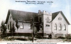 | Murray LDS Second Ward Meetinghouse | 1.5 miles | 2001 |
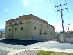 | Murray City Diesel Power Plant | 1.7 miles | 2015 |
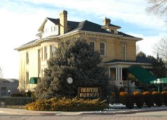 | John P. Cahoon House | 1.9 miles | 1983 |
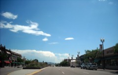 | Murray Downtown Historic District | 2.0 miles | 2006 |
| Westwood Village Historic District | 2.1 miles | 2024 |
| National Archives record | The nomination case file for reference 100007527 in Record Group 79. |
| Salt Lake County | All 399 listed properties in this county. |