 Block
From the record
20 National Register listings published here.
Sources: the National Register database, National Park Service
49 topographic sheets cover 25 settlements here, and 20 properties are on the National Register of Historic Places.
20 National Register listings published here.
Sources: the National Register database, National Park Service
Every property in this county listed on the National Register of Historic Places, with the year it was listed and the federal nomination document.
| Photograph | Property | Type | Listed | Reference |
|---|---|---|---|---|
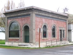 | Bank of Starbuck | building | 1978 | 78002739 |
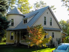 | A. H. Bishop House | building | 1986 | 86001516 |
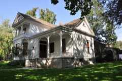 | John Brining House | building | 1986 | 86001517 |
 | Columbia County Courthouse | building | 1975 | 75001845 |
 | Dayton Depot | building | 1974 | 74001949 |
 | Dexter House No. 1 | building | 1986 | 86001519 |
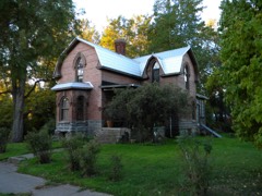 | Dexter House No. 2 | building | 1986 | 86001520 |
| Downtown Dayton Historic District | district | 1999 | 99000567 | |
 | Frank Flintner House | building | 1986 | 86001522 |
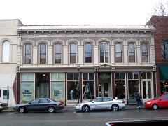 | Guernsey-Sturdevant Building | building | 1993 | 92001589 |
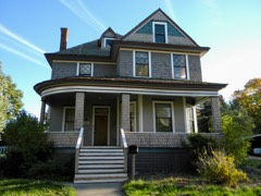 | Grover J. Israel House | building | 1986 | 86001525 |
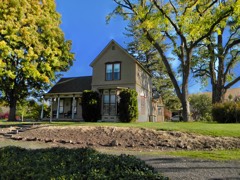 | Mancel Kelley House | building | 1986 | 86001526 |
 | Mill House | building | 1986 | 86001528 |
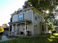 | Andrew Nilsson House | building | 1986 | 86001530 |
 | Dr. Marcel Pietrzycki House | building | 1986 | 86001531 |
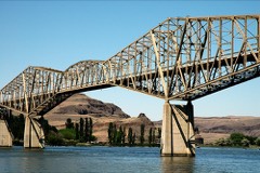 | Snake River Bridge | structure | 1982 | 82004207 |
| South Side Historic District | district | 1986 | 86001515 | |
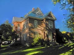 | J. A. Thronson House | building | 1986 | 86001532 |
| Washington Street Historic District | district | 1986 | 86001514 | |
 | Jacob Weinhard House | building | 1986 | 86001524 |
Every wildfire the federal occurrence database records inside this county: 437 of them, burning about 168,602 acres. 280 started naturally and 1 was recorded as arson. Each settlement page carries the fires within five miles of it.
| Reported cause | Fires |
|---|---|
| Natural | 280 |
| Recreation and ceremony | 96 |
| Missing data/not specified/undetermined | 27 |
| Debris and open burning | 21 |
| Equipment and vehicle use | 5 |
| Power generation/transmission/distribution | 3 |
| Other causes | 3 |
| Smoking | 1 |
| Arson/incendiarism | 1 |
The five largest, by the area the report gives. None of them was recorded as arson.
| Date | Cause | Size | Reported by | Name on the report |
|---|---|---|---|---|
| 13 August 2015 | Natural | 80,212 acres | Umatilla National Forest | BUTTE CREEK |
| 5 August 2005 | Power generation/transmission/distribution | 52,000 acres | Umatilla National Forest | SCHOOL |
| 26 August 2010 | Missing data/not specified/undetermined | 11,500 acres | Washington State Fire Marshal's Office | HUBBARD FIRE |
| 7 August 2016 | Missing data/not specified/undetermined | 9,168 acres | Washington State Fire Marshal's Office | FLETCHER ROAD |
| 2 August 1992 | Missing data/not specified/undetermined | 3,000 acres | Umatilla National Forest | TUCANNON |
| 29 August 2015 | Missing data/not specified/undetermined | 2,533 acres | Washington State Department of Natural Resources Headquarters | TUCANNON |
| 17 July 2016 | Missing data/not specified/undetermined | 2,380 acres | Washington State Fire Marshal's Office | STARBUCK |
| 5 August 2017 | Missing data/not specified/undetermined | 1,350 acres | Washington State Fire Marshal's Office | WHETSTONE RD |
Every settlement page carries the fires within five miles of it - see the settlement index below.
The NOAA Storm Events Database holds 26 reports for this county, causing no deaths, no injuries and about $152,500 in recorded property damage. Each settlement page carries the reports that name it.
| Kind of event | Reports |
|---|---|
| Hail | 10 |
| Thunderstorm Wind | 8 |
| Tornado | 2 |
| Flash Flood | 2 |
| Flood | 2 |
| Heavy Rain | 1 |
| Lightning | 1 |
The most serious of them, by death, then injury, then recorded damage. The accounts are quoted exactly as the forecast office filed them.
| When | Event | Place named | Harm | What the report says |
|---|---|---|---|---|
| January 2000 | Tornado (F1) | Dayton | $100,000 | no account filed |
| July 2012 | Thunderstorm Wind | Dayton | $50,000 | Thunderstorm winds downed trees on power lines and at least one house. |
| March 1966 | Tornado (F2) | not stated | $2,500 | no account filed |
| March 2026 | Flood | Dayton | - | The Columbia County Emergency Managers office reported flooding of residences and water over roadways in the town of Dayton the morning of the 14th. Drone footage over Dayton taken on the 14th showed the Touchet river overflowing it's banks into numerous properties adjacent to the river, with flooding also along the Patit Creek that runs through the northern portion of Dayton. |
| June 2022 | Flash Flood | Whetstone | - | A trained spotter 6 miles east of Dayton, WA reported that 2.5 inches of rainfall had fallen in less than an hour. This then led to runoff depositing mud and rock from an adjacent farm field, approximately 1 foot deep in some places, across Patit road. The flowing watr and mud also displaced a tractor in the field. Crops were also reported damaged from the heavy rain. |
| June 2021 | Hail | Marengo | - | A social media report 14 miles NE of Dayton, WA indicated a thunderstorm produced hail up to the size of 1.25 inches at 12:45 am PDT on June 15th. |
| February 2020 | Flood | Dayton | - | The North Fork and main Fork of the Touchet River as well as Coppei Creek and the Tuccanon River saw major flooding with numerous roads, bridges and home affected. 19 roads were closed, 21 bridges have moderate to severe damage, 144 homes were damaged and over 500 minor structures ( culverts, smaller bridges) affected. No dollar estimate at this time. |
| May 2020 | Thunderstorm Wind | Dayton | - | Trees and powerlines down in Dayton. |
| September 2013 | Thunderstorm Wind | Dayton | - | Trees and power lines down. |
| September 2013 | Thunderstorm Wind | Dayton | - | Trees and power lines down. |
| July 2012 | Hail | Midway | - | At Camp Wooten State Park, hail ranged from quarter sized up to ping pong ball and was accompanied by heavy rainfall. |
| June 2012 | Thunderstorm Wind | Huntsville | - | Limbs were pulled off from a tree with the largest limb 4 inches in diameter. |
| June 2012 | Hail | Huntsville | - | Nickel sized hail with a few larger were observed with strong wind. |
| June 2012 | Hail | Dayton | - | Hail damaged window covers on truck. |
| March 2011 | Thunderstorm Wind | Dayton | - | Dayton Middle School recorded a gust to 59 mph. |
| May 2006 | Thunderstorm Wind | Starbuck | - | Numerous large tree limbs down. Shingles off roofs. |
| July 1998 | Heavy Rain | Dayton | - | Up to two inches of rain fell in 45 minutes. Flooding was reported along Patit Creek. Water washed out nearby roads and mudslides covered some roads with as much as three inches of mud. 1/2 inch hail also fell. |
| September 2013 | Flash Flood | Dayton | - | no account filed |
| August 2013 | Hail | Dunlap | - | no account filed |
| July 2012 | Hail | Baileysburg | - | no account filed |
| August 2008 | Hail | Ski Bluewood | - | no account filed |
| June 2001 | Hail | Starbuck | - | no account filed |
| August 2001 | Lightning | Dayton | - | no account filed |
| May 2000 | Thunderstorm Wind | Dayton | - | no account filed |
| April 1998 | Hail | Huntsville | - | no account filed |
| August 1991 | Hail | not stated | - | no account filed |
The Survey's mineral resources record lists 32 workings inside this county. 1 still produces and 31 are closed or unrecorded. Each settlement page carries the workings within five miles of it.
| Commodity | Workings |
|---|---|
| Stone, Crushed/Broken | 16 |
| Sand and Gravel, Construction | 11 |
| Pumice | 3 |
| Clay | 1 |
| Gold | 1 |
The least common of them first, because a county's hundredth gravel pit says nothing its first ten did not.
| Where | Site | Commodity | Status | Recorded |
|---|---|---|---|---|
| Dayton | Clay | Past Producer | ||
| Hoffeditz | Gold | Prospect | ||
| Lyons Ferry | Pumice | Occurrence | ||
| Snake River | Pumice | Occurrence | ||
| Starbuck | Pumice | Occurrence | ||
| Delaney Pit | Sand and Gravel, Construction | Past Producer | ||
| Grange City Pit | Sand and Gravel, Construction | Past Producer | ||
| Gravel Pit | Sand and Gravel, Construction | Past Producer | ||
| Gravel Pit | Sand and Gravel, Construction | Past Producer | ||
| Hale Pit | Sand and Gravel, Construction | Past Producer | ||
| Lee Pit | Sand and Gravel, Construction | Past Producer | ||
| Mays Pit | Sand and Gravel, Construction | Past Producer | ||
| Starbuck Pit | Sand and Gravel, Construction | Past Producer | ||
| Starbuck Pit | Sand and Gravel, Construction | Past Producer | ||
| Unnamed Pit | Sand and Gravel, Construction | Past Producer | ||
| Unnamed Pit | Sand and Gravel, Construction | Past Producer | ||
| Barkley Quarry | Stone, Crushed/Broken | Past Producer | ||
| Barnes Quarry | Stone, Crushed/Broken | Past Producer | ||
| Borrow Pit | Stone, Crushed/Broken | Past Producer | ||
| Delaney Quarry | Stone, Crushed/Broken | Past Producer | ||
| Gaines Quarry | Stone, Crushed/Broken | Producer | ||
| Gravel Pit | Stone, Crushed/Broken | Past Producer | ||
| Hester Quarry | Stone, Crushed/Broken | Past Producer | ||
| Patit Creek Quarry | Stone, Crushed/Broken | Past Producer | ||
| State Pit Qs-Co-16 | Stone, Crushed/Broken | Past Producer | ||
| Unnamed Quarry | Stone, Crushed/Broken | Past Producer | ||
| Unnamed Quarry | Stone, Crushed/Broken | Past Producer | ||
| Unnamed Quarry | Stone, Crushed/Broken | Past Producer | ||
| Unnamed Quarry | Stone, Crushed/Broken | Past Producer | ||
| Unnamed Quarry | Stone, Crushed/Broken | Past Producer | ||
| Unnamed Quarryy | Stone, Crushed/Broken | Past Producer | ||
| Unnamed Quarryy | Stone, Crushed/Broken | Past Producer |
Named settlements recorded in the Geographic Names Information System, each with the topographic sheets covering it. Villages, hamlets and abandoned places alike. Each is shown with the nearest named watercourse or landform and the survey quadrangle it falls on.
Dayton census division · 99328 · Near Davis Hollow · Dayton quadrangle
14 sheets, 1937 to 1981
Dayton census division · 99328 · Near Johnson Hollow · Dayton quadrangle
14 sheets, 1937 to 1981
Starbuck census division · 99328 · Near Dry Hollow · Delaney quadrangle
10 sheets, 1950 to 1982
Dayton census division · 99328 · Near Rose Gulch · Huntsville quadrangle
10 sheets, 1919 to 1980
Starbuck census division · 99359 · On Tucannon River · Starbuck West quadrangle
8 sheets, 1948 to 1983
No longer a settlement
Dayton census division · 99328 · Near Sorghum Hollow · Huntsville quadrangle
10 sheets, 1919 to 1980
Starbuck census division · 99328 · Near Chard Gulch · Delaney quadrangle
10 sheets, 1950 to 1982
Dayton census division · 99328 · Near Payne Hollow · Huntsville quadrangle
10 sheets, 1919 to 1980
Starbuck census division · 99361 · Near McKay Hollow · Waitsburg quadrangle
10 sheets, 1919 to 1980
Dayton census division · 99328 · On Robinson Fork · Robinette Mountain quadrangle
14 sheets, 1937 to 1981
Dayton census division · 99328 · Near Eckler Mountain · Eckler Mountain quadrangle
15 sheets, 1937 to 1995
Dayton census division · 99328 · On North Patit Creek · Cahill Mountain quadrangle
16 sheets, 1937 to 1995
Starbuck census division · 99359 · Near Choke Cherry Canyon · Starbuck West quadrangle
8 sheets, 1948 to 1983
Starbuck census division · 99359 · On Kellogg Creek · Starbuck West quadrangle
8 sheets, 1948 to 1983
Starbuck census division · 99328 · On Willow Creek · Tucannon quadrangle
13 sheets, 1937 to 1981
Dayton census division · 99328 · Near Sorghum Hollow · Huntsville quadrangle
10 sheets, 1919 to 1980
99328 · Near Hanger Gulch · Delaney quadrangle
10 sheets, 1950 to 1982
No longer a settlement
The vanished settlements of Columbia County: the places named above that are no longer on the map.