“In revenge for this bloody affair, the Hydahs sent a war party to Puget Sound, delegated to make suitable reprisals and to bring back the head of a white chief of corresponding prominence among the whites as the Hydah chief killed at Port Gamble was to the Hydah nation. This war party operated stealthily, making its investigations among the island settlements.”
Murder Of Colonel Ebey - History of Snohomish County, Washington, Volume I (1926). Machine-read text.
52 National Register listings published here · the county-history sources tell 9 stories and name 25 people · people the book names include Gov. Douglas Sends Aid (Mukilteo, The City Of "Firsts" - Scene Of Indian Treaty - M. H, 1926) · George Bartlett (Edmonds, 1926) (machine-read).
Washington within the United StatesSnohomish County within Washington
What the record shows
2,998 topographic sheet readings cover the county's settlements.
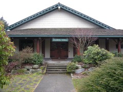
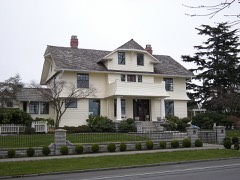
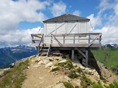
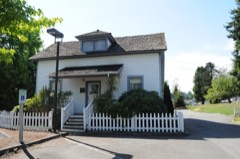
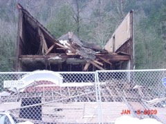
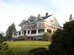
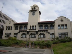
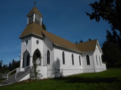
52 properties here are on the National Register of Historic Places: 39 buildings, 7 districts, 4 structures, 1 site and 1 object.
18 of the 52 listings were added during the 1970s.
The Geographic Names Information System records 147 populated places in this county; 146 are covered by at least one topographic sheet.
What happened here
9 accounts
Among them: American Legion Post; Canal De Haro; Cayuse War. These passages come from the
identified county-history source books. Each inset names its own source
and opens the exact section it comes from.
Frank Freese Post No. 66, American Legion, was organized November 3, 1924, with seventeen members, Geo. S. Montgomery, post commander, and Geo. W. Yost, adjutant. Within two years the post has grown to a membership of fortysix. Geo. W. Yost is the commander in 1926, and O. N. Sorenson is adjutant. The post was named in memory of Frank Freese, a soldier from Edmonds, killed in battle in France, October 18, 1918, having won the Distinguished Service decor- -ation.
In 1790 Lieut. Alferez Manuel Quimper in the ship Princess Royal, an English vessel captured from Captain Colnett and now named Princesa Real, on May 31 began the exploration and mapping of Fuca Strait. He named Canal de Haro, now the international boundary line, separating Vancouver Island from the mainland, in honor of his pilot, Gonzalo Lopez de Haro.
On the evening of the day the news of the massacre was received in Oregon City, December 8, a great mass meeting was held and the Oregon Rifles company of volunteers was organized, with Henry A. G. Lee as captain and Joseph Magone and John E. Ross as lieutenants. The Hudson's Bay Company provided arms and ammunition on the credit of the members of the Legislative Committee, and by January 21, the volunteer company reached The Dalles fort, thus shutting off invasion of the West coast for the winter.
Likewise the awful massacre of the White River Valley settlers was made possible when Acting Governor Mason accepted the treacherous assurances of the hostile warriors that they were friendly, and then went to Seattle and persuaded the terrified White River settlers to return to their homes, as he knew positively that the Nisqually Indians were all "friendly." He had, upon hearing that the White River settlers had fled from their homes, obtained an escort of soldiers from Fort Steilacoom and visited and conferred with the Nisqually hostiles in the White and Green River valleys, the wily Indians having told him they were friendly and that they thought the settlers foolish to desert their homes.
In revenge for this bloody affair, the Hydahs sent a war party to Puget Sound, delegated to make suitable reprisals and to bring back the head of a white chief of corresponding prominence among the whites as the Hydah chief killed at Port Gamble was to the Hydah nation. This war party operated stealthily, making its investigations among the island settlements.
MURDER OF CHARLES SIEBERT The great sensation of the county at this time was the murder of Charles Siebert, a well know settler on the flats opposite Lowell. He was killed by his son, Edward, a lad of nineteen, and his body was mutilated in a most savage and brutal way. Siebert had served as sheriff, as election judge and in other minor offices and was one of the substantial men of the county.
ERA OF DEPRESSION ENDS AND WEST BOOMS - SNOHOMISH DOMINATES COUNTY - SNOHOMISH "EYE" OPENS - BUSINESS REVIVAL IN 1883 - FIRST ATTEMPT TO INCORPORATE - SNOHOMISH IN 1884 - EVENTS OF 1885 - ANTI-CHINESE MOVEMENT - GOOD TIMES APPROACH - RAILROAD REACHES SNOHOMISH - FIRST WATERWORKS - SNOHOMISH INCORPORATES - FIRST BANK ORGANIZED - PROGRESS IN EARLY NINETIES - SEATTLE FIRE - MANY IMPROVEMENTS AT SNOHOMISH - FINAL INCORPORATION - POSTAL HISTORY - CITY BANKRUPT - HAPPENINGS OF 1892 - SMALLPOX SCOURGE- - CITY ELECTION OF 1892 - INCENDIARY FIRES OF 1893 - -EVENTS OF 1894-CATHCART FAILURE - COUNTY SEAT REMOVED.
The season of 1884 was in some respects the best Snohomish ever knew, but it ended so disastrously that baseball enthusiasm was nearly killed for a number of years. The first victory was over Seattle, on Memorial Day, the score being 21 to 11. This winning team was lined up as follows: Anderson, catcher; Jackson, third base; Fobes, center field; Van Bowen, second base; Booth, first base; Dunston, right field; Delfel, left field; Moore, shortstop; Welts, pitcher.
In 1889 a magnificent four-pronged buck was shot on the site of Everett. In 1890 P. K. Lewis opened the first store in a tent, on Broadway, when the streets were merely trails and the song of the mosquito was the dominant note. In 1891, a barn was rented for a variety theatre, at $300 per month, and Hewitt Avenue was described as being as busy as Broadway, New York.
Every wildfire the federal occurrence
database records inside this county: 848 of them, burning
about 5,820 acres. 130 started naturally and 30 were recorded as arson. Each settlement page carries the fires within
five miles of it.
Reported cause
Fires
Recreation and ceremony
330
Debris and open burning
147
Natural
130
Missing data/not specified/undetermined
86
Fireworks
48
Smoking
35
Arson/incendiarism
30
Equipment and vehicle use
16
Other causes
11
Misuse of fire by a minor
10
Power generation/transmission/distribution
3
Railroad operations and maintenance
2
The five largest, by the area the report
gives. One of them was set deliberately.
Date
Cause
Size
Reported by
Name on the report
16 August 2020
Natural
3,166 acres
Mt. Baker-Snoqualmie National Forest
DOWNEY CREEK
13 May 2016
Arson/incendiarism
289 acres
Washington State Department of Natural Resources Headquarters
PROCTOR CREEK
29 August 2003
Natural
254 acres
Mt. Baker-Snoqualmie National Forest
DOME CREEK
26 August 2009
Natural
225 acres
Mt. Baker-Snoqualmie National Forest
SPRING
20 August 2015
Natural
200 acres
Mt. Baker-Snoqualmie National Forest
JUMBO
12 August 2015
Natural
182 acres
Mt. Baker-Snoqualmie National Forest
BATH
6 August 2003
Natural
170 acres
Mt. Baker-Snoqualmie National Forest
GOLD HILL
17 August 2018
Natural
150 acres
Mt. Baker-Snoqualmie National Forest
FLOWER
Every settlement page carries the fires within five
miles of it - see the settlement index below.
Storms,
1970 to 2023
54 of 54 shown
The
NOAA Storm Events Database holds
54 reports for this county, causing 44 deaths, 13 injuries and about $84,288,000 in recorded property damage.
Each settlement page carries the reports that name it.
Kind of event
Reports
Flood
10
Lightning
9
Funnel Cloud
9
Tornado
7
Debris Flow
6
Thunderstorm Wind
5
Heavy Rain
4
Hail
3
Flash Flood
1
The most serious of them, by death, then
injury, then recorded damage. The accounts are quoted exactly as the
forecast office filed them.
On a warm and dry 22nd of March, 2014, a large landslide occurred four miles east of the town of Oso, Washington. The slide debris, traveling at over 60 miles per hour, crossed the entire river valley, covering an area of over a square mile with an approximate deposit thickness of 15 to 75 feet in some areas. The force of the slide flow caused 43 fatalities, 12 injuries, destroyed 37 homes, and wiped out SR 530 for over a mile. In addition, the slide debris completely blocked the North Fork Stillaguamish River for over 24 hours, backing up a pool of water that flooded the valley about 2 miles upstream and reached approximately 20 feet deep, inundating an additional 6 homes. The cause of the slide is not fully known, though precipitation in the previous months to years contributed to the ground failure. A rain gage located 2 miles west of the slide had 19.93 inches of rain in the 40 days leading up to the slide. |As of March 19th the nearest reporting station Arlington, had reported 7.14 inches of rain, which is about 2 inches shy of the record 9.23 for the entire month of March. Three days before the slide, the area received close to an inch of rain in one day. Most all of the fatalities occurred at the permanent homes impacted by the slide.
Over a dozen roads were closed due to high water and 20 families were evacuated from their apartments. Roads near Mill Creek and Edmonds will be closed for nearly a month to repair large sinkholes near and under the streets. About 300 residents had minor water damage to their homes.
More than 50 roads in the county were flooded and about 40 were closed, including Highway 9. Highway 530 was closed in multiple locations. Schools in the Stanwood-Camano district were closed for 2 days. Most of Stanwood flooded, even businesses that hadn't flooded in 25 years. Many people were able to evacuate animals before the waters rose, however dozens had to leave via boat. Nearly 500 homes were flooded. Flood waters blew a hole in a dike on Ebey Island.
Record flooding occurred on the Cowlitz, Nooksack, Puyallup, Nisqually, |Skykomish, Stillaguamish, Carbon, Snoqualmie, and Bogachiel. Major flooding occurred on the Tolt, Snohomish, Skokomish, Skagit, and White rivers. Other rivers flooding were the Satsop, Cedar, Wynoochee, Elwha, Deschutes, Dungeness, Skookumchuck, and Chehalis.
Heavy rain and snow melt pushed a number of rivers above flood stage. Moderate flooding occurred on the Snohomish and Skykomish Rivers, with minor flooding on the Stillaguamish. Several pulses of heavy rain from the 3 atmospheric rivers sent the rivers above flood levels multiple times during the episode. Urban and small stream flooding also occurred.
About 33 homes, and one business, were damaged in Granite Falls, Arlington, and Stanwood when the Stillaguamish River hit record flood stage. Parts of Highway 530 were closed. About 240 homes were issued a voluntary evacuation, while 6 people had to be rescued by hovercraft near Granite Falls.
The Snohomish, Skykomish, and Stillaguamish Rivers exceeded flood stage. Urban and small stream flooding also occurred. Heavy rain caused some landslides.
The Skykomish River in Snohomish County near Gold Bar crested at its third highest level on record, over 7 feet above flood stage, the highest level since the record-setting November 2006 flood. Flood waters swamped the town of Sultan, about six miles downstream from Gold Bar, prompting rescue of one woman forced to climb out her home's front window.
Flooding on the North Fork of the Skykomish River finally uprooted and washed away a cabin near index (it had been eroding the land for many years). The South Fork of the Stillaguamish river undermined a section of the Mountain Loop Highway east of Granite Falls.
About 1500 homes in the Snohomish county area lost power. Several trees fell on homes, one man was pinned down by debris after a tree came down on his home.
Anywhere from one to two inches of rain fell over most of Snohomish county, the hardest hit areas were from Mountlake Terrace northeast to Lake Stevens. About 1000 homes lost power, and flooding and mudslides damaged a few roads, farmland and homes.
Microburst. Damage survey indicated straight-line winds. Many trees uprooted or snapped off. 18-inch healthy cedar was snapped off 8 feet above ground. 27-inch partially core-rotted cedar was snapped off at the same level. Damage path estimated at 230 feet wide, length 350-500 yards long. It lasted about 45 seconds.
Heavy, slow moving showers dropped between one and two inches of rain in a 5 hour period around Camano Island. Gardens were washed out and there was flooding of garages and basements.
Scores of residents near Index remained without power and stranded by a massive landslide that blocks the access road to their homes and prevents emergency crews from reaching the area in Snohomish County.
Flooding occurred on the Snohomish River and record flooding occurred on the North Fork, South Fork, and the main stem Stillaguamish River. Water rescues were need in the Stanwood area.
A well defined funnel cloud was reported by a number of local sources with photos and video. Survey team visited the area, talked with witnesses and despite the impressive photos and videos, the team found no evidence the funnel touched down near the honor farm just south of the Monroe correctional facility. The funnel was visible for close to 10 minutes. A second almost horizontal funnel cloud also appeared as the initial one dissipated, but lasted for only about a minute.
Lightning struck the roof of a county courthouse complex, damaging parts of computers and the counties telephone network. Lightning also struck transformers on three power poles.
A funnel cloud was detected on radar and observed by a spotter northeast of Lake Stevens. Showers and thunderstorms dropped a record 1.41 inches of rain at Seatac airport for 24 hours on this day.
The Survey's mineral resources record
lists 999 workings inside this county. 29 still produce and 970 are closed or unrecorded. Each
settlement page carries the workings within five miles of it.
Commodity
Workings
Gold
278
Copper
230
Sand and Gravel, Construction
146
Silver
85
Gold, Silver
54
Arsenic
47
Lead
40
Silver, Gold
39
Copper, Silver
27
Stone, Crushed/Broken
27
Silver, Copper
23
Copper, Silver, Gold
17
Arsenic, Antimony
17
Iron
16
The least common of them first, because a
county's hundredth gravel pit says nothing its first ten did not.
History of Snohomish County, Washington, Volume I (1926)
2,743 words
The county's history books
97,800 words
One book written about this county, cut here
where the book itself is cut, at its printed chapters: 9 chapters in all.
Every chapter is public domain, machine-read from the scan and
reproduced complete. A chapter already given under one of the county's
towns is not repeated in this list.
History of Snohomish County, Washington, Volume I (1926)
Everyone History of Snohomish County, Washington, Volume I stops to write about, with
the section that describes them. Among them are the men who founded the
place and governed the Territory. Each name opens the passage itself, in
the words of 1926.
Named settlements recorded in the Geographic Names
Information System, each with the topographic sheets covering it. Villages,
hamlets and abandoned places alike. Each is shown with the nearest named
watercourse or landform and the survey quadrangle it falls on.
Edmonds census division · 98020 · On Deer Creek · Edmonds West quadrangle
26 sheets, 1895 to 1997
Provenance
Topographic sheets. USGS Historical Topographic Map Collection, county index, measured from the bulk metadata.
Fire insurance maps. Library of Congress Sanborn collection, faceted to this county.
Photographs. Each place queried individually against the Library of Congress Prints and Photographs search.
Wildfire. Short, Karen C. 2022. Spatial wildfire occurrence data for the United States, 1992-2020 [FPA_FOD_20221014]. 6th Edition. Fort Collins, CO: Forest Service Research Data Archive. https://doi.org/10.2737/RDS-2013-0009.6 Collected with United States Government funding and usable without additional permissions or fees.
Mines and quarries. USGS Mineral Resources Data System (MRDS) https://mrdata.usgs.gov/mrds/ A work of the United States government, no copyright under 17 U.S.C. 105.
Storms. NOAA National Centers for Environmental Information, Storm Events Database https://www.ncei.noaa.gov/stormevents/ A work of the United States government, no copyright under 17 U.S.C. 105. Narratives are quoted verbatim from the National Weather Service report and are not edited or summarised.
 Block