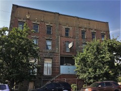
Block
From the record
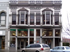
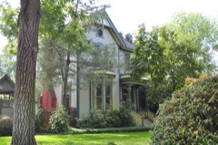
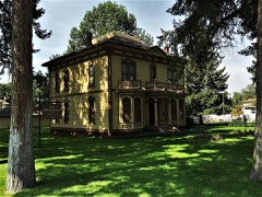
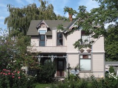
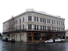
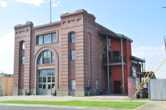
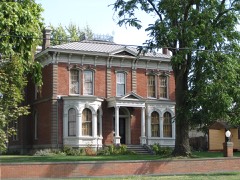
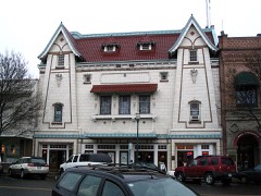
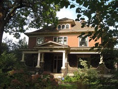
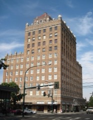
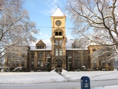
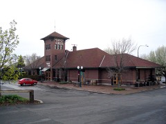
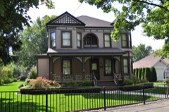
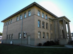
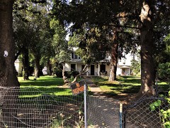
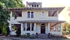
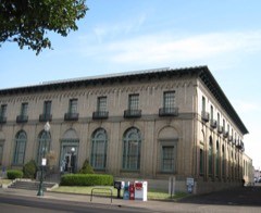
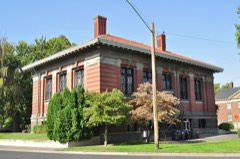
32 National Register listings published here.
Sources: the county history on the Internet Archive · the National Register database, National Park Service
84 topographic sheets cover 81 settlements here, and 32 properties are on the National Register of Historic Places.
32 National Register listings published here.
Sources: the county history on the Internet Archive · the National Register database, National Park Service
Every property in this county listed on the National Register of Historic Places, with the year it was listed and the federal nomination document.
Every wildfire the federal occurrence database records inside this county: 270 of them, burning about 200,506 acres. 31 started naturally and 24 were recorded as arson. Each settlement page carries the fires within five miles of it.
| Reported cause | Fires |
|---|---|
| Missing data/not specified/undetermined | 91 |
| Equipment and vehicle use | 41 |
| Debris and open burning | 38 |
| Natural | 31 |
| Recreation and ceremony | 26 |
| Arson/incendiarism | 24 |
| Railroad operations and maintenance | 8 |
| Fireworks | 6 |
| Power generation/transmission/distribution | 4 |
| Misuse of fire by a minor | 1 |
The five largest, by the area the report gives. None of them was recorded as arson.
| Date | Cause | Size | Reported by | Name on the report |
|---|---|---|---|---|
| 21 August 2006 | Natural | 109,259 acres | Umatilla National Forest | COLUMBIA COMPLEX |
| 25 June 2005 | Missing data/not specified/undetermined | 25,000 acres | Washington State Fire Marshal's Office | WALKER CANYON |
| 6 August 2010 | Missing data/not specified/undetermined | 21,620 acres | Washington State Fire Marshal's Office | EUREKA FIRE |
| 3 September 2014 | Missing data/not specified/undetermined | 11,375 acres | Washington State Fire Marshal's Office | MONUMENTAL |
| 28 July 2001 | Missing data/not specified/undetermined | 9,929 acres | McNary National Wildlife Refuge | PORTKELLY |
| 20 July 2015 | Missing data/not specified/undetermined | 5,992 acres | Washington State Department of Natural Resources Headquarters | BLUE CREEK |
| 7 August 2011 | Missing data/not specified/undetermined | 5,000 acres | McNary National Wildlife Refuge | HATCH GRADE |
| 18 September 2001 | Missing data/not specified/undetermined | 4,810 acres | Southeast Region-Department of Natural Resources | NORTH COPPEI |
Every settlement page carries the fires within five miles of it - see the settlement index below.
The NOAA Storm Events Database holds 90 reports for this county, causing no deaths, no injuries and about $11,630,590 in recorded property damage. Each settlement page carries the reports that name it.
| Kind of event | Reports |
|---|---|
| Thunderstorm Wind | 38 |
| Hail | 21 |
| Flood | 11 |
| Funnel Cloud | 6 |
| Tornado | 5 |
| Flash Flood | 3 |
| Heavy Rain | 2 |
| Lightning | 2 |
| Wildfire | 2 |
The most serious of them, by death, then injury, then recorded damage. The accounts are quoted exactly as the forecast office filed them.
| When | Event | Place named | Harm | What the report says |
|---|---|---|---|---|
| February 2020 | Flood | Touchet | $8,770,000 | Record high water levels were seen on Upper Mill Creek with extensive damage along upper Mill Creek to homes as well as roads and bridges. A number of residents had to be evacuated via helicopter or 4 wheeler. There was minimal damage along Mill Creek through Walla Walla as water was diverted through the Mill Creek Flood Project. Downstream of Walla Walla, there was damaging flooding in College Place with a bridge being washed out near Wallula Road. In Waitsburg, flood waters from both the Touchet River and Coppei Creek inundated the town as levees were damaged. 60 homes were damaged as well as numerous roads and bridges. Damage countywide is estimated at 8.77 million dollars. Walla Walla nr Touchet Flood stage is 13.0 feet. The river rose above flood stage on February 6th at 730 pm, crested at 20.26 feet on February 7th at 445 pm, then fell below flood stage on February 9, 7 am. Major flooding occurred along the Walla Walla River from the headwaters through Milton Freewater to the confluence with the Columbia River. There was extensive damage to roads, bridges and damage to levees through Milton- Freewater. There was widespread flooding of pastures from Milton Freewater to the mouth, with portions of Highway 12 covered by water. |
| July 2012 | Flash Flood | Touchet | $1,250,000 | Thunderstorms training from south southwest to north northeast over the narrow path produced an estimated 1 to 2 inches of rainfall and caused flash flooding and mud slides. A parked pickup truck was completely submerged. Over a dozen county roads were damaged. |
| May 2006 | Thunderstorm Wind | Burbank | $1,000,000 | Downburst destroyed a large storage building and grain bin, flipped a tractor trailer rig onto a dump truck, and overturned an irrigation pivot. Hundreds of trees were downed on a tree farm. |
| May 2006 | Thunderstorm Wind | Burbank | $250,000 | Wind blew off roof from 40 x 60 foot warehouse. Two 2500 gallon tanks blown over. Irrigation pivot damaged and service station sign blown down. |
| April 2019 | Flood | Kooskooskie | $150,000 | Minor flooding was reported on Titus Creek, stemming from log jam on Mill Creek that pushed more water into Titus Creek. As a result of high water on Titus Creek, a tractor was flooded. The Touchet River, 1.5 to 3 miles east of Waitsburg, changed course and began channeling water against a resident's property. The resulting erosion caused two outbuilding to topple into the water. |
| October 2000 | Heavy Rain | Waitsburg | $90,000 | Substantial rains over the previous day, coupled with an early morning thunderstorm that dumped over one-half inch of rain in 45 minutes, lead to widespread agricultural runoff that washed mud over several local roads. Rushing waters stripped several layers of gravel from Miller Road, located just west of Waitsburg. Several local gravel roads needed to be completely regraded. |
| August 2001 | Lightning | Walla Walla | $25,000 | no account filed |
| June 1958 | Tornado (F2) | not stated | $25,000 | no account filed |
| December 2010 | Thunderstorm Wind | Walla Walla | $20,000 | A severe thunderstorm with winds gusting to 58 mph knocked down trees and caused power outages to over 3500 customers in Walla Walla. One large tree fell onto an unoccupied car and caused major damage. |
| May 2005 | Flash Flood | Walla Walla | $20,000 | no account filed |
| February 2017 | Flood | Chew | $10,000 | Mild temperatures February 9 -13 allowed an initial snow melt and heavy rain caused rapid melting and increased runoff across northern Walla Walla County. This area had a snow pack of 5-10 inches on February 15, with much of it melted by February 21. Rain amounts of 0.50 to 0.75 were seen on February 16 and temperatures remained above freezing through February 22 with additional rain amounts of 0.50 to 1.00 inches on February 21-22. Numerous county roads had washouts, erosion, slides and undermining. |
| June 2001 | Hail | Whitman | $5,000 | In addition to dime-sized hail, strong winds estimated at more than 45 mph downed several trees at a farm just west of Whitman. |
| August 2004 | Thunderstorm Wind | Walla Walla | $5,000 | no account filed |
| May 2000 | Heavy Rain | Walla Walla | $3,000 | no account filed |
| August 1987 | Tornado (F0) | not stated | $2,500 | no account filed |
| July 2000 | Thunderstorm Wind | Walla Walla | $2,000 | Winds from a dissipating thunderstorm broke tree limbs 8 to 10 inches in diameter, damaged the roof of a camper, and broke a window. Very little rain fell from this storm. |
| June 2017 | Thunderstorm Wind | Walla Walla | $1,000 | Power lines down due to strong wind gust at Pioneer Park in Walla Walla. Damage amount estimated. |
| March 2011 | Thunderstorm Wind | College Place | $1,000 | High wind blew down a tree onto a fence and street. |
| April 2003 | Lightning | College Place | $1,000 | Lightning associated with a thunderstorm ignited a barn fire. |
| August 1982 | Tornado (F0) | not stated | $30 | no account filed |
| May 1964 | Tornado (F0) | not stated | $30 | no account filed |
| April 1958 | Tornado (F0) | not stated | $30 | no account filed |
| March 2026 | Flood | Waitsburg | - | The Walla Walla County dispatch reported flooding along the Touchet River in the town of Waitsburg the morning of the 14th. The dispatch center relayed that a levee near the Preston Ave bridge had been breached, leading to flooding of properties along the Touchet River. Several roads in the Waitsburg area were also closed, including US Highway 12, due to water over the roadway. |
| April 2026 | Thunderstorm Wind | Minnick | - | The Walla Walla county emergency manager reported a healthy tree had blown down from strong winds that moved through the area around 1820 PDT on the 1st. |
| June 2022 | Flood | Kooskooskie | - | Emergency Manager relayed reports of flooding along Mill Creek between Thomas and Kooskooskie, WA. There were reports of water over roadways as well as pictures showing minor flooding on a property adjacent to Mill Creek. The creek and flood waters receded later on the June 14th. |
| June 2022 | Flood | Langdon | - | Emergency Manager for Walla Walla county relayed several reports of flooding within the area. Near Lanette Cir and Old Milton Hwy reports indicated that there was water over the roadway and that a property had flooding up to the house. Near Powerline road further east, reports of water over the roadways was also reported. |
| June 2021 | Thunderstorm Wind | Martin Arpt | - | The Walla Walla county Sheriff confirmed that a thunderstorm producing gusty winds had uprooted several trees, downed power lines, and had flipped a small plane that was not tied down at Martin Airfield. |
| May 2020 | Thunderstorm Wind | Prescott | - | Roof Damage. |
| February 2018 | Flood | Touchet | - | Walla Walla river near Touchet - Flood Stage 13 feet. River rose to flood stage at 1500 PST, cresting at 13.0 feet at 1530 PST, then went below flood stage after 1600 PST. Only brief minor flooding. |
| March 2017 | Flood | Lowden | - | The Walla Walla river near Touchet, (flood stage 13.0 feet) crested at 14.2 feet at 2245 on March 16th. Fell below flood stage by 1100 on the 17th. |
| March 2017 | Flood | Lowden | - | The Walla Walla river near Touchet (flood stage 13.0 feet) crested at 13.6 feet at 0400 on March 11. Then fell below flood stage around 1300 on the same day. |
| June 2017 | Thunderstorm Wind | Walla Walla | - | Strong thunderstorm winds downed power lines in Walla Walla. |
| December 2017 | Flood | Whitman | - | A very wet weather system brought heavy rain to the northern Blue Mountains on December 29th and 30th. Snow levels were above 7000 feet with rain amounts of 3 to 4 inches. This resulted in rapid rises in streams and creeks draining the Blue Mountains, especially in Walla Walla and Columbia Counties. The Walla Walla River near Touchet rose above flood stage on December 30, crested at 14.2 feet (flood stage is 13.0 feet) and then receded below flood stage on December 31st. |
| May 2015 | Thunderstorm Wind | Walla Walla | - | Roof damage reported in the city of Walla Walla. |
| September 2013 | Thunderstorm Wind | Dry Creek | - | Public reported 34 trees uprooted or snapped as well as a rolled cattle trailer. |
| September 2013 | Thunderstorm Wind | College Place Arpt | - | Pilot reported seeing several trees down, one of which was on a house. A tied down single engine airplane had flipped over, and an irrigation rig was damaged. |
| September 2013 | Thunderstorm Wind | Walla Walla | - | A 60 mph wind gust estimated by the public. |
| September 2013 | Thunderstorm Wind | College Place Arpt | - | Public reported a trampoline hurled 300 feet, 12 trees were downed and a power pole was damaged due to high wind gusts. |
| July 2012 | Hail | Kooskooskie | - | Radio operator was at the Table Rock Fire Lookout. |
| June 2012 | Hail | Waitsburg | - | Hail up to half dollar size accompanied by 60 mph winds wind shredded window screens. |
| July 2012 | Hail | Kooskooskie | - | Hail accompanied by heavy rainfall and wind to 40 mph. |
| July 2012 | Hail | Kooskooskie | - | Accompanied by winds 50 to 60 mph and heavy rainfall. |
| May 2011 | Thunderstorm Wind | Villard Jct | - | Microburst like wind gust blew trampoline over and kicked up several pieces of debris. Several tree limbs 1 to 3 inches in diameter have fallen. |
| May 2011 | Hail | Touchet | - | Hail up to 3/4 inch diameter covered the ground. |
| May 2011 | Hail | Touchet | - | Hail accompanied by very heavy rainfall. |
| March 2011 | Thunderstorm Wind | (Alw)City/Co Arpt Wa | - | Walla Walla ASOS measured 59 mph gust. |
| January 2011 | Flood | College Place Arpt | - | Only minor flooding observed. The gauge at Touchet crested at 13.45 feet which was .45 feet above flood stage. |
| May 2010 | Thunderstorm Wind | College Place Arpt | - | Trees and powers lines were knocked down on Highway 125 due to thunderstorm winds. The College Place Airport mesonet station recorded a wind gust to 50 knots. |
| June 2009 | Thunderstorm Wind | Walla Walla | - | Awnings were ripped off travel trailers and tree limbs up to 6 inches in diameter were snapped. |
| May 2007 | Thunderstorm Wind | Walla Walla | - | Large tree limbs and power lines blown down. |
| May 2006 | Thunderstorm Wind | Prescott | - | Shingles tearing off roof. |
| May 2006 | Thunderstorm Wind | Eureka | - | Utility company reports 7 power poles snapped. |
| May 2006 | Thunderstorm Wind | Burbank | - | Three 50 to 60 foot tall poplar trees downed. Ten foot by 12 foot metal shed lifted and blown into trees. |
| April 2006 | Thunderstorm Wind | Wallula | - | Power lines down. |
| April 2006 | Thunderstorm Wind | Waitsburg | - | Tree limbs on power lines knocked power out. |
| February 2003 | Funnel Cloud | Walla Walla | - | A funnel cloud was cited west of Walla Walla, which had sporadic movement. The base of the funnel cloud was at about 1,000 feet, with the length of the funnel around 500 to 600 feet. |
| April 2003 | Hail | College Place | - | In addition, 0.5 inch diameter hail fell three miles north of Walla Walla, and accumulated to 1.5 inches. |
| June 2003 | Wildfire | Wallula Jct | - | A lightning sparked fire on Hatch Grade burned 150-200 acres of grass, sagebrush, and wheat. Fire District number five, the College Place Fire Department, and firefighters from the U.S. Fish and Wildlife Service all assisted in putting out the blaze. |
| June 2002 | Wildfire | Touchet | - | Lightning caused fire blackened 2,000 acres of grass and wheat. |
| May 2000 | Funnel Cloud | (Alw)City/Co Arpt Wa | - | A small funnel cloud was spotted over the Walla Walla Regional Airport. This was associated with a thunderstorm that brought pea-sized hail to the city. |
The Survey's mineral resources record lists 61 workings inside this county. 2 still produce and 59 are closed or unrecorded. Each settlement page carries the workings within five miles of it.
| Commodity | Workings |
|---|---|
| Sand and Gravel, Construction | 34 |
| Stone, Crushed/Broken | 15 |
| Pumice | 9 |
| Stone | 2 |
| Clay | 1 |
The least common of them first, because a county's hundredth gravel pit says nothing its first ten did not.
| Where | Site | Commodity | Status | Recorded |
|---|---|---|---|---|
| Walla Walla Pit | Clay | Past Producer | ||
| Humorist Pit | Stone | Past Producer | ||
| Q5-0-85 Pit | Stone | Past Producer | ||
| Dodds Road | Pumice | Occurrence | ||
| Dry Creek | Pumice | Occurrence | ||
| Eureka | Pumice | Occurrence | ||
| Pleasant Ridge Road | Pumice | Occurrence | ||
| Prescott-Pleasantville Road | Pumice | Occurrence | ||
| Strohmaier | Pumice | Occurrence | ||
| Touchet | Pumice | Occurrence | ||
| Touchet River | Pumice | Occurrence | ||
| Wallula | Pumice | Occurrence | ||
| Davin Quarry | Stone, Crushed/Broken | Past Producer | ||
| Dodd Quarry | Stone, Crushed/Broken | Past Producer | ||
| Gravel Pit | Stone, Crushed/Broken | Past Producer | ||
| Greenville Pit | Stone, Crushed/Broken | Producer | ||
| Lambdin Quarry | Stone, Crushed/Broken | Past Producer | ||
| Mills Quarry | Stone, Crushed/Broken | Past Producer | ||
| Moore Quarry | Stone, Crushed/Broken | Past Producer | ||
| Sims Road Pit | Stone, Crushed/Broken | Past Producer | ||
| Unnamed Quarry | Stone, Crushed/Broken | Past Producer | ||
| Unnamed Quarry | Stone, Crushed/Broken | Past Producer | ||
| Unnamed Quarry | Stone, Crushed/Broken | Past Producer | ||
| Unnamed Quarry | Stone, Crushed/Broken | Past Producer | ||
| Unnamed Quarry | Stone, Crushed/Broken | Past Producer | ||
| Unnamed Quarry | Stone, Crushed/Broken | Past Producer | ||
| Unnamed Quarry | Stone, Crushed/Broken | Past Producer | ||
| Attalia Pit | Sand and Gravel, Construction | Past Producer | ||
| Borrow Pit | Sand and Gravel, Construction | Past Producer | ||
| Borrow Pit | Sand and Gravel, Construction | Past Producer | ||
| Copeland Pit | Sand and Gravel, Construction | Past Producer | ||
| Davin Pit | Sand and Gravel, Construction | Past Producer | ||
| Dell Avenue Pit | Sand and Gravel, Construction | Producer | ||
| Eucon Pit | Sand and Gravel, Construction | Past Producer | ||
| Jessee and Sons | Sand and Gravel, Construction | Past Producer | ||
| Jones-Scott Company | Sand and Gravel, Construction | Past Producer | ||
| Loos Pit | Sand and Gravel, Construction | Past Producer | ||
| Lowden Pit | Sand and Gravel, Construction | Past Producer | ||
| Mill Creek Pit | Sand and Gravel, Construction | Past Producer | ||
| Mill Creek Pit | Sand and Gravel, Construction | Past Producer | ||
| Thanney Pit | Sand and Gravel, Construction | Past Producer | ||
| Touchet Pit | Sand and Gravel, Construction | Past Producer | ||
| Two Rivers Pit | Sand and Gravel, Construction | Past Producer | ||
| Unnamed Pit | Sand and Gravel, Construction | Past Producer | ||
| Unnamed Pit | Sand and Gravel, Construction | Past Producer | ||
| Unnamed Pit | Sand and Gravel, Construction | Past Producer | ||
| Unnamed Pit | Sand and Gravel, Construction | Past Producer | ||
| Unnamed Pit | Sand and Gravel, Construction | Past Producer | ||
| Unnamed Pit | Sand and Gravel, Construction | Past Producer | ||
| Unnamed Pit | Sand and Gravel, Construction | Past Producer | ||
| Unnamed Pit | Sand and Gravel, Construction | Past Producer | ||
| Unnamed Pit | Sand and Gravel, Construction | Past Producer | ||
| Unnamed Pit | Sand and Gravel, Construction | Past Producer | ||
| Unnamed Pit | Sand and Gravel, Construction | Past Producer | ||
| Unnamed Pit | Sand and Gravel, Construction | Past Producer | ||
| Unnamed Pit | Sand and Gravel, Construction | Past Producer | ||
| Unnamed Pit | Sand and Gravel, Construction | Past Producer | ||
| Unnamed Pit | Sand and Gravel, Construction | Past Producer | ||
| Waitsburg Pit | Sand and Gravel, Construction | Past Producer | ||
| Welch Pit | Sand and Gravel, Construction | Past Producer | ||
| Wilson Pit | Sand and Gravel, Construction | Past Producer |
The part of each published history that is about one town: 4 chapters, each reproduced complete.
| Town | Chapter | From | Length |
|---|---|---|---|
| Dixie | An Illustrated History of Walla Walla County, State of Washington | An Illustrated History of Walla Walla County, State of Washington (1901) | 1,330 words |
| Prescott | An Illustrated History of Walla Walla County, State of Washington | An Illustrated History of Walla Walla County, State of Washington (1901) | 1,014 words |
| Touchet | An Illustrated History of Walla Walla County, State of Washington | An Illustrated History of Walla Walla County, State of Washington (1901) | 1,037 words |
| Wallula | An Illustrated History of Walla Walla County, State of Washington | An Illustrated History of Walla Walla County, State of Washington (1901) | 1,026 words |
One book written about this county, cut here where the book itself is cut, at its printed chapters: 25 chapters in all. Every chapter is public domain, machine-read from the scan and reproduced complete. A chapter already given under one of the county's towns is not repeated in this list.
Named settlements recorded in the Geographic Names Information System, each with the topographic sheets covering it. Villages, hamlets and abandoned places alike. Each is shown with the nearest named watercourse or landform and the survey quadrangle it falls on.
Burbank census division · 99323 · Near Badger Island · Wallula quadrangle
12 sheets, 1915 to 1992
Eureka Flat census division · 99348 · Near Eureka Flat · Eureka quadrangle
11 sheets, 1915 to 1991
Walla Walla-College Place census division · 99362 · On Reser Creek · Walla Walla quadrangle
12 sheets, 1919 to 1998
Waitsburg census division · 99361 · On Spring Creek · Buroker quadrangle
11 sheets, 1919 to 1980
Touchet census division · 99362 · On Big Spring Branch · College Place quadrangle
11 sheets, 1919 to 1980
Walla Walla-College Place census division · 99362 · On Bryant Creek · College Place quadrangle
11 sheets, 1919 to 1980
Waitsburg census division · 99362 · On Mud Creek · College Place quadrangle
11 sheets, 1919 to 1980
Waitsburg census division · 99361 · On Little Blue Creek · Kooskooskie quadrangle
13 sheets, 1919 to 1995
Touchet census division · 99360 · On Touchet River · Touchet quadrangle
11 sheets, 1915 to 1991
Walla Walla-College Place census division · 99362 · College Place quadrangle
11 sheets, 1919 to 1980
Waitsburg census division · 99348 · Near Spring Valley · Hadley quadrangle
11 sheets, 1919 to 1991
Walla Walla-College Place census division · 99362 · Buroker quadrangle
11 sheets, 1919 to 1980
Eureka Flat census division · 99348 · Near Touchet Valley · Harsha quadrangle
11 sheets, 1919 to 1980
Burbank census division · 99363 · On Walla Walla River · Wallula quadrangle
12 sheets, 1915 to 1992
Waitsburg census division · 99362 · Near Railroad Canyon · Kooskooskie quadrangle
13 sheets, 1919 to 1995
Eureka Flat census division · 99348 · Near Winnett Canyon · Eureka quadrangle
11 sheets, 1915 to 1991
Walla Walla-College Place census division · 99362 · On Russell Creek · Walla Walla quadrangle
12 sheets, 1919 to 1998
Eureka Flat census division · 99348 · Near Monumental Rock · Monumental Rock quadrangle
8 sheets, 1948 to 1983
Eureka Flat census division · 99348 · Lower Monumental Dam quadrangle
8 sheets, 1916 to 1983
Touchet census division · 99362 · On Stone Creek · College Place quadrangle
11 sheets, 1919 to 1980
Walla Walla-College Place census division · 99362 · College Place quadrangle
11 sheets, 1919 to 1980
Burbank census division · 99363 · Near Spring Gulch · Wallula quadrangle
12 sheets, 1915 to 1992
Eureka Flat census division · 99348 · Near Whetstone Hollow · Prescott quadrangle
10 sheets, 1919 to 1980
Touchet census division · 99360 · Near Ninemile Canyon · Zangar Junction quadrangle
13 sheets, 1915 to 1991
Eureka Flat census division · 99348 · Near Colville Springs Hollow · Prescott quadrangle
10 sheets, 1919 to 1980
Waitsburg census division · 99362 · On Spring Creek · Valley Grove quadrangle
10 sheets, 1919 to 1980
Waitsburg census division · 99362 · On Spring Creek · Buroker quadrangle
11 sheets, 1919 to 1980
Eureka Flat census division · 99348 · Near Walker Canyon · Snake River quadrangle
11 sheets, 1915 to 1991
Touchet census division · 99362 · On Big Spring Branch · College Place quadrangle
11 sheets, 1919 to 1980
Waitsburg census division · 99362 · On Mud Creek · College Place quadrangle
11 sheets, 1919 to 1980
Waitsburg census division · 99362 · Near Nightingale Canyon · Buroker quadrangle
11 sheets, 1919 to 1980
Touchet census division · 99360 · On Touchet River · Touchet quadrangle
11 sheets, 1915 to 1991
Burbank census division · 99323 · On Two Rivers Islands · Humorist quadrangle
12 sheets, 1915 to 1992
Burbank census division · 99323 · Near Foundation Island · Humorist quadrangle
12 sheets, 1915 to 1992
Touchet census division · 99362 · On Cold Creek · College Place quadrangle
11 sheets, 1919 to 1980
No longer a settlement
Waitsburg census division · 99361 · On Wilson Creek · Waitsburg quadrangle
10 sheets, 1919 to 1980
Eureka Flat census division · 99348 · In Walker Canyon · Snake River quadrangle
11 sheets, 1915 to 1991
Walla Walla-College Place census division · 99362 · On Bryant Creek · Walla Walla quadrangle
12 sheets, 1919 to 1998
Burbank census division · 99363 · Near Crescent Island · Wallula quadrangle
12 sheets, 1915 to 1992
Burbank census division · 99363 · On Walla Walla River · Wallula quadrangle
12 sheets, 1915 to 1992
Touchet census division · 99362 · On West Little Walla Walla River · College Place quadrangle
11 sheets, 1919 to 1980
Burbank census division · 99323 · Zangar Junction quadrangle
13 sheets, 1915 to 1991
The vanished settlements of Walla Walla County: the places named above that are no longer on the map.