Block
From the record
39 National Register listings published here.
Sources: the National Register database, National Park Service
108 topographic sheets cover 94 settlements here, and 39 properties are on the National Register of Historic Places.
39 National Register listings published here.
Sources: the National Register database, National Park Service
Every property in this county listed on the National Register of Historic Places, with the year it was listed and the federal nomination document.
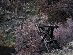
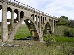
Whitman County has 1 covered bridge on the National Register. Each is a listed structure with a federal nomination on file.
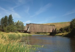 | Manning-Rye Covered Bridge | Listed 1982 |
Every wildfire the federal occurrence database records inside this county: 20 of them, burning about 13,068 acres. 3 started naturally and 1 was recorded as arson. Each settlement page carries the fires within five miles of it.
| Reported cause | Fires |
|---|---|
| Missing data/not specified/undetermined | 8 |
| Natural | 3 |
| Recreation and ceremony | 2 |
| Debris and open burning | 2 |
| Equipment and vehicle use | 2 |
| Smoking | 1 |
| Railroad operations and maintenance | 1 |
| Arson/incendiarism | 1 |
The five largest, by the area the report gives. None of them was recorded as arson.
| Date | Cause | Size | Reported by | Name on the report |
|---|---|---|---|---|
| 7 September 2020 | Missing data/not specified/undetermined | 2,685 acres | Washington State Fire Marshal's Office | MANNING RD |
| 23 August 2006 | Missing data/not specified/undetermined | 2,500 acres | Washington State Fire Marshal's Office | PALOUSE RIVER FIRE |
| 18 August 2008 | Missing data/not specified/undetermined | 2,172 acres | Washington State Fire Marshal's Office | ROCK LAKE FIRE |
| 16 August 2020 | Missing data/not specified/undetermined | 1,400 acres | Washington State Fire Marshal's Office | CHIEF TIMOTHY |
| 21 August 2009 | Natural | 1,185 acres | Washington State Fire Marshal's Office | TEXAS LAKE |
| 21 July 2003 | Smoking | 1,080 acres | Turnbull National Wildlife Refuge | WATT ROAD |
| 23 August 1993 | Equipment and vehicle use | 1,000 acres | Turnbull National Wildlife Refuge | FREEWAY |
| 9 July 1994 | Missing data/not specified/undetermined | 340 acres | Spokane District | SPRAGUE |
Every settlement page carries the fires within five miles of it - see the settlement index below.
The NOAA Storm Events Database holds 126 reports for this county, causing no deaths, 5 injuries and about $3,992,730 in recorded property damage. Each settlement page carries the reports that name it.
| Kind of event | Reports |
|---|---|
| Thunderstorm Wind | 35 |
| Flood | 33 |
| Hail | 22 |
| Flash Flood | 13 |
| Funnel Cloud | 9 |
| Heavy Rain | 4 |
| Tornado | 3 |
| Debris Flow | 3 |
| Wildfire | 2 |
| Lightning | 2 |
The most serious of them, by death, then injury, then recorded damage. The accounts are quoted exactly as the forecast office filed them.
| When | Event | Place named | Harm | What the report says |
|---|---|---|---|---|
| August 2005 | Thunderstorm Wind | Glenwood | 5 hurt, $4,000 | no account filed |
| April 2019 | Flash Flood | Pullman | $1,100,000 | Missouri Flat Creek experienced a Flash Flood which resulted in the North Grand Avenue business district being inundated with up to 4 feet of water in places. Numerous businesses were damaged and parked cars were floated and carried away. Pullman police and fire crews made numerous water rescues of stranded customers and employees of at least 4 businesses including the rescue of 16 people from one business. There were no known injuries and by the next morning the creek had receded back into it's banks. |
| February 2014 | Flood | Lamont | $600,000 | Numerous areas of northern and central Whitman County experienced flooding between the 12th and 14th. State route 23 was closed between Sprague and Saint John between mileposts 15 and 43 due to water over the roadway in several locations. Colfax, WA experienced heavy flooding closing Mill Street from Canyon to Spring which also included mileposts 0 to 1 of SR 272. Flood waters up to a foot were observed in portions of downtown Colfax. Water undercut part of the roadway on SR27 five miles south of Oakesdale washing out part of the northbound lane. Several homes in the community of Ewan were inundated with up to one foot of water. |
| June 1998 | Flash Flood | Hay | $500,000 | flash flood damaged 2 buildings and washed away farm machinery |
| May 2015 | Flash Flood | Seabury | $400,000 | Whitman County Sheriff dispatch reported flash flooding between Oaksdale and Teknoa. The water damaged some nearby spring wheat crops and damaged county roads. |
| February 1999 | Flash Flood | Pullman | $250,000 | Rapid snowmelt and heavy rain lead to rising creeks and streams across Whitman County, which lead to high water levels on the North Fork of the Palouse River. Several homes and business had reports of flooding. |
| March 2014 | Flood | Pine City | $200,000 | Damage to numerous county roads due to flooding. Flooding was also reported along Thorn Creek. |
| August 2022 | Thunderstorm Wind | Oakesdale | $175,000 | Thunderstorm winds moved North from Oakesdale WA to Rockford WA. A weather station clocked gusts to 60 mph. It damaged or knocked down power lines and over 100 trees. It caused power outages around 3200 customers. |
| March 2017 | Flood | Cove | $70,000 | The Palouse River Gage at Potlach, ID recorded a rise above the Flood Stage of 15.0 feet at 10:00 PM PST March 14th, cresting at 17.5 feet at 10:30 AM March 16th. The river dropped below Flood Stage during the evening of the 17th but then rose again above Flood Stage during the afternoon of the 19th cresting 15.6 feet before receding below Flood Stage for the end of the event during the evening of March 19th. |
| July 1998 | Wildfire | La Crosse | $70,000 | Dry and windy conditions help spread small wild fires across farm fields in central Whitman county. Several fires were reported from La Crosse to Endicott to St. John with over 600 acres of wheat and barely burned. |
| November 2010 | Thunderstorm Wind | Pullman Moscow Rgnl | $70,000 | no account filed |
| January 2000 | Thunderstorm Wind | La Crosse | $60,000 | Four downed trees, semi truck overturned and barn destroyed |
| December 1998 | Flash Flood | Pullman | $50,000 | Rapid snowmelt and 2-4 inches of rain lead to flooding of small creeks and streams around Pullman. Portions of the WSU campus exerienced flooding, while several downtown businesses and city streets were indunated by a foot of water. Portions of Highway 195 were closed. |
| August 1998 | Wildfire | Diamond | $50,000 | Dry and windy conditions help spread small three wild fires in farm fields near Diamond. About 11 acres of wheat and timber were burned. One grain elevator was destroyed. |
| February 2000 | Flood | Oakesdale | $50,000 | no account filed |
| January 2000 | Thunderstorm Wind | Garfield | $40,000 | A school roof and apartment roof damaged, 3 storage buildings destored |
| July 1998 | Thunderstorm Wind | Colfax | $40,000 | strong winds knocked trees down, crushing a convertible. only minor wheat damage. |
| March 2026 | Flood | Pullman | $30,000 | South Fork Palouse River flooding, with minor to moderate flooding in areas across Pullman, including downtown, Grand Avenue, and the area around the City Playfields. Water covered N Grand north of NW Windus St. NE Morton St by Reaney pool was flooded across all lanes. Grand Avenue closed from Nye to Ritchie. Main Street from Spring to Pine was closed. Morton Street near Reaney Park closed due to flooding. |
| May 2020 | Thunderstorm Wind | Palouse | $30,000 | Strong thunderstorm winds damaged one vehicle, homes, and a local park. A trained spotter reported that the winds downed trees which caused the damage in Palouse, Washington. There were no known injuries. |
| January 2011 | Flood | Horn | $25,000 | The Palouse River at Palouse overflowed its banks inundating portions of downtown. The hardest hit were low lying areas, where water surrounded homes and covered nearly all of Hayton Green Park on the west end of town. A basement of a local resident and a former school gymnasium were flooded on Main Street. Additional flooding was reported along the Palouse River upstream in Latah County. The Palouse River at Potlach went above its flood stage of 15 feet at 1630PST on the 16th; crested at 16.5 feet at 530PST on the 17th; and then went back below flood stage at 615PST on the 18th. No damage was reported. |
| August 1971 | Tornado (F2) | not stated | $25,000 | no account filed |
| May 2018 | Flash Flood | Grinnell | $20,000 | Heavy rainfall from a slow moving thunderstorm during the evening of May 20th caused Flash Flooding across Ladlow Butte Road near Garfield. A car was swept off the road and into a ditch. The car's occupants were rescued without injury by bystanders. Photos taken as the flood was abating showed mud and debris over a quarter mile stretch of roadway. |
| November 2010 | Thunderstorm Wind | La Crosse | $20,000 | Large trees were uprooted in a park, as well as a tent structure blown over and wrapped around a tree. Part of a roof was also blown off a structure. |
| January 2007 | Flood | Oakesdale | $20,000 | no account filed |
| April 2026 | Flash Flood | Manning | $10,000 | Large road washout on Green Hollow Road at MP5, with large boulders in road and mud flowing across road. |
| February 2025 | Flood | Oakesdale | $10,000 | Overflowing creek in town led to flooding of several homes with water near 6 inches deep. |
| April 2001 | Hail | Albion | $10,000 | A single thunderstorm which moved north-northeast between Colfax and Pullman produced several reports of large hail. Golfball-sized hail at the Whitman County Landfill (4 SSW Albion) did extensive damage to the aluminum canopy on a truck there. A trained spotter in Albion reported dime-sized hail. A farmer located on Clear Creek Road (9 NNE Albion) reported quarter-sized hail which was deep enough to cover the ground. |
| January 2009 | Flood | Colfax | $10,000 | no account filed |
| March 2026 | Flood | Armstrong | $5,000 | SR 194 about 5 miles west of Pullman has been reduced to a single lane due to a washout caused by a failed culvert. |
| February 2025 | Flood | Palouse | $5,000 | An estimated 3 feet of water in basement for several buildings along the Palouse River. |
| September 2024 | Thunderstorm Wind | Whitlow | $5,000 | Large tree branch broke off of tree and crushed the top of a vehicle. Pullman, Moscow Airport recorded a gust of 67 MPH. |
| April 2012 | Flood | Palouse | $5,000 | Hayton Green Park in Palouse was flooded as well as the residence at 415 West Main Street near the park. Flooding was also observed up to the base of the house in the neighboring property. Damage was estimated. |
| January 2007 | Flood | Colfax | $5,000 | no account filed |
| March 2014 | Thunderstorm Wind | Rosalia | $4,500 | Strong winds behind the squall line blew a road sign into a vehicle traveling on State Route 195. |
| August 2004 | Hail | Colfax | $3,000 | no account filed |
| February 2025 | Flood | Garfield | $2,000 | Flooding occurred in town of Garfield with water up to homes. |
| July 2014 | Hail | Wawawai | $2,000 | Hail ranging from quarters to the size of golf balls fell across southwestern Whitman County impacting the communities of Pullman and Palouse. Winds of 50 to 55 mph also accompanied the storm which blew a large water tank about 200 feet. Whitman County Commissioner relayed a report that there was heavy crop damage in the Colton and Pullman areas, but the extent was unknown. |
| June 2010 | Lightning | Dusty | $2,000 | no account filed |
| April 2026 | Heavy Rain | Kitsmiller | $1,000 | Heavy rain led to mud and water over Banner Road and Palouse Albion Road. |
| April 2026 | Heavy Rain | Whitman Co Meml Arpt | $1,000 | Heavy rain led to road washout, mud and rocks on Upper Union Flat Road. |
| February 2025 | Flood | Thornton | $1,000 | Vehicle was stranded in water. |
| February 2025 | Flood | Armstrong | $1,000 | River in the area was overflowing. It led to flooding of cropland, yard and basement. |
| June 2024 | Thunderstorm Wind | Dusty | $1,000 | Washington DOT reported downed trees blocking both lanes on SR 26. A max gust of 42 MPH was recorded. |
| September 2024 | Thunderstorm Wind | Staley | $1,000 | A travel trailer was pushed onto its side. Pullman, Moscow Airport recorded a gust of 67 MPH. |
| September 2019 | Flood | Pullman | $1,000 | Brief heavy rain from a thunderstorm pooled at an intersection in downtown Pullman apparently due to leaf clogged storm drains. The water pooled about 9 inches deep in the intersection which was sufficient to cause minor first floor flooding in a number of adjacent business establishments. |
| June 2010 | Heavy Rain | Dusty | $1,000 | no account filed |
| May 2007 | Thunderstorm Wind | Diamond | $1,000 | no account filed |
| May 2007 | Thunderstorm Wind | Colfax | $1,000 | no account filed |
| May 2007 | Thunderstorm Wind | Ewan | $1,000 | no account filed |
| August 2007 | Thunderstorm Wind | Albion | $1,000 | no account filed |
| August 2007 | Lightning | Palouse | $1,000 | no account filed |
| February 2025 | Flood | Sunshine | $500 | Heavy rain and rapid snow melt led to Sunshine Creek rising and inundating Sunshine Road. The Pullman Airport recorded 1.15 inches of rain. |
| September 2024 | Thunderstorm Wind | Pullman | $500 | Observer reported 1 inch tree limbs broken and shingles blown off roof. Pullman, Moscow Airport recorded a max gusts of 67 MPH. |
| September 2024 | Thunderstorm Wind | Pullman | $500 | Downed tree was reported. Pullman, Moscow Airport recorded a gust of 67 MPH. |
| September 2024 | Thunderstorm Wind | Holland | $500 | Spotter reported roof blown off a greenhouse. Time estimated from ASOS. Pullman, Moscow Airport recorded a max gusts of 67 MPH. |
| August 2014 | Thunderstorm Wind | Riparia | $200 | A line of winds sustained 30 to 45 mph with gusts ranging between 50 and 65 mph blew through Whitman County ahead of a line of thunderstorms. Visibility across western sections of the county lowered below a quarter mile due to blowing dust. Numerous tree limbs were down across the town of Palouse ranging between four and six inches in diameter. |
| September 1986 | Tornado (F0) | not stated | $30 | no account filed |
| February 2025 | Flood | Blackwell | - | Minor flooding in Department of Highways facility with approximately 2 to 3 inches of water in shop. |
| February 2025 | Flood | Glenwood | - | Water over roadway on SR 272 at MP 8 reported. |
| February 2025 | Flood | Rosalia | - | Washed out dirt road with water flowing through. |
The Survey's mineral resources record lists 127 workings inside this county. None of them still produces: all are closed or unrecorded. Each settlement page carries the workings within five miles of it.
| Commodity | Workings |
|---|---|
| Stone, Crushed/Broken | 52 |
| Sand and Gravel, Construction | 48 |
| Clay | 7 |
| Silica | 5 |
| Fire Clay (Refractory) | 2 |
| Pumice | 2 |
| Stone | 2 |
| Gemstone | 2 |
| Semiprecious Gemstone | 2 |
| Slate, Dimension | 1 |
| Stone, Dimension | 1 |
| Quartz | 1 |
| Corundum | 1 |
| Feldspar | 1 |
The least common of them first, because a county's hundredth gravel pit says nothing its first ten did not.
| Where | Site | Commodity | Status | Recorded |
|---|---|---|---|---|
| Bald Butte | Corundum, Gemstone | Occurrence | ||
| Bald Butte | Feldspar | Occurrence | ||
| Colton | Quartz | Occurrence | ||
| Duffield Creek Quarry | Stone, Dimension | Past Producer | ||
| Granite Point Quarry | Granite | Past Producer | ||
| Hole In the Ground | Slate, Dimension | Past Producer | ||
| Cox Pit | Fire Clay (Refractory) | Past Producer | ||
| Moses | Semiprecious Gemstone | Prospect | ||
| Pullman-Moscow Quarry | Stone | Past Producer | ||
| Qs-P-98 Pit | Stone | Past Producer | ||
| Ringo | Fire Clay (Refractory) | Past Producer | ||
| Ringo | Gemstone | Occurrence | ||
| Wawawai Canyon | Pumice | Occurrence | ||
| Whelan | Semiprecious Gemstone | Past Producer | 1891 | |
| Willow Creek | Pumice | Occurrence | ||
| Kamiak Butte | Silica | Occurrence | ||
| Ladow Butte | Silica | Occurrence | ||
| Ringo Hills | Silica | Occurrence | ||
| Steptoe Butte | Silica | Occurrence | ||
| Stratton Butte | Silica | Occurrence | ||
| Colfax | Clay | Past Producer | ||
| Colfax Quarry | Clay | Occurrence | ||
| Garfield | Clay | Occurrence | ||
| Garfield | Clay | Past Producer | ||
| Palouse | Clay | Past Producer | ||
| Pullman | Clay | Past Producer | ||
| Uniontown | Clay | Past Producer | ||
| Barnhill Pit | Sand and Gravel, Construction | Past Producer | ||
| Borrow Pit | Sand and Gravel, Construction | Past Producer | ||
| Borrow Pit | Sand and Gravel, Construction | Past Producer | ||
| Camp Pit | Sand and Gravel, Construction | Past Producer | ||
| Camp Pit | Sand and Gravel, Construction | Past Producer | ||
| Central Premix Concrete Co | Sand and Gravel, Construction | Past Producer | ||
| Dept of Highways | Sand and Gravel, Construction | Past Producer | ||
| Durham Pit | Sand and Gravel, Construction | Past Producer | ||
| Ewan Pit | Sand and Gravel, Construction | Past Producer | ||
| Gravel Pit | Sand and Gravel, Construction | Past Producer | ||
| Gravel Pit | Sand and Gravel, Construction | Past Producer | ||
| Gravel Pit | Sand and Gravel, Construction | Past Producer | ||
| Gravel Pit | Sand and Gravel, Construction | Past Producer | ||
| Gravel Pit | Sand and Gravel, Construction | Past Producer | ||
| Gravel Pit | Sand and Gravel, Construction | Past Producer | ||
| Gravel Pit | Sand and Gravel, Construction | Past Producer | ||
| Gravel Pit | Sand and Gravel, Construction | Past Producer | ||
| Gravel Pit | Sand and Gravel, Construction | Past Producer | ||
| Gravel Pit | Sand and Gravel, Construction | Past Producer | ||
| Gravel Pit | Sand and Gravel, Construction | Past Producer | ||
| Johnson Pit | Sand and Gravel, Construction | Past Producer | ||
| Rosalia Ready Mix | Sand and Gravel, Construction | Past Producer | ||
| Schell Pit | Sand and Gravel, Construction | Past Producer | ||
| Schindler Pit | Sand and Gravel, Construction | Past Producer | ||
| Snow Pit | Sand and Gravel, Construction | Past Producer | ||
| Union Center Quarry | Sand and Gravel, Construction | Past Producer | ||
| Unnamed Pit | Sand and Gravel, Construction | Past Producer | ||
| Unnamed Pit | Sand and Gravel, Construction | Past Producer | ||
| Unnamed Pit | Sand and Gravel, Construction | Past Producer | ||
| Unnamed Pit | Sand and Gravel, Construction | Past Producer | ||
| Unnamed Pit | Sand and Gravel, Construction | Past Producer | ||
| Unnamed Pit | Sand and Gravel, Construction | Past Producer | ||
| Unnamed Pit | Sand and Gravel, Construction | Past Producer | ||
| Unnamed Pit | Sand and Gravel, Construction | Past Producer | ||
| Unnamed Pit | Sand and Gravel, Construction | Past Producer | ||
| Unnamed Pit | Sand and Gravel, Construction | Past Producer | ||
| Unnamed Pit | Sand and Gravel, Construction | Past Producer | ||
| Unnamed Pit | Sand and Gravel, Construction | Past Producer | ||
| Unnamed Pit | Sand and Gravel, Construction | Past Producer | ||
| Unnamed Pit | Sand and Gravel, Construction | Past Producer | ||
| Unnamed Pit | Sand and Gravel, Construction | Past Producer | ||
| Unnamed Pit | Sand and Gravel, Construction | Past Producer | ||
| Unnamed Pit | Sand and Gravel, Construction | Past Producer | ||
| Unnamed Pit | Sand and Gravel, Construction | Past Producer | ||
| Unnamed Quarry | Sand and Gravel, Construction | Past Producer | ||
| Whitman County Road Department | Sand and Gravel, Construction | Past Producer | ||
| Wilma Pit | Sand and Gravel, Construction | Past Producer | ||
| Winona Pit | Sand and Gravel, Construction | Past Producer | ||
| Bishop Quarry | Stone, Crushed/Broken | Past Producer | ||
| Carl Carsoarry | Stone, Crushed/Broken | Past Producer | ||
| Chestnut Quarry | Stone, Crushed/Broken | Past Producer | ||
| Cocking Pit | Stone, Crushed/Broken | Past Producer | ||
| Collins Quarry | Stone, Crushed/Broken | Past Producer | ||
| Crow Rock Products Inc | Stone, Crushed/Broken | Past Producer | ||
| Dahm Quarry | Stone, Crushed/Broken | Past Producer | ||
| Druffel Quarry | Stone, Crushed/Broken | Past Producer | ||
| Druffel Quarry | Stone, Crushed/Broken | Past Producer | ||
| Faires Quarry | Stone, Crushed/Broken | Past Producer | ||
| Fish Quarry | Stone, Crushed/Broken | Past Producer | ||
| Garfield Quarry | Stone, Crushed/Broken | Past Producer | ||
| Glaspy Quarry | Stone, Crushed/Broken | Past Producer | ||
| Gravel Pit | Stone, Crushed/Broken | Past Producer | ||
| Gravel Pit | Stone, Crushed/Broken | Past Producer | ||
| Gravel Pit | Stone, Crushed/Broken | Past Producer | ||
| Gravel Pit | Stone, Crushed/Broken | Past Producer | ||
| Greenwalt Quarry | Stone, Crushed/Broken | Past Producer | ||
| Henderson Quarry | Stone, Crushed/Broken | Past Producer | ||
| Jones Quarry | Stone, Crushed/Broken | Past Producer | ||
| Mcneilly Quarry | Stone, Crushed/Broken | Past Producer | ||
| Murphy Quarry | Stone, Crushed/Broken | Past Producer | ||
| Oakesdale Quarry | Stone, Crushed/Broken | Past Producer | ||
| Palouse Quarry | Stone, Crushed/Broken | Past Producer | ||
| Poppie Quarry | Stone, Crushed/Broken | Past Producer | ||
| Sage Quarry | Stone, Crushed/Broken | Past Producer | ||
| Sanders Quarry | Stone, Crushed/Broken | Past Producer | ||
| Staley Quarry | Stone, Crushed/Broken | Past Producer | ||
| Thompson Quarry | Stone, Crushed/Broken | Past Producer | ||
| Turnbow Quarry | Stone, Crushed/Broken | Past Producer | ||
| Union Flat Quarry | Stone, Crushed/Broken | Past Producer | ||
| United Paving Quarry | Stone, Crushed/Broken | Past Producer | ||
| Unnamed Pit | Stone, Crushed/Broken | Past Producer | ||
| Unnamed Quarry | Stone, Crushed/Broken | Past Producer | ||
| Unnamed Quarry | Stone, Crushed/Broken | Past Producer | ||
| Unnamed Quarry | Stone, Crushed/Broken | Past Producer | ||
| Unnamed Quarry | Stone, Crushed/Broken | Past Producer | ||
| Unnamed Quarry | Stone, Crushed/Broken | Past Producer | ||
| Unnamed Quarry | Stone, Crushed/Broken | Past Producer | ||
| Unnamed Quarry | Stone, Crushed/Broken | Past Producer | ||
| Unnamed Quarry | Stone, Crushed/Broken | Past Producer | ||
| Unnamed Quarry | Stone, Crushed/Broken | Past Producer | ||
| Unnamed Quarry | Stone, Crushed/Broken | Past Producer | ||
| Unnamed Quarry | Stone, Crushed/Broken | Past Producer | ||
| Unnamed Quarry | Stone, Crushed/Broken | Past Producer | ||
| Unnamed Quarry | Stone, Crushed/Broken | Past Producer | ||
| Unnamed Quarry | Stone, Crushed/Broken | Past Producer | ||
| Unnamed Quarry | Stone, Crushed/Broken | Past Producer | ||
| Unnamed Quarry | Stone, Crushed/Broken | Past Producer | ||
| Unnamed Quarry | Stone, Crushed/Broken | Past Producer | ||
| Unnamed Quarry | Stone, Crushed/Broken | Past Producer | ||
| Weitman Quarry | Stone, Crushed/Broken | Past Producer |
Named settlements recorded in the Geographic Names Information System, each with the topographic sheets covering it. Villages, hamlets and abandoned places alike. Each is shown with the nearest named watercourse or landform and the survey quadrangle it falls on.
LaCrosse census division · 99111 · On Little Almota Creek · Almota quadrangle
13 sheets, 1910 to 1982
Colfax-Palouse census division · 99111 · On Spring Flat Creek · Colfax North quadrangle
12 sheets, 1910 to 1982
Garfield-Oakesdale census division · 99130 · On Silver Creek · Elberton quadrangle
12 sheets, 1910 to 1982
Garfield-Oakesdale census division · 99128 · Farmington quadrangle
12 sheets, 1903 to 1994
Garfield-Oakesdale census division · 99130 · On Clear Creek · Colfax North quadrangle
12 sheets, 1910 to 1982
LaCrosse census division · 99143 · On Willow Creek · Rattlesnake Canyon quadrangle
9 sheets, 1950 to 1983
Colfax-Palouse census division · 99111 · On Dry Creek · Diamond quadrangle
12 sheets, 1910 to 1982
Rock Lake census division · 99171 · Near Hastings Gulch · Saint John quadrangle
5 sheets, 1955 to 1984
Rosalia census division · 99170 · On Thorn Creek · Pine City quadrangle
5 sheets, 1955 to 1984
Garfield-Oakesdale census division · 99130 · On Ladow Butte · Palouse quadrangle
13 sheets, 1910 to 1982
Rock Lake census division · 99171 · On East Fork Downing Creek · Ewan quadrangle
6 sheets, 1955 to 1984
Colfax-Palouse census division · 99111 · On Dry Creek · Diamond quadrangle
12 sheets, 1910 to 1982
Uniontown census division · 99347 · Near Steptoe Canyon · Silcott Island quadrangle
10 sheets, 1945 to 1981
Garfield-Oakesdale census division · 99158 · On McCoy Creek · Oakesdale quadrangle
10 sheets, 1903 to 1984
Rosalia census division · 99170 · On Cabbage Creek · Rosalia quadrangle
10 sheets, 1903 to 1984
Colfax-Palouse census division · 99111 · On Fourmile Creek · Colfax South quadrangle
12 sheets, 1910 to 1982
LaCrosse census division · 99143 · In Penawawa Canyon · Ping quadrangle
9 sheets, 1950 to 1982
LaCrosse census division · 99347 · Near Schoolhouse Draw · Central Ferry quadrangle
10 sheets, 1950 to 1982
Rosalia census division · 99170 · On Thorn Creek · Pine City quadrangle
5 sheets, 1955 to 1984
Pullman census division · 99163 · On Missouri Flat Creek · Pullman quadrangle
15 sheets, 1910 to 1982
Pullman census division · 99163 · On Sunshine Creek · Pullman quadrangle
15 sheets, 1910 to 1982
LaCrosse census division · 99347 · Near Cottonwood Canyon · Central Ferry quadrangle
10 sheets, 1950 to 1982
Rock Lake census division · 99017 · On Imbler Creek · Revere quadrangle
5 sheets, 1955 to 1984
LaCrosse census division · 99143 · Near Browns Gulch · Delaney quadrangle
10 sheets, 1950 to 1982
Colfax-Palouse census division · 99161 · Near Angel Butte · Viola quadrangle
13 sheets, 1910 to 1982
LaCrosse census division · 99333 · On Alkali Flat Creek · Starbuck East quadrangle
8 sheets, 1948 to 1983
Pullman census division · 99163 · On Fourmile Creek · Colfax South quadrangle
12 sheets, 1910 to 1982
Garfield-Oakesdale census division · 99111 · Near Tennessee Flat · Steptoe quadrangle
9 sheets, 1903 to 1984
LaCrosse census division · 99347 · In Swift Canyon · Wades Bar quadrangle
9 sheets, 1950 to 1982
Tekoa census division · 99033 · On Little Hangman Creek · Tekoa quadrangle
11 sheets, 1903 to 1984
Pullman census division · 99163 · On Wilbur Creek · Ewartsville quadrangle
12 sheets, 1910 to 1982
Uniontown census division · 99179 · On Spring Creek · Uniontown quadrangle
12 sheets, 1910 to 1982
Tekoa census division · 99128 · On Willow Creek · Oakesdale quadrangle
10 sheets, 1903 to 1984
Uniontown census division · 99113 · In Wawawai Canyon · Almota quadrangle
13 sheets, 1910 to 1982
No longer a settlement
Pullman census division · 99163 · On Sunshine Creek · Pullman quadrangle
15 sheets, 1910 to 1982
Pullman census division · 99163 · Pullman quadrangle
15 sheets, 1910 to 1982
No longer a settlement
Rock Lake census division · 99125 · On Rebel Flat Creek · Winona quadrangle
10 sheets, 1950 to 1982
The vanished settlements of Whitman County: the places named above that are no longer on the map.