 Block
Pullman, Washington
15 topographic sheets cover this place, the earliest surveyed in 1910 and the latest in 1982. It stands in the Pullman census division. It lies in ZIP code area 99163. It stands on Missouri Flat Creek. The Survey maps it on the Pullman quadrangle. 32,901 people lived here at the 2020 count. It stands 2,352 feet above sea level.
Research this city
On record in Pullman
Buildings and businesses the archive holds for this place. Each opens its own page, with the source record it came from.
On the National Register 12 of 13 shown
 Cordova Theaterlisted 2004
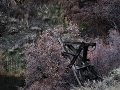 Interior Grain Tramwaylisted 1988
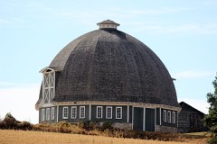 T. A. Leonard Barnlisted 1986
 Northern Pacific Railway Depot - Pullmanlisted 2019
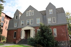 Stevens Halllisted 1979
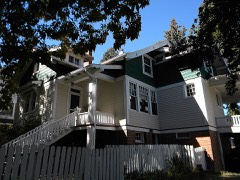 William Swain Houselisted 1994
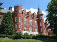 Albert W. Thompson Halllisted 1973
 U.S. Post Office-Pullmanlisted 2003
 United Presbyterian Churchlisted 1989
- College Hill Historic Districtlisted 2006
- Interstate Telephone Co. - Pullmanlisted 2026
- Pullman High Schoollisted 1998
Population over time
2 figuresPullman grew from 29,799 to 32,901 between 2010 and 2020. These are the recorded population figures Wikidata holds for this place, reached through the Geographic Names Information System number this page is keyed on rather than by name, so they belong to this place and not to another of the same name. Most are census counts, but not all are: an early figure may be a founding or settlement estimate, and an estimate published within five years of a census is left out. The change column is computed, and is left blank where more than 20 years separate a figure from the one before it, because a gap that long is not a change between two counts.
| Year | People | Change |
|---|---|---|
| 2010 | 29,799 | |
| 2020 | 32,901 | +3,102 (+10%) |
Topographic sheets covering this place
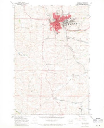
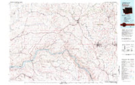
6 surveys from 15 printed sheetsMatched by testing this settlement's coordinate against the published boundary of every sheet in the United States Geological Survey's historical collection. Each opens the scanned sheet at the Survey.
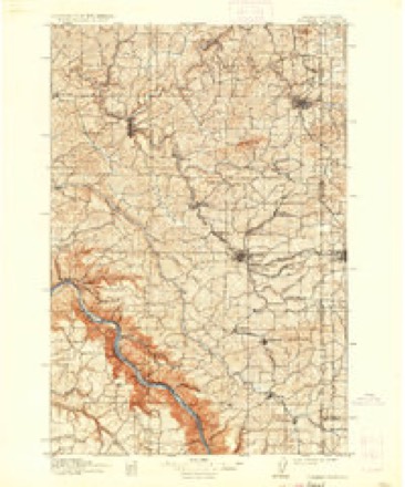
- 1910 USGS Pullman quadrangle1:125000, 5 printings
- 1955 USGS Pullman quadrangle1:250000, 3 printings
- 1958 USGS Pullman quadrangle1:250000, 2 printings
- 1964 USGS Pullman quadrangle1:24000, 3 printings
- 1975 USGS Pullman quadrangle1:24000
- 1982 USGS Pullman quadrangle1:100000

Mines and quarries near this place
10 of 17 shownRegional context, not property-specific evidence. The federal mineral resources record lists 17 workings within 5 miles of Pullman: 17 past producers. None of them still produces. What was taken out: Stone, Crushed/Broken, Sand and Gravel, Construction, Clay. Distance is straight-line from the map coordinates, so a quarry counted here may appear on a neighbouring settlement's page as well.
| Where | Site | Commodity | Status | Recorded |
|---|---|---|---|---|
| Pullman | Clay | Past Producer | ||
| Central Premix Concrete Co | Sand and Gravel, Construction | Past Producer | ||
| Gravel Pit | Sand and Gravel, Construction | Past Producer | ||
| Unnamed Pit | Sand and Gravel, Construction | Past Producer | ||
| Bishop Quarry | Stone, Crushed/Broken | Past Producer | ||
| Carl Carsoarry | Stone, Crushed/Broken | Past Producer | ||
| Druffel Quarry | Stone, Crushed/Broken | Past Producer | ||
| Glaspy Quarry | Stone, Crushed/Broken | Past Producer | ||
| Henderson Quarry | Stone, Crushed/Broken | Past Producer | ||
| Poppie Quarry | Stone, Crushed/Broken | Past Producer |
Storms near this place
20 since 1997Regional context, not property-specific evidence. The National Weather Service names Pullman in 20 storm reports between 1997 and 2026: 8 thunderstorm wind, 4 flash flood, 4 flood, 2 hail. No death or injury is recorded in these reports. Each account below is quoted exactly as the forecast office filed it, from the NOAA Storm Events Database, and each date opens the federal record of that event.
| When | Event | Place named | Harm | What the report says |
|---|---|---|---|---|
| April 2019 | Flash Flood | Pullman | $1,100,000 | Missouri Flat Creek experienced a Flash Flood which resulted in the North Grand Avenue business district being inundated with up to 4 feet of water in places. Numerous businesses were damaged and parked cars were floated and carried away. Pullman police and fire crews made numerous water rescues of stranded customers and employees of at least 4 businesses including the rescue of 16 people from one business. There were no known injuries and by the next morning the creek had receded back into it's banks. |
| February 1999 | Flash Flood | Pullman | $250,000 | Rapid snowmelt and heavy rain lead to rising creeks and streams across Whitman County, which lead to high water levels on the North Fork of the Palouse River. Several homes and business had reports of flooding. |
| December 1998 | Flash Flood | Pullman | $50,000 | Rapid snowmelt and 2-4 inches of rain lead to flooding of small creeks and streams around Pullman. Portions of the WSU campus exerienced flooding, while several downtown businesses and city streets were indunated by a foot of water. Portions of Highway 195 were closed. |
| March 2026 | Flood | Pullman | $30,000 | South Fork Palouse River flooding, with minor to moderate flooding in areas across Pullman, including downtown, Grand Avenue, and the area around the City Playfields. Water covered N Grand north of NW Windus St. NE Morton St by Reaney pool was flooded across all lanes. Grand Avenue closed from Nye to Ritchie. Main Street from Spring to Pine was closed. Morton Street near Reaney Park closed due to flooding. |
| September 2019 | Flood | Pullman | $1,000 | Brief heavy rain from a thunderstorm pooled at an intersection in downtown Pullman apparently due to leaf clogged storm drains. The water pooled about 9 inches deep in the intersection which was sufficient to cause minor first floor flooding in a number of adjacent business establishments. |
| September 2024 | Thunderstorm Wind | Pullman | $500 | Observer reported 1 inch tree limbs broken and shingles blown off roof. Pullman, Moscow Airport recorded a max gusts of 67 MPH. |
| September 2024 | Thunderstorm Wind | Pullman | $500 | Downed tree was reported. Pullman, Moscow Airport recorded a gust of 67 MPH. |
| February 2025 | Flood | Pullman | - | Heavy rain and rapid snow melt led to water over roadway on North Grand by Mobil Station and Cougar County Drive In.. The Pullman Airport recorded 1.15 inches of rain. |
| February 2025 | Flood | Pullman | - | Water over roadway on Fairmount Drive between Grand and Planet Fitness reported. |
| September 2024 | Thunderstorm Wind | Pullman | - | Mesonet station DW6220 in Pullman reported a gust of 69 MPH. |
| May 2022 | Funnel Cloud | Pullman | - | A small funnel cloud dissipated shortly after formation. There is no indication that the circulation ever made contact with the ground. The location is estimated from social media shared by the media. |
| May 2020 | Funnel Cloud | Pullman | - | A member of the public reported and submitted a picture of a funnel cloud in southeast Pullman, Washington. Time estimated by radar. |
| May 2020 | Thunderstorm Wind | Pullman | - | A Mesonet station in Pullman, Washington measured a wind gust of 60 mph. |
| August 2008 | Thunderstorm Wind | Pullman | - | Strong outflow winds from a thunderstorm contributed to several downed power lines in Pullman with about 60 customers losing power. Six trees fell on roads, three trees fell on cars, and two power lines were downed. |
| July 1997 | Hail | Pullman | - | 3/4 inch hail reported by sheriff's office |
| May 1997 | Thunderstorm Wind | Pullman | - | 60 mph gust |
| May 1997 | Thunderstorm Wind | Pullman | - | 60 mph gust |
| May 2008 | Flash Flood | Pullman | - | no account filed |
| August 2007 | Thunderstorm Wind | Pullman | - | no account filed |
| June 2006 | Hail | Pullman | - | no account filed |
Nearest settlements
The eight closest, with where each one stands in the county. Distances are straight-line, computed from the Geographic Names Information System coordinates.
| Map | Place | Distance | Sheets |
|---|---|---|---|
| Pullman Junction | 1.5 miles | 15 | |
| Whitlow | 1.7 miles | 15 | |
| Kitzmiller | 2.0 miles | 12 | |
| Busby | 3.1 miles | 15 | |
| Armstrong | 3.1 miles | 12 | |
| Wilma (historical) | 3.8 miles | 15 | |
| Sunshine | 4.5 miles | 16 | |
| Staley | 4.6 miles | 15 |
Elsewhere
Matched on this settlement's Geographic Names Information System number rather than its name, so it cannot be a different place of the same name in another state.
| Wikipedia article on Pullman | An encyclopaedic summary. Its text is share-alike, so it is linked here rather than copied. |
| Wikidata item Q983540 | The structured record the population and elevation above come from. Public domain (CC0). |
Provenance
This settlement is recorded in the Geographic Names Information System as feature 1531905. The sheet list is computed by point-in-boundary test against the United States Geological Survey's historical topographic inventory. Both are works of the United States government and carry no copyright under 17 U.S.C. 105.
Mines and quarries. USGS Mineral Resources Data System (MRDS) https://mrdata.usgs.gov/mrds/ A work of the United States government, no copyright under 17 U.S.C. 105.
Storms. NOAA National Centers for Environmental Information, Storm Events Database https://www.ncei.noaa.gov/stormevents/ A work of the United States government, no copyright under 17 U.S.C. 105. Narratives are quoted verbatim from the National Weather Service report and are not edited or summarised.