 Block
Stehekin, Washington
14 topographic sheets cover this place, the earliest surveyed in 1902 and the latest in 1969. It stands in the Stehekin census division. It lies in ZIP code area 98852. It stands on Purple Creek. The Survey maps it on the Stehekin quadrangle. It stands 1,148 feet above sea level.
On record in Stehekin
Buildings and businesses the archive holds for this place. Each opens its own page, with the source record it came from.
On the National Register 12 of 13 shown
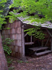 Bridge Creek Shelterlisted 1989
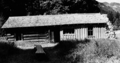 Buckner Cabinlisted 1974
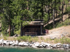 Flick Creek Shelterlisted 1989
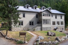 Golden West Lodge Historic Districtlisted 1989
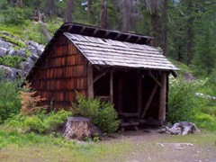 High Bridge Shelterlisted 1989
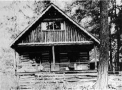 George Miller Houselisted 1989
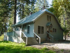 Purple Point-Stehekin Ranger Station Houselisted 1989
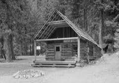 Stehekin Schoollisted 1974
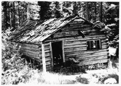 Sulphide-Frisco Cabinlisted 1989
- Black Warrior Minelisted 1974
- Bridge Creek Cabin-Ranger Stationlisted 1989
- Courtney Cabinlisted 1974
Topographic sheets covering this place
6 surveys from 14 printed sheetsMatched by testing this settlement's coordinate against the published boundary of every sheet in the United States Geological Survey's historical collection. Each opens the scanned sheet at the Survey.
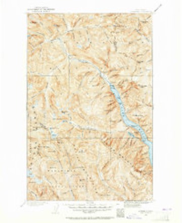
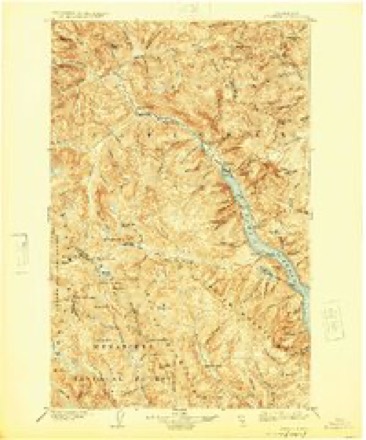
- 1902 USGS Stehekin quadrangle1:125000, 2 printings
- 1904 USGS Stehekin quadrangle1:125000, 5 printings
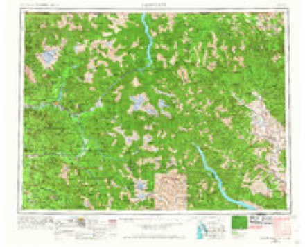
- 1955 USGS Concrete quadrangle1:250000
- 1958 USGS Concrete quadrangle1:250000, 2 printings
- 1962 USGS Concrete quadrangle1:250000
- 1969 USGS Stehekin quadrangle1:24000, 3 printings
Fires near this place
75 since 1992Regional context, not property-specific evidence. The federal wildfire occurrence database lists 75 fires within 5 miles of Stehekin between 1992 and 2019, burning about 15,494 acres in total. 49 started naturally. 1 was recorded as arson. Distance is straight-line from the map coordinates, so a fire counted here may appear on a neighbouring settlement's page as well.
| Reported cause | Fires |
|---|---|
| Natural | 49 |
| Recreation and ceremony | 7 |
| Smoking | 4 |
| Power generation/transmission/distribution | 4 |
| Debris and open burning | 3 |
| Equipment and vehicle use | 2 |
| Misuse of fire by a minor | 2 |
| Missing data/not specified/undetermined | 2 |
| Firearms and explosives use | 1 |
| Arson/incendiarism | 1 |
The most recent of them, most recent first, with the day each was reported and the service that recorded it.
| Date | Cause | Size | Reported by | Name on the report |
|---|---|---|---|---|
| 9 September 2013 | Equipment and vehicle use | under an acre | North Cascades National Park | IMUS PARK |
| 8 September 2016 | Recreation and ceremony | under an acre | Lake Chelan National Recreation Area | LAKEVIEW |
| 8 September 1992 | Natural | under an acre | North Cascades National Park | JUANITA |
| 3 September 2009 | Natural | under an acre | North Cascades National Park | AIRPORT VIEW |
| 24 September 2001 | Debris and open burning | under an acre | North Cascades National Park | IMUS CREEK |
| 17 September 1999 | Recreation and ceremony | under an acre | North Cascades National Park | DOUBLE 07 |
| 7 August 2005 | Smoking | under an acre | North Cascades National Park | RAINBOWTRA |
| 7 August 1999 | Natural | under an acre | Okanogan-Wenatchee National Forest | BLACK BERRY |
Settlements close enough to share some of these fires:
Mines and quarries near this place
2 within 5 milesRegional context, not property-specific evidence. The federal mineral resources record lists 2 workings within 5 miles of Stehekin: 1 occurrence, 1 prospect. None of them still produces. What was taken out: Uranium, Copper. Distance is straight-line from the map coordinates, so a quarry counted here may appear on a neighbouring settlement's page as well.
| Where | Site | Commodity | Status | Recorded |
|---|---|---|---|---|
| Dead Fish | Uranium | Occurrence | ||
| Sad Paul's Duck | Copper | Prospect |
Storms near this place
17 since 2006Regional context, not property-specific evidence. The National Weather Service names Stehekin in 17 storm reports between 2006 and 2026: 11 flood, 4 debris flow, 2 flash flood. No death or injury is recorded in these reports. Each account below is quoted exactly as the forecast office filed it, from the NOAA Storm Events Database, and each date opens the federal record of that event.
| When | Event | Place named | Harm | What the report says |
|---|---|---|---|---|
| November 2006 | Flood | Stehekin | $569,000 | Heavy rainfall of 7-8 inches in two days led to river flooding on the Stehekin River at Stehekin. The river crested at 28.8 feet, with a flood stage of 24.0 feet. Some homes were flooded by the river. Washed out roads prevented Stehekin residents from reaching town. |
| September 2013 | Flash Flood | Stehekin | $330,000 | Flash flooding and debris traveled down Imus Creek near Stehekin and covered approximately 350 linear feet of Stehekin Valley Road. Mud and debris covered the road up to eight feet deep in spots. Several vehicles and bicycles in a parking area were damaged and/or pushed into Stehekin Lake. An office and residential building were surrounded by mud and debris, but only received minimal interior flood damage. Damage costs were estimated. |
| September 2013 | Flash Flood | Stehekin | $110,000 | Highway 20 was closed across Chelan County due to flash flooding and debris flows. Damage costs were estimated. |
| December 2025 | Flood | Stehekin | $100,000 | Several reports of flood impacts were received from the Lake Chelan Recreation Area and Stehekin. A rockslide took place outside the Pioneer burn area from 2024 and blocked the road, damaging 200 yards of the road between Purple Point and Loggers Point. Several debris flows coming down onto roads in the area, including Stehekin Valley Road. The town of Stehekin experienced a debris flow from the Pioneer Fire Burn Scar. A debris flow has washed out multiple roads, and swept away the water treatment plant and sewer system. They are currently receiving pallets of water and other resources. Damage cost is estimated. |
| September 2013 | Debris Flow | Stehekin | $40,000 | A debris flow blocked the road to Harts Pass just below Deadhorse Point. The slide continued down onto Lost River Road near the River Bend Campground. Mud and debris accumulated to about five feet in depth across the road. Damage costs were estimated. |
| May 2017 | Flood | Stehekin | $5,000 | The Stehekin River Gage at Stehekin recorded a rise above the Flood Stage of 24.0 feet at 5:00 PM PST May 23rd, crested at 24.8 feet at 12:30 AM May 24th and then dropped below Flood Stage at 10:15 AM May 24th. The river then rose again above Flood Stage at 8:30 PM PST on May 28th, crested near 25.8 feet at 2:15 AM on May 31st, and remained above Flood Stage through early June. |
| November 2017 | Flood | Stehekin | $3,000 | The Stehekin River reached minor flood on November 23rd. The Stehekin COOP observer reported minor damage to a bridge. Several access roads to private residencies and a camp ground were flooded with minor gravel damage to the road surface. |
| June 2017 | Flood | Stehekin | $2,000 | The Stehekin River Gage at Stehekin recorded a rise above the Flood Stage of 24.0 feet at 8:30 PM PST on May 28th, crested near 25.8 feet at 2:15 AM on May 31st, and then receded, passing below the Flood Stage at 7:45 AM on June 1st. |
| August 2014 | Debris Flow | Stehekin | $2,000 | Heavy rain caused a mudslide at Thimbleberry Creek at the 7.5 mile marker on Stehekin Valley Road. Three large culverts and creek channels are filled with debris. The water became rerouted around the debris and along the road to a culvert 1000 feet down valley. A second smaller slide was at the No Named Creek. A third slide is at mile 9.2 where debris slid to a barn and corral at a ranch. |
| March 2026 | Flood | Stehekin | $1,000 | Social media shared a video showing water Company Creek Road. Exact location and time estimated. |
| May 2023 | Debris Flow | Stehekin | $1,000 | Debris flow and flooding near Eagle Creek off the Twisp River. Several large logs and mud moved down the channel and impacted the forest service roads. Rain, for areas around the spot, several days prior ranged from 0.30-1 inch. |
| May 2018 | Flood | Stehekin | $250 | The USGS River Gage on the Stehekin River at Stehekin recorded a rise above the Flood Stage of 24 feet at 5:15 PM PST on May 15th. The river fluctuated slightly above and below the Flood Stage due to the diurnal snow melt and run off cycle through May 17th, with a maximum crest of 24.4 feet at 11:00 PM on May 15th. The river dropped below the Flood Stage and continued to recede at 3:30 AM on May 17th. |
| November 2017 | Flood | Stehekin | - | The Stehekin River Gage at Stehekin rose above the Flood Stage of 24.0 feet at 3:45 AM PST on November 23rd. The river crested at 25.8 feet at 8:30 AM and dropped back below Flood Stage at 8:00 PM. |
| July 2012 | Debris Flow | Stehekin | - | no account filed |
| November 2008 | Flood | Stehekin | - | no account filed |
| May 2008 | Flood | Stehekin | - | no account filed |
| May 2006 | Flood | Stehekin | - | no account filed |
Nearest settlements
The eight closest, with where each one stands in the county. Distances are straight-line, computed from the Geographic Names Information System coordinates.
| Map | Place | Distance | Sheets |
|---|---|---|---|
| Moore | 5.6 miles | 18 | |
| Lucerne | 8.1 miles | 18 | |
| Domke Lake Resort | 9.3 miles | 18 | |
| Holden (historical) | 9.8 miles | 24 | |
| Trinity | 19.2 miles | 23 | |
| Telma | 33.3 miles | 17 | |
| Hollywood Beach | 35.3 miles | 13 | |
| Shrine Beach | 35.8 miles | 13 |
Elsewhere
Matched on this settlement's Geographic Names Information System number rather than its name, so it cannot be a different place of the same name in another state.
| Wikipedia article on Stehekin | An encyclopaedic summary. Its text is share-alike, so it is linked here rather than copied. |
| Wikidata item Q3113277 | The structured record the population and elevation above come from. Public domain (CC0). |
Provenance
This settlement is recorded in the Geographic Names Information System as feature 1526531. The sheet list is computed by point-in-boundary test against the United States Geological Survey's historical topographic inventory. Both are works of the United States government and carry no copyright under 17 U.S.C. 105.
Wildfire. Short, Karen C. 2022. Spatial wildfire occurrence data for the United States, 1992-2020 [FPA_FOD_20221014]. 6th Edition. Fort Collins, CO: Forest Service Research Data Archive. https://doi.org/10.2737/RDS-2013-0009.6 Collected with United States Government funding and usable without additional permissions or fees.
Mines and quarries. USGS Mineral Resources Data System (MRDS) https://mrdata.usgs.gov/mrds/ A work of the United States government, no copyright under 17 U.S.C. 105.
Storms. NOAA National Centers for Environmental Information, Storm Events Database https://www.ncei.noaa.gov/stormevents/ A work of the United States government, no copyright under 17 U.S.C. 105. Narratives are quoted verbatim from the National Weather Service report and are not edited or summarised.