Block
From the record
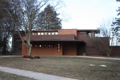
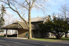
38 National Register listings published here, 1 of them a National Historic Landmark.
Sources: the county history on the Internet Archive · the National Register database, National Park Service
64 topographic sheets cover 55 settlements here, and 38 properties are on the National Register of Historic Places.
38 National Register listings published here, 1 of them a National Historic Landmark.
Sources: the county history on the Internet Archive · the National Register database, National Park Service
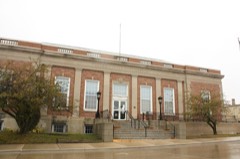
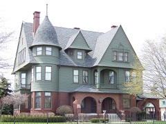
Every property in this county listed on the National Register of Historic Places, with the year it was listed and the federal nomination document.
Every wildfire the federal occurrence database records inside this county: 64 of them, burning about 139 acres. None started naturally and 7 were recorded as arson. Each settlement page carries the fires within five miles of it.
| Reported cause | Fires |
|---|---|
| Missing data/not specified/undetermined | 26 |
| Debris and open burning | 25 |
| Arson/incendiarism | 7 |
| Misuse of fire by a minor | 2 |
| Recreation and ceremony | 1 |
| Equipment and vehicle use | 1 |
| Smoking | 1 |
| Fireworks | 1 |
The five largest, by the area the report gives. Two of them were set deliberately.
| Date | Cause | Size | Reported by | Name on the report |
|---|---|---|---|---|
| 22 April 1994 | Arson/incendiarism | 85 acres | Wisconsin Department of Natural Resources | not named |
| 13 May 2020 | Missing data/not specified/undetermined | 20 acres | Wisconsin Department of Natural Resources | 10 |
| 10 April 1994 | Missing data/not specified/undetermined | 5.0 acres | Wisconsin Department of Natural Resources | not named |
| 8 April 1997 | Debris and open burning | 3.9 acres | Wisconsin Department of Natural Resources | not named |
| 24 March 1998 | Arson/incendiarism | 2.5 acres | Wisconsin Department of Natural Resources | not named |
| 24 April 2020 | Missing data/not specified/undetermined | 2.0 acres | Wisconsin Department of Natural Resources | 17 |
| 13 April 2003 | Missing data/not specified/undetermined | 1.8 acres | Wisconsin Department of Natural Resources | not named |
| 27 April 2003 | Recreation and ceremony | 1.8 acres | Wisconsin Department of Natural Resources | not named |
Every settlement page carries the fires within five miles of it - see the settlement index below.
The NOAA Storm Events Database holds 275 reports for this county, causing no deaths, 33 injuries and about $63,900,100 in recorded property damage. Each settlement page carries the reports that name it.
| Kind of event | Reports |
|---|---|
| Thunderstorm Wind | 155 |
| Hail | 69 |
| Tornado | 22 |
| Funnel Cloud | 8 |
| Flash Flood | 8 |
| Flood | 7 |
| Lightning | 5 |
| Heavy Rain | 1 |
The most serious of them, by death, then injury, then recorded damage. The accounts are quoted exactly as the forecast office filed them.
| When | Event | Place named | Harm | What the report says |
|---|---|---|---|---|
| May 2000 | Hail | St Nazianz | 30 hurt, $46,000,000 | no account filed |
| July 1994 | Tornado (F4) | Maribel to | 2 hurt, $5,000,000 | no account filed |
| August 1990 | Thunderstorm Wind | not stated | 1 hurt | no account filed |
| July 2006 | Hail | Branch | $6,000,000 | no account filed |
| July 2004 | Tornado (F1) | Clark Mills | $1,600,000 | no account filed |
| June 2013 | Hail | Manitowoc | $1,500,000 | Thunderstorms produced copious amounts of golf ball size to tennis ball size hail in Manitowoc. The hail damaged hundreds of cars and at least 50 homes and businesses. |
| July 1994 | Tornado (F2) | Cooperstown | $500,000 | no account filed |
| July 2020 | Lightning | Rockville | $400,000 | Lightning struck an apartment complex on Clay Street in Kiel during the early evening hours, causing a fire and extensive structural damage. |
| August 1988 | Tornado (F1) | not stated | $250,000 | no account filed |
| July 1987 | Tornado (F1) | not stated | $250,000 | no account filed |
| July 1980 | Tornado (F1) | not stated | $250,000 | no account filed |
| June 1980 | Tornado (F2) | not stated | $250,000 | no account filed |
| June 1967 | Tornado (F2) | not stated | $250,000 | no account filed |
| May 2018 | Flood | Reedsville | $200,000 | Heavy rainfall caused rivers, roads and basements to flood. The flooding washed out some roads, mainly in the northwest half of the county. |
| June 2008 | Flash Flood | Manitowoc | $200,000 | Torrential rain, including 5.10 inches in Valders, caused the Manitowoc River to rise three feet in four hours. Resultant flooding washed out part of State Highway 57 near Kiel and created a large pothole on Clarks Mills Road. |
| March 2019 | Flood | Two Rivers | $170,000 | Runoff from rainfall and snow melt combined with ice jams to cause flooding on rivers, streams and roads in the vicinity of Manitowoc and Two Rivers. Some residents living near the West Twin River had to be evacuated while county emergency crews worked to contain the overflowing Shoto Dam. The runoff also caused flooding of other low-lying and poor drainage areas. Two homes sustained major flood damage, and four homes and one business sustained minor damage. Some roads were also damaged by the flooding and required repairs after the water receded. The Manitowoc River reached major flood stage just west of Manitowoc, reaching a (preliminary) record stage of 13.58 feet. A county-wide state of emergency was declared on March 15th. |
| May 1998 | Thunderstorm Wind | Whitelaw | $150,000 | no account filed |
| May 1998 | Thunderstorm Wind | Manitowoc | $150,000 | no account filed |
| July 1997 | Thunderstorm Wind | Cleveland | $150,000 | no account filed |
| April 2014 | Thunderstorm Wind | Louis Corners | $100,000 | Thunderstorm winds downed numerous trees and power lines between Keil and Cleveland. Winds from the storms also tore the roof from an elementary school in Cleveland and knocked a garage from its foundation just west of Cleveland. |
| August 2013 | Tornado (EF1) | Rosecrans | $100,000 | The tornado that initially formed in Outagamie County 2.7 miles east-northeast of Mackville at 12:40 am CDT, and moved across Brown County and the Fox Valley, entered Manitowoc County about 4.1 miles northwest of Rosecrans at 1:01 am CDT. The tornado damaged several outbuildings (DI 1, DOD 3; DI 1, DOD 4) and damaged the roof of a barn (DI 1, DOD 2). A 110 year old stone structure at the Maribel Caves County Park was knocked over by the strong winds. Hundreds of trees were damaged or uprooted along the path of the tornado (DI 27, DOD 2 and 3; DI 28, DOD 3 and 4). The damage survey revealed the tornado ended a couple miles east of Maribel, but straight-line wind damage continued into the eastern part of the county. The average path width of the tornado in Manitowoc County was 125 yards. |
| August 2018 | Tornado (EF1) | Kiel | $75,000 | The tornado that began just inside the Calumet County border near Meggers Road moved into Manitowoc County and destroyed a barn (DI 1, DOD 5,6). The tornado produced sporadic tree damage along its path and dissipated less than two minutes after it formed. |
| May 2012 | Flash Flood | Maple Grove | $50,000 | Flash flooding shut down access to the Town of Rockwood. Three homes sustained basement damage from the flood. |
| July 2012 | Thunderstorm Wind | Melnik | $40,000 | Thunderstorm winds produced extensive damage at 141 Speedway southeast of Maribel. Track vehicles were damaged, covers were torn from bleachers, some walls were blown out, billboards were knocked down, and doors were ripped from their hinges. The time of this event was estimated based on radar data. |
| July 2021 | Flash Flood | Two Rivers | $28,000 | Several rounds of thunderstorms dumped rainfall amounts of 3 to 5 inches during the afternoon and evening hours of July 14. Numerous reports of flooded and impassable roads were reported in Manitowoc and surrounding areas. |
| July 2018 | Thunderstorm Wind | Shoto | $25,000 | Thunderstorm winds damaged approximately two dozen trees at a residence near Shoto and shifted a 100 year old barn off its foundation by about one foot. |
| May 1989 | Tornado (F0) | not stated | $25,000 | no account filed |
| August 1979 | Tornado (F1) | not stated | $25,000 | no account filed |
| August 1972 | Tornado (F1) | not stated | $25,000 | no account filed |
| July 2019 | Thunderstorm Wind | Mishicot | $20,000 | Thunderstorm winds downed a tree that moved a house from its foundation. The time of this event is an estimate based on radar data. |
| June 1998 | Lightning | Kiel | $20,000 | no account filed |
| August 2005 | Tornado (F1) | Manitowoc | $15,000 | no account filed |
| July 2017 | Hail | Collins | $10,000 | Walnut size hail and strong winds from a thunderstorm combined to dent the metal siding of a fire station in Collins. |
| May 1998 | Thunderstorm Wind | Rockville | $10,000 | no account filed |
| June 1997 | Thunderstorm Wind | St Nazianz | $10,000 | no account filed |
| June 2011 | Thunderstorm Wind | Valders | $7,500 | Thunderstorms winds uprooted a greenhouse at a co-op store in Valders and tore several panels from its roof. Tires were blown across the parking lot and garbage cans were blown more than a block away from the store. The winds took down nearly every flag and banner that had been hanging from a pole in Valders. |
| July 2019 | Thunderstorm Wind | Kingsbridge | $5,000 | Thunderstorm winds downed trees on County Road Q, between Lorenz Road and Beagle Lane. One tree, about 13 inches in diameter, landed on a power line. The time of this event is an estimate based on radar data. |
| July 2017 | Hail | St Nazianz | $5,000 | Golf ball size hail damaged crops, stripped leaves from numerous trees and broke windows of several buildings in St. Nazianz. |
| July 2006 | Thunderstorm Wind | Manitowoc | $5,000 | no account filed |
| July 2012 | Thunderstorm Wind | Two Rivers | $4,500 | Thunderstorms produced a wind gust estimated at 65 mph that downed trees, one of which fell on a car, as they moved through Two Rivers. The storms also produced dime size hail as they passed. |
| May 2006 | Lightning | Manitowoc | $3,100 | no account filed |
| June 2010 | Thunderstorm Wind | Kiel | $3,000 | An isolated thunderstorm moved across southwest Manitowoc County near Kiel and produced a wind gust over 60 mph. The wind knocked over two utility poles, blew a trampoline 500 feet from its yard, ripped off the railings from a backyard deck, and flattened a grass field. |
| May 1973 | Tornado (F1) | not stated | $2,500 | no account filed |
| July 1967 | Tornado (F1) | not stated | $2,500 | no account filed |
| April 1960 | Tornado | not stated | $2,500 | no account filed |
| July 1957 | Tornado (F1) | not stated | $2,500 | no account filed |
| June 1997 | Thunderstorm Wind | St Nazianz | $2,000 | no account filed |
| August 1996 | Thunderstorm Wind | Valders | $2,000 | no account filed |
| June 2017 | Flood | Manitowoc | $1,000 | Heavy rainfall from thunderstorms caused minor urban flooding in Manitowoc. |
| June 2017 | Flood | Whitelaw | $1,000 | Heavy rainfall from thunderstorms caused street flooding at Highway 10 and Pine Street in Whitelaw. |
| July 1997 | Thunderstorm Wind | Kiel | $1,000 | no account filed |
| June 1997 | Thunderstorm Wind | Cato | $1,000 | no account filed |
| June 1997 | Thunderstorm Wind | Kiel | $1,000 | no account filed |
| April 2026 | Flash Flood | Two Creeks | - | Rainfall amounts of 1 to 3 inches in a short time caused several road closures in northern Manitowoc County due to flash flooding. The river washed out Devils River Campground near Maribel, taking multiple campers downstream. The time of these reports is an estimate based on radar data. |
| June 2025 | Thunderstorm Wind | Kiel | - | Thunderstorm winds snapped a tree and uprooted another tree in Kiel. The time of this report is an estimate based on radar. |
| July 2025 | Flash Flood | Alverne | - | Rainfall of 4 to 5.5 inches in a short time caused flash flooding in the city of Manitowoc and south of Shoto. Multiple roads were closed with vehicles stranded. The time of this report is an estimate based on radar data. |
| July 2025 | Tornado (EF0) | Branch | - | A tornado touched down north of Branch at 4:21 PM CDT. The tornado tracked southeast and snapped and uprooted some trees and produced siding and roofing damage near the start of the tornado, tracking over farm fields with damage evident on satellite data before dissipating just northeast of Branch at 4:25 PM CDT. Total path length is estimated to be 1.58 miles long, with a width of 60 yards. Peak wind estimated to be around 77 mph. |
| June 2024 | Thunderstorm Wind | (Mtw)Manitowoc Arpt | - | Thunderstorms produced a wind gust to 58 mph at the Manitowoc airport. |
| June 2024 | Thunderstorm Wind | Manitowoc | - | Thunderstorm winds downed trees across Manitowoc County. The time of this event is an estimate based on radar data. |
| June 2024 | Thunderstorm Wind | (Mtw)Manitowoc Arpt | - | Thunderstorm winds downed trees and power lines in Manitowoc. The time of this event is an estimate based on radar data. |
The Survey's mineral resources record lists 27 workings inside this county. 18 still produce and 9 are closed or unrecorded. Each settlement page carries the workings within five miles of it.
| Commodity | Workings |
|---|---|
| Sand and Gravel, Construction | 22 |
| Calcium | 2 |
| Stone | 1 |
| Stone, Crushed/Broken, Limestone, Dimension | 1 |
| Stone, Crushed/Broken | 1 |
The least common of them first, because a county's hundredth gravel pit says nothing its first ten did not.
| Where | Site | Commodity | Status | Recorded |
|---|---|---|---|---|
| Housbach Quarry | Stone | Past Producer | ||
| Manitowoc Operation | Stone, Crushed/Broken | Past Producer | ||
| Valders Lime and Stone Quarry | Stone, Crushed/Broken, Limestone, Dimension | Producer | ||
| Manitowoc Lime Kiln | Calcium | Plant | ||
| Rockwell Quarry | Calcium | Producer | ||
| Brillion Pit | Sand and Gravel, Construction | Producer | ||
| Brocker Pit | Sand and Gravel, Construction | Producer | ||
| County Pit | Sand and Gravel, Construction | Unknown | ||
| Fels Pit | Sand and Gravel, Construction | Producer | ||
| Fricke Pit | Sand and Gravel, Construction | Producer | ||
| Gretz Pit | Sand and Gravel, Construction | Past Producer | ||
| Grimm Pit | Sand and Gravel, Construction | Unknown | ||
| Grimm Pit | Sand and Gravel, Construction | Producer | ||
| Kiel Pit | Sand and Gravel, Construction | Producer | ||
| L. Fries Pit | Sand and Gravel, Construction | Producer | ||
| Lutski Pit | Sand and Gravel, Construction | Producer | ||
| Lutzki Pit | Sand and Gravel, Construction | Producer | ||
| O Connell Pit | Sand and Gravel, Construction | Producer | ||
| Pit No. 1 | Sand and Gravel, Construction | Producer | ||
| Q Pit | Sand and Gravel, Construction | Producer | ||
| Scheutte Pit | Sand and Gravel, Construction | Unknown | ||
| Schnelle Pit | Sand and Gravel, Construction | Past Producer | ||
| Schuette Construction Company Pit | Sand and Gravel, Construction | Past Producer | ||
| Schwartz Pit | Sand and Gravel, Construction | Producer | ||
| Yanda Pit | Sand and Gravel, Construction | Producer | ||
| Zeman Sand & Gravel | Sand and Gravel, Construction | Producer | ||
| Zimmerman Pit | Sand and Gravel, Construction | Past Producer |
A History of Manitowoc County devotes a chapter to each township: its boundaries and streams, who settled it and when, the mills, the schools and the churches. All 2 are reproduced here in full. Each row shows the township's own shape and where it lies in the county, drawn from the Census Bureau's boundary. Which settlements belong to which township is computed from that same boundary, not taken from the book.
| Shape and position in the county | Township | Settlements in it | Length | Sections |
|---|---|---|---|---|
| Two Creeks Town | Two Creeks | 28 words | 1 | |
| Two Rivers Town | Shoto | 1,303 words | 1 |
One book written about this county, cut here where the book itself is cut, at its printed chapters: 16 chapters in all. Every chapter is public domain, machine-read from the scan and reproduced complete. A chapter already given under one of the county's towns is not repeated in this list.
| Chapter | Length |
|---|---|
| The Indians | 2,916 words |
| Chapter with an unread heading (no. 2 of those read) | 4,346 words |
| Chapter 4: Growth and Foreign Immigration | 3,659 words |
| Chapter 5: Means of Communication | 4,845 words |
| Chapter 6: Marine | 10,506 words |
| Chapter 7: Railroads | 9,275 words |
| Chapter 8: Military | 7,364 words |
| Chapter 9: Politics | 11,823 words |
| Chapter 10: Village and City Government | 5,428 words |
| Chapter with an unread heading (no. 10 of those read) | 15,597 words |
| Chapter 12: Societies and Organizations | 5,233 words |
| Chapter 13: Education | 4,354 words |
| Chapter 14: The Press | 5,045 words |
| Chapter 15: The Professions | 4,215 words |
| Chapter 16: Banks and Banking | 2,330 words |
| Chapter 17: Business and Industry | 1,650 words |
Named settlements recorded in the Geographic Names Information System, each with the topographic sheets covering it. Villages, hamlets and abandoned places alike. Each is shown with the nearest named watercourse or landform and the survey quadrangle it falls on.
Cleveland village · 53015 · On Centerville Creek · Cleveland East quadrangle
9 sheets, 1954 to 1989
Mishicot town · 54208 · On Tisch Mills Creek · Two Creeks quadrangle
9 sheets, 1954 to 1984
Two Rivers city · 54241 · On East Twin River · Two Rivers quadrangle
8 sheets, 1954 to 1984
Manitowoc city · 54220 · On Silver Creek · Manitowoc quadrangle
9 sheets, 1954 to 1984