 Block
From the record
One of 38 National Register listings published here for Manitowoc County · listed in 2017 · category: Site.
Sources: the National Register database, National Park Service
Listed on the National Register of Historic Places in 2017.
One of 38 National Register listings published here for Manitowoc County · listed in 2017 · category: Site.
Sources: the National Register database, National Park Service
Regional context, not property-specific evidence. The federal wildfire occurrence database lists 2 fires within 5 miles of LOOKOUT (schooner) Shipwreck between 1994 and 2018, burning about 5 acres in total. None started naturally. None was recorded as arson. Distance is straight-line from the map coordinates, so a fire counted here may appear on a neighbouring settlement's page as well.
| Reported cause | Fires |
|---|---|
| Missing data/not specified/undetermined | 2 |
The most recent of them, most recent first, with the day each was reported and the service that recorded it.
| Date | Cause | Size | Reported by | Name on the report |
|---|---|---|---|---|
| 10 April 1994 | Missing data/not specified/undetermined | 5.0 acres | Wisconsin Department of Natural Resources | not named |
| 3 November 2018 | Missing data/not specified/undetermined | under an acre | Wisconsin Department of Natural Resources | 180124 |
Regional context, not property-specific evidence. The National Weather Service names Two Rivers, the town this property stands in, in 16 storm reports between 2000 and 2024: 7 thunderstorm wind, 6 hail, 1 lightning, 1 flood. No death or injury is recorded in these reports. Each account below is quoted exactly as the forecast office filed it, from the NOAA Storm Events Database, and each date opens the federal record of that event.
| When | Event | Place named | Harm | What the report says |
|---|---|---|---|---|
| March 2019 | Flood | Two Rivers | $170,000 | Runoff from rainfall and snow melt combined with ice jams to cause flooding on rivers, streams and roads in the vicinity of Manitowoc and Two Rivers. Some residents living near the West Twin River had to be evacuated while county emergency crews worked to contain the overflowing Shoto Dam. The runoff also caused flooding of other low-lying and poor drainage areas. Two homes sustained major flood damage, and four homes and one business sustained minor damage. Some roads were also damaged by the flooding and required repairs after the water receded. The Manitowoc River reached major flood stage just west of Manitowoc, reaching a (preliminary) record stage of 13.58 feet. A county-wide state of emergency was declared on March 15th. |
| July 2021 | Flash Flood | Two Rivers | $28,000 | Several rounds of thunderstorms dumped rainfall amounts of 3 to 5 inches during the afternoon and evening hours of July 14. Numerous reports of flooded and impassable roads were reported in Manitowoc and surrounding areas. |
| July 2012 | Thunderstorm Wind | Two Rivers | $4,500 | Thunderstorms produced a wind gust estimated at 65 mph that downed trees, one of which fell on a car, as they moved through Two Rivers. The storms also produced dime size hail as they passed. |
| April 2024 | Thunderstorm Wind | Two Rivers | - | Winds from a decaying line of showers caused wind damage in Two Rivers. The winds uprooted some trees, pushed over a fence, and snapped a few power poles. |
| June 2022 | Hail | Two Rivers | - | Half dollar size hail fell in Two Rivers. |
| June 2022 | Hail | Two Rivers | - | Ping pong size hail fell near Two Rivers. |
| June 2021 | Hail | Two Rivers | - | Penny size hail fell in Two Rivers. |
| July 2019 | Thunderstorm Wind | Two Rivers | - | Thunderstorm winds downed trees in Two Rivers. The time of this event is an estimate based on radar data. |
| June 2016 | Thunderstorm Wind | Two Rivers | - | Thunderstorm winds downed trees in Two Rivers, knocking out power to the west side of town. |
| August 2013 | Thunderstorm Wind | Two Rivers | - | The public reported that many trees and powerlines were knocked down on the north side of Two Rivers. |
| July 2012 | Hail | Two Rivers | - | Quarter size hail fell at Two Rivers. |
| July 2012 | Hail | Two Rivers | - | A thunderstorm produced golf ball size hail and strong winds at Two Rivers. The winds downed a flag pole and threw chairs across a yard. |
| July 2006 | Thunderstorm Wind | Two Rivers | - | no account filed |
| June 2002 | Lightning | Two Rivers | - | no account filed |
| August 2001 | Hail | Two Rivers | - | no account filed |
| July 2000 | Thunderstorm Wind | Two Rivers | - | no account filed |
No historic map-sheet match is published for this property yet. That does not mean no map exists. This record needs a coordinate-quality review before it can be joined to a sheet boundary. Browse the county's mapped places while that work is pending.
Other National Register properties close enough to walk or drive between, ordered by distance from this one. Both positions come from the same geocoding pass that matched these properties to their map sheets.
| Photograph | Property | Distance | Listed |
|---|---|---|---|
| ALASKA Shipwreck (Scow Schooner) | 0.1 miles | 2017 | |
| LASALLE Shipwreck (schooner) | 0.2 miles | 2017 | |
| MAJOR ANDERSON (barkentine) Shipwreck | 1.0 miles | 2014 | |
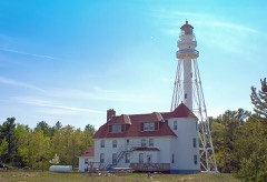 | Rawley Point Light Station | 1.0 miles | 1984 |
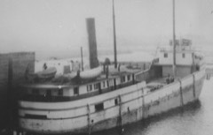 | S.C. BALDWIN Shipwreck (barge) | 1.5 miles | 2016 |
| TUBAL CAIN (barque) Shipwreck | 1.7 miles | 2017 |
| National Archives record | The nomination case file for reference 100001051 in Record Group 79. |
| Manitowoc County | All 38 listed properties in this county. |