 Block
From the record
12 National Register listings published here.
Sources: the National Register database, National Park Service
55 topographic sheets cover 18 settlements here, and 12 properties are on the National Register of Historic Places.
12 National Register listings published here.
Sources: the National Register database, National Park Service
Every property in this county listed on the National Register of Historic Places, with the year it was listed and the federal nomination document.
| Photograph | Property | Type | Listed | Reference |
|---|---|---|---|---|
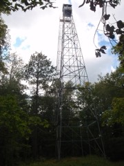 | Fifield Fire Lookout Tower | structure | 2007 | 07000668 |
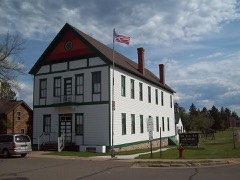 | Fifield Town Hall | building | 1978 | 78000339 |
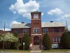 | Flambeau Paper Company Office Building | building | 1985 | 85002331 |
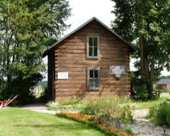 | Albin Johnson Log House | building | 1978 | 78000127 |
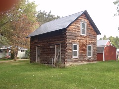 | Matt Johnson Log House | building | 1978 | 78000128 |
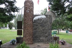 | Lidice Memorial | object | 2006 | 06000301 |
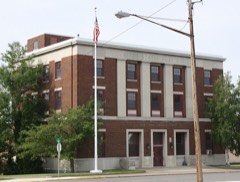 | Park Falls Post Office | building | 2000 | 00001238 |
 | Phillips High School | building | 1995 | 95000156 |
| Prentice Boy Scout Cabin | building | 2017 | 100001857 | |
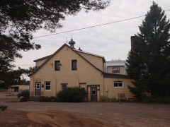 | Prentice Co-operative Creamery Company | building | 1985 | 85002329 |
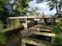 | Round Lake Logging Dam | structure | 1981 | 81000055 |
 | Wisconsin Concrete Park | site | 2005 | 05001195 |
Every wildfire the federal occurrence database records inside this county: 605 of them, burning about 780 acres. 21 started naturally and 42 were recorded as arson. Each settlement page carries the fires within five miles of it.
| Reported cause | Fires |
|---|---|
| Debris and open burning | 199 |
| Equipment and vehicle use | 97 |
| Missing data/not specified/undetermined | 94 |
| Power generation/transmission/distribution | 49 |
| Arson/incendiarism | 42 |
| Recreation and ceremony | 32 |
| Railroad operations and maintenance | 21 |
| Natural | 21 |
| Smoking | 18 |
| Other causes | 17 |
| Fireworks | 8 |
| Misuse of fire by a minor | 7 |
The five largest, by the area the report gives. One of them was set deliberately.
| Date | Cause | Size | Reported by | Name on the report |
|---|---|---|---|---|
| 4 May 2000 | Railroad operations and maintenance | 46 acres | Wisconsin Department of Natural Resources | not named |
| 5 April 1998 | Debris and open burning | 30 acres | Wisconsin Department of Natural Resources | not named |
| 12 April 1998 | Debris and open burning | 21 acres | Wisconsin Department of Natural Resources | not named |
| 19 October 2003 | Misuse of fire by a minor | 17 acres | Wisconsin Department of Natural Resources | not named |
| 29 November 2017 | Debris and open burning | 16 acres | Wisconsin Department of Natural Resources | PRENTICE-HILL ROAD |
| 6 May 2013 | Debris and open burning | 16 acres | Wisconsin Department of Natural Resources | WORCESTER RD |
| 4 May 1999 | Equipment and vehicle use | 14 acres | Wisconsin Department of Natural Resources | not named |
| 7 November 1999 | Arson/incendiarism | 14 acres | Wisconsin Department of Natural Resources | not named |
Every settlement page carries the fires within five miles of it - see the settlement index below.
The NOAA Storm Events Database holds 347 reports for this county, causing no deaths, 29 injuries and about $28,007,000 in recorded property damage. Each settlement page carries the reports that name it.
| Kind of event | Reports |
|---|---|
| Hail | 164 |
| Thunderstorm Wind | 138 |
| Tornado | 25 |
| Flash Flood | 14 |
| Flood | 3 |
| Funnel Cloud | 2 |
| Heavy Rain | 1 |
The most serious of them, by death, then injury, then recorded damage. The accounts are quoted exactly as the forecast office filed them.
| When | Event | Place named | Harm | What the report says |
|---|---|---|---|---|
| June 1985 | Tornado (F3) | not stated | 26 hurt, $25,000,000 | no account filed |
| July 1999 | Thunderstorm Wind | Phillips | 2 hurt, $500,000 | no account filed |
| July 1987 | Thunderstorm Wind | not stated | 1 hurt | no account filed |
| July 1995 | Hail | Fifield | $600,000 | Hail from 1.25 to three inches in diameter fell in and around Fifield between 1624 and 1635CST. An automobile dealership sustained $550 thousand worth of damage to inventory. |
| April 1994 | Tornado (F2) | Ogema to | $500,000 | Severe thunderstorm winds caused property damage just north of Downing, Dunn County. A tornado skipped along a 12-mile path in Price County from four miles southwest of Ogema to two miles northeast of Prentice. Along its path, the tornado damaged a construction company shed, knocked a garage against a home, rolled a large mobile home onto its top, demolished a cabin trailer and barn, and damaged a farm home. |
| May 1992 | Tornado (F1) | not stated | $250,000 | no account filed |
| June 1969 | Tornado (F1) | not stated | $250,000 | no account filed |
| June 1950 | Tornado (F2) | not stated | $250,000 | no account filed |
| April 2023 | Flood | Kaiser | $120,000 | Warm temperatures early in April led to rapid snowmelt of a well above normal snowpack across the region. Additionally, heavy rainfall on top of the snowpack led to additional high runoff across the county as well. Roads began to be impacted on the 12th with water overtopping low spots leading to washouts and failed culverts. Temperatures cooled during the middle of the month along with a heavy snow event the 16th into the 17th. This allowed the runoff to slow and water levels to drop. However, water levels rose again later in the month as this new snow melted as well. Numerous road closures were reported across the entire county due to failed culverts, washouts and gravel roads being washed away. The county stated that they had run out of high water signs during the height of the event with many municipalities being out as well. Multiple communities in addition to the county issued disaster declarations due to the extent of washed out roads. |
| June 2024 | Flash Flood | Catawba | $75,000 | The heavy rainfall led to washouts along Highway 111 north of the Needle Creek bridge to US Highway 8 leading to the road to be closed. |
| July 2023 | Thunderstorm Wind | Catawba | $60,000 | A few trees were down across a road. Additionally, widespread tree and powerline damage was reported across the county from the storms. |
| June 2024 | Thunderstorm Wind | Phillips | $50,000 | Numerous trees and powerlines were down near Phillips leading to power outages. |
| June 2020 | Flash Flood | Brantwood | $50,000 | Rainfall of 2 to 4 inches with localized amounts in excess of 5 inches fell over much of Price County. The heavier amounts led to flash flooding in the Town of Knox in the form of washed out roads and shoulders along with damaged culverts. This led to a disaster declaration for the county. |
| August 1993 | Tornado (F1) | Phillips | $50,000 | no account filed |
| July 2020 | Flash Flood | Dover | $30,000 | Numerous roads were washed out in the town of Emery with a few culvert failures as well. |
| June 1984 | Tornado (F1) | not stated | $25,000 | no account filed |
| June 1973 | Tornado (F1) | not stated | $25,000 | no account filed |
| September 1972 | Tornado (F2) | not stated | $25,000 | no account filed |
| June 2024 | Thunderstorm Wind | Price Co Arpt | $20,000 | A metal roof was partially peeled off a building and blown over. |
| July 2024 | Flash Flood | Phillips | $20,000 | Short-term street flooding was reported due to heavy rainfall and storm sewer backup. Flood waters led to damage inside an ambulance garage where water flowed under the bay doors. |
| August 2024 | Thunderstorm Wind | Price Co Arpt | $20,000 | Winds from the storms downed trees which were blocking County Highway W west of Phillips and Storms Road. A power transformer was on fire at the site of the downed trees on County Highway W. |
| June 2024 | Thunderstorm Wind | Phillips | $20,000 | Large trees were uprooted and a business sign was snapped. |
| July 2010 | Thunderstorm Wind | Phillips | $10,000 | Trees were reported downed county-wide. |
| July 2010 | Thunderstorm Wind | Phillips | $6,000 | Trees and power lines were blown down. |
| July 2010 | Thunderstorm Wind | Phillips | $6,000 | Trees were blown down along Price County Highway W. Trees also brought down some power lines. |
| July 2023 | Thunderstorm Wind | Park Falls | $5,000 | A tree was downed onto a car near Park Falls. |
| May 2011 | Tornado (EF0) | Dover | $5,000 | A tornado affected the area near the intersection of County Highway H and Willow Road. A citizen reported a tornado around this location that further corroborates the damage survey findings. Damage along the path was mostly to trees. A small shed was destroyed, a metal barn lost some roof paneling, and several large trees were snapped at one property. [DI 1 (SBO), DOD 2, EXP, Est. Gust 75-80 mph]. |
| September 1993 | Tornado (F1) | Kennen | $5,000 | no account filed |
| May 2011 | Tornado (EF1) | Lugerville | $4,000 | A weak tornado developed and tracked roughly along Price Lakes Road for slightly over 3 miles, before dissipating near Le Tourneau Lake. The damage consisted of primarily trees and large tree limbs blown down or snapped in a convergent pattern along the road. Some large pine trees were snapped. Structural damage was very minor, with one house experiencing some roof damage and a blown in window. [DI 28 (TS), DOD 4, LB-EXP, Est Gust 90-95mph]. |
| July 2010 | Thunderstorm Wind | Park Falls | $4,000 | Trees were blown down. |
| August 2010 | Thunderstorm Wind | Park Falls | $4,000 | Trees were blown down onto power lines near Butternut Lake. |
| May 2011 | Thunderstorm Wind | Kennan | $3,000 | Several small farm outbuildings were destroyed. Nearby large barns and house only sustained minor damage. |
| August 2010 | Thunderstorm Wind | Park Falls | $3,000 | Several trees and a power line were blown down. |
| July 2010 | Thunderstorm Wind | Fifield | $2,500 | Trees were blown down near Pike Lake in the Chequamegon National Forest. |
| May 1969 | Tornado (F1) | not stated | $2,500 | no account filed |
| July 2010 | Thunderstorm Wind | Park Falls | $2,000 | Several trees were blown down. |
| June 2017 | Flash Flood | Fifield | $1,000 | A culvert washed out along Old Highway 13/Case Avenue. |
| June 2017 | Flood | Fifield | $1,000 | Water flowed over Wisconsin State Highway 13 and Boyer Road near Fifield. |
| June 2017 | Flood | Price Co Arpt | $1,000 | Roads flooded along Wisconsin State Highway 13 and Wyoming Street in Phillips. |
| June 2017 | Flash Flood | Kaiser | $1,000 | A mud slide flowed across the roadway at Dam Road and County Highway G in Ojibwa. The mud was approximately 3 feet deep on the road. |
| May 2011 | Tornado (EF0) | Prentice | $1,000 | A weak tornado tracked for just over a mile around U.S. Highway 8 to the west of Prentice. The damage was primarily to trees, with a few 6-12 inch diameter pine trees snapped and blown in a convergent damage pattern. A metal barn also had some minor damage, mainly to eaves and siding. [DI 1 (SBO), DOD 1, EXP-UB, Est Gust 70 mph]. |
| April 2026 | Hail | Kaiser | - | Hail was mainly dime-sized with a few to the size of quarters. |
| April 2026 | Hail | Kaiser | - | Law enforcement reported quarter size hail about 5 miles west of Park Falls near the animal rescue. |
| July 2025 | Thunderstorm Wind | Kaiser | - | Several trees were down along Meier Road. |
| July 2025 | Thunderstorm Wind | Lymantown | - | Several trees in a wind row were snapped, but not all the trees were healthy. |
| July 2025 | Thunderstorm Wind | Lymantown | - | A tree was down along with a power line across the road. |
| June 2024 | Thunderstorm Wind | Phillips Price Co Ar | - | Multiple trees were uprooted at the observers location. |
| June 2024 | Thunderstorm Wind | (Pkf)Park Falls Muni | - | Photos were received showing numerous small to medium sized trees that were down. |
| June 2024 | Thunderstorm Wind | Phillips Price Co Ar | - | Numerous trees 20 to 30 inches in diameter were down at the spotter's location. |
| June 2024 | Thunderstorm Wind | Phillips Price Co Ar | - | A total of 22 trees were snapped and uprooted. Red pines 15 to 20 inches in diameter and aspens 11 to 14 inches in diameter were included. One 26 inch diameter white pine was also snapped. |
| June 2024 | Thunderstorm Wind | Brantwood | - | Trees and powerlines were reported down in the area. |
| June 2024 | Thunderstorm Wind | Ogema | - | Numerous trees were down on powerlines leading to several fires. |
| June 2024 | Thunderstorm Wind | Cranberry Lake | - | A measured gust of 71 mph was recorded by a handheld anemometer. |
| August 2024 | Thunderstorm Wind | Phillips | - | Price County dispatch reported multiple trees down in the area. |
| August 2024 | Thunderstorm Wind | Park Falls | - | Price County dispatch reported multiple trees down in the area. |
| June 2024 | Thunderstorm Wind | Price Co Arpt | - | Photos were received showing numerous trees snapped or uprooted. |
| June 2024 | Thunderstorm Wind | Price Co Arpt | - | Large trees were snapped in several places around town. |
| July 2023 | Thunderstorm Wind | Lymantown | - | Multiple trees were down and a barn window was blown in. |
| July 2023 | Thunderstorm Wind | Dover | - | A tree was downed onto a road near Pike Lake. |
| July 2023 | Thunderstorm Wind | Lymantown | - | Reports of both trees and powerlines down near Park Falls. |
The Survey's mineral resources record lists 125 workings inside this county. 1 still produces and 124 are closed or unrecorded. Each settlement page carries the workings within five miles of it.
| Commodity | Workings |
|---|---|
| Sand and Gravel, Construction | 123 |
| Zinc | 2 |
| Copper | 1 |
| Gold | 1 |
The least common of them first, because a county's hundredth gravel pit says nothing its first ten did not.
| Where | Site | Commodity | Status | Recorded |
|---|---|---|---|---|
| Ritchie Creek Propsect | Copper, Gold, Zinc | Prospect | 1979 | |
| Prentice East Prospect | Zinc | Prospect | ||
| Alockhouse Lake Gravel Pit #3 | Sand and Gravel, Construction | Past Producer | ||
| Aspen Road Gravel Deposit | Sand and Gravel, Construction | Occurrence | ||
| Bass Lake Gravel Pit | Sand and Gravel, Construction | Past Producer | ||
| Beaver Creek Gravel Pit | Sand and Gravel, Construction | Past Producer | ||
| Betsy Creek Gravel Pit | Sand and Gravel, Construction | Past Producer | ||
| Bjorklund Road Sand Pit | Sand and Gravel, Construction | Past Producer | ||
| Blockhouse Lake Gravel Pit #1 | Sand and Gravel, Construction | Past Producer | ||
| Blockhouse Lake Gravel Pit #2 | Sand and Gravel, Construction | Past Producer | ||
| Bluff Road Sand Pit | Sand and Gravel, Construction | Past Producer | ||
| Burtle Road Gravel Pit | Sand and Gravel, Construction | Past Producer | ||
| Camp Creek Gravel Pit | Sand and Gravel, Construction | Past Producer | ||
| Camp Four Springs Gravel Deposit | Sand and Gravel, Construction | Occurrence | ||
| Chada Road Gravel Pit #1 | Sand and Gravel, Construction | Past Producer | ||
| Chada Road Gravel Pit #2 | Sand and Gravel, Construction | Past Producer | ||
| Chada Road Sand Pit | Sand and Gravel, Construction | Past Producer | ||
| Clover Creek Road Gravel Pit | Sand and Gravel, Construction | Past Producer | ||
| Coolidge Lake Gravel Pit | Sand and Gravel, Construction | Past Producer | ||
| Cramer Creek Gravel Deposit | Sand and Gravel, Construction | Occurrence | ||
| Cranberry Lake Gravel Deposit | Sand and Gravel, Construction | Occurrence | ||
| Crowley Road Sand Pit | Sand and Gravel, Construction | Past Producer | ||
| Deer Lake Gravel Deposit | Sand and Gravel, Construction | Occurrence | ||
| Douglas Creek Gravel Deposit #1 | Sand and Gravel, Construction | Occurrence | ||
| Douglas Creek Gravel Deposit #2 | Sand and Gravel, Construction | Occurrence | ||
| Douglas Creek Gravel Pit #1 | Sand and Gravel, Construction | Past Producer | ||
| Duroy Lake Gravel Deposit | Sand and Gravel, Construction | Occurrence | ||
| Elm Drive Gravel Deposit | Sand and Gravel, Construction | Occurrence | ||
| Elm Drive Gravel Pit | Sand and Gravel, Construction | Past Producer | ||
| Engstrom Gravel Pit | Sand and Gravel, Construction | Past Producer | ||
| Fifield Gravel Pit | Sand and Gravel, Construction | Past Producer | ||
| Fifield Lookout Tow. Gravel Deposit | Sand and Gravel, Construction | Occurrence | ||
| Fifield Lookout Tower Gravel Pit | Sand and Gravel, Construction | Past Producer | ||
| Flambeau River Gravel Deposit #1 | Sand and Gravel, Construction | Occurrence | ||
| Flambeau River Gravel Deposit #2 | Sand and Gravel, Construction | Occurrence | ||
| Flambeau River Gravel Deposit #3 | Sand and Gravel, Construction | Occurrence | ||
| Flambeau River Gravel Pit #1 | Sand and Gravel, Construction | Past Producer | ||
| Fryklund Road Gravel Pit | Sand and Gravel, Construction | Past Producer | ||
| Granger Lake Gravel Pit | Sand and Gravel, Construction | Past Producer | ||
| Hay Creek Gravel Deposit #1 | Sand and Gravel, Construction | Occurrence | ||
| Hay Creek Gravel Deposit #2 | Sand and Gravel, Construction | Occurrence | ||
| Hay Creek Gravel Deposit #3 | Sand and Gravel, Construction | Occurrence | ||
| Hay Creek Gravel Deposit #4 | Sand and Gravel, Construction | Occurrence | ||
| Hay Creek Gravel Pit # 2 | Sand and Gravel, Construction | Past Producer | ||
| Hay Creek Gravel Pit #1 | Sand and Gravel, Construction | Past Producer | ||
| Hay Creek Gravel Pit #3 | Sand and Gravel, Construction | Past Producer | ||
| Heikkinen Gravel Deposit | Sand and Gravel, Construction | Occurrence | ||
| Hill-Prentice Road Gravel Pit | Sand and Gravel, Construction | Past Producer | ||
| Hilmar Olson Road Gravel Pit | Sand and Gravel, Construction | Past Producer | ||
| Hobbles Creek Gravel Deposit #1 | Sand and Gravel, Construction | Occurrence | ||
| Holmes Creek Gravel Pit #1 | Sand and Gravel, Construction | Past Producer | ||
| Holmes Creek Gravel Pit #2 | Sand and Gravel, Construction | Past Producer | ||
| Hultman Lake Gravel Deposit | Sand and Gravel, Construction | Occurrence | ||
| Island Lake Gravel Pit | Sand and Gravel, Construction | Past Producer | ||
| Jacobson Road Gravel Deposit | Sand and Gravel, Construction | Occurrence | ||
| Joe Spacek Gravel Deposit | Sand and Gravel, Construction | Occurrence | ||
| Kabol Lake Gravel Pit | Sand and Gravel, Construction | Past Producer | ||
| Knox Creek Gravel Pit | Sand and Gravel, Construction | Past Producer | ||
| Krucky Road Gravel Pit | Sand and Gravel, Construction | Past Producer | ||
| Lake Sixteen Gravel Deposit | Sand and Gravel, Construction | Occurrence | ||
| Lake Sixteen Gravel Pit | Sand and Gravel, Construction | Past Producer | ||
| Lake Three Gravel Deposit | Sand and Gravel, Construction | Occurrence | ||
| Lakeshore Drive Gravel Pit | Sand and Gravel, Construction | Past Producer | ||
| Larkin Road Gravel Deposit | Sand and Gravel, Construction | Occurrence | ||
| Larkin Road Gravel Pit | Sand and Gravel, Construction | Past Producer | ||
| Levitt Creek Gravel Deposit | Sand and Gravel, Construction | Occurrence | ||
| Levitt Creek Gravel Pit | Sand and Gravel, Construction | Past Producer | ||
| Liberty Lane Gravel Deposit | Sand and Gravel, Construction | Occurrence | ||
| Liberty Lane Gravel Pit | Sand and Gravel, Construction | Past Producer | ||
| Lindberg Lake Gravel Deposit | Sand and Gravel, Construction | Occurrence | ||
| Linden Road Sand Pit | Sand and Gravel, Construction | Past Producer | ||
| Little Chicago Road Gravel Deposit | Sand and Gravel, Construction | Occurrence | ||
| Lookout Tower Gravel Pit | Sand and Gravel, Construction | Past Producer | ||
| Makovsky Gravel Pit | Sand and Gravel, Construction | Past Producer | ||
| Many Roads Gravel Deposit | Sand and Gravel, Construction | Occurrence | ||
| Maple Ridge Road Gravel Pit | Sand and Gravel, Construction | Past Producer | ||
| Marheime Creek Gravel Pit | Sand and Gravel, Construction | Past Producer | ||
| Meridian Road Gravel Pit | Sand and Gravel, Construction | Past Producer | ||
| Moonshine Alley Gravel Deposit #1 | Sand and Gravel, Construction | Occurrence | ||
| Moonshine Alley Gravel Deposit #2 | Sand and Gravel, Construction | Occurrence | ||
| Moonshine Alley Gravel Pit | Sand and Gravel, Construction | Past Producer | ||
| Morgan Creek Gravel Deposit | Sand and Gravel, Construction | Occurrence | ||
| Morgan Creek Gravel Pit #1 | Sand and Gravel, Construction | Past Producer | ||
| Morgan Creek Gravel Pit #2 | Sand and Gravel, Construction | Past Producer | ||
| Morner Road Gravel Deposit | Sand and Gravel, Construction | Occurrence | ||
| Morner Road Gravel Pit | Sand and Gravel, Construction | Past Producer | ||
| New Lake Gravel Pit | Sand and Gravel, Construction | Past Producer | ||
| Newman Springs Gravel Deposit | Sand and Gravel, Construction | Occurrence | ||
| Newman Springs Gravel Pit | Sand and Gravel, Construction | Past Producer | ||
| Oak Ridge Avenue Gravel Pit | Sand and Gravel, Construction | Past Producer | ||
| Old 13 Road Gravel Deposit | Sand and Gravel, Construction | Occurrence | ||
| Old 182 Road Gravel Pit | Sand and Gravel, Construction | Past Producer | ||
| Old Mill Creek Gravel Deposit | Sand and Gravel, Construction | Occurrence | ||
| Park Falls Gravel Pit # 3 | Sand and Gravel, Construction | Past Producer | ||
| Park Falls Gravel Pit #1 | Sand and Gravel, Construction | Past Producer | ||
| Park Falls Gravel Pit #2 | Sand and Gravel, Construction | Past Producer | ||
| Park Falls Sand Pit #1 | Sand and Gravel, Construction | Past Producer | ||
| Park Falls Sand Pit #2 | Sand and Gravel, Construction | Past Producer | ||
| Pennington Road Gravel Deposit | Sand and Gravel, Construction | Occurrence | ||
| Pennington Road Gravel Pit #1 | Sand and Gravel, Construction | Past Producer | ||
| Pennington Road Gravel Pit #2 | Sand and Gravel, Construction | Past Producer | ||
| Phillips Gravel Deposit #1 | Sand and Gravel, Construction | Occurrence | ||
| Phillips Gravel Deposit #2 | Sand and Gravel, Construction | Occurrence | ||
| Pikes Peak Road Gravel Pit | Sand and Gravel, Construction | Past Producer | ||
| Pioneer Road Gravel Deposit | Sand and Gravel, Construction | Occurrence | ||
| Pot Lake Gravel Pit | Sand and Gravel, Construction | Past Producer | ||
| Prentice Gravel Deposit | Sand and Gravel, Construction | Occurrence | ||
| Prentice Gravel Pit | Sand and Gravel, Construction | Past Producer | ||
| Price County Pit | Sand and Gravel, Construction | Producer | ||
| Riley Creek Gravel Pit | Sand and Gravel, Construction | Past Producer | ||
| Ritchie Road Gravel Pit | Sand and Gravel, Construction | Past Producer | ||
| Sailor Creek Sand Pit #1 | Sand and Gravel, Construction | Past Producer | ||
| Sailor Lake Gravel Deposit | Sand and Gravel, Construction | Occurrence | ||
| So. Fork Jump River Gravel Deposit | Sand and Gravel, Construction | Occurrence | ||
| South Oxbow Road Gravel Deposit #1 | Sand and Gravel, Construction | Occurrence | ||
| South Oxbow Road Gravel Deposit #2 | Sand and Gravel, Construction | Occurrence | ||
| South Oxbow Road Gravel Deposit #3 | Sand and Gravel, Construction | Occurrence | ||
| Spring Drive Gravel Deposit | Sand and Gravel, Construction | Occurrence | ||
| Spring Lake Gravel Deposit | Sand and Gravel, Construction | Occurrence | ||
| Spur Road Gravel Deposit | Sand and Gravel, Construction | Occurrence | ||
| Wagner Road Sand Pit | Sand and Gravel, Construction | Past Producer | ||
| Wickdale Road Sand Pit | Sand and Gravel, Construction | Past Producer | ||
| Woodlawn Road Gravel Pit | Sand and Gravel, Construction | Past Producer | ||
| Yerkie Road Gravel Deposit | Sand and Gravel, Construction | Occurrence | ||
| Ziembo Gravel Deposit | Sand and Gravel, Construction | Occurrence |
Named settlements recorded in the Geographic Names Information System, each with the topographic sheets covering it. Villages, hamlets and abandoned places alike. Each is shown with the nearest named watercourse or landform and the survey quadrangle it falls on.
Fifield town · 54524 · Priest Lake quadrangle
11 sheets, 1941 to 1984
No longer a settlement
Flambeau town · 54555 · On Mount Pelee Creek · Lugerville quadrangle
10 sheets, 1941 to 1980
Phillips city · 54555 · On Aabajijiwani-ziibiinsing · Phillips quadrangle
10 sheets, 1941 to 1984
The vanished settlements of Price County: the places named above that are no longer on the map.