Block
From the record
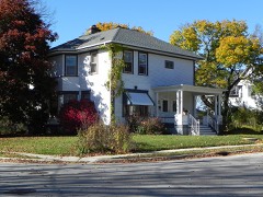
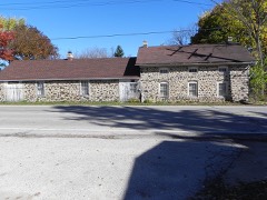
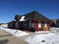
30 National Register listings published here.
Sources: the National Register database, National Park Service
86 topographic sheets cover 43 settlements here, and 30 properties are on the National Register of Historic Places.
30 National Register listings published here.
Sources: the National Register database, National Park Service
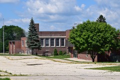
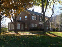
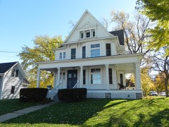
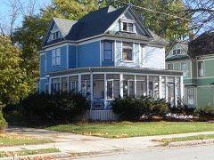
Every property in this county listed on the National Register of Historic Places, with the year it was listed and the federal nomination document.
Every wildfire the federal occurrence database records inside this county: 126 of them, burning about 291 acres. None started naturally and 5 were recorded as arson. Each settlement page carries the fires within five miles of it.
| Reported cause | Fires |
|---|---|
| Missing data/not specified/undetermined | 64 |
| Debris and open burning | 38 |
| Smoking | 7 |
| Equipment and vehicle use | 6 |
| Arson/incendiarism | 5 |
| Recreation and ceremony | 3 |
| Power generation/transmission/distribution | 1 |
| Misuse of fire by a minor | 1 |
| Fireworks | 1 |
The five largest, by the area the report gives. None of them was recorded as arson.
| Date | Cause | Size | Reported by | Name on the report |
|---|---|---|---|---|
| 19 November 2020 | Missing data/not specified/undetermined | 100 acres | Wisconsin Department of Natural Resources | 2046 |
| 21 April 2019 | Debris and open burning | 50 acres | Wisconsin Department of Natural Resources | 1901286 |
| 9 November 2004 | Missing data/not specified/undetermined | 25 acres | Wisconsin Department of Natural Resources | not named |
| 21 March 2018 | Debris and open burning | 20 acres | Wisconsin Department of Natural Resources | 74 |
| 21 April 2013 | Missing data/not specified/undetermined | 9.3 acres | Wisconsin Department of Natural Resources | not named |
| 18 April 2020 | Missing data/not specified/undetermined | 6.0 acres | Wisconsin Department of Natural Resources | 2000580 |
| 25 March 2020 | Recreation and ceremony | 5.0 acres | Wisconsin Department of Natural Resources | 20026 |
| 29 April 2018 | Debris and open burning | 5.0 acres | Wisconsin Department of Natural Resources | 24 |
Every settlement page carries the fires within five miles of it - see the settlement index below.
The NOAA Storm Events Database holds 418 reports for this county, causing 5 deaths, 61 injuries and about $70,202,600 in recorded property damage. Each settlement page carries the reports that name it.
| Kind of event | Reports |
|---|---|
| Thunderstorm Wind | 197 |
| Hail | 139 |
| Lightning | 28 |
| Tornado | 19 |
| Funnel Cloud | 12 |
| Flash Flood | 12 |
| Flood | 6 |
| Heavy Rain | 5 |
The most serious of them, by death, then injury, then recorded damage. The accounts are quoted exactly as the forecast office filed them.
| When | Event | Place named | Harm | What the report says |
|---|---|---|---|---|
| April 1981 | Tornado (F4) | not stated | 3 killed, 53 hurt, $25,000,000 | no account filed |
| May 1998 | Thunderstorm Wind | Countywide | 1 killed, 2 hurt, $8,570,000 | no account filed |
| September 2025 | Lightning | Michaels | 1 killed | An employee of the Wisconsin Department of Natural Resources was struck by lightning when working outside near the New Fane hiking trail. The lightning strike was fatal. |
| April 1980 | Tornado (F2) | not stated | 2 hurt, $250,000 | no account filed |
| June 2006 | Tornado (F1) | Hartford | 1 hurt, $4,000,000 | This tornado segment is a continuation of the Dodge County segment southeast of Rubicon. This second segment entered Washington County at a location 2.0 miles west of Hartford (about 0.6 mile south of where STH 60 goes east into Dodge Co.) and headed east-southeast through the southern part of the city of Hartford. The tornado strengthened to a high end F1 as it passed through the city. Around 147 residences sustained at least some damage ranging from tree damage to severe structural damage. Ten businesses also sustained structural damage. Lincoln Elementary School's roof was completely destroyed. Estimated damage amounts totaled about 4 million dollars. One person was directly injured by the tornado and two others were indirectly injured. Nobody was killed. The tornado continued east-southeast to a dissipation location 2.7 miles southeast of Hartford (about 0.1 mile southeast of the northern intersection of CTH E and K) at 1339CST. This segment of the tornado track was rated as F1 with winds of 64-97 knots (73-112 mph). |
| July 1991 | Tornado (F1) | not stated | 1 hurt, $250,000 | no account filed |
| May 1999 | Lightning | West Bend | 1 hurt, $35,000 | no account filed |
| June 1997 | Thunderstorm Wind | Kewaskum | 1 hurt, $4,000 | no account filed |
| June 2008 | Flash Flood | Wayne | $5,130,000 | Heavy rains resulted in flash flooding over much of Washington County. Water depths on road surfaces reached 3 feet or more and there were gravel washouts. Some farm fields would remain flooded into early July. The breakdown in residential home losses were: 560 affectd with minimal damage, 60 with minor damage, and 12 with major damage (total of about $2.4 million). Business losses were: 45 with minor damage, and 5 with major damage (total of about $1.125 million). Crops losses were estimated at 3.5 million. Public sector damage was about $0.6 million. Several roads and bridges sustained damage. |
| June 1997 | Flash Flood | Germantown | $2,700,000 | no account filed |
| August 2025 | Flash Flood | Kirchhayn | $2,400,000 | Flash flooding of streets, creeks, rivers, and low lying neighborhoods in Germantown and surrounding areas. More specifically, the flash flooding of the Menomonee River and its tributaries flooded and closed portions of many roads. This included portions of County Line Road, a lane of I-41, Freistadt Road, Lilac Lane, Maple Road, Rockfield Road, and Wausaukee Road. There was a small number of stranded vehicles in relatively deep, still water, as well as some basement flooding in Germantown. |
| August 2025 | Flash Flood | Kirchhayn | $2,400,000 | Flash flooding of streets, creeks, rivers, and low lying neighborhoods in West Bend and other communities over northern Washington County. Some vehicles were stranded in relatively deep, still water. The neighborhoods near the Silverbrook Creek Parkway experienced the worst of the flash flooding in West Bend, as several homes suffered foundation damage, while most had basement flooding. Some sewer backups occurred in West Bend. Approximately 316 properties reported flood damage. |
| August 2013 | Lightning | Slinger | $2,100,000 | A dump truck hauling granite was struck by lightning in the southbound lane of highway 41 north of Sherman Road in the Town of Polk. Some of the granite was propelled from the truck. In addition, a 18 inch deep and 3 foot long hole was found in the roadway from the lightning strike. Two vehicles behind the truck suffered wheel and tire damage due to the asphalt debris lying on the highway. No one was injured. |
| August 2012 | Hail | Kewaskum | $2,000,000 | A trained spotter reported large hail, between 1 1/4 inch and 1 1/2 inch in diameter that fell in Kewaskum. The 5-8 minute hail storm was the worst to hit Kewaskum in many years. Roughly 200 vehicles suffered damage from the hail, as well as many homes, condos, apartments and outdoor equipment. Hail damage to vehicles was about $250,000, and about $1.75 M to buildings and equipment. This information was supplied by local auto-body shops and insurance companies and is a broad estimate. |
| April 2006 | Hail | Germantown | $1,990,000 | Hail sized ranged from 1.00 to 2.00 inches in diameter. |
| April 2006 | Hail | Jackson | $1,990,000 | no account filed |
| April 2006 | Hail | Colgate | $1,990,000 | no account filed |
| April 2006 | Hail | St Lawrence | $1,990,000 | no account filed |
| August 2025 | Flood | Kirchhayn | $1,000,000 | A continuation of flooding of streets, creeks, rivers, low lying neighborhoods, and basements in West Bend and other communities over northern Washington County. Additional showers and storms aggravated the flooding. The neighborhoods near the Silverbrook Creek Parkway in West Bend experienced severe basement flooding, but also several instances of partial foundation collapse. Approximately 316 properties reported flood damage in West Bend. |
| August 2025 | Flood | Kirchhayn | $1,000,000 | A continuation of flooding of streets, creeks, rivers, low lying neighborhoods, and basements in Germantown and surrounding communities. Additional showers and storms aggravated the flooding. Some vehicles stranded in relatively deep, still water. More specifically, the flooding of the Menomonee River and its tributaries flooded and closed portions of many roads. This included portions of County Line Road, the northbound lane of I-41, Freistadt Road, Lilac Lane, Maple Road, Rockfield Road, and Wausaukee Road. The Riversbend Circle neighborhood in southwest Germantown experienced widespread flooding with 2 to 3 feet of water on the streets, especially on Riverbend Circle W. Many homes reported basement flooding and electrical power was lost in the neighborhood. A voluntary evacuation of 48 citizens was conducted by the local government. Overall there were about a 170 reports of flooding in Germantown. An elderly man died and his wife was hospitalized from probable carbon monoxide poisoning from a generator being run in a garage. |
| June 2022 | Lightning | Mayfield | $700,000 | A residential home was struck by lightning but the fire was contained to some degree. However, the home reignited a night later resulting in the total loss of the home. |
| August 2018 | Flash Flood | Holy Hill | $584,000 | Flash flooding of city streets in Jackson and West Bend and other urban areas of Washington County. Up to 18 inches of water depth on some streets in West Bend. Flooding of creeks and lowland in rural areas with various roads flooded or washed out. The Town of Farmington experienced the greatest impact from the flooding. Overall, 24 homes had affected flood damage with 5 homes experiencing minor flood damage. |
| June 2001 | Tornado (F1) | Hartford | $400,000 | This tornado entered Washington County 2.2 miles west/northwest of Hartford, after spinning up just north/northwest of Rubicon in Dodge County. It traveled southeast and intensified to a F1 rating (winds about 78 to 87 knots, or 90 to 100 mph) as it cut across the southwest part of Hartford. This tornado inflicted minor damage on 250 homes, major damage to 5 homes, and minor damage to 3 businesses. Additional tornado-related costs, such as debris removal, protective measures, etc, amounted to $102,100. |
| May 2004 | Thunderstorm Wind | Hartford | $350,000 | no account filed |
| July 1998 | Lightning | West Bend | $262,000 | no account filed |
| June 1977 | Tornado (F3) | not stated | $250,000 | no account filed |
| June 2022 | Lightning | Kohlsville | $175,000 | A residential home was struck by lightning causing a fire in the attic. 7 fire departments responded and contained the fire mostly to the attic. |
| March 2005 | Thunderstorm Wind | St Lawrence | $150,000 | A gustnado on the leading gust front of a line of severe thunderstorms damaged a shed, a garage, a roof, trees, and two road signs. In addition, a barn imploded, and a storage shed was destroyed. Gustnadoes, a shallow ground-based vortex, are classified as thunderstorm wind events. |
| July 1997 | Lightning | West Bend | $150,000 | Lightning struck a business building and ignited an attic fire. Walls needed to reinforced and much of the business equipment was ruined. |
| June 2004 | Lightning | Kewaskum | $150,000 | no account filed |
| March 2016 | Lightning | Kohlsville | $100,000 | Lightning struck a home causing a significant fire. The Sheriff's office said the house suffered significant roof, smoke, and water damage. An adult, a child, and a dog escaped unharmed. |
| June 2011 | Hail | Hartford | $100,000 | This hail swath was about 3 miles wide, resulting in numerous dented vehicles. Damage amount is rough estimate. |
| July 2008 | Lightning | St Lawrence | $100,000 | Fire struck a barn and started a fire that resulted in damage. A firefighter was injured by flying debris while fightning the fire. |
| August 2007 | Flash Flood | Hartford | $100,000 | Heavy rain from thunderstorms resulted in flash flood conditions northeast of Hartford. Rainfalls of 2 to 3 inches were measured in the area. A flower farm reported substantial damage amounts due to the heavy rains, with some small hail adding insult. Soil erosion and crop damage also occurred on several other farms in that area. in the Watertown to Rubicon area. Fast-flowing water depths of 6 inches to 1 foot were also reported on a couple roads. Additionally, a few basements had water damage to contents. |
| May 2000 | Thunderstorm Wind | Allenton | $100,000 | no account filed |
| July 1996 | Lightning | Kewaskum | $100,000 | no account filed |
| June 2011 | Thunderstorm Wind | Holy Hill | $75,000 | Part of a line of severe thunderstorms with damaging wind gusts estimated up to 64 mph (56 knots) that blew down numerous trees and power lines moved through southern Washington County during the middle afternoon of June 21st. The powerful wind gusts blew a tree down on a house and knocked down a barn near Holy Hill. |
| May 2000 | Flash Flood | South Portion | $75,000 | no account filed |
| June 2017 | Thunderstorm Wind | Germantown | $50,000 | A heating unit was ripped off the roof of a building as a strong thunderstorm moved through the area. |
| September 2013 | Thunderstorm Wind | Hartford | $50,000 | Widespread tree and power line damage, including uprooted and snapped trees, starting at Druid Lake and extending to the south side of Hartford. A large tree fell on a house causing minor damage. Several corn fields suffered damage, with bent over stalks, some small areas flattened. The corn was in relatively poor condition due to a poor growing season. Then sporadic reports of trees and power lines down from Hartford to Slinger. |
| July 2007 | Lightning | Kewaskum | $50,000 | Lightning struck an 150-year-old building's TV antenna, resulting in an attic fire. Damage was limited to the attic and one apartment. |
| June 2006 | Thunderstorm Wind | Countywide | $50,000 | Widespread tree and power line damage across most of the county. |
| October 2006 | Lightning | West Bend | $50,000 | Lightning struck a home's roof, resulting in an attic fire. |
| July 1994 | Thunderstorm Wind | Hartland | $50,000 | A series of squall lines with severe thunderstorms produced five tornadoes and violent wind gusts to 77 mph. A tornado set down in Dickeyville (Grant County) and traveled three miles damaging five homes, two sheds, and two farms. Damage was about $200,000. A small tornado caused $100,000 damage to a house, two outbuildings and nine cars just southeast of Woodford (Lafayette County). A tornado skipped along an eight mile path starting two miles northwest of Prairie du Sac (Sauk County), moving northeast along Highway 78, crossing the Wisconsin River into Columbia County along Highway 188, then crossed back into Sauk County at Highway 113 and entered Merrimac. Damage was estimated at $760,000 to 60 homes in Merrimac, and to a fertilizer plant and Dairy Forage Center in Prairie du Sac. Tornadoes briefly touched down but caused no damage four miles west of Fremont (Waupaca County) and 1.5 miles north of Oregon (Dane County). The intense winds knocked down numerous trees and power lines and caused other property damage mainly to sheds and outbuildings. |
| August 1996 | Lightning | Germantown | $50,000 | no account filed |
| November 2013 | Thunderstorm Wind | Michaels | $30,000 | A squall line produced an estimated 100 mph downburst several miles east of Kewaskum. A farm silo collapsed on a small portion of the barn killing 12 cattle. 40-50 healthy trees were downed by the strong winds. |
| August 2009 | Lightning | Richfield | $30,000 | Lightning struck a home's chimney and started a fire in the attic and roof area. |
| July 2001 | Thunderstorm Wind | Hartford | $30,000 | no account filed |
| July 1999 | Flash Flood | Hartford | $30,000 | no account filed |
| June 2017 | Thunderstorm Wind | Kewaskum | $25,000 | Numerous fallen trees in Kewaskum. Some roads blocked by fallen trees. Minor structural damage from high winds or fallen trees. |
| June 2017 | Thunderstorm Wind | Hartford | $25,000 | Numerous trees and power lines down across the county. |
| November 2013 | Thunderstorm Wind | Allenton | $25,000 | A squall line produced an estimated 100 mph downburst just northeast of Allenton. A 10 x 12 foot section of roof decking was torn off a home. A 20 x 20 foot section of shingles were removed from a home along with damage to the chimney. 18 healthy trees in a one mile stretch were blown down in the same direction. |
| June 2007 | Tornado (EF1) | Kirchhayn | $25,000 | A weak tornado struck a rural cluster of homes about 2.9 miles north-northeast (82 degrees) of Kuchhayn, or 4.5 miles east of Jackson, or about 0.4 miles southeast (135 degrees) of the intersection of CTH M and Cedar Creek Rd., and then headed north and crossed Cedar Creek Rd. It dissipated just south of Cedar Creek, or about 3.3 north-northeast (72 degrees) of Kirchhayn. Two homes on Highview Dr. sustained slight damage to roof shingles, gutters, and siding. A boat and shed were also damaged. About 30 trees sustained damage, and 6 were uprooted. Average path width was about 25 yards. The specific lat/lon data is: N43.3370 W88.07220 for the start and N43.34350 W88.07290 for the end point. DI #2 (FR12), DOD2. Estimated wind speeds 90 mph. |
| August 2007 | Thunderstorm Wind | Hartford | $25,000 | Powerful thunderstorm wind gusts up to 52 knots (60 mph) toppled several large trees and damaged some power-lines. |
| August 2007 | Thunderstorm Wind | Hartford | $25,000 | Powerful thunderstorm wind gusts up to 56 knots (65 mph) toppled several large trees and damaged some power-lines. |
| August 2007 | Thunderstorm Wind | Hartford | $25,000 | Powerful thunderstorm wind gusts up to 58 knots (68 mph) toppled several large trees and damaged some power-lines. |
| October 2006 | Thunderstorm Wind | Wayne | $25,000 | Powerful thunderstorm winds knocked down large trees and power-lines. |
| July 2005 | Thunderstorm Wind | Hartford | $25,000 | A 20 by 20 foot section of a barn door was blown off as well as a roof of a storage garage. A 100 by 30 foot corn patch was flattened. |
| March 2002 | Lightning | Colgate | $25,000 | no account filed |
| June 2000 | Flash Flood | Hartford | $25,000 | no account filed |
The Survey's mineral resources record lists 15 workings inside this county. 8 still produce and 7 are closed or unrecorded. Each settlement page carries the workings within five miles of it.
| Commodity | Workings |
|---|---|
| Sand and Gravel, Construction | 14 |
| Stone, Crushed/Broken | 1 |
The least common of them first, because a county's hundredth gravel pit says nothing its first ten did not.
| Where | Site | Commodity | Status | Recorded |
|---|---|---|---|---|
| Jackson Quarry | Stone, Crushed/Broken | Producer | ||
| Barton Sand Deposit | Sand and Gravel, Construction | Occurrence | ||
| Cedar Lake Sand and Gravel Pit | Sand and Gravel, Construction | Producer | ||
| Colgate Pit | Sand and Gravel, Construction | Past Producer | ||
| Hubertos Pit | Sand and Gravel, Construction | Unknown | ||
| Johann Pit | Sand and Gravel, Construction | Producer | ||
| Johann Pit No. 2 | Sand and Gravel, Construction | Unknown | ||
| Merget Pit Number 2 | Sand and Gravel, Construction | Producer | ||
| O and W Wash Plant | Sand and Gravel, Construction | Past Producer | ||
| Richfield Pit | Sand and Gravel, Construction | Producer | ||
| Rugby Pit | Sand and Gravel, Construction | Producer | ||
| Schulties Pit | Sand and Gravel, Construction | Producer | ||
| Slinger Pit | Sand and Gravel, Construction | Past Producer | ||
| Thoma Pit | Sand and Gravel, Construction | Unknown | ||
| West Bend Sand & Stone Schelle Pit | Sand and Gravel, Construction | Producer |
Named settlements recorded in the Geographic Names Information System, each with the topographic sheets covering it. Villages, hamlets and abandoned places alike. Each is shown with the nearest named watercourse or landform and the survey quadrangle it falls on.
Polk town · 53095 · Near Fox Hill · Hartford East quadrangle
15 sheets, 1904 to 1991
Germantown village · 53022 · On Willow Creek · Sussex quadrangle
20 sheets, 1892 to 1991