 Block
Afton, Wisconsin
16 topographic sheets cover this place, the earliest surveyed in 1891 and the latest in 1981. It stands in Rock town. It lies in ZIP code area 53501. It stands on Bass Creek. The Survey maps it on the Beloit quadrangle.
Topographic sheets covering this place
9 surveys from 16 printed sheetsMatched by testing this settlement's coordinate against the published boundary of every sheet in the United States Geological Survey's historical collection. Each opens the scanned sheet at the Survey.
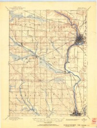
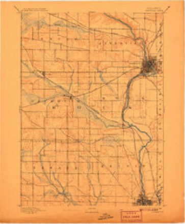
- 1891 USGS Janesville quadrangle1:62500
- 1893 USGS Janesville quadrangle1:62500, 4 printings
- 1954 USGS Rockford quadrangle1:250000
- 1955 USGS Rockford quadrangle1:250000
- 1958 USGS Rockford quadrangle1:250000, 4 printings
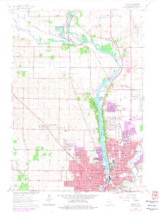
- 1962 USGS Beloit quadrangle1:24000, 2 printings
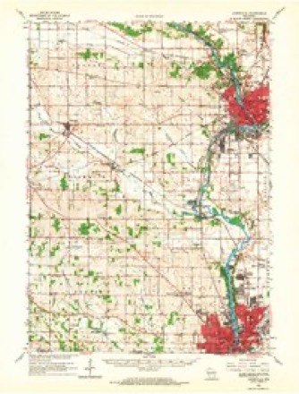
- 1962 USGS Janesville quadrangle1:62500
- 1963 USGS Rockford quadrangle1:250000
- 1981 USGS Monroe quadrangle1:100000





In the county-history sources
7,583 words on this townshipHistory of Rock County, and Transactions of the Rock County Agricultural Society and Mechanics' Institute, published 1856 names this settlement in its chapter on Rock Town. These are the passages that mention it, exactly as the scans read.
Township 2, north of Range 12 east. This town is situated on both sides of Rock River, which divides it into two nearly equal portions. That part upon the East side of the river is nearly all prairie, but that upon the West side is mostly timber, some of it being Very good, though the greater part being " oak openings." The soil of the entire town is of excellent quality. It is well watered, especially that part West of the river. Springs and "running brooks," of New England memory, are abundant.. Bass, or Afton creek, enters the town towards its North-west comer and empties itself into Rock River at Afton, not far fi'om its South-easi; corner. Along its margin are extensive meadows of unrivalled luxuriance, affording abundance of that great " Western Staple," " Marsh Hay." For variety and richness of soil, good water, and a plentiful supply; timber properly disposed, and prairie just as it should be, and every other desirable accompaniment to an agricultural town, this town is inferior to none in Rock County, or in the State of Wisconsin. It was oi'ganized in 1842, and contained only its standard limits; six miles square, and was the only town in the County which at that time comprised only its legitimate territory, and ' consequently obtaiifed the " sobriquet" of the "little town of Rock." As to its " ancient history," little is known, but from the "remains" of its fortifications it is judged to have been once the theatre of war, and the " play gi-ound" of the hero ; and subsequently to have been no less the favorite dwelling place of the Horticulturist, the farmer and mechanic, as the "remains" of gardens and fields, tmd specimens of mechanical skill unmistakably indicate; and that this town sustained a vastly larger population in " olden times" than at present, no
Passage source: History of Rock County, and Transactions of the Rock County Agricultural Society and Mechanics' Institute, published 1856.
The Pottawatamies, Wiimebagos, ahd other tribes of Indians, long had made their home amid its gardens and shady groves, beside its purling brooks and bubbling springs^ beside its noble river, and no where did the hunter find his game more plenty ; for beast and bird, as well as man^ seek their home where nature in her kindest mood, showers most profiisely her be^ -quests to all.
Passage source: History of Rock County, and Transactions of the Rock County Agricultural Society and Mechanics' Institute, published 1856.
In the month of September, 1836, Mr. Hiram Brown and family arrived at the " cabin " ; others having moved out, made room for him. Dr. James Heath built a house 16 by 16, one and a half miles down the river, on Sec. 2, at East Wisconsin City in the spring, where he opened a store and tavern, which were the first in town. Here the " customer " was served, the " travelers and boarders " lodged, while the family and servants found ample room besides. Travelers were laid upon tiers of shelves up the sides of the house like dry goods, while " commoners " took the floor. Business increasing, and the Doctor thinking his house too small for the accommodation of his store and tavern, entered into partnership with Mr. Sexton, (now of SextonvUle,) and removed his goods into another house, which had been erected about eighty rods from the " tavern,'' which afforded more room for the replenished stock of the new fii-m. During this year, (1836,) John Inman & Co. started the first stage. It made its regular trips from Racine to " East Wiscofisin City" during the summer; Dr. Heath keeping the " Stage House." Any person curious in such matters can now be shown that identical " tavern " ; the augur holes into which the pins were put to sustain the " traveler's shelves," and also the " remains " of Heath & Sexton's store, by calling about one half mile west from the Institute of the Blind. True, the landlord will not be there to greet them, n6r will they see, probably, the stages from Racine unloading their passengers, nor the impatient customeiB inquiring for " dry goods and gi-oceries," but they will see the house, empty though it be, and the oak trees, which stood there as faithful sentinels, will now be seen keeping their vigils and sighing over the ruins and desolations of Wisconsin City. While speaking of the commercial interests of this town, we would not forget to mention a store opened by Thomas Holmes, and kept for some time in the house now owned by Judge Bailey, near the " ferry."
Passage source: History of Rock County, and Transactions of the Rock County Agricultural Society and Mechanics' Institute, published 1856.
Machine-read from a century-old scan, so expect the errors a machine makes: misspelled names, dropped words, stray characters.
Read the whole chapter on Rock Town - it names this place 22 more 22 times.
Fires near this place
16 since 2018Regional context, not property-specific evidence. The federal wildfire occurrence database lists 16 fires within 5 miles of Afton between 2018 and 2020, burning about 19 acres in total. None started naturally. 1 was recorded as arson. Distance is straight-line from the map coordinates, so a fire counted here may appear on a neighbouring settlement's page as well.
| Reported cause | Fires |
|---|---|
| Missing data/not specified/undetermined | 8 |
| Debris and open burning | 4 |
| Recreation and ceremony | 2 |
| Power generation/transmission/distribution | 1 |
| Arson/incendiarism | 1 |
The most recent of them, most recent first, with the day each was reported and the service that recorded it.
| Date | Cause | Size | Reported by | Name on the report |
|---|---|---|---|---|
| 25 September 2018 | Missing data/not specified/undetermined | under an acre | Wisconsin Department of Natural Resources | 181293 |
| 22 August 2019 | Debris and open burning | under an acre | Wisconsin Department of Natural Resources | 19941 |
| 30 July 2018 | Missing data/not specified/undetermined | under an acre | Wisconsin Department of Natural Resources | 181021 |
| 4 May 2018 | Missing data/not specified/undetermined | under an acre | Wisconsin Department of Natural Resources | 18573 |
| 8 April 2019 | Arson/incendiarism | 1.0 acres | Wisconsin Department of Natural Resources | 19395 |
| 6 April 2019 | Debris and open burning | under an acre | Wisconsin Department of Natural Resources | 19385 |
| 29 April 2018 | Missing data/not specified/undetermined | under an acre | Wisconsin Department of Natural Resources | 18557 |
| 28 April 2018 | Recreation and ceremony | 3.0 acres | Wisconsin Department of Natural Resources | 181717 |
Settlements close enough to share some of these fires:
Mines and quarries near this place
5 within 5 milesRegional context, not property-specific evidence. The federal mineral resources record lists 5 workings within 5 miles of Afton: 3 producers, 2 past producers. 3 still produce. What was taken out: Stone, Crushed/Broken, Sand and Gravel, Construction. Distance is straight-line from the map coordinates, so a quarry counted here may appear on a neighbouring settlement's page as well.
| Where | Site | Commodity | Status | Recorded |
|---|---|---|---|---|
| Poff Pit | Sand and Gravel, Construction | Past Producer | ||
| Townline Pit | Sand and Gravel, Construction | Producer | ||
| Alseths Quarry | Stone, Crushed/Broken | Producer | ||
| Gunn Pit | Stone, Crushed/Broken | Producer | ||
| O'Leary Quarry | Stone, Crushed/Broken | Past Producer |
Storms near this place
14 since 1999Regional context, not property-specific evidence. The National Weather Service names Afton in 14 storm reports between 1999 and 2025: 5 thunderstorm wind, 5 hail, 2 flood, 1 tornado. No death or injury is recorded in these reports. Each account below is quoted exactly as the forecast office filed it, from the NOAA Storm Events Database, and each date opens the federal record of that event.
| When | Event | Place named | Harm | What the report says |
|---|---|---|---|---|
| June 2024 | Tornado (EF2) | Afton | $24,800,000 | The tornado began just west of Murray Rd, north of Bass Creek where portions of several trees were snapped. The tornado quickly grew, moved to the east-northeast and produced damage rated EF-1 neighborhoods near Loch Lomond park. EF-2 damage was noted at a residence on the east side of county highway D where well over one hundred trees were snapped or uprooted. The tornado continued to the northeast, crossing the Rock River, Highway 11 and Highway 51 producing damage rated EF-1. The second area of EF-2 damage was noted a neighborhood just northwest of Burbank Park, where a house lost its roof and a portion of its second story. The roof was found to the north-northwest over a block away. The tornado continued northeast crossing Beloit Ave. and ending in the fields to the west of South Read Rd. Damage along the majority of the path was rated EF-1. Tree damage was substantial with well over 1000 trees that were snapped, uprooted or had large sections damaged. Roof damage on several structures included shingle loss, occasional loss of roof decking material, peeled or dislodged siding and other facia and soffit peeling and removal. A few structure sustained damage to walls when their garage doors were breached. Numerous power poles were leaning, with several snapped. |
| August 2004 | Thunderstorm Wind | Afton | $100,000 | no account filed |
| August 2025 | Flash Flood | Afton | $50,000 | Multiple reports of cars stalled around Beloit as they drove into flooded roads. |
| May 2013 | Thunderstorm Wind | Afton | $50,000 | Law enforcement officials reported many trees and power lines downed by powerful thunderstorm winds that gusted to an estimated 75 mph (65 knots) along a path from 5 miles east of Beloit to Afton. One tree went through the roof of a home 3 miles northwest of Beloit. |
| November 2020 | Thunderstorm Wind | Afton | $30,000 | Widespread tree damage from Beloit to Janesville. |
| April 2013 | Flood | Afton | $10,000 | The Rock River near Afton experienced moderate flooding, cresting at 11.76 feet, or 2.76 feet over the flood stage of 9 feet, at 10 AM CDT on April 18th. The river remained above flood stage into May. |
| June 1999 | Thunderstorm Wind | Afton | $10,000 | no account filed |
| June 2024 | Thunderstorm Wind | Afton | $1,000 | Several large tree limbs downed toward the southeast. |
| April 2019 | Flood | Afton | $1,000 | The Rock River at Afton crested in late March at minor flood stage. The minor flooding continued until April 12th. Floodwaters affect the property of a home on South Christian Rd. on the east side of the river in the Afton area. Floodwaters affect Riverside Park on the north side of Janesville, and South River Rd. on the south side of Janesville. There is widespread lowland and agricultural flooding in the Afton and Janesville areas. |
| May 2011 | Hail | Afton | - | no account filed |
| May 2005 | Hail | Afton | - | no account filed |
| May 2005 | Hail | Afton | - | no account filed |
| September 2005 | Hail | Afton | - | no account filed |
| October 2001 | Hail | Afton | - | no account filed |
Nearest settlements
The eight closest, with where each one stands in the county. Distances are straight-line, computed from the Geographic Names Information System coordinates.
| Map | Place | Distance | Sheets |
|---|---|---|---|
| Garden Village | 4.1 miles | 16 | |
| Victory Heights | 4.3 miles | 16 | |
| Holiday Hills | 4.4 miles | 16 | |
| Belcrest | 4.5 miles | 16 | |
| Crestview | 4.8 miles | 16 | |
| Christilla Heights | 5.2 miles | 16 | |
| Hanover | 5.4 miles | 16 | |
| Janesville | 6.1 miles | 17 |
Provenance
This settlement is recorded in the Geographic Names Information System as feature 1560708. The sheet list is computed by point-in-boundary test against the United States Geological Survey's historical topographic inventory. Both are works of the United States government and carry no copyright under 17 U.S.C. 105.
Wildfire. Short, Karen C. 2022. Spatial wildfire occurrence data for the United States, 1992-2020 [FPA_FOD_20221014]. 6th Edition. Fort Collins, CO: Forest Service Research Data Archive. https://doi.org/10.2737/RDS-2013-0009.6 Collected with United States Government funding and usable without additional permissions or fees.
Mines and quarries. USGS Mineral Resources Data System (MRDS) https://mrdata.usgs.gov/mrds/ A work of the United States government, no copyright under 17 U.S.C. 105.
Storms. NOAA National Centers for Environmental Information, Storm Events Database https://www.ncei.noaa.gov/stormevents/ A work of the United States government, no copyright under 17 U.S.C. 105. Narratives are quoted verbatim from the National Weather Service report and are not edited or summarised.