 Block
Janesville, Wisconsin
17 topographic sheets cover this place, the earliest surveyed in 1891 and the latest in 1981. It stands in Janesville City. It lies in ZIP code area 53545. It stands on Spring Brook. The Survey maps it on the Janesville West quadrangle. 65,615 people lived here at the 2020 count. It stands 853 feet above sea level.
Research this city
On record in Janesville
Buildings and businesses the archive holds for this place. Each opens its own page, with the source record it came from.
On the National Register 12 of 39 shown
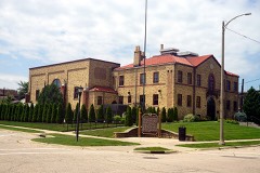 Armory, Thelisted 1978
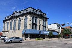 Court Street Methodist Churchlisted 1977
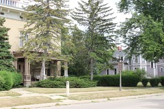 Courthouse Hill Historic Districtlisted 1986
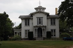 James B. Crosby Houselisted 1995
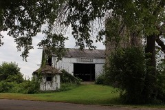 Erastus Dean Farmsteadlisted 1978
 Fredendall Blocklisted 1982
 Janesville Cotton Milllisted 1980
 Janesville High Schoollisted 1999
 Janesville Public Librarylisted 1981
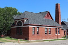 Janesville Pumping Stationlisted 1985
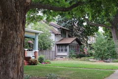 Jefferson Avenue Historic Districtlisted 2006
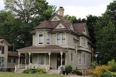 John H. Jones Houselisted 2008
Population over time
2 figuresJanesville grew from 63,575 to 65,615 between 2010 and 2020. These are the recorded population figures Wikidata holds for this place, reached through the Geographic Names Information System number this page is keyed on rather than by name, so they belong to this place and not to another of the same name. Most are census counts, but not all are: an early figure may be a founding or settlement estimate, and an estimate published within five years of a census is left out. The change column is computed, and is left blank where more than 20 years separate a figure from the one before it, because a gap that long is not a change between two counts.
| Year | People | Change |
|---|---|---|
| 2010 | 63,575 | |
| 2020 | 65,615 | +2,040 (+3%) |
Topographic sheets covering this place
9 surveys from 17 printed sheetsMatched by testing this settlement's coordinate against the published boundary of every sheet in the United States Geological Survey's historical collection. Each opens the scanned sheet at the Survey.
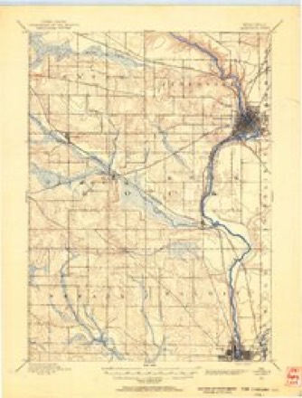
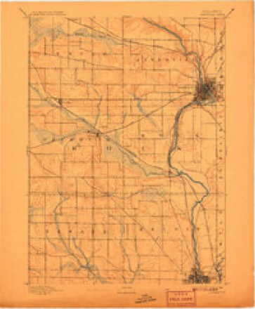
- 1891 USGS Janesville quadrangle1:62500
- 1893 USGS Janesville quadrangle1:62500, 4 printings
- 1954 USGS Rockford quadrangle1:250000
- 1955 USGS Rockford quadrangle1:250000
- 1958 USGS Rockford quadrangle1:250000, 4 printings
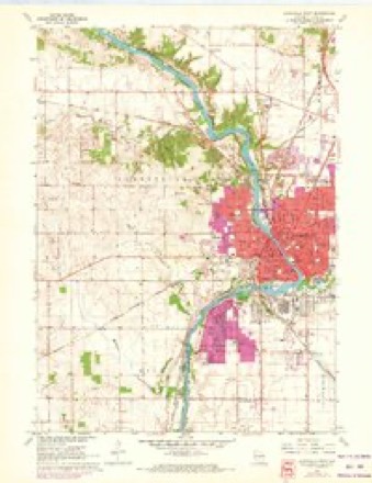
- 1961 USGS Janesville West quadrangle1:24000, 3 printings
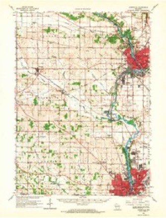
- 1962 USGS Janesville quadrangle1:62500
- 1963 USGS Rockford quadrangle1:250000
- 1981 USGS Monroe quadrangle1:100000





In the county-history sources
70,689 words on this townshipHistory of Rock County, and Transactions of the Rock County Agricultural Society and Mechanics' Institute, published 1856 names this settlement in its chapter on Janesville City. These are the passages that mention it, exactly as the scans read.
Janesville is the County Seat of Rock County. The city is beautifully located on the Rock River, nearly in the center of the county, twelve miles north of the Illinois State line, sixty-five miles west of Racine, the same distance from Milwaukee, and forty miles S. E. of Madison. Its history, so far as known, like most of the towns of the west, is comprised within a compass of twenty years. A silence rests upon the early history of this spot which the antiquarian in vain attempts to break. There are no ancient records of primeval times, no traditionary legends which carry us back to' the dreamy past, not even a national ballad to commemorate the deeds <rf the s;reat and good who here lived and died.
Passage source: History of Rock County, and Transactions of the Rock County Agricultural Society and Mechanics' Institute, published 1856.
Scattered in clusters on some of the beautiful eminences near town, are to be seen numbers of those mysterious mounds so common at the west, whose very silence points us to a former race who here dwelt, but who have left no other memorials than these hieroglyphics of their existence.
Passage source: History of Rock County, and Transactions of the Rock County Agricultural Society and Mechanics' Institute, published 1856.
And scarcely more intelligible are the traces left by the Aboriginees which preceded us. It is true the foot-prints of a numerous and powerful people were seen by the early settlers upon this river, and their trails, and burial places, and even fields of agriculture are still visible. But no record hands down to us the names of those who here lived and journeyed and died. No aged chieftain comes back from beyond the " Father of Waters '' to tell us the incidents of the last half century defore the " pale faces" came, or even to give us the name of the Indian village which lay spread out on the bottom land south of the bend in the river. The archives of the past contain little that is intelligible. Here and there a strange character or a mutilated line appears, but like the inscription on some ancient tomb-stone which time has been wearing away, all is indistinct and uncertain.
Passage source: History of Rock County, and Transactions of the Rock County Agricultural Society and Mechanics' Institute, published 1856.
Machine-read from a century-old scan, so expect the errors a machine makes: misspelled names, dropped words, stray characters.
Read the whole chapter on Janesville City - it names this place 307 more 307 times.
Fires near this place
12 since 2018Regional context, not property-specific evidence. The federal wildfire occurrence database lists 12 fires within 5 miles of Janesville between 2018 and 2019, burning about 2 acres in total. None started naturally. None was recorded as arson. Distance is straight-line from the map coordinates, so a fire counted here may appear on a neighbouring settlement's page as well.
| Reported cause | Fires |
|---|---|
| Missing data/not specified/undetermined | 9 |
| Debris and open burning | 2 |
| Smoking | 1 |
The most recent of them, most recent first, with the day each was reported and the service that recorded it.
| Date | Cause | Size | Reported by | Name on the report |
|---|---|---|---|---|
| 7 August 2018 | Missing data/not specified/undetermined | under an acre | Wisconsin Department of Natural Resources | 6330 |
| 8 July 2019 | Debris and open burning | under an acre | Wisconsin Department of Natural Resources | 5344 |
| 7 July 2018 | Missing data/not specified/undetermined | under an acre | Wisconsin Department of Natural Resources | 5449 |
| 5 June 2018 | Missing data/not specified/undetermined | under an acre | Wisconsin Department of Natural Resources | 4517 |
| 29 April 2018 | Smoking | 1.0 acres | Wisconsin Department of Natural Resources | 3368 |
| 29 April 2018 | Missing data/not specified/undetermined | under an acre | Wisconsin Department of Natural Resources | 3363 |
| 23 April 2018 | Debris and open burning | under an acre | Wisconsin Department of Natural Resources | 279 |
| 13 April 2018 | Missing data/not specified/undetermined | under an acre | Wisconsin Department of Natural Resources | 2895 |
Settlements close enough to share some of these fires:
Mines and quarries near this place
10 within 5 milesRegional context, not property-specific evidence. The federal mineral resources record lists 10 workings within 5 miles of Janesville: 5 past producers, 4 producers, 1 unknown. 4 still produce. What was taken out: Sand and Gravel, Construction, Stone, Crushed/Broken, Stone. Distance is straight-line from the map coordinates, so a quarry counted here may appear on a neighbouring settlement's page as well.
| Where | Site | Commodity | Status | Recorded |
|---|---|---|---|---|
| Bass Quarry | Stone | Unknown | ||
| Austin Quarry | Stone, Crushed/Broken | Past Producer | ||
| Beaudin Quarry | Stone, Crushed/Broken | Producer | ||
| County Shop Quarry | Stone, Crushed/Broken | Past Producer | ||
| O'Leary Quarry | Stone, Crushed/Broken | Past Producer | ||
| Frank Brothers | Sand and Gravel, Construction | Past Producer | ||
| Janesville Pit & Mill | Sand and Gravel, Construction | Producer | ||
| Rock County Pioneer Crusher 493 | Sand and Gravel, Construction | Producer | ||
| Townline Pit | Sand and Gravel, Construction | Producer | ||
| Wheeler Pit | Sand and Gravel, Construction | Past Producer |
Storms near this place
60 of 67 shownRegional context, not property-specific evidence. The National Weather Service names Janesville in 67 storm reports between 1994 and 2006: 31 thunderstorm wind, 14 hail, 12 lightning, 4 flood. The reports record 7 injuries. Each account below is quoted exactly as the forecast office filed it, from the NOAA Storm Events Database, and each date opens the federal record of that event.
| When | Event | Place named | Harm | What the report says |
|---|---|---|---|---|
| June 1998 | Lightning | Janesville | 5 hurt | no account filed |
| August 1998 | Flash Flood | Janesville | 1 hurt, $1,500,000 | no account filed |
| September 1997 | Strong Wind | Janesville | 1 hurt, $1,000 | no account filed |
| August 1998 | Flash Flood | Janesville | $550,000 | no account filed |
| May 1999 | Thunderstorm Wind | Janesville | $175,000 | no account filed |
| July 1998 | Thunderstorm Wind | Janesville | $100,000 | no account filed |
| July 1998 | Lightning | Janesville | $50,000 | no account filed |
| May 1999 | Lightning | Janesville | $40,000 | no account filed |
| May 1999 | Lightning | Janesville | $40,000 | no account filed |
| July 1999 | Lightning | Janesville | $35,000 | no account filed |
| March 2002 | Lightning | Janesville | $30,000 | no account filed |
| May 2000 | Lightning | Janesville | $25,000 | no account filed |
| August 2002 | Lightning | Janesville | $20,000 | no account filed |
| June 1995 | Thunderstorm Wind | Janesville | $20,000 | no account filed |
| June 1998 | Thunderstorm Wind | Janesville | $19,000 | no account filed |
| July 2000 | Thunderstorm Wind | Janesville | $15,000 | no account filed |
| July 2000 | Lightning | Janesville | $10,000 | no account filed |
| May 1998 | Thunderstorm Wind | Janesville | $7,000 | no account filed |
| April 1996 | Lightning | Janesville | $7,000 | no account filed |
| April 1997 | Thunderstorm Wind | Janesville | $5,000 | no account filed |
| June 1998 | Thunderstorm Wind | Janesville | $4,000 | no account filed |
| August 2002 | Lightning | Janesville | $2,500 | no account filed |
| July 1999 | Thunderstorm Wind | Janesville | $2,000 | no account filed |
| July 1999 | Thunderstorm Wind | Janesville | $1,500 | no account filed |
| June 1998 | Thunderstorm Wind | Janesville | $1,500 | no account filed |
| March 2004 | Thunderstorm Wind | Janesville | $1,000 | no account filed |
| February 1999 | Lightning | Janesville | $1,000 | no account filed |
| June 1997 | Thunderstorm Wind | Janesville | $1,000 | no account filed |
| September 1997 | Thunderstorm Wind | Janesville | $1,000 | no account filed |
| May 1998 | Thunderstorm Wind | Janesville | $500 | no account filed |
| May 2006 | Thunderstorm Wind | Janesville | - | Trees and powerlines down. |
| June 2006 | Thunderstorm Wind | Janesville | - | Trees down. |
| June 2006 | Thunderstorm Wind | Janesville | - | Widespread tree damage. |
| August 2006 | Hail | Janesville | - | no account filed |
| March 2005 | Hail | Janesville | - | no account filed |
| May 2005 | Hail | Janesville | - | no account filed |
| June 2005 | Thunderstorm Wind | Janesville | - | no account filed |
| June 2005 | Thunderstorm Wind | Janesville | - | no account filed |
| June 2005 | Thunderstorm Wind | Janesville | - | no account filed |
| June 2005 | Thunderstorm Wind | Janesville | - | no account filed |
| May 2005 | Hail | Janesville | - | no account filed |
| May 2005 | Hail | Janesville | - | no account filed |
| June 2005 | Hail | Janesville | - | no account filed |
| September 2005 | Thunderstorm Wind | Janesville | - | no account filed |
| May 2004 | Thunderstorm Wind | Janesville | - | no account filed |
| November 2003 | Heavy Rain | Janesville | - | no account filed |
| July 2003 | Thunderstorm Wind | Janesville | - | no account filed |
| August 2003 | Hail | Janesville | - | no account filed |
| April 2002 | Hail | Janesville | - | no account filed |
| July 2002 | Thunderstorm Wind | Janesville | - | no account filed |
| April 2001 | Hail | Janesville | - | no account filed |
| June 2001 | Thunderstorm Wind | Janesville | - | no account filed |
| June 2000 | Funnel Cloud | Janesville | - | no account filed |
| May 2000 | Hail | Janesville | - | no account filed |
| July 2000 | Flood | Janesville | - | no account filed |
| August 2000 | Flood | Janesville | - | no account filed |
| February 1999 | Hail | Janesville | - | no account filed |
| June 1999 | Flood | Janesville | - | no account filed |
| June 1998 | Hail | Janesville | - | no account filed |
| June 1998 | Hail | Janesville | - | no account filed |
Nearest settlements
The eight closest, with where each one stands in the county. Distances are straight-line, computed from the Geographic Names Information System coordinates.
| Map | Place | Distance | Sheets |
|---|---|---|---|
| Anderson | 2.4 miles | 17 | |
| Afton | 6.1 miles | 16 | |
| Leyden | 6.7 miles | 16 | |
| Milton Junction | 7.5 miles | 19 | |
| Milton | 7.5 miles | 19 | |
| Emerald Grove | 7.5 miles | 18 | |
| Hanover | 8.2 miles | 16 | |
| Turtleville | 8.3 miles | 18 |
Elsewhere
Matched on this settlement's Geographic Names Information System number rather than its name, so it cannot be a different place of the same name in another state.
| Wikipedia article on Janesville | An encyclopaedic summary. Its text is share-alike, so it is linked here rather than copied. |
| Wikidata item Q257536 | The structured record the population and elevation above come from. Public domain (CC0). |
Provenance
This settlement is recorded in the Geographic Names Information System as feature 1567100. The sheet list is computed by point-in-boundary test against the United States Geological Survey's historical topographic inventory. Both are works of the United States government and carry no copyright under 17 U.S.C. 105.
Wildfire. Short, Karen C. 2022. Spatial wildfire occurrence data for the United States, 1992-2020 [FPA_FOD_20221014]. 6th Edition. Fort Collins, CO: Forest Service Research Data Archive. https://doi.org/10.2737/RDS-2013-0009.6 Collected with United States Government funding and usable without additional permissions or fees.
Mines and quarries. USGS Mineral Resources Data System (MRDS) https://mrdata.usgs.gov/mrds/ A work of the United States government, no copyright under 17 U.S.C. 105.
Storms. NOAA National Centers for Environmental Information, Storm Events Database https://www.ncei.noaa.gov/stormevents/ A work of the United States government, no copyright under 17 U.S.C. 105. Narratives are quoted verbatim from the National Weather Service report and are not edited or summarised.