 Block
Berlin, Wisconsin
10 topographic sheets cover this place, the earliest surveyed in 1916 and the latest in 1980. It stands in Berlin City. It lies in ZIP code area 54923. The Survey maps it on the Berlin quadrangle. 5,571 people lived here at the 2020 count. It stands 807 feet above sea level.
Research this city
On record in Berlin
Buildings and businesses the archive holds for this place. Each opens its own page, with the source record it came from.
On the National Register 9 records
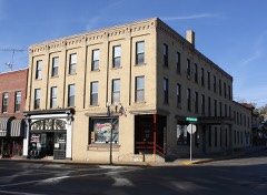 Beckwith House Hotellisted 1991
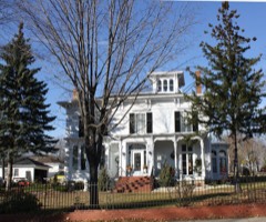 Nelson F. Beckwith Houselisted 1990
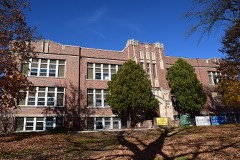 Berlin High Schoollisted 2016
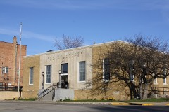 Berlin Post Officelisted 2000
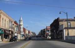 Huron Street Historic Districtlisted 1992
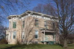 McClelland-Kasuboski Houselisted 1998
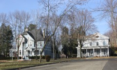 Nathan Strong Park Historic Districtlisted 2005
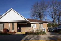 Wisconsin Power and Light Berlin Power Plantlisted 1992
- J. P. Luther Company Glove Factorylisted 1997
Topographic sheets covering this place
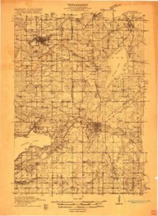
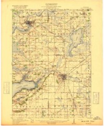
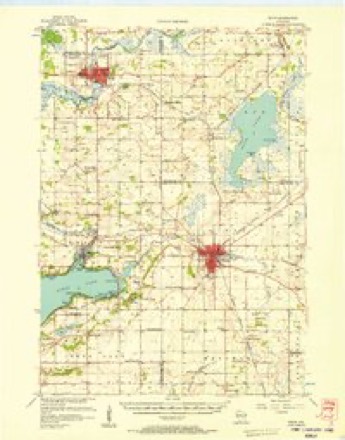
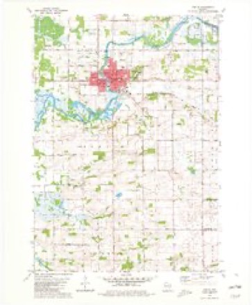
7 surveys from 10 printed sheetsMatched by testing this settlement's coordinate against the published boundary of every sheet in the United States Geological Survey's historical collection. Each opens the scanned sheet at the Survey.
- 1916 USGS Ripon quadrangle1:48000
- 1918 USGS Ripon quadrangle1:62500
- 1956 USGS Ripon quadrangle1:62500
- 1957 USGS Madison quadrangle1:250000, 3 printings
- 1960 USGS Madison quadrangle1:250000, 2 printings
- 1980 USGS Berlin quadrangle1:24000
- 1980 USGS Fond Du Lac quadrangle1:100000



Fires near this place
203 since 1992Regional context, not property-specific evidence. The federal wildfire occurrence database lists 203 fires within 5 miles of Berlin between 1992 and 2020, burning about 788 acres in total. None started naturally. 10 were recorded as arson. Distance is straight-line from the map coordinates, so a fire counted here may appear on a neighbouring settlement's page as well.
| Reported cause | Fires |
|---|---|
| Debris and open burning | 84 |
| Missing data/not specified/undetermined | 47 |
| Equipment and vehicle use | 41 |
| Arson/incendiarism | 10 |
| Misuse of fire by a minor | 6 |
| Smoking | 5 |
| Recreation and ceremony | 3 |
| Railroad operations and maintenance | 3 |
| Power generation/transmission/distribution | 2 |
| Other causes | 1 |
| Fireworks | 1 |
The most recent of them, most recent first, with the day each was reported and the service that recorded it.
| Date | Cause | Size | Reported by | Name on the report |
|---|---|---|---|---|
| 6 September 2003 | Debris and open burning | under an acre | Wisconsin Department of Natural Resources | not named |
| 6 September 2003 | Equipment and vehicle use | under an acre | Wisconsin Department of Natural Resources | not named |
| 6 September 2003 | Recreation and ceremony | under an acre | Wisconsin Department of Natural Resources | not named |
| 5 September 2003 | Equipment and vehicle use | under an acre | Wisconsin Department of Natural Resources | not named |
| 30 September 2012 | Misuse of fire by a minor | under an acre | Wisconsin Department of Natural Resources | UMOS CAMP FIRE |
| 30 September 1996 | Debris and open burning | under an acre | Wisconsin Department of Natural Resources | not named |
| 17 September 2003 | Missing data/not specified/undetermined | under an acre | Wisconsin Department of Natural Resources | not named |
| 10 September 2003 | Missing data/not specified/undetermined | under an acre | Wisconsin Department of Natural Resources | not named |
Settlements close enough to share some of these fires:
Mines and quarries near this place
4 within 5 milesRegional context, not property-specific evidence. The federal mineral resources record lists 4 workings within 5 miles of Berlin: 3 past producers, 1 producer. 1 still produces. What was taken out: Stone, Crushed/Broken, Sand and Gravel, Construction. Distance is straight-line from the map coordinates, so a quarry counted here may appear on a neighbouring settlement's page as well.
| Where | Site | Commodity | Status | Recorded |
|---|---|---|---|---|
| A.F. Gelhar Sand Pit | Sand and Gravel, Construction | Past Producer | ||
| Chier Industrial Plant | Sand and Gravel, Construction | Past Producer | ||
| Ewald Quarry | Stone, Crushed/Broken | Producer | ||
| Ewald Quarry | Stone, Crushed/Broken | Past Producer |
Storms near this place
39 since 1994Regional context, not property-specific evidence. The National Weather Service names Berlin in 39 storm reports between 1994 and 2024: 16 hail, 14 thunderstorm wind, 4 tornado, 4 funnel cloud. The reports record 4 injuries. Each account below is quoted exactly as the forecast office filed it, from the NOAA Storm Events Database, and each date opens the federal record of that event.
| When | Event | Place named | Harm | What the report says |
|---|---|---|---|---|
| May 2000 | Hail | Berlin | 4 hurt, $1,500,000 | no account filed |
| August 1997 | Thunderstorm Wind | Berlin | $1,000,000 | no account filed |
| August 1995 | Thunderstorm Wind | Berlin | $160,000 | no account filed |
| April 2010 | Tornado (EF1) | Berlin | $130,000 | A weak tornado spun up southeast of Berlin near the intersection of CTH AA and Forest Ridge Rd. The tornado moved northeast and disappated near the intersection of CTH V and White Ridge Rd. The average path width was 60 yards. A damage survey noted seven high tension wood power poles were snapped. A few trees were uprooted including one that fell on and damaged a car. There was minor roof damage to a barn. Several small barrels were thrown over 100 yards into a nearby field. A portable toilet was moved about 50 feet. Near the end of the track, a TV antenna was snapped and there was damage to the facia of a home. A small shed was destroyed and a couch that was outdoors was thrown about 75 feet. The Green Lake County Emergency Manager estimated property damage at $30,000. Additionally, it is estimated that the power-pole and line replacement cost was about $100,000. |
| August 2010 | Thunderstorm Wind | Berlin | $100,000 | County officials reported a tree fell through a house in Berlin. Power lines were reported down by the strong thunderstorm gusts, as well as minor crop damage. |
| May 2007 | Thunderstorm Wind | Berlin | $20,000 | Large trees were uprooted and several power-lines were damaged/felled. |
| August 1995 | Thunderstorm Wind | Berlin | $20,000 | no account filed |
| May 2024 | Thunderstorm Wind | Berlin | $10,000 | Tree damage across Berlin. |
| June 1998 | Thunderstorm Wind | Berlin | $6,000 | no account filed |
| July 2020 | Thunderstorm Wind | Berlin | $5,000 | Scattered trees and power lines down across Berlin. |
| August 2019 | Thunderstorm Wind | Berlin | $5,000 | A prolonged period of thunderstorms resulted in multiple trees down in Berlin, including an aluminum garage blown over. |
| September 2018 | Flood | Berlin | $5,000 | The Fox River reached moderate flood stage, cresting at 15.18 feet the morning of September 12th. Riverside and Webster Parks are flooded in Berlin. Some homes along Webster St. are affected by floodwaters. |
| June 1996 | Thunderstorm Wind | Berlin | $5,000 | no account filed |
| July 1994 | Tornado (F1) | Berlin | $5,000 | no account filed |
| April 2011 | Tornado (EF0) | Berlin | $300 | An EF0 tornado developed about 3.5 miles south-southeast of Berlin just south of the intersection of County Road F and County Road AA and traveled northeast about 1.8 miles before dissipating on Meadow Brook Road just east of County Trunk Highway V. The tornadic winds sucked lawn furniture from under a porch where it was being stored and threw it against a fence. Tree branches were snapped and a wooden structure received light damage along the path of the tornado. There was $300 dollars of damage done to an outdoor spa. The exact start location was Lat 43.91978 Lon -88.91302. The exact end locations was Lat 43.93922 Lon -88.88818. The EF-rating was based on DI 27 (TH), DOD 2 which suggests winds speeds around 80 mph. The average path width of the tornado was 30 yards. |
| August 2024 | Funnel Cloud | Berlin | - | Funnel clouds reported in northern Green Lake County. |
| August 2015 | Hail | Berlin | - | Dime to nickel size hail falling with estimated winds of 30 mph. |
| July 2011 | Thunderstorm Wind | Berlin | - | The Green Lake County Emergency Manager reported many large tree branches down in the town of Berlin from thunderstorm wind gusts measured at 63 mph (55 knots). |
| July 2006 | Thunderstorm Wind | Berlin | - | Trees down. |
| September 2021 | Hail | Berlin | - | no account filed |
| August 2020 | Hail | Berlin | - | no account filed |
| August 2019 | Hail | Berlin | - | no account filed |
| August 2019 | Hail | Berlin | - | no account filed |
| July 2017 | Hail | Berlin | - | no account filed |
| June 2011 | Hail | Berlin | - | no account filed |
| June 2011 | Funnel Cloud | Berlin | - | no account filed |
| July 2006 | Funnel Cloud | Berlin | - | no account filed |
| July 2006 | Hail | Berlin | - | no account filed |
| September 2005 | Thunderstorm Wind | Berlin | - | no account filed |
| May 2004 | Hail | Berlin | - | no account filed |
| October 2004 | Hail | Berlin | - | no account filed |
| July 2003 | Thunderstorm Wind | Berlin | - | no account filed |
| April 2002 | Hail | Berlin | - | no account filed |
| April 2001 | Hail | Berlin | - | no account filed |
| April 1997 | Hail | Berlin | - | no account filed |
| July 1996 | Funnel Cloud | Berlin | - | no account filed |
| August 1995 | Hail | Berlin | - | no account filed |
| May 1995 | Hail | Berlin | - | no account filed |
| July 1994 | Tornado (F0) | Berlin | - | no account filed |
Nearest settlements
The eight closest, with where each one stands in the county. Distances are straight-line, computed from the Geographic Names Information System coordinates.
| Map | Place | Distance | Sheets |
|---|---|---|---|
| Fairburn | 5.0 miles | 14 | |
| Green Lake | 8.6 miles | 10 | |
| Pleasant Point | 9.0 miles | 10 | |
| Sherwood Forest | 9.6 miles | 10 | |
| Forest Glen Beach | 10.4 miles | 10 | |
| Sandstone Bluff | 10.5 miles | 10 | |
| Spring Grove | 10.6 miles | 10 | |
| Tuleta Hills | 11.2 miles | 10 |
Elsewhere
Matched on this settlement's Geographic Names Information System number rather than its name, so it cannot be a different place of the same name in another state.
| Wikipedia article on Berlin | An encyclopaedic summary. Its text is share-alike, so it is linked here rather than copied. |
| Wikidata item Q1569850 | The structured record the population and elevation above come from. Public domain (CC0). |
Provenance
This settlement is recorded in the Geographic Names Information System as feature 1561600. The sheet list is computed by point-in-boundary test against the United States Geological Survey's historical topographic inventory. Both are works of the United States government and carry no copyright under 17 U.S.C. 105.
Wildfire. Short, Karen C. 2022. Spatial wildfire occurrence data for the United States, 1992-2020 [FPA_FOD_20221014]. 6th Edition. Fort Collins, CO: Forest Service Research Data Archive. https://doi.org/10.2737/RDS-2013-0009.6 Collected with United States Government funding and usable without additional permissions or fees.
Mines and quarries. USGS Mineral Resources Data System (MRDS) https://mrdata.usgs.gov/mrds/ A work of the United States government, no copyright under 17 U.S.C. 105.
Storms. NOAA National Centers for Environmental Information, Storm Events Database https://www.ncei.noaa.gov/stormevents/ A work of the United States government, no copyright under 17 U.S.C. 105. Narratives are quoted verbatim from the National Weather Service report and are not edited or summarised.