 Block
Black Earth, Wisconsin
15 topographic sheets cover this place, the earliest surveyed in 1907 and the latest in 1991. It stands in Black Earth town. It lies in ZIP code area 53515. It stands on Vermont Creek. The Survey maps it on the Black Earth quadrangle. 1,493 people lived here at the 2020 count. It stands 837 feet above sea level.
On record in Black Earth
Buildings and businesses the archive holds for this place. Each opens its own page, with the source record it came from.
On the National Register 1 record
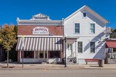 Heiney's Meat Marketlisted 1984
Population over time
2 figuresBlack Earth grew from 1,338 to 1,493 between 2010 and 2020. These are the recorded population figures Wikidata holds for this place, reached through the Geographic Names Information System number this page is keyed on rather than by name, so they belong to this place and not to another of the same name. Most are census counts, but not all are: an early figure may be a founding or settlement estimate, and an estimate published within five years of a census is left out. The change column is computed, and is left blank where more than 20 years separate a figure from the one before it, because a gap that long is not a change between two counts.
| Year | People | Change |
|---|---|---|
| 2010 | 1,338 | |
| 2020 | 1,493 | +155 (+12%) |
Topographic sheets covering this place
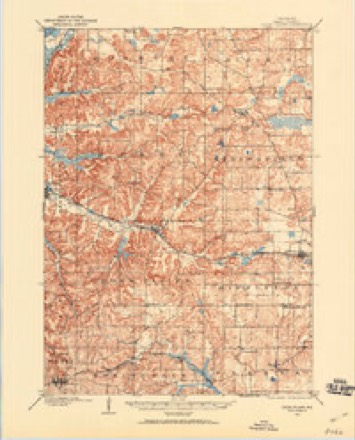
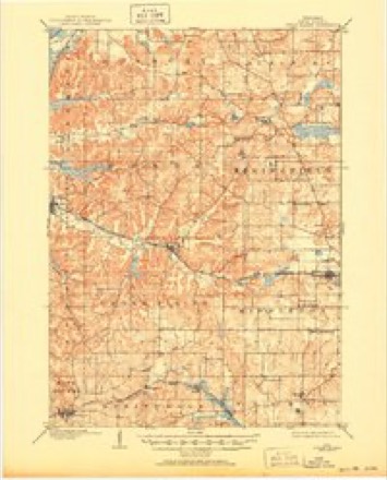
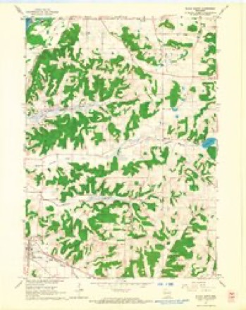
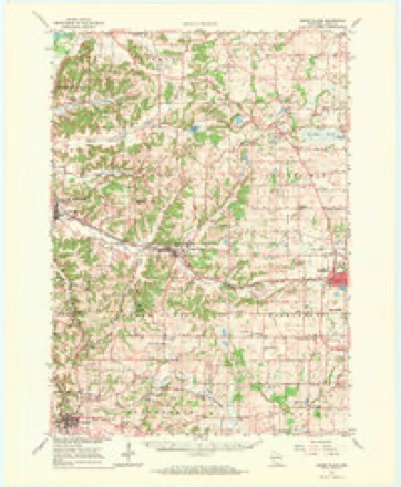
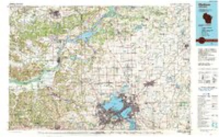
7 surveys from 15 printed sheetsMatched by testing this settlement's coordinate against the published boundary of every sheet in the United States Geological Survey's historical collection. Each opens the scanned sheet at the Survey.
- 1907 USGS Cross Plains quadrangle1:62500
- 1909 USGS Cross Plains quadrangle1:62500, 4 printings
- 1957 USGS Madison quadrangle1:250000, 3 printings
- 1960 USGS Madison quadrangle1:250000, 2 printings
- 1962 USGS Black Earth quadrangle1:24000, 2 printings
- 1962 USGS Cross Plains quadrangle1:62500, 2 printings
- 1991 USGS Madison quadrangle1:100000


In the county-history sources
14,108 words on this townshipHistory of Dane County, Wisconsin ... Preceded by a History of Wisconsin, Statistics of the State, and an Abstract of Its Laws and Constitution and of the Constitution of the United States, published 1880 names this settlement in its chapter on Black Earth Town. These are the passages that mention it, exactly as the scans read.
This territory was first brought under town government as a part of the town of Madison. On the 2d day of August, 1848, it was, along with the township adjoining it on the west, erected into the town of Parmersville, the name of the latter being changed to Black Earth on February 1,1851. Previous to this, however, in 1850, Berry was erected into a separate town.
Passage source: History of Dane County, Wisconsin ... Preceded by a History of Wisconsin, Statistics of the State, and an Abstract of Its Laws and Constitution and of the Constitution of the United States, published 1880.
The first to unite in the bonds of wedlock here were John Gray and Elizabeth Harrison, who were married by Squire Wilson, of Black Earth, in June, 1846. They are both living in the enjoyment of a prosperous old age. The early dead were buried here and there throughout the town, as there were no cemeteries for several years after the first settlement.
Passage source: History of Dane County, Wisconsin ... Preceded by a History of Wisconsin, Statistics of the State, and an Abstract of Its Laws and Constitution and of the Constitution of the United States, published 1880.
The soil is usually very productive, particularly in the valleys, where corn, hay and oats do very well. Wheat does better on the higher ground, which is usually a sandy loam or limestone marl, according to the height, the very highest ridges being composed of limestone, and the lower ridges of sandstone. The best soil in town is on Section 36 and adjoining. That which the farmers most regret is the washing of the hills, which has very materially damaged the arable land throughout this section. . largest of the streams is the East Blue Mound Creek, which enters the town on Section 6i, ana, flowing northwest, passes out on Section 6. The land, through which this creek flows, is cauea the saw*mill bottoms, and is very fertile. This stream supplies excellent mill privileges, wtuoa have been partly improved. All of the other streams, of which there are several, are tributary to the Bast Blue Mounds Creek, with the exception of one, which, rising on Section 25, flows northerly, passing out of the town on Section 2, and empties into the Black Earth Creek.
Passage source: History of Dane County, Wisconsin ... Preceded by a History of Wisconsin, Statistics of the State, and an Abstract of Its Laws and Constitution and of the Constitution of the United States, published 1880.
Machine-read from a century-old scan, so expect the errors a machine makes: misspelled names, dropped words, stray characters.
Read the whole chapter on Black Earth Town - it names this place 4 more 4 times.
Fires near this place
103 since 1992Regional context, not property-specific evidence. The federal wildfire occurrence database lists 103 fires within 5 miles of Black Earth between 1992 and 2020, burning about 230 acres in total. 1 started naturally. 8 were recorded as arson. Distance is straight-line from the map coordinates, so a fire counted here may appear on a neighbouring settlement's page as well.
| Reported cause | Fires |
|---|---|
| Debris and open burning | 63 |
| Missing data/not specified/undetermined | 9 |
| Equipment and vehicle use | 9 |
| Arson/incendiarism | 8 |
| Railroad operations and maintenance | 4 |
| Recreation and ceremony | 3 |
| Smoking | 3 |
| Power generation/transmission/distribution | 2 |
| Other causes | 1 |
| Natural | 1 |
The most recent of them, most recent first, with the day each was reported and the service that recorded it.
| Date | Cause | Size | Reported by | Name on the report |
|---|---|---|---|---|
| 26 August 2008 | Smoking | under an acre | Wisconsin Department of Natural Resources | not named |
| 15 August 2002 | Railroad operations and maintenance | under an acre | Wisconsin Department of Natural Resources | not named |
| 19 July 2005 | Debris and open burning | 3.0 acres | Wisconsin Department of Natural Resources | not named |
| 13 July 2001 | Power generation/transmission/distribution | under an acre | Wisconsin Department of Natural Resources | not named |
| 10 July 2012 | Debris and open burning | under an acre | Wisconsin Department of Natural Resources | DENEEN BARREL |
| 8 May 2018 | Missing data/not specified/undetermined | 1.0 acres | Wisconsin Department of Natural Resources | 1800046 |
| 6 May 2005 | Railroad operations and maintenance | under an acre | Wisconsin Department of Natural Resources | not named |
| 6 May 2005 | Railroad operations and maintenance | under an acre | Wisconsin Department of Natural Resources | not named |
Settlements close enough to share some of these fires:
Mines and quarries near this place
3 within 5 milesRegional context, not property-specific evidence. The federal mineral resources record lists 3 workings within 5 miles of Black Earth: 2 past producers, 1 producer. 1 still produces. What was taken out: Sand and Gravel, Construction, Limestone, Dimension, Stone, Crushed/Broken. Distance is straight-line from the map coordinates, so a quarry counted here may appear on a neighbouring settlement's page as well.
| Where | Site | Commodity | Status | Recorded |
|---|---|---|---|---|
| Boehnen Inc. Hollefelder Quarry | Stone, Crushed/Broken | Producer | ||
| Marvin Beuthin Gravel Pit | Sand and Gravel, Construction | Past Producer | ||
| Valley Hites Quarry | Limestone, Dimension | Past Producer |
Storms near this place
20 since 1999Regional context, not property-specific evidence. The National Weather Service names Black Earth in 20 storm reports between 1999 and 2026: 8 hail, 5 thunderstorm wind, 2 lightning, 2 tornado. No death or injury is recorded in these reports. Each account below is quoted exactly as the forecast office filed it, from the NOAA Storm Events Database, and each date opens the federal record of that event.
| When | Event | Place named | Harm | What the report says |
|---|---|---|---|---|
| May 2000 | Flood | Black Earth | $30,000 | no account filed |
| August 2021 | Thunderstorm Wind | Black Earth | $10,000 | Multiple reports of trees and power lines downed across Dane County. Cities impacted were Black Earth, Cross Plains, Middleton, Madison, Oregon, and Cottage Grove. |
| July 2011 | Lightning | Black Earth | $10,000 | A home in the 1200 block of Hillcrest Road in Black Earth was struck by lightning and caught fire. The home suffered extensive water and smoke damage. |
| June 2016 | Flash Flood | Black Earth | $5,000 | County Road KP was closed due to flooding between South Valley Road and Scherbel Road, which is between Black Earth and Cross Plains. 1.5 feet of water on the roads in the Town of Berry near highway 19 and County Road KP. Shoulder washouts on highway 19 east to Indian Lake. Shoulder washouts in various locations on County Road KP between highway 14 and highway 19. Shoulder washouts also on highway V from Loeper Road and to the west on V. Doppler radar estimates 5 to 8 inches of rain in a 6 hour period. |
| June 1999 | Thunderstorm Wind | Black Earth | $3,000 | no account filed |
| August 2007 | Lightning | Black Earth | $1,000 | Lightning struck a blew apart a 60-foot pine tree which was about 30 feet from a residential home. Part of the generated electrical current fried the home's telephone line. The time is estimated within a plus or minus 15 minutes. |
| May 2000 | Thunderstorm Wind | Black Earth | $1,000 | no account filed |
| April 2026 | Hail | Black Earth | - | Public report of 1 inch diameter hail in Black Earth. Time confirmed via radar data. |
| April 2026 | Hail | Black Earth | - | Public report of 1.75 inch diameter hail west of Black Earth. Time confirmed via radar data. |
| April 2026 | Hail | Black Earth | - | Trained spotter reports 2.75 inch diameter hail with damaging to siding and roofs. |
| July 2022 | Thunderstorm Wind | Black Earth | - | A large tree limb snapped off. |
| July 2021 | Tornado (EF0) | Black Earth | - | This was 1 of 17 tornadoes to occur in Wisconsin on the night of July 28th into the early morning hours of July 29th. This was the 6th overall tornado for the event.|A line of storms developed in northern Wisconsin and pushed south into southern Wisconsin in the overnight hours of the 28th into the 29th of July with mainly brief tornadoes and damaging winds occurring. This tornado began northeast of Black Earth in the Marsh Valley and tracked to the south through the center of Cross Plains. There wasn't much in the way of structural damage from this tornado, rather consistent tree damage from the start point through to the south side of Cross Plains. |
| June 2014 | Tornado (EF0) | Black Earth | - | A brief EF0 tornado was observed ripping apart trees. |
| July 2013 | Hail | Black Earth | - | A trained spotter reported hail up to 1.50 inch in diameter partially covered the ground. Thunderstorm wind gusts estimated up to 50 mph knocked down 6-inch diameter tree limbs. |
| April 2025 | Hail | Black Earth | - | no account filed |
| June 2015 | Hail | Black Earth | - | no account filed |
| August 2006 | Hail | Black Earth | - | no account filed |
| August 2005 | Funnel Cloud | Black Earth | - | no account filed |
| July 2002 | Thunderstorm Wind | Black Earth | - | no account filed |
| May 2000 | Hail | Black Earth | - | no account filed |
Nearest settlements
The eight closest, with where each one stands in the county. Distances are straight-line, computed from the Geographic Names Information System coordinates.
| Map | Place | Distance | Sheets |
|---|---|---|---|
| Mazomanie | 3.7 miles | 16 | |
| Cross Plains | 5.1 miles | 16 | |
| Elvers | 5.4 miles | 16 | |
| Marxville | 5.9 miles | 15 | |
| Pine Bluff | 7.1 miles | 16 | |
| Little Norway | 7.9 miles | 16 | |
| Aldens Corners (historical) | 8.1 miles | 15 | |
| Roxbury | 8.6 miles | 15 |
Elsewhere
Matched on this settlement's Geographic Names Information System number rather than its name, so it cannot be a different place of the same name in another state.
| Wikipedia article on Black Earth | An encyclopaedic summary. Its text is share-alike, so it is linked here rather than copied. |
| Wikidata item Q2671303 | The structured record the population and elevation above come from. Public domain (CC0). |
Provenance
This settlement is recorded in the Geographic Names Information System as feature 1561861. The sheet list is computed by point-in-boundary test against the United States Geological Survey's historical topographic inventory. Both are works of the United States government and carry no copyright under 17 U.S.C. 105.
Wildfire. Short, Karen C. 2022. Spatial wildfire occurrence data for the United States, 1992-2020 [FPA_FOD_20221014]. 6th Edition. Fort Collins, CO: Forest Service Research Data Archive. https://doi.org/10.2737/RDS-2013-0009.6 Collected with United States Government funding and usable without additional permissions or fees.
Mines and quarries. USGS Mineral Resources Data System (MRDS) https://mrdata.usgs.gov/mrds/ A work of the United States government, no copyright under 17 U.S.C. 105.
Storms. NOAA National Centers for Environmental Information, Storm Events Database https://www.ncei.noaa.gov/stormevents/ A work of the United States government, no copyright under 17 U.S.C. 105. Narratives are quoted verbatim from the National Weather Service report and are not edited or summarised.