 Block
Mazomanie, Wisconsin
16 topographic sheets cover this place, the earliest surveyed in 1920 and the latest in 1991. It stands in Mazomanie Village. It lies in ZIP code area 53560. It stands on Halfway Prairie Creek. The Survey maps it on the Mazomanie quadrangle.
On record in Mazomanie
Buildings and businesses the archive holds for this place. Each opens its own page, with the source record it came from.
On the National Register 4 records
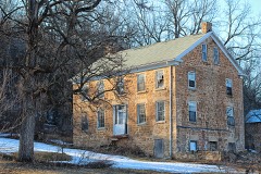 Adam Dunlap Farmsteadlisted 2001
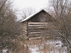 John and Margarethe Kemp Cabinlisted 2008
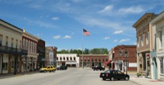 Mazomanie Downtown Historic Districtlisted 1992
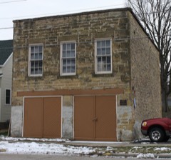 Mazomanie Town Halllisted 1980
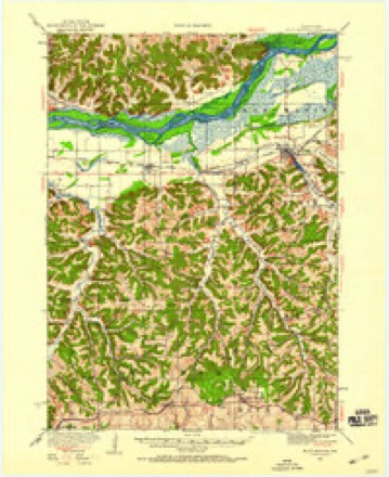
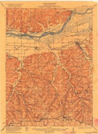
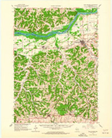
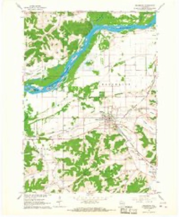
Topographic sheets covering this place
7 surveys from 16 printed sheetsMatched by testing this settlement's coordinate against the published boundary of every sheet in the United States Geological Survey's historical collection. Each opens the scanned sheet at the Survey.
- 1920 USGS Blue Mounds quadrangle1:62500
- 1922 USGS Blue Mounds quadrangle1:62500, 3 printings
- 1957 USGS Madison quadrangle1:250000, 3 printings
- 1960 USGS Madison quadrangle1:250000, 2 printings
- 1962 USGS Blue Mounds quadrangle1:62500, 3 printings
- 1962 USGS Mazomanie quadrangle1:24000, 3 printings
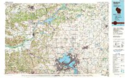
- 1991 USGS Madison quadrangle1:100000


In the county-history sources
10,669 words on this townshipHistory of Dane County, Wisconsin ... Preceded by a History of Wisconsin, Statistics of the State, and an Abstract of Its Laws and Constitution and of the Constitution of the United States, published 1880 names this settlement in its chapter on Mazomanie Village. These are the passages that mention it, exactly as the scans read.
At the first annual parade and inspection, held the first Monday in June, 1877, Protection Fire Company, No. 1, of Mazomanie, came up to the village and were duly welcomed. After parade and housing the machines, the companies marched to the town hall, where the ladies had prepared a sumptuous repast for the boys, who did full justice to the viands. In the evening, a social dance was participated in by over forty couples. At the annual meeting, hdd March 4, 1878, J. E. Bardsley was elected Foreman; John Muskat, First Assistant; A. M. Partridge Second Assistant; C. Burnett, Secretary; Ed Kirst, Treasurer. Abuilding was erected during this year for the trucks, near the railroad, at a cost of $125. The second annual parade occurred the first Monday in June, and was 'a successful affair. The town voted an appropriation of $200 toward purchasing a fire engine, the same to be taken out of the license fund, at the annual meeting in the spring of 1878, but, the amount not being sufficient for the purpose, George Zellor offered to advance $200, taking a mortgage on the same, which offer was accepted by the company and engine purchased.
Passage source: History of Dane County, Wisconsin ... Preceded by a History of Wisconsin, Statistics of the State, and an Abstract of Its Laws and Constitution and of the Constitution of the United States, published 1880.
On Tuesday evening, January 23, 1877, at about 8:80, a fire was discovered in the attic of the store building of Isaacson & Nordrum, the largest mercantile establishment in the village. The alarm was given, and in a very few minutes the street was filled with people ready to render assistance. It was at once decided, that, not having a regular organized company, and no means with which to cope with the fire, the building could not be saved, therefore steps were taken toward saving the stock. Every one worked with a will, and soon the three safes containing the firm's books and valuables, together with a portion of the goods, were deposited in the streets. In a short space of time the building was throwing out such an intense heat that it was impossible to remain longer in it, and the flames, leaping toward the sky, had created a strong draught of air, which was bearing cinders and burning fragments to the adjoining buildings, and attention must needs be given to the property endangered. The bright light of the flames was seen for miles around. Alarm reached Mazomanie, and Protection Company, No. 1, at once started to render assistance, but arrived too late to be of service. The loss of Isaacson & Nordrum was $16,000, on which there was an insurance of $11,800.
Passage source: History of Dane County, Wisconsin ... Preceded by a History of Wisconsin, Statistics of the State, and an Abstract of Its Laws and Constitution and of the Constitution of the United States, published 1880.
Machine-read from a century-old scan, so expect the errors a machine makes: misspelled names, dropped words, stray characters.
Read the whole chapter on Mazomanie Village - it names this place 1 more 1 time.
Fires near this place
134 since 1992Regional context, not property-specific evidence. The federal wildfire occurrence database lists 134 fires within 5 miles of Mazomanie between 1992 and 2020, burning about 528 acres in total. 1 started naturally. 6 were recorded as arson. Distance is straight-line from the map coordinates, so a fire counted here may appear on a neighbouring settlement's page as well.
| Reported cause | Fires |
|---|---|
| Debris and open burning | 72 |
| Equipment and vehicle use | 19 |
| Missing data/not specified/undetermined | 18 |
| Smoking | 6 |
| Arson/incendiarism | 6 |
| Power generation/transmission/distribution | 4 |
| Railroad operations and maintenance | 3 |
| Recreation and ceremony | 3 |
| Natural | 1 |
| Other causes | 1 |
| Misuse of fire by a minor | 1 |
The most recent of them, most recent first, with the day each was reported and the service that recorded it.
| Date | Cause | Size | Reported by | Name on the report |
|---|---|---|---|---|
| 21 September 2005 | Missing data/not specified/undetermined | 15 acres | Wisconsin Department of Natural Resources | not named |
| 6 August 2012 | Debris and open burning | under an acre | Wisconsin Department of Natural Resources | FITZGERALD YARD |
| 31 August 1995 | Equipment and vehicle use | under an acre | Wisconsin Department of Natural Resources | not named |
| 27 August 2020 | Equipment and vehicle use | under an acre | Wisconsin Department of Natural Resources | BREUNIG RD |
| 26 August 2008 | Smoking | under an acre | Wisconsin Department of Natural Resources | not named |
| 15 August 2002 | Railroad operations and maintenance | under an acre | Wisconsin Department of Natural Resources | not named |
| 13 August 2015 | Debris and open burning | under an acre | Wisconsin Department of Natural Resources | COUNTY Y FIRE |
| 14 July 2005 | Missing data/not specified/undetermined | under an acre | Wisconsin Department of Natural Resources | not named |
Settlements close enough to share some of these fires:
Mines and quarries near this place
3 within 5 milesRegional context, not property-specific evidence. The federal mineral resources record lists 3 workings within 5 miles of Mazomanie: 3 past producers. None of them still produces. What was taken out: Sand and Gravel, Construction, Limestone, Dimension, Flagstone. Distance is straight-line from the map coordinates, so a quarry counted here may appear on a neighbouring settlement's page as well.
| Where | Site | Commodity | Status | Recorded |
|---|---|---|---|---|
| Hildebrandt Stone Company Quarry | Flagstone | Past Producer | ||
| Marvin Beuthin Gravel Pit | Sand and Gravel, Construction | Past Producer | ||
| Valley Hites Quarry | Limestone, Dimension | Past Producer |
Storms near this place
26 since 1995Regional context, not property-specific evidence. The National Weather Service names Mazomanie in 26 storm reports between 1995 and 2026: 9 thunderstorm wind, 8 hail, 4 flood, 2 lightning. No death or injury is recorded in these reports. Each account below is quoted exactly as the forecast office filed it, from the NOAA Storm Events Database, and each date opens the federal record of that event.
| When | Event | Place named | Harm | What the report says |
|---|---|---|---|---|
| August 2007 | Flash Flood | Mazomanie | $6,800,000 | Although general flooding affected all of Dane County, significant flash flooding affected the community areas of Mt. Horeb, Oregon, Sun Prairie, and Dane. At least 798 homes in Dane County sustained water damage to basement contents and/or basement walls, with damage totals of about $3.96 million. Thirteen homes had major water damage and two were destroyed, while 783 had minor damage. At least 10 businesses reported minor water damage totaling about $380,000. Crop losses were an estimated $5 million. Livestock losses were about $200,000, and farm building losses were about $500,000. Additionally, road damages were about $538,000, water control facility damage was about $320,000, public building damage was about $288,000, public utility damage was about $124,000, and other public property damage was about $37,000. Not included in property or crop losses were debris clearance costs of $197,000 and protective measures of $258,000. A bridge on CTH Y just north of Mazomanie was undermined and damaged by the flood waters and will need to be replaced. Water depths on STH 69 south of Verona reached 3 to 4 feet. Several gravel shoulder washouts occurred and crops across the county were damaged. Soil erosion and crop damage was reported. The water level on Lake Mendota rose to within 1 foot of it's record maximum level. The water level on Lake Monona came within 0.02 feet of it's record maxmium level. Rainfall rates were impressive - a spotter near Oregon measured 2.1 of rain between 2000 and 2100CST on August 18th. In Morrisonville, a spotter measured 7.07 overnight through 1700CST on August 19th. Overnight through 0245CST, 4.40 was measured by a coop observer 3NNE Sun Prairie with water overflowing most roads in that area. Also, water was reported in many basements in the Sun Prairie area. A spotter measured 6.39 overnight in DeForest. At a location 1SE Verona, 5.59 fell overnight through 0122CST. The Stoughton coop observer had 6.03 overnight. In Oregon a spotter measured 5.45 overnight. For comparison, locations in Dane County normally receive about 4 to 4.25 inches of rain in the entire month of August. |
| May 2008 | Thunderstorm Wind | Mazomanie | $115,000 | Powerful thunderstorm straight-line winds toppled trees which then pulled down power lines. |
| August 2001 | Lightning | Mazomanie | $30,000 | A home in Mazomanie suffered roof damage due to a lightning fire. |
| June 2000 | Flood | Mazomanie | $25,000 | no account filed |
| May 2020 | Thunderstorm Wind | Mazomanie | $20,000 | Four horse shelters collapsed by downburst winds. |
| May 2024 | Thunderstorm Wind | Mazomanie | $10,000 | Scattered tree limbs down, some large, along highway 14 from just east of Mazomanie to just west of Middleton after a series of lines and clusters of thunderstorms. |
| February 2018 | Flood | Mazomanie | $10,000 | Widespread flooding of lowland and agricultural land including some roads. The flooding was most concentrated over the southern portion of the county. |
| May 1996 | Lightning | Mazomanie | $10,000 | no account filed |
| May 2016 | Thunderstorm Wind | Mazomanie | $7,000 | Trees and power lines down. |
| October 2019 | Flood | Mazomanie | $3,000 | The Black Earth Creek at Mazomanie reached minor flood stage, cresting at 10.95 feet the afternoon of October 2nd. Floodwaters affect Curtiss Street and other streets on the northeast side of Mazomanie. There is also general lowland flooding in the Mazomanie area. |
| March 2019 | Flood | Mazomanie | $3,000 | The Black Earth Creek at Mazomanie reached minor flood stage, cresting at 11.66 feet the late evening of March 14th. Floodwaters affect Curtiss St. and other streets on the northeast side of Mazomanie, including County Road Y. |
| May 2024 | Thunderstorm Wind | Mazomanie | $2,000 | Several trees down. |
| June 2013 | Thunderstorm Wind | Mazomanie | $2,000 | Law enforcement officials reported trees down in Mazomanie due to thunderstorm wind gusts estimated up to 60 mph (56 knots). |
| April 2026 | Hail | Mazomanie | - | Trained spotter reports 2.5 inch diameter hail near Mazomanie. Time confirmed via radar data. |
| April 2026 | Hail | Mazomanie | - | Public report of 1.5 inch diameter hail in Mazomanie. Time confirmed via radar data. |
| April 2026 | Hail | Mazomanie | - | Trained spotter reports 1.75 inch diameter hail near Mazomanie. Time confirmed via radar data. |
| March 2025 | Thunderstorm Wind | Mazomanie | - | Mesonet Station EW4463 1 mile east of Mazomanie. |
| July 2025 | Tornado (EF0) | Mazomanie | - | Tornado started along Highway 78 near Racek Road and went through the hills near the Black Hawk Unit before crossing County Highway Y, ending Just across Highway 12. The main area of damage was to the Birchwood Drive neighborhood where about 20 to 40 trees were uprooted or had multiple limbs broken off. Multiple storm chaser videos show the main tornado tracking just along and to the west of this neighborhood. The only structural damage noted that wasn't from falling trees was to one house on Birchwood Drive that had a few shingles pulled up. |
| September 2021 | Hail | Mazomanie | - | no account filed |
| May 2016 | Hail | Mazomanie | - | no account filed |
| April 2015 | Hail | Mazomanie | - | no account filed |
| June 2008 | Funnel Cloud | Mazomanie | - | no account filed |
| March 2005 | Hail | Mazomanie | - | no account filed |
| June 2002 | Thunderstorm Wind | Mazomanie | - | no account filed |
| August 2002 | Hail | Mazomanie | - | no account filed |
| July 1995 | Thunderstorm Wind | Mazomanie | - | no account filed |
Nearest settlements
The eight closest, with where each one stands in the county. Distances are straight-line, computed from the Geographic Names Information System coordinates.
| Map | Place | Distance | Sheets |
|---|---|---|---|
| Black Earth | 3.7 miles | 15 | |
| Marxville | 7.2 miles | 15 | |
| Elvers | 7.4 miles | 16 | |
| Roxbury | 8.1 miles | 15 | |
| Cross Plains | 8.5 miles | 16 | |
| Aldens Corners (historical) | 8.8 miles | 15 | |
| Little Norway | 10.3 miles | 16 | |
| Lutheran Hill | 10.5 miles | 15 |
Provenance
This settlement is recorded in the Geographic Names Information System as feature 1569153. The sheet list is computed by point-in-boundary test against the United States Geological Survey's historical topographic inventory. Both are works of the United States government and carry no copyright under 17 U.S.C. 105.
Wildfire. Short, Karen C. 2022. Spatial wildfire occurrence data for the United States, 1992-2020 [FPA_FOD_20221014]. 6th Edition. Fort Collins, CO: Forest Service Research Data Archive. https://doi.org/10.2737/RDS-2013-0009.6 Collected with United States Government funding and usable without additional permissions or fees.
Mines and quarries. USGS Mineral Resources Data System (MRDS) https://mrdata.usgs.gov/mrds/ A work of the United States government, no copyright under 17 U.S.C. 105.
Storms. NOAA National Centers for Environmental Information, Storm Events Database https://www.ncei.noaa.gov/stormevents/ A work of the United States government, no copyright under 17 U.S.C. 105. Narratives are quoted verbatim from the National Weather Service report and are not edited or summarised.