 Block
Boscobel, Wisconsin
10 topographic sheets cover this place, the earliest surveyed in 1933 and the latest in 1985. It stands in Boscobel City. It lies in ZIP code area 53805. It stands on Sanders Creek. The Survey maps it on the Boscobel quadrangle. 3,286 people lived here at the 2020 count. It stands 663 feet above sea level.
On record in Boscobel
Buildings and businesses the archive holds for this place. Each opens its own page, with the source record it came from.
On the National Register 3 records
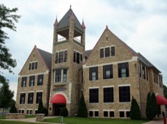 Boscobel High Schoollisted 1986
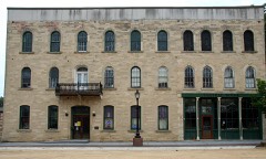 Central House Hotellisted 1996
- Boscobel Grand Army of the Republic Halllisted 2007
Population over time
2 figuresBoscobel grew from 3,231 to 3,286 between 2010 and 2020. These are the recorded population figures Wikidata holds for this place, reached through the Geographic Names Information System number this page is keyed on rather than by name, so they belong to this place and not to another of the same name. Most are census counts, but not all are: an early figure may be a founding or settlement estimate, and an estimate published within five years of a census is left out. The change column is computed, and is left blank where more than 20 years separate a figure from the one before it, because a gap that long is not a change between two counts.
| Year | People | Change |
|---|---|---|
| 2010 | 3,231 | |
| 2020 | 3,286 | +55 (+2%) |
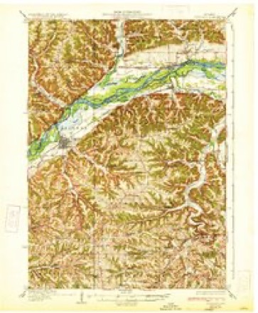
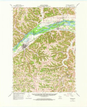
Topographic sheets covering this place
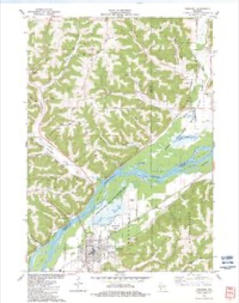
8 surveys from 10 printed sheetsMatched by testing this settlement's coordinate against the published boundary of every sheet in the United States Geological Survey's historical collection. Each opens the scanned sheet at the Survey.
- 1933 USGS Boscobel quadrangle1:62500, 2 printings
- 1958 USGS La Crosse quadrangle1:250000, 2 printings
- 1961 USGS La Crosse quadrangle1:250000
- 1965 USGS La Crosse quadrangle1:250000
- 1967 USGS Boscobel quadrangle1:62500
- 1976 USGS La Crosse quadrangle1:250000
- 1983 USGS Boscobel quadrangle1:24000
- 1985 USGS Richland Center quadrangle1:100000




In the county-history sources
45,101 words on this townshipHistory of Grant County, Wisconsin, published 1881 names this settlement in its chapter on Boscobel City. These are the passages that mention it, exactly as the scans read.
Joliet, with Nicholas Perrot, a voyageur, who spoke Algonquin fluently, as interpreter. By arrangement, St. Lusson remained at Manitoulin Islands through the winter, while Perrot made a tour of the diiFerent tribes to invite them to a general conference at the Sault Ste. Marie in the fjllowing spring. Perrot, having first sent messages to the northern tribes, went to Green Bay for the purpose of obtaining the presence of the nations residing upon its borders to the proposed meeting.
Passage source: History of Grant County, Wisconsin, published 1881.
St. Lusson, accompanied by his men (fifteen in number), appeared at the Sault over a month in advance of the time appointed. When all the tribes had assembled, the Frenchman prepared to execute the mission with which he was charged. A large cross of wood was prepared, and in the presence of the assembled savages, it was planted in the ground. A post of cedar was then planted beside it attached to which was a metal-plate engraved with the royal arms. Then St. Lussen made proclamation : " In the name of the most high, mighty, and redoubtable moaarch, Louis XIV, of that name, most Christian King of France and Navarre, I take possession of this place Sainte Marie du Sault, as also of Lakes Huron and Superior, the Island of Manitoulin and all countries, rivers, lakes and streams, contiguous and adjacent thereto; both those which have been discovered, and those which may be discovered hereafter, in all their length and breadth, bounded on the one side by the seas of the North and of the West, and on the other by the South Sea, declaring to the nations thereof, that from this time forth they are vassals of His Majesty, bound to obey his laws and follow his customs ; promising them on his part all succor and protection against the incursions and invasions of their enemies ; declaring to all other potentates, princes, sovereigns, states and republics - to them and their subjects - that they cannot and are not to seize or settle upon any parts of the aforesaid countries, save only under the good pleasure of His Most Christian Majesty, and of him who will govern in his behalf; and this on pain of incurring his resentment and the efforts of his arms." So far as words alone could «fFect it, thus passed the whole Northwest, including the territory of the present State of Wisconsin, under the dominion of France. She had discovered and, to a certain extent, explored it, a rude commerce with its barbarous inhabitants, and, through her missionaries, proclaimed the Christian doctrine to their heathen ears. But none of her agents, traders or missionaries, had so far reached that great river of which so many marvels were being constantly related.
Passage source: History of Grant County, Wisconsin, published 1881.
Upon the return of the expedition to Quebec, it was determined to explore this mysterious stream. The choice fell upon tfoliet. Said the Governor on the 2d of November, 1672 : " It has been judged expedient to send Sieur Joliet to the Maskoutiens (Mascoutins), to discover the south sea and the great river they call the Mississippi, which is supposed to discharge itself into the Sea of California." Continuing, the official adds: " He is a man of great experience in these sorts of discoveries, and has already been almost at the great river, the mouth of which he promises to see."
Passage source: History of Grant County, Wisconsin, published 1881.
Machine-read from a century-old scan, so expect the errors a machine makes: misspelled names, dropped words, stray characters.
Read the whole chapter on Boscobel City - it names this place 9 more 9 times.
Fires near this place
79 since 1993Regional context, not property-specific evidence. The federal wildfire occurrence database lists 79 fires within 5 miles of Boscobel between 1993 and 2020, burning about 121 acres in total. 2 started naturally. 6 were recorded as arson. Distance is straight-line from the map coordinates, so a fire counted here may appear on a neighbouring settlement's page as well.
| Reported cause | Fires |
|---|---|
| Debris and open burning | 31 |
| Equipment and vehicle use | 16 |
| Missing data/not specified/undetermined | 11 |
| Arson/incendiarism | 6 |
| Recreation and ceremony | 3 |
| Smoking | 3 |
| Railroad operations and maintenance | 3 |
| Natural | 2 |
| Misuse of fire by a minor | 2 |
| Power generation/transmission/distribution | 1 |
| Other causes | 1 |
The most recent of them, most recent first, with the day each was reported and the service that recorded it.
| Date | Cause | Size | Reported by | Name on the report |
|---|---|---|---|---|
| 27 September 2008 | Arson/incendiarism | under an acre | Wisconsin Department of Natural Resources | not named |
| 25 September 1999 | Smoking | 1.6 acres | Wisconsin Department of Natural Resources | not named |
| 21 September 2004 | Debris and open burning | under an acre | Wisconsin Department of Natural Resources | not named |
| 11 September 2003 | Debris and open burning | under an acre | Wisconsin Department of Natural Resources | not named |
| 28 August 2012 | Equipment and vehicle use | under an acre | Wisconsin Department of Natural Resources | BROKEN TINE |
| 2 August 2006 | Equipment and vehicle use | under an acre | Wisconsin Department of Natural Resources | not named |
| 2 August 2006 | Equipment and vehicle use | under an acre | Wisconsin Department of Natural Resources | not named |
| 2 August 2006 | Equipment and vehicle use | under an acre | Wisconsin Department of Natural Resources | not named |
Settlements close enough to share some of these fires:
Mines and quarries near this place
3 within 5 milesRegional context, not property-specific evidence. The federal mineral resources record lists 3 workings within 5 miles of Boscobel: 1 plant, 1 past producer, 1 producer. 2 still produce. What was taken out: Stone, Crushed/Broken. Distance is straight-line from the map coordinates, so a quarry counted here may appear on a neighbouring settlement's page as well.
| Where | Site | Commodity | Status | Recorded |
|---|---|---|---|---|
| Edward Kraemer and Sons, Inc. | Stone, Crushed/Broken | Plant | ||
| Salzgeber Quarry | Stone, Crushed/Broken | Producer | ||
| Staskal and Son-Sand and Gravel | Stone, Crushed/Broken | Past Producer |
Storms near this place
33 since 1995Regional context, not property-specific evidence. The National Weather Service names Boscobel in 33 storm reports between 1995 and 2021: 14 thunderstorm wind, 9 hail, 4 flood, 3 flash flood. No death or injury is recorded in these reports. Each account below is quoted exactly as the forecast office filed it, from the NOAA Storm Events Database, and each date opens the federal record of that event.
| When | Event | Place named | Harm | What the report says |
|---|---|---|---|---|
| June 2013 | Flash Flood | Boscobel | $7,100,000 | Very heavy rain produced flash flooding across the northeast part of Grant County. |In Boscobel, numerous houses became surrounded by water with evacuations needed, most streets were flooded and cars were under water. 650 homes were impacted by the flood waters with two dozen families displaced. County Roads M and S near Boscobel were impassable due to high water and several other county roads between Blue River and Fennimore were covered with water and impassable. Portions of County Road C southwest of Woodman were under water. The flooding washed out sections of State Highway 133 outside of Woodman and Blue River. Debris was washed down Glass Hollow and Dry Hollow Creeks where it became lodged across railroad bridges in Bagley producing flooding in the town. The railroad tracks through Woodman were washed out. Flooding debris blocked some roads around Patch Grove. 54 canoeists had to be rescued from the Wisconsin River because of rising water. |
| August 2021 | Tornado (EF3) | Boscobel | $430,000 | A NWS storm survey confirmed that an EF3 tornado occurred across northern Grant County. The tornado started in Boscobel where damage to trees, power poles and power lines occurred. The tornado then moved east/southeast before dissipating south of Blue River. Along the path, six homes sustained enough damage to be considered total losses while numerous other had minor to moderate damage. No injuries were reported. |
| July 2019 | Flash Flood | Boscobel | $410,000 | Slow moving thunderstorms dropped between 3 and 5 inches of rain across the northeast portion of Grant County. Runoff from the rain caused a mudslide to occur along County Highway M south of Blue River and water covered County Highway B southeast of Ellenboro. A mudslide near Glen Haven covered some railroad tracks resulting in a train derailment. Nine cars derailed with one partially going into the Mississippi River. |
| August 2010 | Flood | Boscobel | $300,000 | Widespread rainfall amounts of 2 to 3 inches fell in two hours across much of the eastern half of Grant County. Many roads throughout the county were underwater and closed temporarily, including U.S. Highway 151 near Platteville. Damage did occur to some roads as well as to homes and businesses. The cities that had the worst impacts included Boscobel, Fennimore, Livingston, Cuba City, Kieler, and Hazel Green. |
| June 1998 | Hail | Boscobel | $35,000 | no account filed |
| September 2007 | Thunderstorm Wind | Boscobel | $5,000 | Trees and powerlines were blown down in the city of Boscobel. |
| September 2021 | Thunderstorm Wind | Boscobel | $3,000 | A tree was was started on fire when it was blown onto a power line. |
| September 2013 | Thunderstorm Wind | Boscobel | $3,000 | Trees and power lines were blown down in Boscobel. |
| August 2003 | Thunderstorm Wind | Boscobel | $2,500 | no account filed |
| June 2014 | Thunderstorm Wind | Boscobel | $2,000 | Trees were blown down in Boscobel. |
| June 2005 | Thunderstorm Wind | Boscobel | $2,000 | no account filed |
| August 2003 | Thunderstorm Wind | Boscobel | $2,000 | no account filed |
| September 2001 | Thunderstorm Wind | Boscobel | $2,000 | no account filed |
| August 2016 | Thunderstorm Wind | Boscobel | $1,000 | A road was blocked in Boscobel when a large tree was blown down. |
| September 2011 | Thunderstorm Wind | Boscobel | $500 | An estimated 60 mph wind gust occurred in Boscobel blowing down some small tree branches. |
| July 2019 | Flood | Boscobel | - | After thunderstorms dropped between 2 and 5 inches of rain across much of Grant County, several rivers and streams flooded including the Little Platte, Platte and Grant rivers. |
| June 2014 | Flood | Boscobel | - | Heavy rain caused street flooding to occur in Boscobel. |
| June 2013 | Flood | Boscobel | - | Locally heavy rain caused some street flooding in Boscobel. |
| June 2013 | Heavy Rain | Boscobel | - | The mesonet observing equipment in Boscobel measured 7.79 inches of rain. |
| July 2019 | Hail | Boscobel | - | no account filed |
| June 2017 | Hail | Boscobel | - | no account filed |
| April 2014 | Hail | Boscobel | - | no account filed |
| April 2014 | Hail | Boscobel | - | no account filed |
| June 2013 | Hail | Boscobel | - | no account filed |
| June 2008 | Funnel Cloud | Boscobel | - | no account filed |
| July 2008 | Hail | Boscobel | - | no account filed |
| September 2007 | Thunderstorm Wind | Boscobel | - | no account filed |
| May 2003 | Hail | Boscobel | - | no account filed |
| June 2003 | Hail | Boscobel | - | no account filed |
| April 2001 | Thunderstorm Wind | Boscobel | - | no account filed |
| June 1997 | Flash Flood | Boscobel | - | no account filed |
| August 1995 | Thunderstorm Wind | Boscobel | - | no account filed |
| April 1995 | Thunderstorm Wind | Boscobel | - | no account filed |
Nearest settlements
The eight closest, with where each one stands in the county. Distances are straight-line, computed from the Geographic Names Information System coordinates.
| Map | Place | Distance | Sheets |
|---|---|---|---|
| Homer | 5.8 miles | 10 | |
| Woodman | 5.9 miles | 10 | |
| Hickory Grove | 6.0 miles | 10 | |
| Blue River | 8.2 miles | 10 | |
| Werley | 8.5 miles | 10 | |
| Fennimore | 10.7 miles | 15 | |
| Castle Rock | 11.0 miles | 10 | |
| Mount Ida | 11.6 miles | 15 |
Elsewhere
Matched on this settlement's Geographic Names Information System number rather than its name, so it cannot be a different place of the same name in another state.
| Wikipedia article on Boscobel | An encyclopaedic summary. Its text is share-alike, so it is linked here rather than copied. |
| Wikidata item Q798640 | The structured record the population and elevation above come from. Public domain (CC0). |
Provenance
This settlement is recorded in the Geographic Names Information System as feature 1562085. The sheet list is computed by point-in-boundary test against the United States Geological Survey's historical topographic inventory. Both are works of the United States government and carry no copyright under 17 U.S.C. 105.
Wildfire. Short, Karen C. 2022. Spatial wildfire occurrence data for the United States, 1992-2020 [FPA_FOD_20221014]. 6th Edition. Fort Collins, CO: Forest Service Research Data Archive. https://doi.org/10.2737/RDS-2013-0009.6 Collected with United States Government funding and usable without additional permissions or fees.
Mines and quarries. USGS Mineral Resources Data System (MRDS) https://mrdata.usgs.gov/mrds/ A work of the United States government, no copyright under 17 U.S.C. 105.
Storms. NOAA National Centers for Environmental Information, Storm Events Database https://www.ncei.noaa.gov/stormevents/ A work of the United States government, no copyright under 17 U.S.C. 105. Narratives are quoted verbatim from the National Weather Service report and are not edited or summarised.