 Block
Fennimore, Wisconsin
15 topographic sheets cover this place, the earliest surveyed in 1900 and the latest in 1984. It stands in Fennimore City. It lies in ZIP code area 53809. The Survey maps it on the Fennimore quadrangle. 2,764 people lived here at the 2020 count. It stands 1,194 feet above sea level.
On record in Fennimore
Buildings and businesses the archive holds for this place. Each opens its own page, with the source record it came from.
On the National Register 1 record
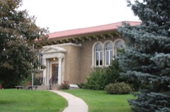 Dwight T. Parker Public Librarylisted 1983
Population over time
2 figuresFennimore grew from 2,497 to 2,764 between 2010 and 2020. These are the recorded population figures Wikidata holds for this place, reached through the Geographic Names Information System number this page is keyed on rather than by name, so they belong to this place and not to another of the same name. Most are census counts, but not all are: an early figure may be a founding or settlement estimate, and an estimate published within five years of a census is left out. The change column is computed, and is left blank where more than 20 years separate a figure from the one before it, because a gap that long is not a change between two counts.
| Year | People | Change |
|---|---|---|
| 2010 | 2,497 | |
| 2020 | 2,764 | +267 (+11%) |
Topographic sheets covering this place
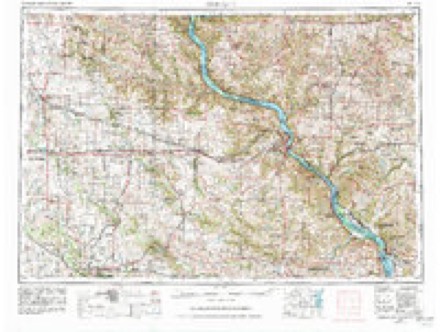
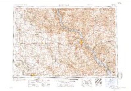
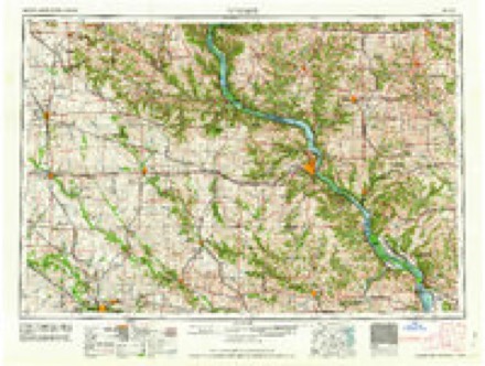
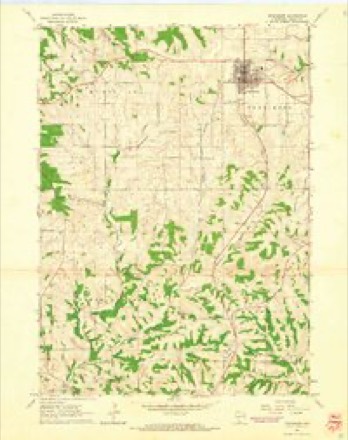
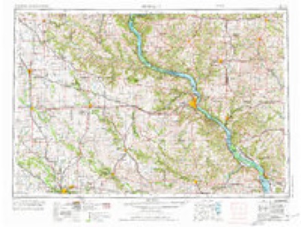
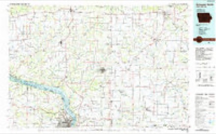
9 surveys from 15 printed sheetsMatched by testing this settlement's coordinate against the published boundary of every sheet in the United States Geological Survey's historical collection. Each opens the scanned sheet at the Survey.
- 1900 USGS Lancaster quadrangle1:125000
- 1904 USGS Lancaster quadrangle1:125000
- 1908 USGS Lancaster quadrangle1:125000, 5 printings
- 1959 USGS Dubuque quadrangle1:250000
- 1961 USGS Dubuque quadrangle1:250000
- 1962 USGS Dubuque quadrangle1:250000, 2 printings
- 1962 USGS Fennimore quadrangle1:24000
- 1976 USGS Dubuque quadrangle1:250000
- 1984 USGS Dubuque North quadrangle1:100000, 2 printings
In the county-history sources
3,948 words on this township[History of Grant County, Wisconsin, Preceded by a History of Wisconsin, published 1881 names this settlement in its chapter on Fennimore City. These are the passages that mention it, exactly as the scans read.
This town owes its name to a settler, who, at the time of the breaking-out of the Black Hawk war, was living on Section 22, Town 6, Range 2 west of the Fourth Principal Meridian. He disappeared during this struggle and was not again heard from. In 1837, a Mr. Palmer settled on Fennimore's old claim, but left after remaining a short time. In 1838, John Robinson, Sr., settled on Section 34, Town 6, Range 2. John Switzer, John Dillon, John McReynolds and Henry Meeker settled in the year 1843. The first German settlers were Sigmund Stuart, who came in 1845, and John Nauert and George Bohl, who arrived in 1846. The organization of the town of Fennimore took place in 1849, embracing at that time the territory of the present towns of Fennimore, Marion, Hickory Grove, Woodman, Boscobel, Waterstown and part of Muscoda. The first town meeting was held on the 3d day of April, 1849, on Section 7, Town 6, Range 2 west, and the following officers elected : Supervisor, Lester Pratt, M. D., Chairman. Solomon C. Peckham and John Switzer ; Clerk, John A. Shearer ; Assessor, H. A. W. McNair ; Treasurer. Philo A. Dempsey ; Superintendent of Schools, John A. Shearer ; Justice of the Peace, Charles W. Loney ; Constable, Robert Munns. Chester Pratt, as Chairman, in 1849 received $10 for his services, and H. A. W. McNair, as Assessor, who had to tramp all over the above designated territory, $9.
Passage source: [History of Grant County, Wisconsin, Preceded by a History of Wisconsin, published 1881.
At the present date, Fennimore embraces Township 6, Range 2, and Township 6, Range 3. The first Justice of the Peace, James Russell, was appointed by the Governor of the Territory. The first elected by the people was Charles W. Loney, elected as above. The first religious organization was formed in 1844 by Rev. Elder Allen, the class consisting of three - John Switzer, Philo Dempsey and Mrs. Dempsey. The first marriage celebrated was that of Elijah Goodrich and Allemina Russell, in 1817, the magistrate performing the ceremony being Justice Russell, nicknamed the " Chief Justice."
Passage source: [History of Grant County, Wisconsin, Preceded by a History of Wisconsin, published 1881.
Fennimore is at present divided into twelve whole and eight joint school districts, and contains fifteen schoolhouses. The village of Fennimore Center was laid out in 1868. Previous to this, or in July, 1862, the first house had been moved to the '' Center " by Mr. John G. Perkins. Fennimore Center contains two churches, one Methodist Episcopal, and organized as early as 1849; the other. Advent, There is also a church at Mount Ida, in this township. The village comprises in its limits three general merchandise stores, doing a good business, two blacksmith and wagon shops, one harness-shop, two shoe-shops, one hotel, two saloons, and has two physicians. In 1879, the building of the narrow gauge railroad through from Woodman to Lancaster, and passing through Fennimore, gave added importance to the village, and, surrounded as it is by a good farming country, Fennimore Center is situated in a most favorable position for advancement in the future.
Passage source: [History of Grant County, Wisconsin, Preceded by a History of Wisconsin, published 1881.
Machine-read from a century-old scan, so expect the errors a machine makes: misspelled names, dropped words, stray characters.
Read the whole chapter on Fennimore City - it names this place 1 more 1 time.
Fires near this place
12 since 1992Regional context, not property-specific evidence. The federal wildfire occurrence database lists 12 fires within 5 miles of Fennimore between 1992 and 2020, burning about 48 acres in total. None started naturally. None was recorded as arson. Distance is straight-line from the map coordinates, so a fire counted here may appear on a neighbouring settlement's page as well.
| Reported cause | Fires |
|---|---|
| Debris and open burning | 7 |
| Missing data/not specified/undetermined | 3 |
| Equipment and vehicle use | 2 |
The most recent of them, most recent first, with the day each was reported and the service that recorded it.
| Date | Cause | Size | Reported by | Name on the report |
|---|---|---|---|---|
| 4 April 1992 | Debris and open burning | under an acre | Wisconsin Department of Natural Resources | not named |
| 30 April 2018 | Missing data/not specified/undetermined | under an acre | Wisconsin Department of Natural Resources | 143018 |
| 30 April 2018 | Missing data/not specified/undetermined | under an acre | Wisconsin Department of Natural Resources | 43018 |
| 20 April 2019 | Debris and open burning | under an acre | Wisconsin Department of Natural Resources | 1042019 |
| 12 April 2018 | Debris and open burning | 1.1 acres | Wisconsin Department of Natural Resources | COUNTY HIGHWAY T |
| 10 April 2014 | Debris and open burning | under an acre | Wisconsin Department of Natural Resources | BREEZY HILL |
| 10 April 2005 | Debris and open burning | under an acre | Wisconsin Department of Natural Resources | not named |
| 24 March 1994 | Debris and open burning | 1.6 acres | Wisconsin Department of Natural Resources | not named |
Settlements close enough to share some of these fires:
Mines and quarries near this place
2 within 5 milesRegional context, not property-specific evidence. The federal mineral resources record lists 2 workings within 5 miles of Fennimore: 1 past producer, 1 producer. 1 still produces. What was taken out: Stone, Crushed/Broken. Distance is straight-line from the map coordinates, so a quarry counted here may appear on a neighbouring settlement's page as well.
| Where | Site | Commodity | Status | Recorded |
|---|---|---|---|---|
| Croft Quarry | Stone, Crushed/Broken | Producer | ||
| Grant County Quarries | Stone, Crushed/Broken | Past Producer |
Storms near this place
38 since 1994Regional context, not property-specific evidence. The National Weather Service names Fennimore in 38 storm reports between 1994 and 2023: 18 hail, 13 thunderstorm wind, 3 heavy rain, 2 tornado. No death or injury is recorded in these reports. Each account below is quoted exactly as the forecast office filed it, from the NOAA Storm Events Database, and each date opens the federal record of that event.
| When | Event | Place named | Harm | What the report says |
|---|---|---|---|---|
| June 2014 | Tornado (EF1) | Fennimore | $410,000 | A tornado touched down 2 miles northeast of Fennimore and skipped along an east path to 3 miles northwest of Montfort. The tornado damaged several mature hardwood trees, several outbuildings and three homes. On one farm alone, eight buildings were destroyed. The homes sustained minor damage compared to the hardwood trees and outbuildings. The tornado was rated an EF1 with maximum estimated winds of 110 mph. Total path length was 8.2 miles and the maximum width of the tornado was 600 yards. |
| July 2017 | Thunderstorm Wind | Fennimore | $50,000 | A cattle barn was blown down southwest of Fennimore. |
| September 1997 | Thunderstorm Wind | Fennimore | $30,000 | no account filed |
| July 1998 | Thunderstorm Wind | Fennimore | $28,000 | no account filed |
| May 2018 | Tornado (EF0) | Fennimore | $25,000 | An EF-0 tornado touched down outside of Fennimore along Golf Road. The tornado was on the ground for approximately two minutes and damaged a machine shed, barn, trees and blew windows out of a house. |
| July 2006 | Thunderstorm Wind | Fennimore | $25,000 | no account filed |
| May 1998 | Thunderstorm Wind | Fennimore | $25,000 | no account filed |
| May 1998 | Hail | Fennimore | $15,000 | no account filed |
| June 2014 | Thunderstorm Wind | Fennimore | $13,000 | Trees and power lines were blown down near Fennimore. Two trucks were overturned at a cement plant just north of town. |
| May 2000 | Hail | Fennimore | $8,000 | no account filed |
| May 2018 | Lightning | Fennimore | $5,000 | A lightning strike started a small fire on the roof of the Fennimore elementary school. The fire was extinguished before it reached the interior of the school. The start of school was delayed for two hours. |
| July 2017 | Lightning | Fennimore | $5,000 | A house was struck by lightning near Fennimore. |
| September 2007 | Thunderstorm Wind | Fennimore | $2,250 | One tree and a few street signs were blown. |
| July 2012 | Thunderstorm Wind | Fennimore | $2,000 | Several power lines were blown down in Fennimore. |
| July 2009 | Hail | Fennimore | $2,000 | no account filed |
| September 2001 | Thunderstorm Wind | Fennimore | $800 | no account filed |
| August 2007 | Thunderstorm Wind | Fennimore | $500 | Trees were blown down. |
| July 2007 | Heavy Rain | Fennimore | $500 | no account filed |
| June 2007 | Thunderstorm Wind | Fennimore | $500 | no account filed |
| May 1994 | Thunderstorm Wind | Fennimore | $500 | no account filed |
| July 2023 | Hail | Fennimore | - | Law enforcement reported quarter sized hail falling for 10 minutes near Fennimore. |
| June 2018 | Heavy Rain | Fennimore | - | In Fennimore, a mesonet station measured 6.6 inches of rain. |
| October 2018 | Heavy Rain | Fennimore | - | A mesonet station in Fennimore measured 5.56 inches of rain. |
| June 2014 | Hail | Fennimore | - | Quarter sized hail fell in Fennimore. |
| May 2018 | Hail | Fennimore | - | no account filed |
| August 2017 | Hail | Fennimore | - | no account filed |
| October 2015 | Hail | Fennimore | - | no account filed |
| April 2014 | Hail | Fennimore | - | no account filed |
| July 2009 | Hail | Fennimore | - | no account filed |
| July 2008 | Hail | Fennimore | - | no account filed |
| April 2007 | Hail | Fennimore | - | no account filed |
| July 2006 | Hail | Fennimore | - | no account filed |
| August 2003 | Hail | Fennimore | - | no account filed |
| May 2003 | Hail | Fennimore | - | no account filed |
| May 2003 | Hail | Fennimore | - | no account filed |
| May 2000 | Hail | Fennimore | - | no account filed |
| May 1998 | Hail | Fennimore | - | no account filed |
| June 1995 | Thunderstorm Wind | Fennimore | - | no account filed |
Nearest settlements
The eight closest, with where each one stands in the county. Distances are straight-line, computed from the Geographic Names Information System coordinates.
| Map | Place | Distance | Sheets |
|---|---|---|---|
| Lancaster Junction | 2.2 miles | 15 | |
| Stitzer | 4.3 miles | 15 | |
| Mount Ida | 5.7 miles | 15 | |
| Preston | 5.8 miles | 15 | |
| Werley | 6.3 miles | 10 | |
| Homer | 7.3 miles | 10 | |
| Shady Dell | 7.4 miles | 15 | |
| Castle Rock | 7.9 miles | 10 |
Elsewhere
Matched on this settlement's Geographic Names Information System number rather than its name, so it cannot be a different place of the same name in another state.
| Wikipedia article on Fennimore | An encyclopaedic summary. Its text is share-alike, so it is linked here rather than copied. |
| Wikidata item Q1404789 | The structured record the population and elevation above come from. Public domain (CC0). |
Provenance
This settlement is recorded in the Geographic Names Information System as feature 1564906. The sheet list is computed by point-in-boundary test against the United States Geological Survey's historical topographic inventory. Both are works of the United States government and carry no copyright under 17 U.S.C. 105.
Wildfire. Short, Karen C. 2022. Spatial wildfire occurrence data for the United States, 1992-2020 [FPA_FOD_20221014]. 6th Edition. Fort Collins, CO: Forest Service Research Data Archive. https://doi.org/10.2737/RDS-2013-0009.6 Collected with United States Government funding and usable without additional permissions or fees.
Mines and quarries. USGS Mineral Resources Data System (MRDS) https://mrdata.usgs.gov/mrds/ A work of the United States government, no copyright under 17 U.S.C. 105.
Storms. NOAA National Centers for Environmental Information, Storm Events Database https://www.ncei.noaa.gov/stormevents/ A work of the United States government, no copyright under 17 U.S.C. 105. Narratives are quoted verbatim from the National Weather Service report and are not edited or summarised.