 Block
Bristol, Wisconsin
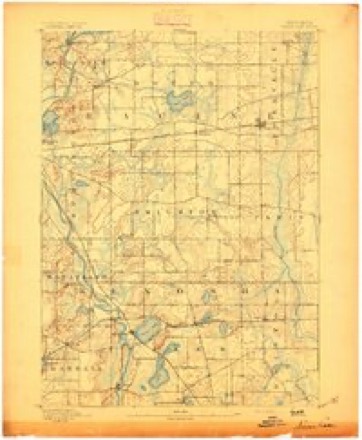
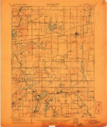
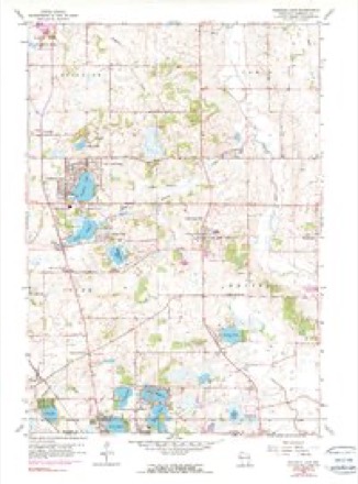
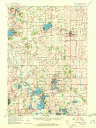
19 topographic sheets cover this place, the earliest surveyed in 1893 and the latest in 1980. It stands in Bristol Village. It lies in ZIP code area 53104. It stands on Salem Branch. The Survey maps it on the Paddock Lake quadrangle. 5,192 people lived here at the 2020 count. It stands 778 feet above sea level.
Population over time
2 figuresBristol grew from 2,584 to 5,192 between 2010 and 2020. These are the recorded population figures Wikidata holds for this place, reached through the Geographic Names Information System number this page is keyed on rather than by name, so they belong to this place and not to another of the same name. Most are census counts, but not all are: an early figure may be a founding or settlement estimate, and an estimate published within five years of a census is left out. The change column is computed, and is left blank where more than 20 years separate a figure from the one before it, because a gap that long is not a change between two counts.
| Year | People | Change |
|---|---|---|
| 2010 | 2,584 | |
| 2020 | 5,192 | +2,608 (+101%) |
Topographic sheets covering this place
9 surveys from 19 printed sheetsMatched by testing this settlement's coordinate against the published boundary of every sheet in the United States Geological Survey's historical collection. Each opens the scanned sheet at the Survey.
- 1893 USGS Silver Lake quadrangle1:62500, 2 printings
- 1906 USGS Silver Lake quadrangle1:62500, 3 printings
- 1954 USGS Rockford quadrangle1:250000
- 1955 USGS Rockford quadrangle1:250000
- 1958 USGS Rockford quadrangle1:250000, 4 printings
- 1959 USGS Paddock Lake quadrangle1:24000, 3 printings
- 1960 USGS Silver Lake quadrangle1:62500, 3 printings
- 1963 USGS Rockford quadrangle1:250000
- 1980 USGS Lake Geneva quadrangle1:100000





In the county-history sources
5,017 words on this townshipThe History of Racine and Kenosha Counties, Wisconsin .., published 1879 names this settlement in its chapter on Bristol Village. These are the passages that mention it, exactly as the scans read.
The village of Bristol is situated on the Kenosha & Rockford Division of the North-Western Road, twelve miles west of Kenosha. The land was originallv owned by Alfred Giddings, at present residing in Kenosha, who laid it out in town lots, and sold the property to A. B. Emmons, who, in turn, disposed of his purchase to John F. Chase, who completed the platting of the village, and executed deeds to purchasers. Bristol is a thriving village, containing an industrious and enterprising population, four stores and several mechanical shops ; Asbury Chapel, built in 1842 ; Hosraer Chapel, built in 1857, and Wesley Chapel in 1872, all of the Methodist Episcopal denomination ; also, S^. Mary's Roman Catholic Church, built in 1866, and a Masonic Lodge, with a membership of upward of fifty. The Bristol Soda Springs are within two miles of the village, and offer superior inducements to invalid seekers after health. The population is variously estimated at from one to two hundred souls.
Passage source: The History of Racine and Kenosha Counties, Wisconsin .., published 1879.
WILLIAM C. BACOM, farmer. Sees. 5 and 6 ; P. 0. Bristol ; son of the above ; was b Aug. 1, 1855, in Bristol Township, and has worked on the farm all his life; he now owns a part of and rents the portions belonging to his mother and sister, in all 220 acres, and on it he raises aU kinds stock and grain ; he makes a specialty of breeding sheep and hogs. Married Miss Maggie Sheen. Paris Township, May 20, 1879. He is a member of the Sons of Temperance.
Passage source: The History of Racine and Kenosha Counties, Wisconsin .., published 1879.
JAMES W. BRYANT, farmer, Sees. 7 and 18; P. 0. Bristol; bom Au>s. 21, 1825 Otsego Co., N. Y.; moved to Columbia Co., N. Y., with his parents when quite young and worked oi furm there till about 20 years of age, when he learned the business of carpenter and joiner, and worked it in various parts of Eastern New York. In the spring of 1855, he visited Wisconsin, bought 107 nt of land in Bristol Township, and returned to New York; in September, 1855, he came to Wisconsin reside, and worked at his trade in Lake and Kenosha Cos. In the winter of 1859, he revwted New Yo returned to Kenosha in March, 1860, and that spring went on a pleasure trip to Pike's Peak, Colo.; October, 1860, returned, and went to work on his farm, at the same time buying and shipping grain, which he had a warehouse at the Bristol depot, to Chicago and Milwaukee. In the spring of 1862, bought 115 acres more land. About 1870, sold the warehouse and business connected with it, and bej shipping live stock to the same markets, and still does so. On his farm, he raises, principally, com, a hay and stock. Married Miss Lenora Shumway, of Bristol, March 16, 1868, and has one child - E M., born September 19, 1871. He is a member of Washburn Lodge, No. 145, Masons.
Passage source: The History of Racine and Kenosha Counties, Wisconsin .., published 1879.
Machine-read from a century-old scan, so expect the errors a machine makes: misspelled names, dropped words, stray characters.
Read the whole chapter on Bristol Village - it names this place 15 more 15 times.
Fires near this place
12 since 2018Regional context, not property-specific evidence. The federal wildfire occurrence database lists 12 fires within 5 miles of Bristol between 2018 and 2020, burning about 28 acres in total. None started naturally. None was recorded as arson. Distance is straight-line from the map coordinates, so a fire counted here may appear on a neighbouring settlement's page as well.
| Reported cause | Fires |
|---|---|
| Missing data/not specified/undetermined | 9 |
| Debris and open burning | 2 |
| Smoking | 1 |
The most recent of them, most recent first, with the day each was reported and the service that recorded it.
| Date | Cause | Size | Reported by | Name on the report |
|---|---|---|---|---|
| 8 July 2018 | Smoking | under an acre | Wisconsin Department of Natural Resources | 218402 |
| 10 July 2018 | Missing data/not specified/undetermined | under an acre | Wisconsin Department of Natural Resources | 218407 |
| 3 June 2018 | Missing data/not specified/undetermined | under an acre | Wisconsin Department of Natural Resources | 218317 |
| 2 May 2018 | Missing data/not specified/undetermined | 1.0 acres | Wisconsin Department of Natural Resources | 218249 |
| 8 April 2018 | Debris and open burning | 2.0 acres | Wisconsin Department of Natural Resources | 218175 |
| 30 April 2018 | Missing data/not specified/undetermined | 20 acres | Wisconsin Department of Natural Resources | 1800402 |
| 11 April 2018 | Missing data/not specified/undetermined | 1.0 acres | Wisconsin Department of Natural Resources | 218185 |
| 18 March 2018 | Missing data/not specified/undetermined | 3.0 acres | Wisconsin Department of Natural Resources | 218145 |
Settlements close enough to share some of these fires:
Mines and quarries near this place
3 within 5 milesRegional context, not property-specific evidence. The federal mineral resources record lists 3 workings within 5 miles of Bristol: 2 past producers, 1 producer. 1 still produces. What was taken out: Sand and Gravel, Construction. Distance is straight-line from the map coordinates, so a quarry counted here may appear on a neighbouring settlement's page as well.
| Where | Site | Commodity | Status | Recorded |
|---|---|---|---|---|
| Bristol Sand and Gravel Pit | Sand and Gravel, Construction | Producer | ||
| Hillard Pit | Sand and Gravel, Construction | Past Producer | ||
| Pit No. 1 | Sand and Gravel, Construction | Past Producer |
Storms near this place
8 since 1996Regional context, not property-specific evidence. The National Weather Service names Bristol in 8 storm reports between 1996 and 2013: 5 thunderstorm wind, 3 hail. No death or injury is recorded in these reports. Each account below is quoted exactly as the forecast office filed it, from the NOAA Storm Events Database, and each date opens the federal record of that event.
| When | Event | Place named | Harm | What the report says |
|---|---|---|---|---|
| June 1998 | Thunderstorm Wind | Bristol | $200,000 | no account filed |
| November 2013 | Thunderstorm Wind | Bristol | $28,000 | A path of trees, branches and wires down. A partial roof removed from a residential home. The west to east corridor of damage was bounded on the north near highway S and in the south by highway 50. |
| June 2008 | Thunderstorm Wind | Bristol | $20,000 | Powerful thunderstorm wind gusts knocked down large trees and power-lines. |
| July 1996 | Thunderstorm Wind | Bristol | $10,000 | no account filed |
| July 2007 | Thunderstorm Wind | Bristol | - | Powerful thunderstorm wind gusts to 50 knots (58 mph) toppled several large trees in the Bristol area. |
| September 2010 | Hail | Bristol | - | no account filed |
| October 2006 | Hail | Bristol | - | no account filed |
| March 2000 | Hail | Bristol | - | no account filed |
Nearest settlements
The eight closest, with where each one stands in the county. Distances are straight-line, computed from the Geographic Names Information System coordinates.
| Map | Place | Distance | Sheets |
|---|---|---|---|
| Salem Oaks | 2.3 miles | 19 | |
| Woodworth | 2.5 miles | 19 | |
| Paddock Lake | 3.2 miles | 19 | |
| Salem | 3.3 miles | 19 | |
| Salem Lakes | 3.3 miles | 19 | |
| Liberty Corners | 3.7 miles | 19 | |
| Lake Shangrila | 3.9 miles | 19 | |
| Klondike | 4.3 miles | 19 |
Elsewhere
Matched on this settlement's Geographic Names Information System number rather than its name, so it cannot be a different place of the same name in another state.
| Wikipedia article on Bristol | An encyclopaedic summary. Its text is share-alike, so it is linked here rather than copied. |
| Wikidata item Q3709271 | The structured record the population and elevation above come from. Public domain (CC0). |
Provenance
This settlement is recorded in the Geographic Names Information System as feature 1562217. The sheet list is computed by point-in-boundary test against the United States Geological Survey's historical topographic inventory. Both are works of the United States government and carry no copyright under 17 U.S.C. 105.
Wildfire. Short, Karen C. 2022. Spatial wildfire occurrence data for the United States, 1992-2020 [FPA_FOD_20221014]. 6th Edition. Fort Collins, CO: Forest Service Research Data Archive. https://doi.org/10.2737/RDS-2013-0009.6 Collected with United States Government funding and usable without additional permissions or fees.
Mines and quarries. USGS Mineral Resources Data System (MRDS) https://mrdata.usgs.gov/mrds/ A work of the United States government, no copyright under 17 U.S.C. 105.
Storms. NOAA National Centers for Environmental Information, Storm Events Database https://www.ncei.noaa.gov/stormevents/ A work of the United States government, no copyright under 17 U.S.C. 105. Narratives are quoted verbatim from the National Weather Service report and are not edited or summarised.