 Block
Chaseburg, Wisconsin
11 topographic sheets cover this place, the earliest surveyed in 1926 and the latest in 1990. It stands in Chaseburg Village. It lies in ZIP code area 54621. It stands on Hasley Creek. The Survey maps it on the Coon Valley quadrangle. 241 people lived here at the 2020 count. It stands 709 feet above sea level.
Population over time
2 figuresChaseburg fell from 284 to 241 between 2010 and 2020. These are the recorded population figures Wikidata holds for this place, reached through the Geographic Names Information System number this page is keyed on rather than by name, so they belong to this place and not to another of the same name. Most are census counts, but not all are: an early figure may be a founding or settlement estimate, and an estimate published within five years of a census is left out. The change column is computed, and is left blank where more than 20 years separate a figure from the one before it, because a gap that long is not a change between two counts.
| Year | People | Change |
|---|---|---|
| 2010 | 284 | |
| 2020 | 241 | -43 (-15%) |
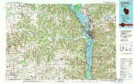
Topographic sheets covering this place
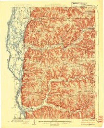
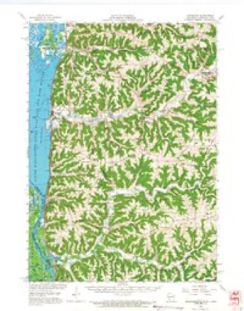
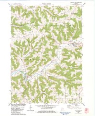
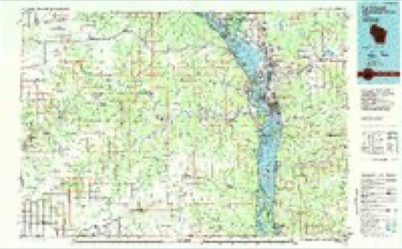
9 surveys from 11 printed sheetsMatched by testing this settlement's coordinate against the published boundary of every sheet in the United States Geological Survey's historical collection. Each opens the scanned sheet at the Survey.
- 1926 USGS Stoddard quadrangle1:62500, 2 printings
- 1958 USGS La Crosse quadrangle1:250000, 2 printings
- 1961 USGS La Crosse quadrangle1:250000
- 1965 USGS La Crosse quadrangle1:250000
- 1965 USGS Stoddard quadrangle1:62500
- 1976 USGS La Crosse quadrangle1:250000
- 1983 USGS Coon Valley quadrangle1:24000
- 1984 USGS La Crosse quadrangle1:100000
- 1990 USGS La Crosse quadrangle1:100000




In the county-history sources
1,917 words on this townshipHistory of Vernon County, Wisconsin .., published 1884 names this settlement in its chapter on Chaseburg Village. These are the passages that mention it, exactly as the scans read.
Hon. George W. Swain, who located in the town of Hamburg in 1863, was born in the Granite State, in 1824. He there received a good common school education, and in 1845, removed to the adjoining State of Vermont, where he resided for eight years. In 1853, he came west to Dane Co., Wis., and ten years later settled in this town. He purchased a saw-mill and 240 acres of laud, lying on sections 28, 14 and 6, from Messrs. Chase and Lyttle, and in 1860, surveyed and platted the village of Chaseburg. Mr. Swain was in 1870 a county supervisor. He is a strong republican in politics, and in 1878 was the nominee of his party for State senator, against A. D. Chase, the candidate of both the democratic and greenback parties. Mr. Swain was elected by a handsome majority. He still owns the saw-mill and carries on a large business in getting out wagon and plow stuff and hard-wood lumber. He also owns the only hotel in the village. Mr. Swain was united in marriage, in 1849, to Hannah Chase. They have reared four children - Josiah B., who married Mary Lattimer, Cora E., wife of Frank E. Aiken, Allie L. and Nellie J. Mrs Swain was born in New Hampshire, in 18-.'5, and when five years of age accompanied her parents to Vermont. She was there married to our subj<.'Ct, and in 1863, came to the town of Hamburg with the honor of being the first American woman in the town. Her daughter Nellie was the first American child born in the town.
Passage source: History of Vernon County, Wisconsin .., published 1884.
.Joseph W. Hoyt is also postmaster of Cha^eburg, and owns 190 acres of land in this town. In 1861 he enlisted in the 1st regiment, Vermont Cavalry, but was discharged a little later, on account of sickness. He was chairman of the board of Hamburg town for five years, also chairman of the county board for two years. In 1870-71, he represented the county of Vernon in the State Legislature. He was- married, in 1863, to Elizabeth Isham, and three children
Passage source: History of Vernon County, Wisconsin .., published 1884.
parents removed to I'utnam Co., Ind., where they remained till 1851, when they moved to LaCrosse Co., Wis., and se tied in what is called the "Ramsey Cooley," where Mr. Markle remained until he was called to defend his country in 1861. He then enlisted in the 2d regiment Wisconsin Volunteers, company B, and was discharged in 1864. Mr. Markle was wounded at the battle of South Mountain in the left arm and at the battle of the wilderness was wounded in the right arm. In 1867, Mr. Markle came to tbe village of Chaseburg, where he has carried on the business of blacksmithing and manufacturing wagons, and now owns sixty-two acres of land on section 28, also a house and three lots and a smith wagon and paint shop in the village of Chaseburg Mr. Markle was married in 1869, to Neoma J. Maxwell, of Vernon county, who has borne him four children - Berthier E., Claud O. and Cora B. Charles died in 1883. Mr. Markle's father, George Markle, was born in Pennsylvania in 1818, and now resides in LaCrosse Co., Wis. His mother, Elizabeth Markle, is also a native of Pennsylvania, born in 1818, and is now living in La- Crosse Co., Wis.
Passage source: History of Vernon County, Wisconsin .., published 1884.
Machine-read from a century-old scan, so expect the errors a machine makes: misspelled names, dropped words, stray characters.
Read the whole chapter on Chaseburg Village - it names this place 2 more 2 times.
Fires near this place
5 since 2018Regional context, not property-specific evidence. The federal wildfire occurrence database lists 5 fires within 5 miles of Chaseburg between 2018 and 2020, burning about 3 acres in total. None started naturally. None was recorded as arson. Distance is straight-line from the map coordinates, so a fire counted here may appear on a neighbouring settlement's page as well.
| Reported cause | Fires |
|---|---|
| Missing data/not specified/undetermined | 2 |
| Debris and open burning | 2 |
| Smoking | 1 |
The most recent of them, most recent first, with the day each was reported and the service that recorded it.
| Date | Cause | Size | Reported by | Name on the report |
|---|---|---|---|---|
| 16 May 2018 | Missing data/not specified/undetermined | under an acre | Wisconsin Department of Natural Resources | 2018-17 |
| 9 April 2018 | Missing data/not specified/undetermined | under an acre | Wisconsin Department of Natural Resources | 38 |
| 19 April 2020 | Smoking | 2.0 acres | Wisconsin Department of Natural Resources | 202009 |
| 10 April 2020 | Debris and open burning | 1.0 acres | Wisconsin Department of Natural Resources | 182020 |
| 28 March 2018 | Debris and open burning | under an acre | Wisconsin Department of Natural Resources | 35 |
Settlements close enough to share some of these fires:
Mines and quarries near this place
2 within 5 milesRegional context, not property-specific evidence. The federal mineral resources record lists 2 workings within 5 miles of Chaseburg: 1 past producer, 1 producer. 1 still produces. What was taken out: Stone, Crushed/Broken. Distance is straight-line from the map coordinates, so a quarry counted here may appear on a neighbouring settlement's page as well.
| Where | Site | Commodity | Status | Recorded |
|---|---|---|---|---|
| Chipmonk Coulee Quarry | Stone, Crushed/Broken | Producer | ||
| Zogg Quarry | Stone, Crushed/Broken | Past Producer |
Storms near this place
11 since 2000Regional context, not property-specific evidence. The National Weather Service names Chaseburg in 11 storm reports between 2000 and 2017: 5 thunderstorm wind, 4 flood, 1 hail, 1 tornado. No death or injury is recorded in these reports. Each account below is quoted exactly as the forecast office filed it, from the NOAA Storm Events Database, and each date opens the federal record of that event.
| When | Event | Place named | Harm | What the report says |
|---|---|---|---|---|
| July 2017 | Thunderstorm Wind | Chaseburg | $15,000 | A barn was blown down between Stoddard and Chaseburg. |
| September 2011 | Thunderstorm Wind | Chaseburg | $15,000 | A roof was blown off a house in Chaseburg. |
| July 2000 | Tornado (F0) | Chaseburg | $8,000 | no account filed |
| September 2005 | Thunderstorm Wind | Chaseburg | $3,000 | no account filed |
| March 2017 | Thunderstorm Wind | Chaseburg | $2,000 | Power lines were blown down in Chaseburg. |
| August 2007 | Thunderstorm Wind | Chaseburg | $500 | Law enforcement reported trees down. |
| June 2013 | Flood | Chaseburg | - | Locally heavy rain produced street flooding in Chaseburg, Westby and Viroqua. |
| June 2010 | Flood | Chaseburg | - | Heavy rain caused flooding to occur along Highway 162 near Chaseburg prompting officials to close the road until the water receded. Rainfall totals included 3.50 inches near Goose Island and 3.10 inches about 5 miles northeast of Stoddard near the La Crosse County border. |
| August 2010 | Flood | Chaseburg | - | State Highway 162 in Chaseburg was underwater. |
| September 2010 | Flood | Chaseburg | - | A few roads were closed in Chaseburg, including State Highway 162 as flooding occurred along Coon Creek. |
| May 2000 | Hail | Chaseburg | - | no account filed |
Nearest settlements
The eight closest, with where each one stands in the county. Distances are straight-line, computed from the Geographic Names Information System coordinates.
| Map | Place | Distance | Sheets |
|---|---|---|---|
| Newton | 5.0 miles | 11 | |
| Coon Valley | 5.4 miles | 11 | |
| Pleasant Valley | 6.0 miles | 11 | |
| Stoddard | 6.5 miles | 11 | |
| Esofea | 7.3 miles | 14 | |
| Romance | 7.7 miles | 11 | |
| Genoa | 8.8 miles | 11 | |
| Bud | 9.0 miles | 14 |
Elsewhere
Matched on this settlement's Geographic Names Information System number rather than its name, so it cannot be a different place of the same name in another state.
| Wikipedia article on Chaseburg | An encyclopaedic summary. Its text is share-alike, so it is linked here rather than copied. |
| Wikidata item Q3301401 | The structured record the population and elevation above come from. Public domain (CC0). |
Provenance
This settlement is recorded in the Geographic Names Information System as feature 1562965. The sheet list is computed by point-in-boundary test against the United States Geological Survey's historical topographic inventory. Both are works of the United States government and carry no copyright under 17 U.S.C. 105.
Wildfire. Short, Karen C. 2022. Spatial wildfire occurrence data for the United States, 1992-2020 [FPA_FOD_20221014]. 6th Edition. Fort Collins, CO: Forest Service Research Data Archive. https://doi.org/10.2737/RDS-2013-0009.6 Collected with United States Government funding and usable without additional permissions or fees.
Mines and quarries. USGS Mineral Resources Data System (MRDS) https://mrdata.usgs.gov/mrds/ A work of the United States government, no copyright under 17 U.S.C. 105.
Storms. NOAA National Centers for Environmental Information, Storm Events Database https://www.ncei.noaa.gov/stormevents/ A work of the United States government, no copyright under 17 U.S.C. 105. Narratives are quoted verbatim from the National Weather Service report and are not edited or summarised.