 Block
Clintonville, Wisconsin
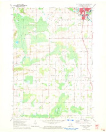
8 topographic sheets cover this place, the earliest surveyed in 1955 and the latest in 1993. It stands in Clintonville City. It lies in ZIP code area 54929. The Survey maps it on the Clintonville South quadrangle. 4,591 people lived here at the 2020 count. It stands 814 feet above sea level.
On record in Clintonville
Buildings and businesses the archive holds for this place. Each opens its own page, with the source record it came from.
On the National Register 2 records
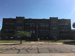 Clintonville High Schoollisted 2018
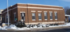 Clintonville Post Officelisted 2000
Population over time
2 figuresClintonville grew from 4,559 to 4,591 between 2010 and 2020. These are the recorded population figures Wikidata holds for this place, reached through the Geographic Names Information System number this page is keyed on rather than by name, so they belong to this place and not to another of the same name. Most are census counts, but not all are: an early figure may be a founding or settlement estimate, and an estimate published within five years of a census is left out. The change column is computed, and is left blank where more than 20 years separate a figure from the one before it, because a gap that long is not a change between two counts.
| Year | People | Change |
|---|---|---|
| 2010 | 4,559 | |
| 2020 | 4,591 | +32 (+1%) |
Topographic sheets covering this place
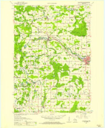
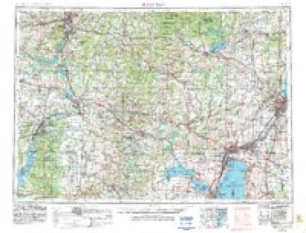
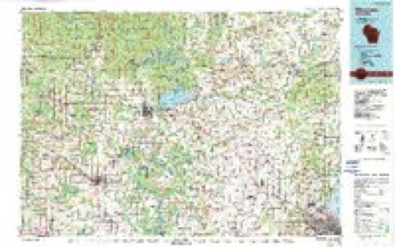
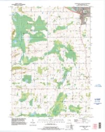
5 surveys from 8 printed sheetsMatched by testing this settlement's coordinate against the published boundary of every sheet in the United States Geological Survey's historical collection. Each opens the scanned sheet at the Survey.
- 1955 USGS Clintonville quadrangle1:48000, 2 printings
- 1955 USGS Green Bay quadrangle1:250000, 2 printings
- 1970 USGS Clintonville South quadrangle1:24000
- 1984 USGS Shawano quadrangle1:100000, 2 printings
- 1993 USGS Clintonville South quadrangle1:24000
In the county-history sources
3,268 words on this townshipHistory of Waupaca County, Wisconsin, published 1890 names this settlement in its chapter on Clintonville City. These are the passages that mention it, exactly as the scans read.
In the Fall of 1881 the writer was in the little backwoods village of Clintonville. It was then a small, unpretentious burgh, giving no indications of much future smartness. In the Spring of 1890, he paid a second visit, and met with a surprise. In nine years it had become a pleasant city, with a population of nearly 2,000. It is full of live, energetic business men, ^lo will make it a successful rival of its sister towns, if money and brains can doit.
Passage source: History of Waupaca County, Wisconsin, published 1890.
We do not believe that we can conclude our sketch of Clintonville more acceptably than by copying two chapters from that spicy sheet. The Dual-City Tribune, by Frank H. Brady, who has laid us under many obligations for kind attentions paid during our recent visit to his cit3^ Mr. Brady is a grandson of Mr. Clinton, a sketch of whose life is here given :
Passage source: History of Waupaca County, Wisconsin, published 1890.
Norman C. Clinton was born in Ferrisburg, Vt., December 29, 1796. He was of Yankee origin, and sprung from the great family of Clintons, who are scattered all over the Eastern, and many of the Western states. He was more religiously inclined than many Clintonville residents of today, and from boyhood till death was a member of the Baptist church.
Passage source: History of Waupaca County, Wisconsin, published 1890.
Machine-read from a century-old scan, so expect the errors a machine makes: misspelled names, dropped words, stray characters.
Read the whole chapter on Clintonville City - it names this place 6 more 6 times.
Fires near this place
76 since 1993Regional context, not property-specific evidence. The federal wildfire occurrence database lists 76 fires within 5 miles of Clintonville between 1993 and 2020, burning about 113 acres in total. None started naturally. 4 were recorded as arson. Distance is straight-line from the map coordinates, so a fire counted here may appear on a neighbouring settlement's page as well.
| Reported cause | Fires |
|---|---|
| Debris and open burning | 40 |
| Equipment and vehicle use | 10 |
| Missing data/not specified/undetermined | 10 |
| Recreation and ceremony | 4 |
| Arson/incendiarism | 4 |
| Misuse of fire by a minor | 3 |
| Fireworks | 2 |
| Other causes | 1 |
| Smoking | 1 |
| Power generation/transmission/distribution | 1 |
The most recent of them, most recent first, with the day each was reported and the service that recorded it.
| Date | Cause | Size | Reported by | Name on the report |
|---|---|---|---|---|
| 6 September 1998 | Equipment and vehicle use | under an acre | Wisconsin Department of Natural Resources | not named |
| 19 September 2009 | Debris and open burning | under an acre | Wisconsin Department of Natural Resources | PALMER RD |
| 26 August 2003 | Missing data/not specified/undetermined | under an acre | Wisconsin Department of Natural Resources | not named |
| 23 August 2017 | Equipment and vehicle use | under an acre | Wisconsin Department of Natural Resources | 7TH ST FIRE |
| 2 August 2009 | Debris and open burning | under an acre | Wisconsin Department of Natural Resources | JEPSON |
| 19 August 2018 | Missing data/not specified/undetermined | under an acre | Wisconsin Department of Natural Resources | 819181 |
| 11 August 2001 | Debris and open burning | under an acre | Wisconsin Department of Natural Resources | not named |
| 10 August 2007 | Recreation and ceremony | 1.5 acres | Wisconsin Department of Natural Resources | not named |
Settlements close enough to share some of these fires:
Mines and quarries near this place
4 within 5 milesRegional context, not property-specific evidence. The federal mineral resources record lists 4 workings within 5 miles of Clintonville: 3 past producers, 1 producer. 1 still produces. What was taken out: Sand and Gravel, Construction. Distance is straight-line from the map coordinates, so a quarry counted here may appear on a neighbouring settlement's page as well.
| Where | Site | Commodity | Status | Recorded |
|---|---|---|---|---|
| Apple Road Gravel Pit | Sand and Gravel, Construction | Past Producer | ||
| Draheim Pit | Sand and Gravel, Construction | Past Producer | ||
| Mantin Pit | Sand and Gravel, Construction | Producer | ||
| Pella Opening Road Sand Pit | Sand and Gravel, Construction | Past Producer |
Storms near this place
45 since 1995Regional context, not property-specific evidence. The National Weather Service names Clintonville in 45 storm reports between 1995 and 2026: 23 thunderstorm wind, 16 hail, 2 tornado, 2 flash flood. No death or injury is recorded in these reports. Each account below is quoted exactly as the forecast office filed it, from the NOAA Storm Events Database, and each date opens the federal record of that event.
| When | Event | Place named | Harm | What the report says |
|---|---|---|---|---|
| July 1999 | Thunderstorm Wind | Clintonville | $50,000 | no account filed |
| June 1998 | Thunderstorm Wind | Clintonville | $10,000 | no account filed |
| June 2017 | Flood | Clintonville | $1,000 | Heavy rainfall from thunderstorms caused street flooding in Clintonville. |
| June 1998 | Thunderstorm Wind | Clintonville | $1,000 | no account filed |
| June 1997 | Thunderstorm Wind | Clintonville | $1,000 | no account filed |
| April 2026 | Hail | Clintonville | - | Quarter size hail fell in Clintonville. |
| June 2025 | Flash Flood | Clintonville | - | Rainfall amounts of 2 to 3 inches in a short time caused US Highway 45 to close at the intersection of County Road O south of Clintonville due to flash flooding. The time of this report is an estimate based on radar data. |
| July 2025 | Tornado (EFU) | Clintonville | - | A tornado briefly touched down south of Clintonville at 5:32 PM|CDT, moving east-northeast before dissipating at 5:34 PM CDT. The tornado was spotted by the local fire department and tracked over mainly open areas with little to no damage indicators. The only damage indicators were disturbances to crops on satellite analysis. Total path length is estimated to be 1.32 miles long, with a width of 80 yards. Path estimated based on radar and satellite imagery. |
| July 2025 | Thunderstorm Wind | Clintonville | - | Thunderstorms produced a wind gust to 60 mph at Clintonville on a personal weather station. |
| June 2024 | Thunderstorm Wind | Clintonville | - | Thunderstorm winds downed multiple trees in Clintonville. The time of this event is an estimate based on radar data. |
| May 2024 | Thunderstorm Wind | Clintonville | - | Thunderstorms produced a wind gust to 70 mph in Clintonville. |
| June 2021 | Hail | Clintonville | - | Penny size hail fell in Clintonville. |
| August 2021 | Hail | Clintonville | - | Quarter size hail fell in Clintonville. |
| May 2019 | Hail | Clintonville | - | A thunderstorms dropped penny size hail in Clintonville. |
| August 2018 | Thunderstorm Wind | Clintonville | - | Thunderstorm winds downed trees in Clintonville. The time of this report was estimated based on radar data. |
| May 2017 | Thunderstorm Wind | Clintonville | - | Thunderstorm winds downed trees and power lines in Clintonville. |
| June 2017 | Thunderstorm Wind | Clintonville | - | Thunderstorm wind gusts were estimated at 60 mph in Clintonville. |
| June 2016 | Hail | Clintonville | - | A thunderstorm dropped nickel size hail in Clintonville. |
| June 2016 | Thunderstorm Wind | Clintonville | - | A thunderstorm produced a wind gust that a spotter estimated at 60 mph in Clintonville. |
| June 2016 | Thunderstorm Wind | Clintonville | - | Thunderstorm winds downed trees and snapped off a transformer at the intersection of Highways 45 and 76, just to the west of Bear Creek. |
| June 2016 | Thunderstorm Wind | Clintonville | - | Thunderstorm winds downed many trees and power lines as the storms moved through Clintonville. |
| September 2015 | Heavy Rain | Clintonville | - | Heavy rainfall caused urban flooding in Clintonville. |
| July 2015 | Thunderstorm Wind | Clintonville | - | Thunderstorms produced a wind gust to 60 mph in Clintonville. |
| June 2013 | Hail | Clintonville | - | Nickel size hail fell south of Clintonville. |
| June 2013 | Thunderstorm Wind | Clintonville | - | Thunderstorms winds downed numerous trees in Clintonville near Walnut Street and Grove Street. |
| June 2013 | Hail | Clintonville | - | The storm that downed numerous trees in Clintonville also produced nickel size hail that covered the ground. |
| August 2013 | Thunderstorm Wind | Clintonville | - | A trained spotter reported trees down on 14th Street in Clintonville. Time of event was estimated based on radar data. |
| May 2012 | Hail | Clintonville | - | Nickel size hail, torrential rain and wind gusts estimated at 45 mph were reported by a spotter in Clintonville as thunderstorms moved through the area. |
| May 2012 | Hail | Clintonville | - | Penny size hail was observed by a spotter in Clintonville. |
| June 2012 | Hail | Clintonville | - | Thunderstorms produced quarter to half dollar size hail at Clintonville. |
| July 2012 | Hail | Clintonville | - | Ping pong ball size hail fell at Clintonville. |
| September 2012 | Thunderstorm Wind | Clintonville | - | Thunderstorms produced wind gusts estimated at 60 mph in Clintonville. |
| July 2012 | Hail | Clintonville | - | Nickel size hail fell near Bear Creek. |
| September 2010 | Flash Flood | Clintonville | - | Heavy rain fell across northeast Waupaca County causing rivers and streams to overflow their banks in some locations, washing out culverts and flooding County Highway C near Clintonville. Storm total rainfall in northern Waupaca County was generally in excess of 3 inches. The highest recorded total was 4.73 inches at Clintonville. |
| July 2010 | Hail | Clintonville | - | Ping pong ball size hail fell at the intersection of Duwe Road and Kratzke Road near Clintonville. |
| July 2008 | Thunderstorm Wind | Clintonville | - | no account filed |
| July 2006 | Thunderstorm Wind | Clintonville | - | no account filed |
| June 2005 | Tornado (F0) | Clintonville | - | no account filed |
| August 2004 | Thunderstorm Wind | Clintonville | - | no account filed |
| April 2003 | Hail | Clintonville | - | no account filed |
| June 2001 | Hail | Clintonville | - | no account filed |
| June 2000 | Hail | Clintonville | - | no account filed |
| June 1999 | Thunderstorm Wind | Clintonville | - | no account filed |
| July 1995 | Thunderstorm Wind | Clintonville | - | no account filed |
| August 1995 | Thunderstorm Wind | Clintonville | - | no account filed |
Nearest settlements
The eight closest, with where each one stands in the county. Distances are straight-line, computed from the Geographic Names Information System coordinates.
| Map | Place | Distance | Sheets |
|---|---|---|---|
| Embarrass | 4.3 miles | 8 | |
| Buckbee | 4.3 miles | 8 | |
| Bear Creek Corners | 6.2 miles | 7 | |
| Nicholson | 6.8 miles | 8 | |
| Marble (historical) | 7.0 miles | 8 | |
| Marion | 7.6 miles | 8 | |
| Nowell (historical) | 9.2 miles | 7 | |
| Symco | 10.5 miles | 8 |
Elsewhere
Matched on this settlement's Geographic Names Information System number rather than its name, so it cannot be a different place of the same name in another state.
| Wikipedia article on Clintonville | An encyclopaedic summary. Its text is share-alike, so it is linked here rather than copied. |
| Wikidata item Q645222 | The structured record the population and elevation above come from. Public domain (CC0). |
Provenance
This settlement is recorded in the Geographic Names Information System as feature 1563198. The sheet list is computed by point-in-boundary test against the United States Geological Survey's historical topographic inventory. Both are works of the United States government and carry no copyright under 17 U.S.C. 105.
Wildfire. Short, Karen C. 2022. Spatial wildfire occurrence data for the United States, 1992-2020 [FPA_FOD_20221014]. 6th Edition. Fort Collins, CO: Forest Service Research Data Archive. https://doi.org/10.2737/RDS-2013-0009.6 Collected with United States Government funding and usable without additional permissions or fees.
Mines and quarries. USGS Mineral Resources Data System (MRDS) https://mrdata.usgs.gov/mrds/ A work of the United States government, no copyright under 17 U.S.C. 105.
Storms. NOAA National Centers for Environmental Information, Storm Events Database https://www.ncei.noaa.gov/stormevents/ A work of the United States government, no copyright under 17 U.S.C. 105. Narratives are quoted verbatim from the National Weather Service report and are not edited or summarised.