| September 1951 | Tornado (F4) | not stated | 6 killed, 3 hurt, $250,000 | no account filed |
| May 1955 | Tornado (F1) | not stated | 4 hurt, $25,000 | no account filed |
| August 2013 | Tornado (EF1) | Partridge Lake | 2 hurt, $25,000 | A tornado formed just after 12:20 am CDT and quickly moved east-southeast. The storm hit a campground, blowing several camper trailers over. Two people sustained minor injuries at the campground. Over 100 trees were snapped or uprooted along the path of the tornado (DI 27, DOD 3 and 4; DI 28, DOD 3 and 4). The tornado moved into Outagamie County about 3.1 miles south of New London at 12:26 am CDT. The average path width of the tornado in Waupaca County was 75 yards. |
| May 1964 | Tornado (F2) | not stated | 1 hurt, $250,000 | no account filed |
| July 2019 | Thunderstorm Wind | Sheridan | 1 hurt, $150,000 | Thunderstorm winds downed several trees at Hartman Creek State Park. A woman taking shelter in a truck was injured by a fallen tree. |
| July 1997 | Thunderstorm Wind | New London | 1 hurt, $20,000 | no account filed |
| July 2008 | Thunderstorm Wind | Iola | 1 hurt | Strong winds from thunderstorms caused a tree branch to fall on a tent, injuring a male camper. The man was camped near Iola to take part in the Iola Old Car Show. The strong winds also caused several canopies to break loose, damaging vehicles at the show. |
| May 1999 | Thunderstorm Wind | Marion | 1 hurt | no account filed |
| April 1984 | Tornado (F3) | not stated | $2,500,000 | no account filed |
| June 2001 | Thunderstorm Wind | Iola | $1,380,000 | no account filed |
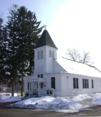
| August 2013 | Tornado (EF2) | New London | $1,000,000 | Another fast-moving tornado formed within a line of severe thunderstorms and raced to the southeast. The tornado struck a church, causing severe damage (DI 9, DOD 6 and 7). A large portion of the roof collapsed, causing failure of two walls. A wall on a new portion of the church was pushed in. In addition, hundreds of trees were snapped or uprooted. Several homes along the path sustained damage, mainly from fallen trees. The tornado exited Waupaca County about one mile south of New London at about 12:25 am CDT. The average path width in Waupaca County was 100 yards. |
| June 2004 | Tornado (F2) | Waupaca | $915,000 | no account filed |
| July 2024 | Flash Flood | Manawa | $260,000 | Rainfall amounts of 4 to 6 inches, combined with the failure of the Manawa Dam, caused flooding in Manawa during the late morning and early afternoon. |
| June 2021 | Lightning | Fremont | $250,000 | Lightning struck a house on Highway 110 in Fremont during the late evening hours, causing it to burn to the ground. |
| December 1970 | Tornado (F2) | not stated | $250,000 | no account filed |
| June 2016 | Tornado (EF1) | Symco | $200,000 | A weak tornado formed 4.2 miles east-southeast of Symco and traveled east just under three miles. At least a half dozen pine trees were snapped along the path and several large trees were uprooted (DI 28, DOD 3,4). Several farm outbuildings were heavily damaged, with metal from the buildings strewn downwind hundreds of yards. A manufactured home was pushed off its block foundation (DI 3, DOD 3). The tornado dissipated about 6.3 miles north-northeast of Northport. Average path width was 75 yards. |
| July 1996 | Thunderstorm Wind | Waupaca | $180,000 | no account filed |
| July 2019 | Tornado (EF1) | Waupaca | $150,000 | A tornado formed south of Waupaca and moved east-northeast to near White Lake. The tornado damaged siding and shingles on six homes (DI 2, DOD 2) and an apartment in a new subdivision near the Waupaca Airport. The garage door of a newer home was blown completely in, causing damage to the roof of the house (DI 2, DOD 4). Another house had a small part of its roof heavily damaged. Numerous trees were also damaged along the path. Peak winds were estimated around 90 mph. |
| July 2019 | Tornado (EF0) | Weyauwega | $150,000 | Brief tornado damaged several trees (DI 27,28, DOD 2,3) on the south side of Weyauwega. Peak wind estimated at 75 mph. |
| June 2017 | Thunderstorm Wind | Iola | $150,000 | Thunderstorm winds downed numerous trees in Iola, including some large trees that were knocked onto houses and power lines. |
| July 2019 | Thunderstorm Wind | Scandinavia | $100,000 | Thunderstorm winds downed trees on homes, roads, and wires across Scandinavia. The time of this event is an estimate based on radar data. |
| July 2019 | Thunderstorm Wind | Iola | $100,000 | Thunderstorm winds downed a large tree, about a foot in diameter, in Iola. |
| July 2019 | Tornado (EF0) | New London | $100,000 | A tornado formed at 11:09 AM CDT and damaged a few trees before entering Outagamie County at 11:10 AM CDT about 1.4 miles south of New London. |
| July 2015 | Tornado (EF1) | Marion | $100,000 | A tornado formed and heavily damaged a barn (DI 1, DOD 6) and adjacent garage. The roof of a nearby house was damaged and windows of another were broken (DI 2, DOD 3 and 4). At least two dozen trees were uprooted or snapped (DI 27 and 28, DOD 3 and 4). Average path width was 50 yards. |
| August 2010 | Thunderstorm Wind | New London | $100,000 | Thunderstorm winds downed more than 1,000 trees throughout New London. A 28 foot trailer was blown onto its side and a section of the roof of the Sara Lee plant was damaged. At least 2 homes sustained damage from fallen trees. |
| March 2019 | Flood | Northland | $87,500 | Runoff from rainfall and melting snow, along with clogged storm drains and ice jams, caused numerous roads, ditches, streams and low-lying areas to flood throughout Waupaca County. Some roads were damaged by the flooding and required repairs after the water receded. |
| May 2015 | Thunderstorm Wind | Rural | $75,000 | Thunderstorm winds downed about two dozen trees, some more than a foot in diameter, near the corner of Holmnlane and Stratton Lake Roads, in southwest Waupaca County. Most of the fallen trees were uprooted in the very wet, sandy soil. Fallen trees damaged a garage and caused roof damage to four cottages. The high winds also flattened nearby wheat fields. |
| May 2013 | Thunderstorm Wind | Symco | $75,000 | A thunderstorm produced high winds that blew down two storage sheds just outside Bear Creek in Waupaca County. More than a dozen farming machines were in one of the sheds; many sustained damage. |
| July 1999 | Thunderstorm Wind | Clintonville | $50,000 | no account filed |
| August 1997 | Lightning | Weyauwega | $50,000 | no account filed |
| July 1994 | Thunderstorm Wind | Waupaca | $50,000 | no account filed |
| August 1993 | Thunderstorm Wind | Marion | $50,000 | no account filed |
| August 1996 | Thunderstorm Wind | Waupaca | $39,000 | no account filed |
| June 2017 | Thunderstorm Wind | Northport | $30,000 | Thunderstorm winds heavily damaged a barn and tore the roof from an outbuilding near Sugar Bush. |
| May 1992 | Tornado (F1) | not stated | $25,000 | no account filed |
| July 1970 | Tornado (F1) | not stated | $25,000 | no account filed |
| July 1969 | Tornado (F0) | not stated | $25,000 | no account filed |
| March 2016 | Lightning | Northport | $20,000 | Lightning caused a fire that destroyed a barn west of New London. The damage total is an estimate. |
| August 2013 | Thunderstorm Wind | King | $10,000 | The public reported trees and powerlines down in the town of King, or just southwest of the city of Waupaca. A few trees fell on homes. |
| June 2011 | Thunderstorm Wind | Symco | $10,000 | Thunderstorm winds downed trees and caused damage at four farms in central Waupaca County. Two barns, two sheds and a silo chute sustained damage from the storm. |
| July 2007 | Thunderstorm Wind | Weyauwega | $10,000 | Straight-line thunderstorm winds downed numerous large trees, knocking some of the trees onto houses. Two large maple trees in the backyard of one residence broke windows, damaged siding and tore soffits and rain gutters from the house. Oakwood Cemetery sustained widespread damage to large trees and some headstones. The damage there was still being cleaned up 6 days after the storm. |
| June 1998 | Thunderstorm Wind | Clintonville | $10,000 | no account filed |
| July 1997 | Thunderstorm Wind | Weyauwega | $10,000 | no account filed |
| July 2016 | Thunderstorm Wind | Iola | $7,500 | Thunderstorm winds downed a dozen trees and power lines north of Iola. One of the trees landed on a garage. The time of this event was estimated based on radar data. |
| August 2007 | Lightning | New London | $7,500 | no account filed |
| June 1998 | Thunderstorm Wind | Big Falls | $5,000 | no account filed |
| June 1997 | Thunderstorm Wind | Waupaca | $2,000 | no account filed |
| July 1996 | Thunderstorm Wind | Scandinavia | $2,000 | no account filed |
| June 2017 | Flood | Clintonville | $1,000 | Heavy rainfall from thunderstorms caused street flooding in Clintonville. |
| July 2016 | Thunderstorm Wind | King | $1,000 | Thunderstorm winds caused widespread damage west of Waupaca, around King, downing trees and power lines, and tearing shingles from roofs. |
| August 2005 | Tornado (F0) | New London | $1,000 | no account filed |
| June 1998 | Thunderstorm Wind | Clintonville | $1,000 | no account filed |
| June 1998 | Thunderstorm Wind | Waupaca | $1,000 | no account filed |
| June 1998 | Thunderstorm Wind | Ogdensburg | $1,000 | no account filed |
| July 1997 | Thunderstorm Wind | Waupaca | $1,000 | no account filed |
| July 1997 | Thunderstorm Wind | Marion | $1,000 | no account filed |
| June 1997 | Thunderstorm Wind | Clintonville | $1,000 | no account filed |
| May 1996 | Thunderstorm Wind | Iola | $1,000 | no account filed |
| June 2014 | Heavy Rain | King | $500 | The combination of heavy rain that fell overnight and additional heavy rainfall from thunderstorms produced saturated soil. Wind gusts from the storms, estimated at 50 mph, uprooted two trees near Waupaca, one of which landed on a house. |
| June 1980 | Tornado (F1) | not stated | $250 | no account filed |
 Block