 Block
Dalton, Wisconsin
10 topographic sheets cover this place, the earliest surveyed in 1955 and the latest in 1990. It stands in Kingston town. It lies in ZIP code area 53926. The Survey maps it on the Marquette quadrangle.
Topographic sheets covering this place
6 surveys from 10 printed sheetsMatched by testing this settlement's coordinate against the published boundary of every sheet in the United States Geological Survey's historical collection. Each opens the scanned sheet at the Survey.
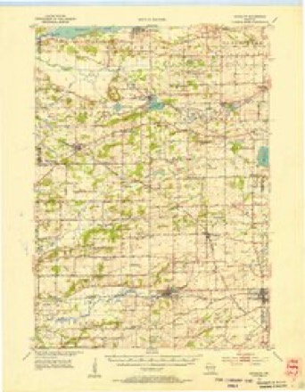
- 1955 USGS Randolph quadrangle1:62500, 2 printings
- 1957 USGS Madison quadrangle1:250000, 3 printings
- 1960 USGS Madison quadrangle1:250000, 2 printings
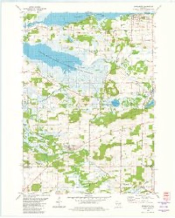
- 1980 USGS Marquette quadrangle1:24000
- 1985 USGS Wisconsin Dells quadrangle1:100000
- 1990 USGS Wisconsin Dells quadrangle1:100000


Fires near this place
123 since 1992Regional context, not property-specific evidence. The federal wildfire occurrence database lists 123 fires within 5 miles of Dalton between 1992 and 2020, burning about 484 acres in total. 1 started naturally. 4 were recorded as arson. Distance is straight-line from the map coordinates, so a fire counted here may appear on a neighbouring settlement's page as well.
| Reported cause | Fires |
|---|---|
| Debris and open burning | 47 |
| Equipment and vehicle use | 33 |
| Missing data/not specified/undetermined | 19 |
| Railroad operations and maintenance | 8 |
| Arson/incendiarism | 4 |
| Other causes | 4 |
| Smoking | 3 |
| Recreation and ceremony | 3 |
| Natural | 1 |
| Power generation/transmission/distribution | 1 |
The most recent of them, most recent first, with the day each was reported and the service that recorded it.
| Date | Cause | Size | Reported by | Name on the report |
|---|---|---|---|---|
| 8 September 1999 | Equipment and vehicle use | under an acre | Wisconsin Department of Natural Resources | not named |
| 29 September 1996 | Debris and open burning | under an acre | Wisconsin Department of Natural Resources | not named |
| 29 September 1995 | Equipment and vehicle use | 7.1 acres | Wisconsin Department of Natural Resources | not named |
| 26 September 1999 | Equipment and vehicle use | under an acre | Wisconsin Department of Natural Resources | not named |
| 26 September 1999 | Equipment and vehicle use | under an acre | Wisconsin Department of Natural Resources | not named |
| 21 September 2005 | Arson/incendiarism | 1.5 acres | Wisconsin Department of Natural Resources | not named |
| 12 September 1998 | Equipment and vehicle use | under an acre | Wisconsin Department of Natural Resources | not named |
| 11 September 1998 | Debris and open burning | 3.0 acres | Wisconsin Department of Natural Resources | not named |
Settlements close enough to share some of these fires:
Mines and quarries near this place
2 within 5 milesRegional context, not property-specific evidence. The federal mineral resources record lists 2 workings within 5 miles of Dalton: 1 past producer, 1 producer. 1 still produces. What was taken out: Stone, Crushed/Broken. Distance is straight-line from the map coordinates, so a quarry counted here may appear on a neighbouring settlement's page as well.
| Where | Site | Commodity | Status | Recorded |
|---|---|---|---|---|
| Gaastra Quarry | Stone, Crushed/Broken | Producer | ||
| Highway E Quarry | Stone, Crushed/Broken | Past Producer |
Storms near this place
19 since 2001Regional context, not property-specific evidence. The National Weather Service names Dalton in 19 storm reports between 2001 and 2025: 10 thunderstorm wind, 4 hail, 4 tornado, 1 flash flood. No death or injury is recorded in these reports. Each account below is quoted exactly as the forecast office filed it, from the NOAA Storm Events Database, and each date opens the federal record of that event.
| When | Event | Place named | Harm | What the report says |
|---|---|---|---|---|
| July 2008 | Tornado (EF1) | Dalton | $150,000 | A weak tornado spun up about 1/2 mile southwest of Downtown Dalton near a creek and proceeded to track east across STH 44 just northeast of the intersection of STH 44 and South Main Steet, and ultimately dissipated about 1/2 mile east-southeast of Downtown Dalton just southeast of the intersection of Fountain Lane and Belle Fountain Creek. It took the roof off of a lumberyard pole shed, took part of a roof off an office building, uprooted trees, and brought down some power-lines. The starting and ending lat/long pairs of numbers are 43.65243/-89.21794 and 43.65347/-89.19503. DI#1 (SBO), DOD 5. The winds were estimated at 93 mph. The average path width was about 50 yards. |
| June 2001 | Thunderstorm Wind | Dalton | $100,000 | no account filed |
| June 2008 | Thunderstorm Wind | Dalton | $25,000 | Powerful thunderstorm wind gusts knocked down large trees and power-lines. |
| August 2025 | Thunderstorm Wind | Dalton | $12,000 | Multiple reports from the Dalton area of tree and power lines down. Some structural damage to a lumberyard and gun club including signs and poles down. |
| July 2016 | Thunderstorm Wind | Dalton | $10,000 | Trees and branches down on CR B, also near Kingston, Marquette, and Dalton. |
| July 2008 | Thunderstorm Wind | Dalton | $10,000 | Powerful thunderstorm winds toppled large trees and broke branches that knocked down power-lines. |
| May 2011 | Tornado (EF0) | Dalton | $1,000 | An EF0 tornado spun up about 2 miles south-southwest of Kingston about 900 ft southeast of the intersection of County Road H and State Highway 44 and traveled northeast approximately 1/3 mile before dissipating just south of State Highway 44. The tornado damaged a door on a shed, broke tree branches, and damaged a greenhouse. The EF-rating was based on DI 27(TH) DOD 2 with winds of 65 mph. The starting location was 43.658216/-89.185059 and the ending location was 43.661958/-89.179995. Average path width was about 15 yards. |
| August 2021 | Thunderstorm Wind | Dalton | - | Wind gust was estimated. |
| June 2011 | Thunderstorm Wind | Dalton | - | This downburst swath was about 10 miles wide. Trees and power lines were brought down. |
| August 2010 | Thunderstorm Wind | Dalton | - | The Green Lake County emergency manager reported tree damage caused by thunderstorm wind gusts estimated at 56 knots (65 mph). |
| April 2010 | Tornado (EF0) | Dalton | - | This tornado segment in Green Lake County was the 2nd of a 2-segment tornado that stared in Marquette County at 1815 CST. It entered Green Lake County about 6 miles northwest of Dalton at the mid-point of the wide part of the Grand River and continued to move northeast. It crossed Pukaway Lake and came ashore just east of the corner of Marquette County near a boat launch site. A few trees had broken branches or were partially uprooted. The average path width was 35 yards. The EF0 rating was based on DI 27 (TH), and DOD 2, 65-70 mph, after a NWS survey. The responsible thunderstorm was the sourthern of two parallel moving storms with embedded circulations. The northern storm also produced a weak tornado. |
| July 2009 | Tornado (EF0) | Dalton | - | This tornado segment was a continuation of a EF1 tornado what spun up about 3 miles soutwhest of Montello in Marquette County. It moved southeast and crossed into Green Lake County where Grand Ave. enters the county. It dissipated about 2 miles north-northwest of the Village of Dalton. Damage was limited mainly to trees (uprooted or branches snapped), but there was some minor damage to a corn field. |
| July 2009 | Hail | Dalton | - | An emergency management official reported hail up to 1.50 inches in diameter covered the ground on Grand Ave. on a farm about about 3 miles northwest of the Village of Dalton. Hail stones still measured 1 inch in diameter 18 hours later at this location which was shaded by trees and a corn crop. Newspaper reports indicated that some corn fields were shredded by the hail, therefore an estimated loss estimate of $5000 was entered with this event. |
| July 2009 | Thunderstorm Wind | Dalton | - | Police officials reported tree damage in the Village of Dalton due to damaging thunderstorm wind gusts. |
| June 2008 | Flash Flood | Dalton | - | Heavy rains resulted in flash flooding from the Dalton area northeast to Berlin. Water depths on road surfaces reached 3 feet or more and there were gravel washouts. Total home damage was about $626 thousand. Total business losses were about $31,300, and total crops losses were about $40,000. Public sector damage was about $1.02 million. There were several roads and bridges that sustained damage. The Fox River gauge site at Berlin crested at the second highest all-time high level of 16.08' on 6/22 due to the heavy rains in its river basin. |
| June 2008 | Thunderstorm Wind | Dalton | - | Powerful thunderstorm winds gusts knocked down several large trees from Dalton to along CTH GG near the Green Lake/Columbia County boarder. |
| August 2025 | Hail | Dalton | - | no account filed |
| April 2008 | Hail | Dalton | - | no account filed |
| October 2006 | Hail | Dalton | - | no account filed |
Nearest settlements
The eight closest, with where each one stands in the county. Distances are straight-line, computed from the Geographic Names Information System coordinates.
| Map | Place | Distance | Sheets |
|---|---|---|---|
| Kingston | 5.0 miles | 10 | |
| Marquette | 7.2 miles | 10 | |
| Manchester | 8.7 miles | 10 | |
| Green Lake Terrace | 11.5 miles | 14 | |
| Markesan | 12.0 miles | 8 | |
| Greenwyck | 13.1 miles | 14 | |
| Lakewood Estates | 13.7 miles | 14 | |
| Sylvan Shores | 13.7 miles | 14 |
Provenance
This settlement is recorded in the Geographic Names Information System as feature 1563680. The sheet list is computed by point-in-boundary test against the United States Geological Survey's historical topographic inventory. Both are works of the United States government and carry no copyright under 17 U.S.C. 105.
Wildfire. Short, Karen C. 2022. Spatial wildfire occurrence data for the United States, 1992-2020 [FPA_FOD_20221014]. 6th Edition. Fort Collins, CO: Forest Service Research Data Archive. https://doi.org/10.2737/RDS-2013-0009.6 Collected with United States Government funding and usable without additional permissions or fees.
Mines and quarries. USGS Mineral Resources Data System (MRDS) https://mrdata.usgs.gov/mrds/ A work of the United States government, no copyright under 17 U.S.C. 105.
Storms. NOAA National Centers for Environmental Information, Storm Events Database https://www.ncei.noaa.gov/stormevents/ A work of the United States government, no copyright under 17 U.S.C. 105. Narratives are quoted verbatim from the National Weather Service report and are not edited or summarised.